Guria Region
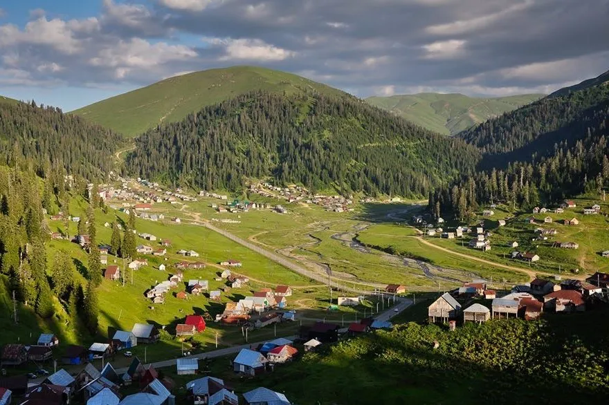




Guria is a small, green region in western Georgia, tucked between the Black Sea coast and forested hills. It feels soft and humid, with tea plantations, citrus gardens, and mist rolling through the mountains. The sea town of Ureki is known for its unusual magnetic black sand beaches, while inland villages move at a quiet, agricultural pace. Gurians are famous for their sharp humor, bold character, and distinctive polyphonic singing style. The food is simple but flavorful – especially spicy dishes and fresh dairy. Guria is not grand or monumental; it’s intimate, slightly wild, and full of personality.


Chokhatauri Municipality
Chokhatauri Municipality is located in western Georgia, in the Guria region. Its administrative center is the town of Chokhatauri. Chokhatauri is bordered by Samtredia and Vani municipalities to the north, Vani to the east, Khulo and Adigeni to the south, and Ozurgeti and Lanchkhuti to the west.
The name is derived from the family name (Chakhatarashvili, Chkhatarashvili). This region has often witnessed bloodshed and misfortune. During the Imereti Uprising, from April to August 1820, Chakhatauri was one of the battlefields of battles between the troops of the Russian Empire and the rebellious Gurians.
Chokhatauri is distinguished by its beauty, especially in spring, when it is completely covered in greenery and the scent of acacia flowers wafts around. Anyone who has been to Bakhmaro and has looked out over the sea of clouds tinged with pink rays from the “Sunset Hill” or has seen the first rays on the “Sunrise Hill” will never forget this sight.
On the way to Bakhmaro, you should definitely stop in Nabeghlavi and taste the mineral water; this is a kind of tradition for vacationers and travelers on the way to Bakhmaro. Chokhatauri is not distinguished by its abundance of lakes and waterfalls, however, Lake Jaji, nestled between alpine meadows and blue mountains, with its breathtaking views, is one of the perfect places for hiking enthusiasts. Along with the beauty of nature, you can also visit ancient and interesting cultural and historical monuments in the region.
Nabeghlavi Resort
A balneological resort and village, located in Guria, Chokhatauri municipality, 475 meters above sea level, on the banks of the Gubazeuli River. 22 km from Chokhatauri. The Chokhatauri – Bakhmaro highway passes through the village.
Nabeglavi is famous for its unique climatic and balneological conditions. The precious mineral water “Nabeglavi” flows here, which is successfully used to treat the gastrointestinal tract, liver and biliary tract, kidneys, bones and joints. It is used both for drinking and in the form of baths. It is recommended for people of any age, and in unlimited quantities.
The Nabeglavi spring was discovered in 1905. According to legend, the attention of the local population was attracted by one of the springs, which was more tolerated by livestock than others. The water was found to have a special taste and distinctive healing properties. Soon, researchers visited the deposit. They scientifically studied the healing properties of the water and officially granted Nabeghlavi the status of a resort.
There are family-style hotels in the village.
View on mapBakhmaro
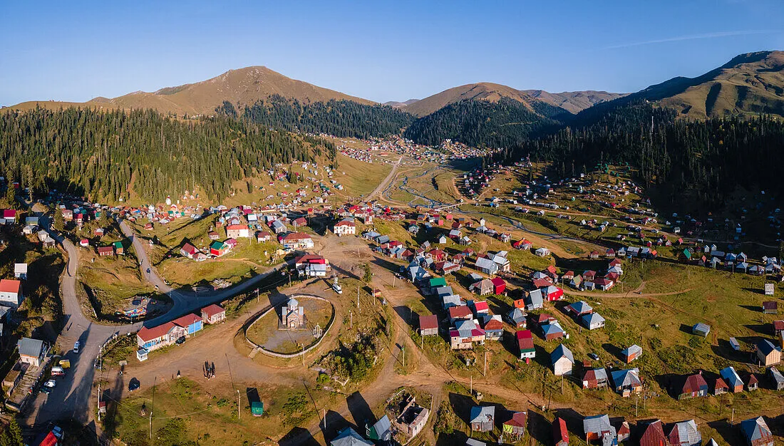
Is a mountain resort in Guria, Chokhatauri Municipality, where the sea and mountain air combine to create a unique environment. Accordingly, it has natural healing properties. The resort is a kind of cave surrounded by evergreen forests of spruce and fir.
In winter, the average temperature is -5C, and in summer it is moderately cool, the average temperature is -14C. Bakhmaro is 52 km from Chokhatauri, 340 km from Tbilisi. The road surface is asphalt and can be reached by any type of car. The altitude is 2050 m above sea level.
The resort has typical wooden summer cottages, which can be rented.
There is a mountain in Bakhmaro, known among vacationers as “Mountain of the Sunrise”. The mountain is located a few kilometers from Bakhmaro. In the evenings, vacationers come with tents and watch the sunrise on the mountain, where it is truly an amazing sight, how the sun rises in the sea of clouds. Watching the sunset here is no less beautiful, with a pleasant breeze and the flickering of the setting sun’s rays….
View on map
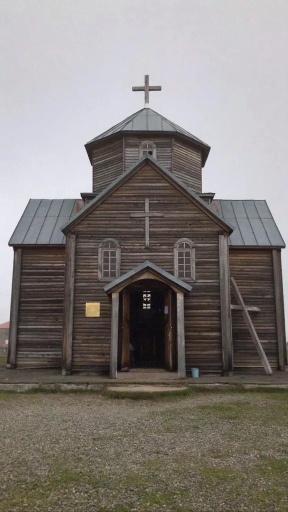
The Bakhmaro Transfiguration Church
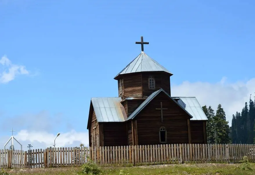
Is located in Guria, Chokhatauri Municipality, in the central part of the resort of Bakhmaro. This is a wooden church. It is a free-cross type cross-domed building, The windows are arched. The temple has a rectangular entrance on the west. The facades are decorated with large wooden crosses. Beautiful views of the Guria Mountains open up around the church.
View on map
Lake Jaji
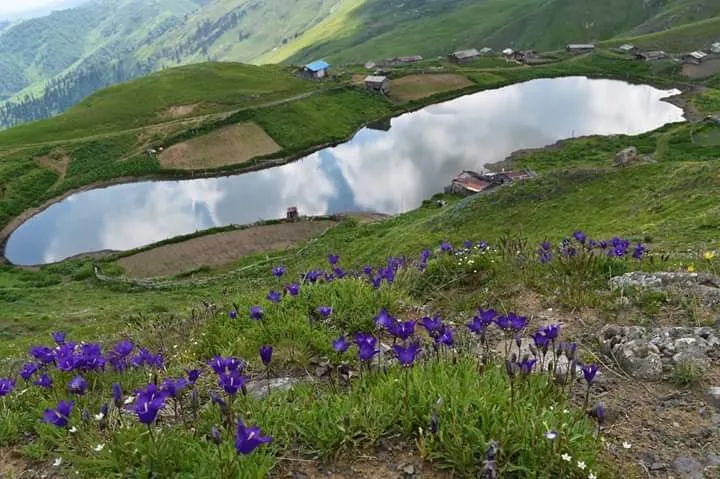
Lake Jaji is located on the southern slope of the Meskheti Range at an altitude of 2,655 meters above sea level. The lake borders the municipalities of Chokhatauri, Vani, and Adigeni. The peak of Mepistskaro is located near the lake, which is 2,850 meters high and offers travelers views of three different regions: Imereti, Guria, and Samtskhe-Javakheti. There are several routes to the lake: 1. Abastumani; 2. Fersati Plateau; 3. Dertseli Village. Of the given options, the closest access to the lake by transport is from the Dertseli Summer Farms and Fersati Plateau.
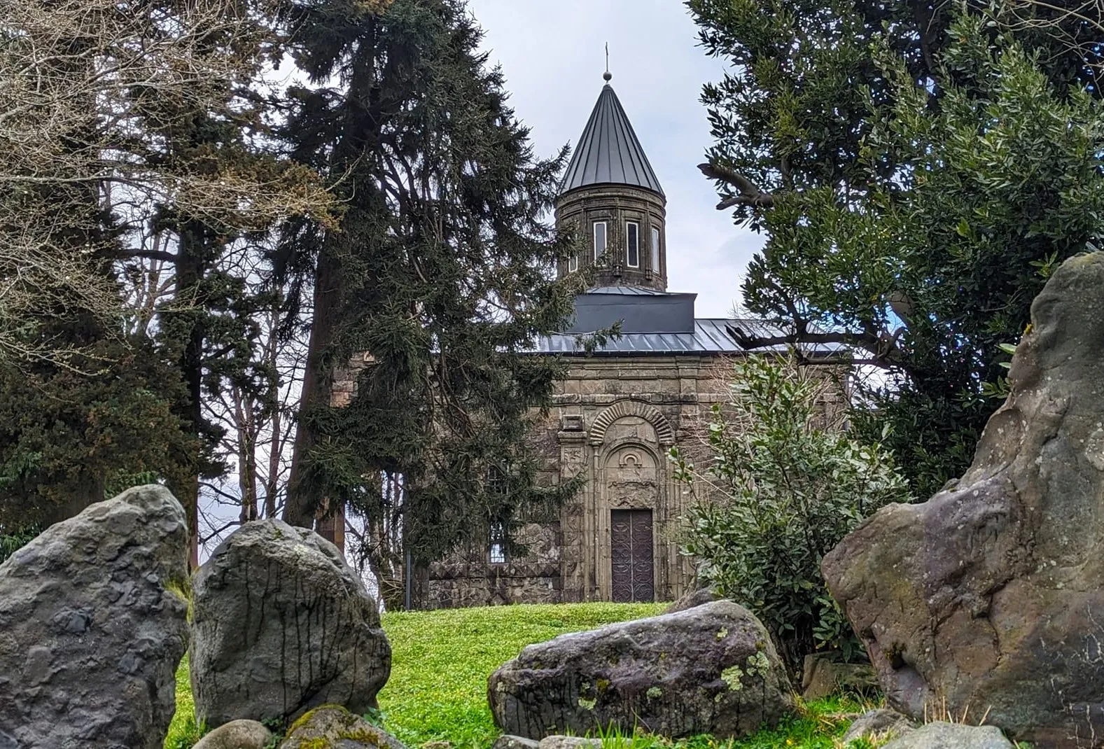
The castle-hall of the Gurian dukes is located in the village of Goraberezhouli, Chokhatauri municipality. The castle was built on a high hill in the 17th-1th centuries. It was for military purposes and belonged to local dukes. The castle is surrounded by 4 walls, each 5 meters high and 25 meters long. The castle walls are equipped with cannons, and inside there is a cellar and an agricultural building. A small chapel is built to the east of the castle, which is currently in a semi-destroyed state. A beautiful dendrological forest-park has been planted around it, with many varieties of rare century-old plants: three-century oak, pencil tree, candy tree, giant sequoia and others.
Bukistsikhe Tamar Fortress
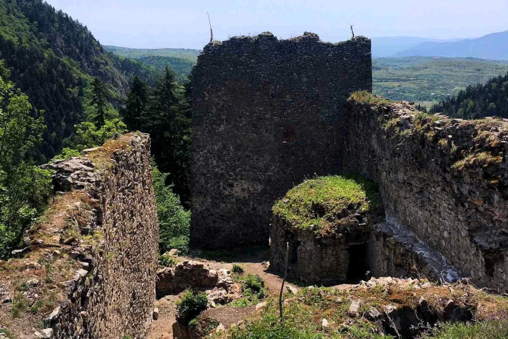
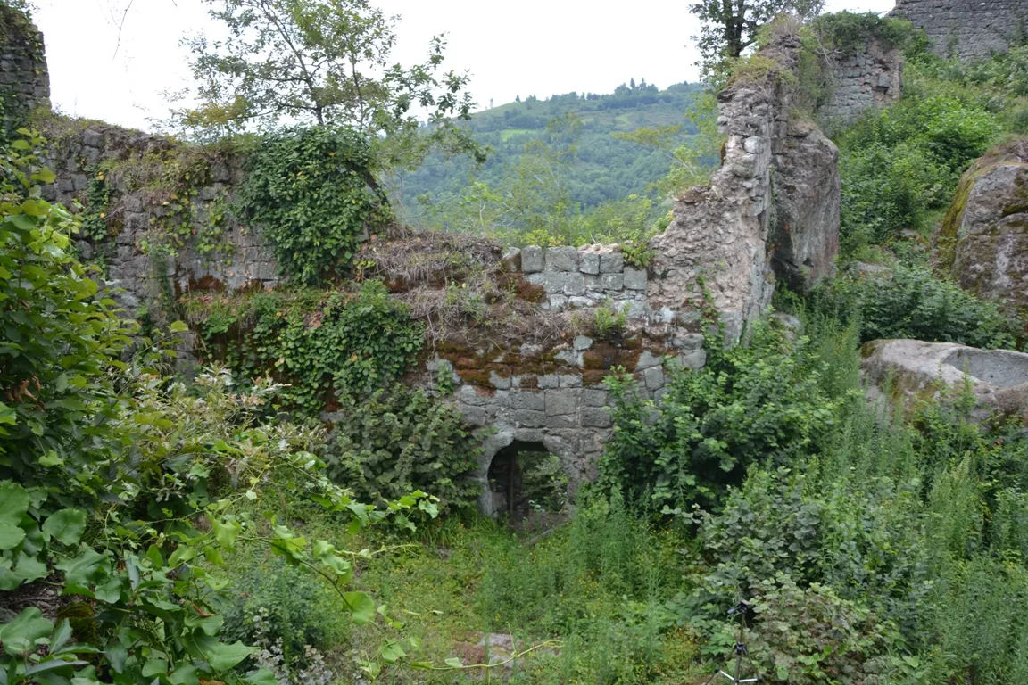
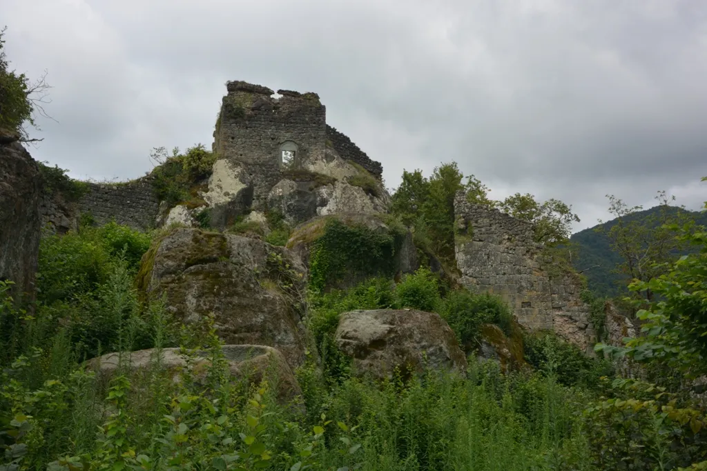
Is located in the village of Bukistsikhe, Chokhatauri Municipality, Guria, on a high hill. People have lived in this area since the Bronze Age, and an urban settlement appeared in the Qintian period. The Tamar Fortress itself consists of several construction layers, from the early Middle Ages to the late Middle Ages. In 1774, Bukistsikhe, along with Likhauri Fortress and Askani Fortress, was taken by the Turks. In the same year, it was recaptured by Mamia IV Gurieli and Solomon I. Before the annexation of Guria to Russia, the Tamar Fortress controlled the road from Imereti and Meskheti to the Black Sea. The monument is very damaged today, only the northeastern part of the fortress has survived. A large stone press and the remains of a masonry staircase were discovered on the first floor of the multi-story tower on the northern side of the building. The second floor should be residential, and the third floor – military. It is dated to the 6th-7th centuries. A 10th-century church was built to the east of the fortress, of which only the northern and eastern walls have survived. The entrance to the church is from the west. The altar is rectangular. The inside of the monument is tiled.
The Erketi Church
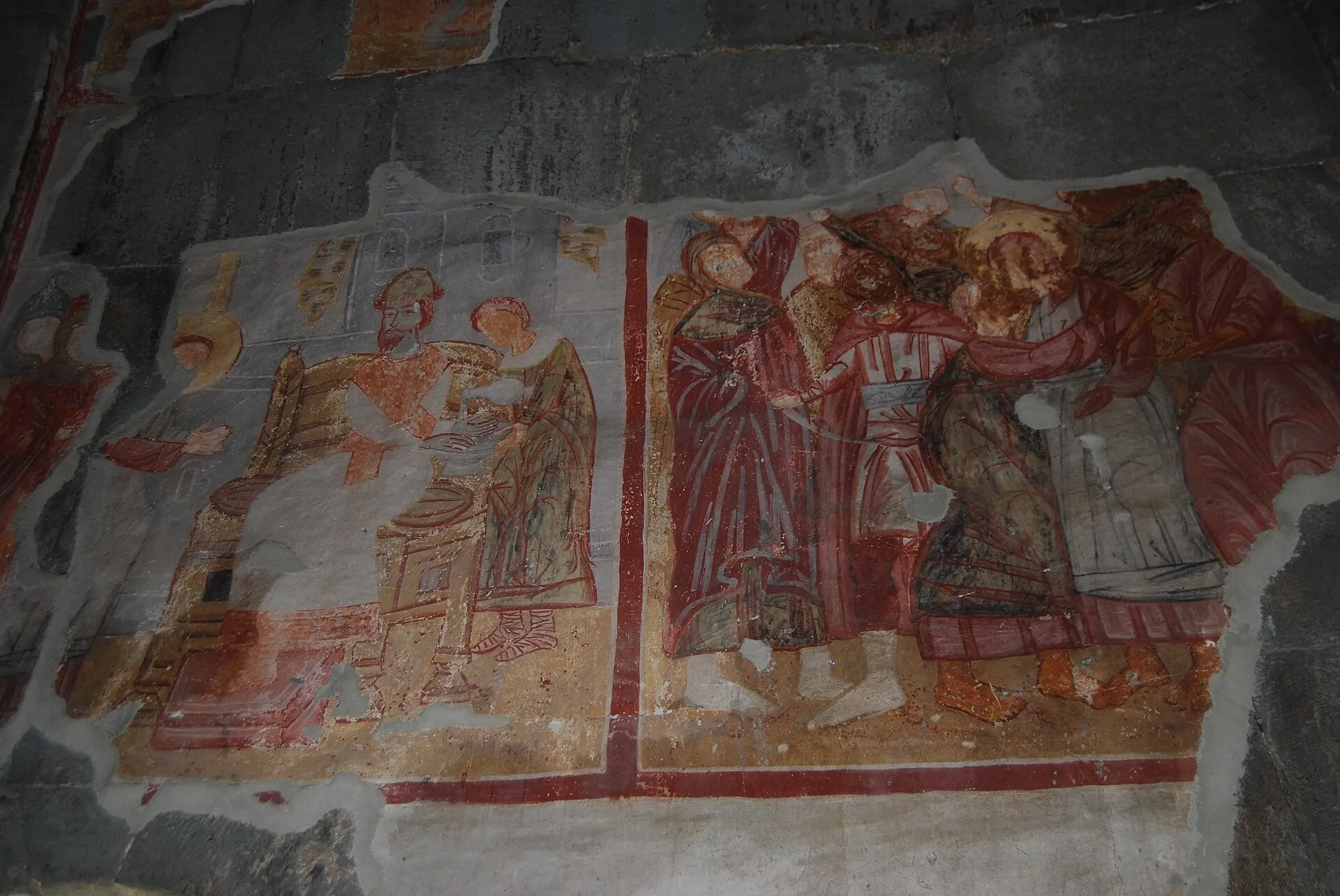
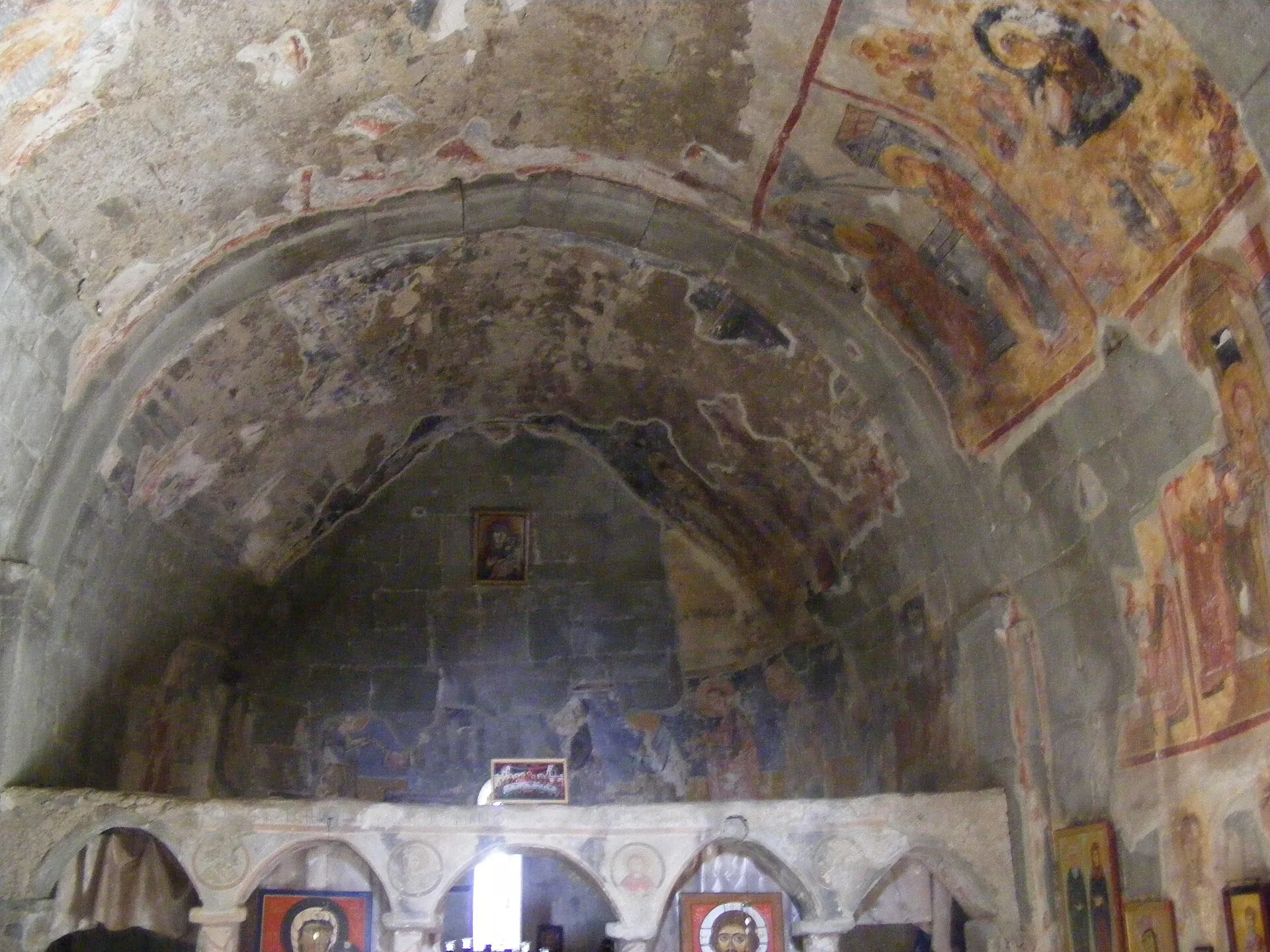
Is located in Guria, in the village of Zemo Erketi, Chokhatauri Municipality. It dates back to the 9th century. The church and its surrounding area were part of the estate of the Guria Eristavi, its leaders were the Sharvashidzes. The monument has been rebuilt several times. The church is a hall-shaped building with two nave buildings. There are two entrances – from the west and south, both entrances are rectangular from the outside, and arched from the inside. The longitudinal walls are divided by pilasters. The hall is covered with a vault, which rests on ribbed arches carried on pilasters. The interior has damaged late medieval paintings. The facades are intact. A simple relief cross is placed in a semicircular tympanum bordered by shafts above both entrances. A fragment of vine ornamentation has survived near the western doors. The eastern window has a cylindrical frame. The facades are completed by a circular-shaped pediment. The church is built with well-cut squares. The church is currently in use, and a nunnery functions here.
View on map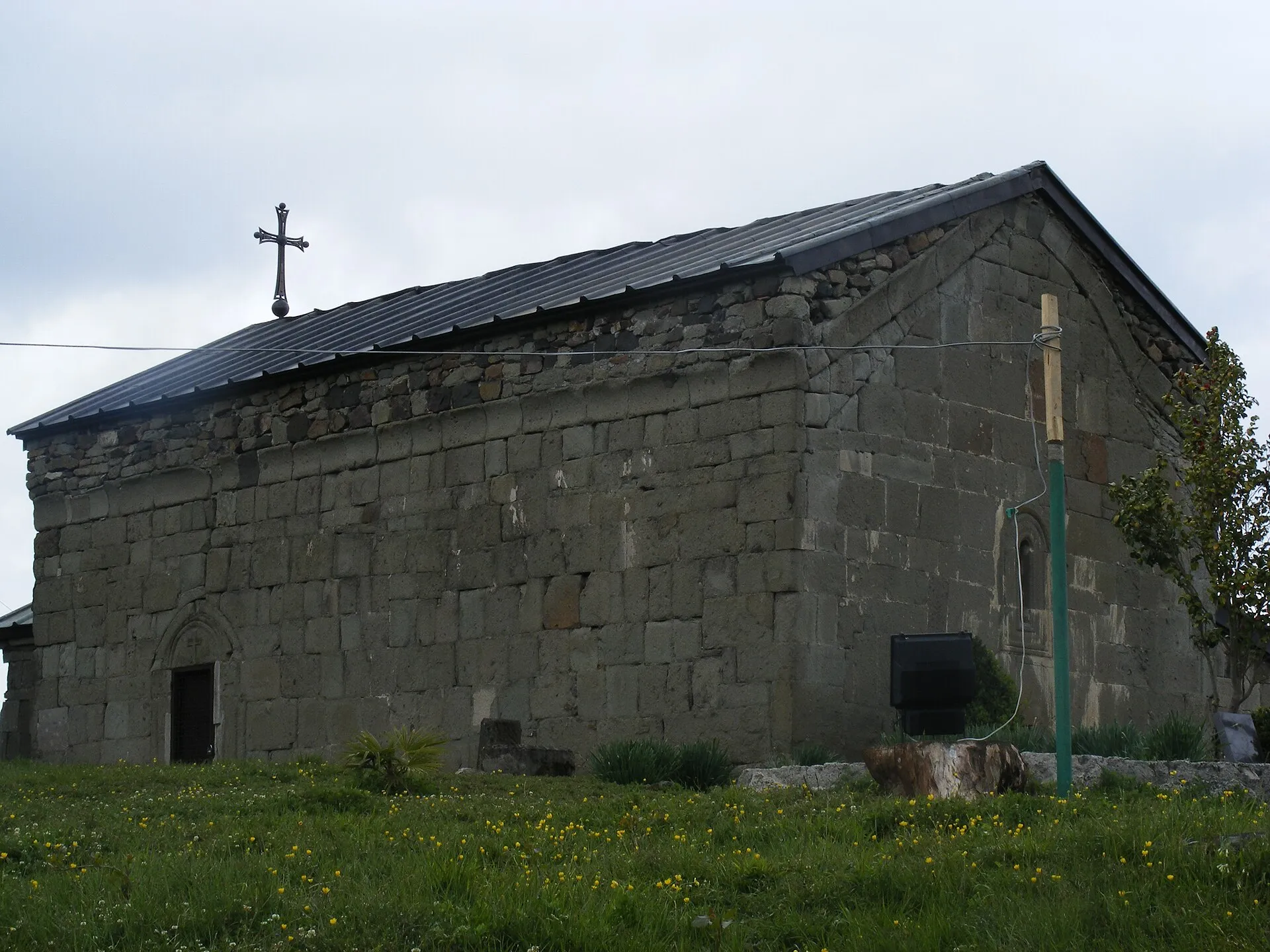

Lanchkhuti Municipality
Lanchkhuti Municipality is located in the Guria region of western Georgia. The region has been inhabited since the Stone Age. Urban life has been developing here since the Bronze Age, as evidenced by the Shukhuti settlement. Lanchkhuti is first mentioned in historical sources in the 17th century. It covers the territory of the Odish-Guria lowland and its surrounding hills. The administrative center of the district is the city of Lanchkhuti. The municipality is bordered by the Black Sea coast to the west, Samtredia and Chokhatauri municipalities to the east, Khobi, Senaki and Abasha municipalities to the north, and Ozurgeti municipality to the south.
With its ancient culture and history, Lanchkhuti is also distinguished by its natural beauty. Here, rugged coastlines and a lush environment blend together.
Lanchkhuti is perfect for both traveling and seaside recreation. Against the backdrop of the setting sun, golden water, hot sand and thatched bungalows fill you with tropical colors and lightness. In addition to beautiful nature, you can also visit important historical and cultural monuments in the district. Ancient settlements, ruins of medieval fortresses and temples offer an interesting journey into Georgia’s past.
The Church of the Savior of Aketi
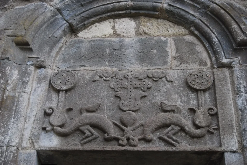
A church in the village of Kvemo Aketi, Lanchkhuti Municipality. The church is located on a slightly elevated platform on the bank of the Atsaura River, a right tributary of the Supsa River. It is surrounded by a stone fence. The Aketi Church is a cross-domed building. It has a three-aisled apse to the east. The building has an apse attached to the north. An arched bell tower is built on the roof of the temple. The church had a stone, carved spire. The windows are arched. There are two entrances – to the south and north. Both entrances are arched and cut into a barrel vault. Reliefs are placed on the architraves. In the 19th century, Russian priests whitewashed the interior with lime. The church is built of roughly hewn blocks.
Museum Airport

The Chanchati Stele
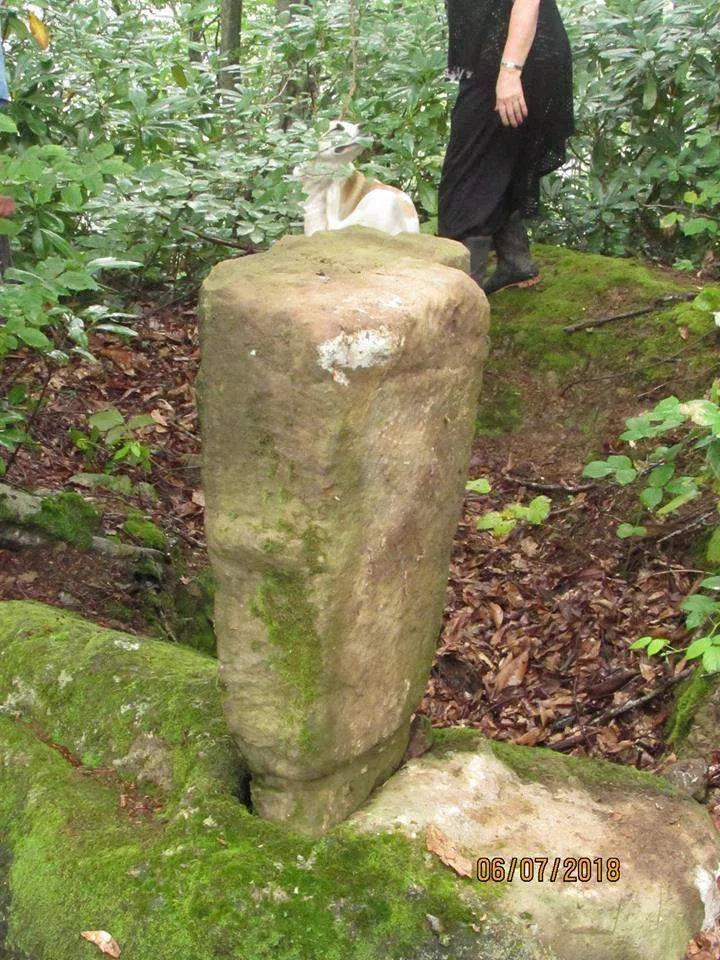
The Chanchati Stele is located in the village of Chanchati in Lanchkhuti Municipality, Guria, approximately 5 km from the village, on top of Mount Gori. It is a stone pillar bearing archaic signs, with a masonry base. The base is a large, unworked boulder with a cut-out for the pillar base. The stela itself is worked, narrower at the bottom and wider at the top. The pillar has a 20-centimeter ridge on the upper side, and simple ornaments are found on its front and around it. A small stone fragment with the image of a cross was also found in this area.
View on map
Jikheti Sameba (Trinity)
Jikheti Church — a 19th-century church in the Guria region, Lanchkhuti municipality, between the villages of Chkhonagora and Sameba, currently a nunnery.
Jikheti is located on the northern slope of the Guria Range, on Mount Nigoiti, 250 m above sea level. 12 km from Lanchkhuti, 3 km from Nigoiti, 6 km from the highway.
The monastery was founded at the end of the 19th century. The main – Assumption Cathedral was built in 1896 by Ilarion Menabde from Ozurgeti. In 1987, a bell tower was built to the Assumption Cathedral. In 1988, a basilica-type church of St. George was built. In 2002, the Cathedral of the Assumption of St. John the Baptist was built. A baptismal font is arranged in the courtyard, into which spring water flows (“Jordan Spring”). The water has healing properties.
Every December 4 – the day of the Presentation of the Virgin Mary to the Temple – a holiday is held in the monastery – Jikhetoba.
There is a legend about the location of the Jikheti Monastery. It was built on Mount Jikheti, in a very inaccessible place. The nuns were very worried about the lack of water, so they decided to choose a new place for the temple. This choice, like the flood, was attributed to three doves. In the place where the doves flew, a new monastery was built.
View on map


Tskaltsminda
The resort of Tskaltsminda is located in Guria, in the Lanchkhuti municipality, 2 meters above sea level. The green surroundings, fresh air and comfortable hotels create a pleasant environment for relaxation. The resort is close to the sea coast. Tskaltsminda is especially famous for its fish market, which attracts seafood lovers. There are also restaurants here where you can taste delicious fish and other dishes. If you want to relax and unwind in peace by the sea, Tskaltsminda is a great place for this.
View on map
Grigoleti
The Grigoleti resort is located in Guria, Lanchkhuti municipality, on the Guria plain, on the Black Sea coast, 3 meters above sea level. It is one of the popular vacation spots and is visited by many tourists and locals. If you are a lover of the clear sea, sandy, sunny beaches and a chocolate tan and want a comfortable vacation, Grigoleti is a great place for this. It is a seaside climatic resort, which is distinguished by its magnetic sand beach with healing properties. The climate is subtropical, with mild, snowless winters and hot summers. The resort is also charming due to the perennial pine forest. Greenery, well-equipped infrastructure, comfortable hotels and the endless, emerald sea create a fabulous environment for diverse recreation and relaxation.
View on map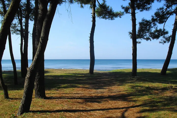
Grigoleti Lake is located in Guria, in the resort town of Grigoleti, Lanchkhuti Municipality, quite close to the seashore. The shores of the lake are covered with algae. There are fields and forests around it, which creates a wonderful environment for a picnic. The lake is also often visited by fishing enthusiasts. Grigoleti Lake is one of the wonderful places for relaxation and recreation in nature.
View on mapSakvikhia Waterfall is located in the village of Atsana, Lanchkhuti Municipality, Guria, near the road from Atsana to Mamati, in the gorge of the Atsanura River. The waterfall cascades down the rocks in steps and creates a small depression in one of the platforms. The waterfall, nestled in the rocks in the green gorge, creates a very beautiful sight and is a great place for a picnic, to escape the summer heat and relax in the peace of nature.
View on mapJapana Lake — located in Lanchkhuti Municipality. It is located on the Guria Plain, 13 meters above sea level. The lake was formed as a result of changing the river bed. The abandoned winding section of the river is called a meander, and the water inside is a meander lake. The surface area of the Japan River Lake is 1.17 km², the catchment area is 5.2 km². The average depth is 3.7 m. The water volume is 4.3 million. m³. It is fed by rain and groundwater. It is a freshwater lake. In winter, migratory birds, hundreds of wild ducks and other types of birds live on this lake. Japana Lake has now been converted into a pond. It is used for fish farming.
View on mapOzurgeti Municipality
Ozurgeti Municipality is located in the Guria region. Traces of human life here date back to ancient times. Bronze Age settlements and workshops have been discovered on the territory of the district, such as the Vakijvari workshop and the Shekhemodi settlement. Ozurgeti was first mentioned in historical sources in the 16th century. It was a culturally and economically developed region in the Middle Ages, as evidenced by the many temples and fortresses located on the territory of the municipality. The city of Ozurgeti was an important trading city and the residence of the Guria princes in the late feudal era. A treasure trove of coins, 270 silver coins, known as the Ozurgeti Treasure, was discovered here.
Ozurgeti Municipality is located in the valleys of the Natani and Supsa rivers. Its administrative center is the city of Ozurgeti.
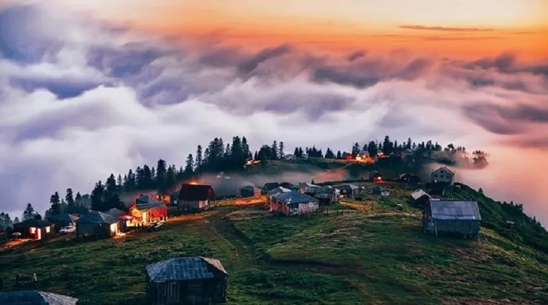
The municipality is distinguished by its beautiful nature and interesting cultural monuments. Forests, mountains and amazing views are perfect for nature lovers. The Gomismta resort is very popular, which makes an unforgettable impression with its endless sea of clouds, fir forest and beautiful surroundings. One of the outstanding places is Chinchao Lake, surrounded by alpine meadows, from which beautiful views open. There are also many important cultural and historical monuments in Ozurgeti.
Ozurgeti Historical Museum — a museum in the city of Ozurgeti, Guria region. It is the oldest museum among the seven museums of Guria.
The museum houses more than six thousand exhibits, the chronology of which covers the period from the 9th millennium BC to the present day, including the Neolithic period, materials from the Early, Middle and Late Bronze Ages, rare examples of Colchian axes, segments of hoes, bronze sculptures, gold and silver objects from early antiquity, and part of the Ureki treasure.
View on map
Ozurgeti Drama Theater — Aleksandre Tsutsunava State Drama Theater in Ozurgeti, Guria region. The theater is 150 years old.
The theater is a five-story building. The theater has an audience hall for 750 people with two tiers. The parterre is semicircular and connects to the stage (length-width 20-20 meters, height 18 meters), in the middle of which is placed a mechanical moving circle with a diameter of 13 meters. The tiers are carved with Georgian-style ornaments. The volume of the building is 42,800 m3, the area is 4,000 m2. The superstructure of the building is faced with Kursev granite, the cornices are made of Eklan white stone, and the roof is covered with galvanized tin.
View on mapGomismta (Gomi mountain)
Gomismta is a high-mountain summer resort in Guria, Ozurgeti Municipality. Its altitude varies from 2100 meters to 2755 meters above sea level in different places. The resort is distinguished by its natural and climatic conditions with healing properties, which are determined by the combination of sea and mountain air. Gomismta is known as the kingdom of clouds and fogs, which is caused by the specific climate here. Vacationers and travelers often visit the resort for this very reason. If you climb a high hill, you will see a sun-drenched, endless mountain range covered in fogs. The sun setting in the sea of clouds or the sunrise in the fog create such a magnificent and unforgettable spectacle that it is impossible to convey either in words or with a camera. You have to see all this with your own eyes. If you visit Gomismta, you can also visit
View on map
Lake Chinchao
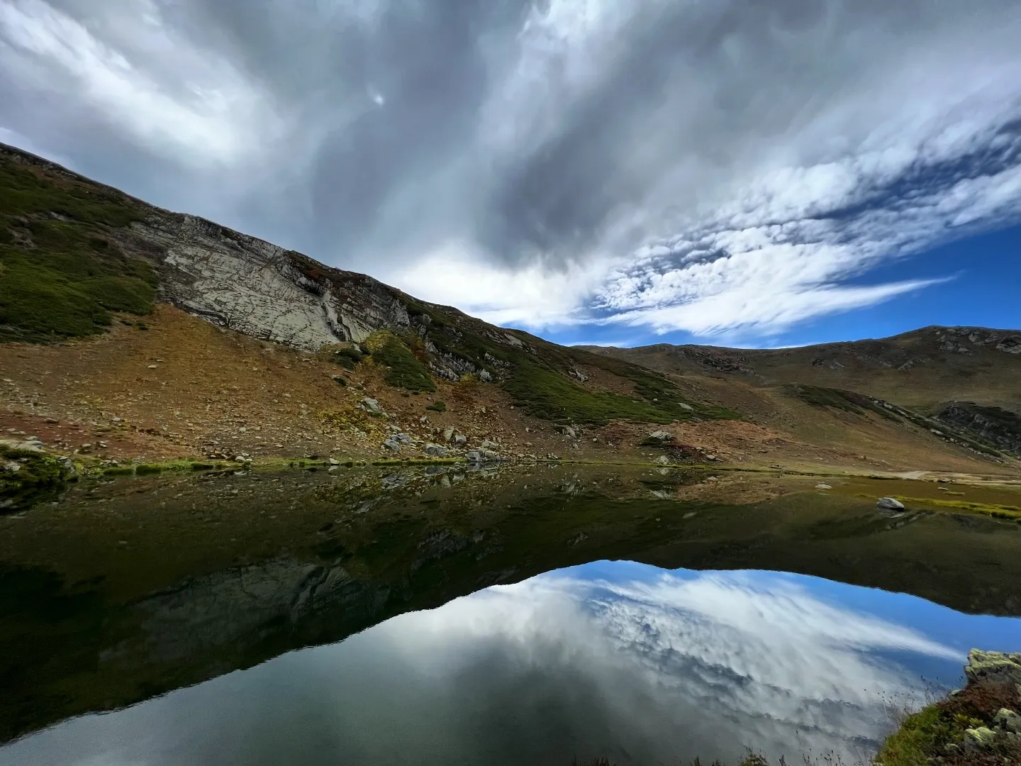
Is located at an altitude of 2,500 meters above sea level. The distance from the resort to the lake is 11 km. There is a road leading to the lake, which is only accessible by off-road vehicles.
The resort has no infrastructure, no electricity or water supply system. Locals get their water from mountain springs. This is the reason why Gomismta cottages often lack bathrooms. Like Bakhmaro, typical wooden cottages are popular on Gomismta, which can be rented.
If you decide to relax here, you need to take everything with you and spend time in peace, fresh air, and nature, cut off from civilization. In August (the date changes every year), the resort holds the “Gomismtoba” holiday. Various sports competitions and horse racing are organized. A kind of tradition of the resort is also a bonfire in the evenings and gatherings around it, singing, and having fun.
Shemokmedi
Shemokmedi Monastery Complex — a medieval monastery complex in the Guria region, Ozurgeti municipality, in the village of Shekhomedi, the center of the Shekhomedi diocese. It is located on the left bank of the Bzhuzha River, 7-8 km southwest of Ozurgeti.
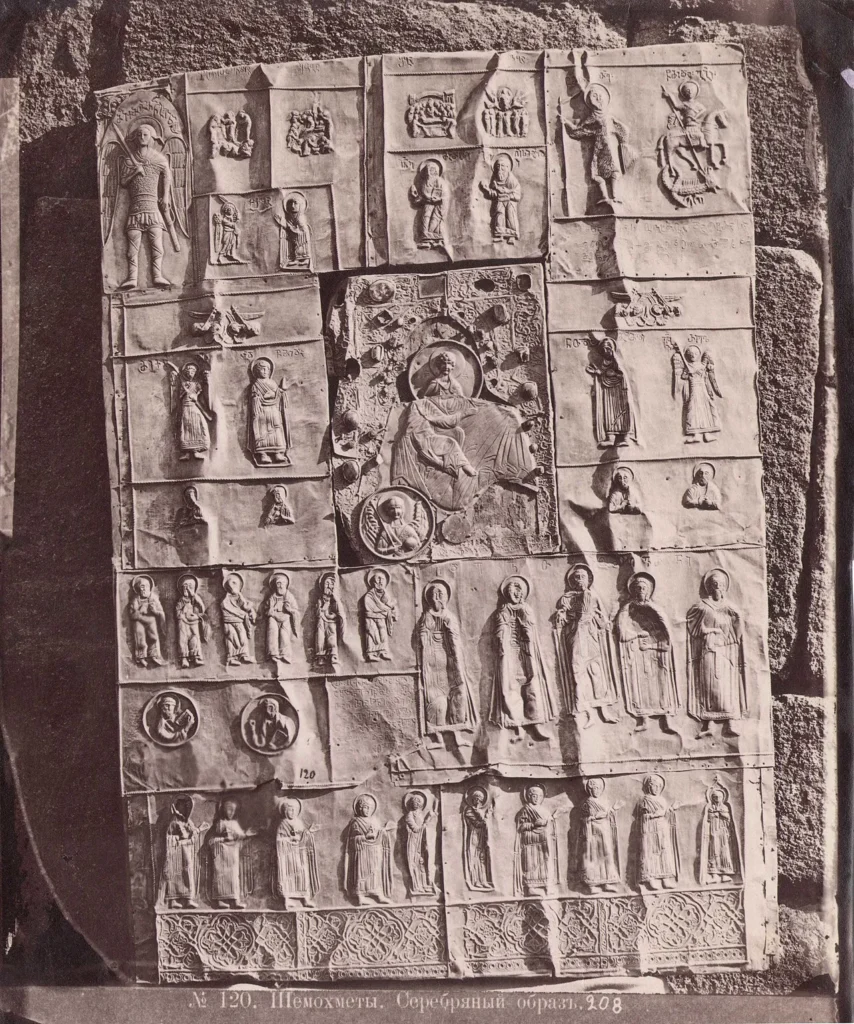
The monastery consists of two temples and a bell tower built in the 16th century. The right temple is the 12th-century “Divine”, the left one is the 16th-century “Zarzma”, which Vakhtang I Gurieli – specially built in 1572 to house the icon of the Transfiguration transferred from the Zarzma monastery in the 16th century. It is the oldest of the surviving Georgian icons and dates back to 886. Shekhomedi Monastery had rich and diverse book depositories.
The Shekhedomi Monastery owned rich estates. The Shekhedomi Monastery was the crypt of the Shekhedomi bishops and the Gurieli family.
On the right bank of the Bzhuzha River, below the church, at the foot of the hill, there was a cave where monks used to live. The cave consists of two main sections – two rooms, the first room is smaller than the second. The entrance to the cave faces north. It has a semi-oval shape. Today, the cave is abandoned.

The Church of the Virgin Mary of Likhauri
Is located in the village of Likhauri, Ozurgeti Municipality, Guria. It dates back to the second half of the 13th century. The church was rebuilt in the 18th century. The 11th-century Likhauri Gospel was kept here, which is now preserved at the National Center for Manuscripts. In 1989, the church and bell tower were restored once again. The Likhauri Church is a hall-like building, semicircular in the east, with a vaulted apse and a western gate. The gate opens with an arch from the west. The apse stands on a two-tiered plinth, and the hall – on one tier. There is a wide and arched window cut out on each of the three sides of the apse, and there is a similar window in the western wall. There are rectangular windows in the northern and southern walls.
The temple is built of hewn stone. To the west of the Likhauri Virgin Mary Church is a two-story bell tower dating back to the 15th century. The first floor is an arched gateway, and the second floor is a six-arched bell tower. The facades of the bell tower feature a high-relief of a ram’s head and a construction inscription dating back to 1422.
View on mapThe Church of St. George of Achi
Is located in the village of Achi, Ozurgeti Municipality, Guria. It dates back to the 13th century. There is practically no historical information about the church, the oldest written sources date back to the second half of the 16th century and are mainly donation or purchase books. The princes of Guria showed special care for the Acha Church.
The Acha Church is a hall-like building. There are two entrances – from the south and west. Both entrances are architraves, and carved crosses are depicted on the architraves. There is also a rosette on the top of the cross on the west. There is a five-line Asomtavruli inscription on the top of the southern door, to the right and left of the cross.
The windows of the church and the columned cross on the east side are decorated with carvings. The interior is completely painted.
The temple is built of well-hewn stone blocks and is surrounded by a high, solidly built stone wall.
View on map

The Jumati Monastery
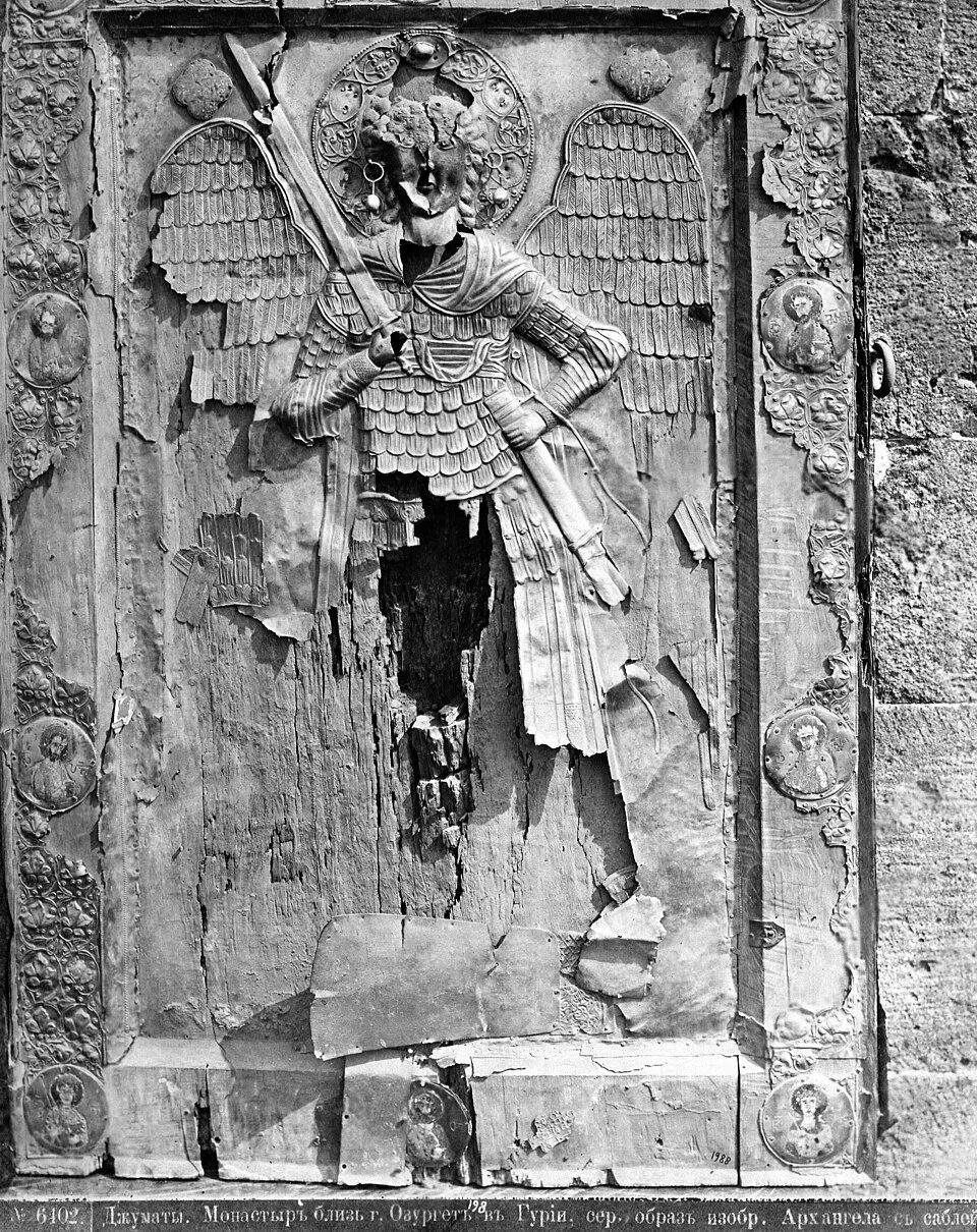
Is located in the village of Dzirijumati, Ozurgeti Municipality, Guria. The complex consists of the Archangel Church, a bell tower and a wall. The date of construction of the Jumati Church is unknown.
The monastery was an important center of church and educational life.
During the communist regime, only one monk lived in the Jumati Monastery – the priest-monk Ioane, who, despite many objections and insults, quietly baptized people. After that, a military unit was stationed on the territory of the monastery for several years. The bell tower, famous for its ringing bells, was destroyed by the soldiers with a cannon shot. In the following years, a pioneer camp was established here, which was abolished in the 80s of the 20th century. In 1877-78, Dimitri Ermakov visited the Jumati Monastery and admired the monastery and its antiquities. At the beginning of the 20th century, the monastery was repeatedly plundered and many relics were lost. Monastic life in Jumati was restored in 1990.
View on map
Askani Fortress
Is located in Guria, in the village of Mtispiri, Ozurgeti Municipality. The structure consists of several construction layers, the oldest of which dates back to the 4th century, and the newest – to the 19th century. According to legend, Murvan-The deaf marched on the fortress, and his campaign in Guria is confirmed by the Life of Kartli.
In addition to the citadel, the complex includes a church, a palace and farm buildings. The structure is currently very damaged. The entrance to the fortress is in the southwestern part. The basilica was built of hewn stone, and the fortress was built of smooth stone on limestone.
View on map

Shekvetili
The resort of Shekvetili is located in Guria, Ozurgeti Municipality, on the shores of the Black Sea, 2 meters above sea level. The vast, blue sea, sunny beaches, green pine forests and comfortable hotels attract many vacationers every year. Several hotels, the amusement park “Tsitsinatela“, the concert hall “Black Sea Arena“, the “Musicians’ Park“, the “Miniatures’ Park” and the dendrological park operate in Shekvetili. The natural healing factors of the resort are the coastal humid subtropical climate, sea water, and magnetic sand. In Ureki, the sea subtropical climate is present, with mild, snowless winters and warm, humid summers. If you love the sea, sunny beaches, chocolate tan, diversity, color and fun, Shekvetili is a great place for this. Here you will be able to relax in a well-equipped, comfortable environment, visit “Tsitsinatela”, where adrenaline lovers will find extreme attractions, see miniature models of Georgian landmarks, attend concerts and various types of events, get acquainted with various species, plants, animals and birds in the dendrological park and fill yourself with emotions. Shektili is one of the popular resorts, visited by many foreigners and locals.
Shekvetili Dendrological Park – in the resort of Shekvetili, Ozurgeti Municipality, Guria. The Shekvetili Dendrological Park is unique not only in the Black Sea region, but also in the entire region with its scale, unique and diverse collection of plants, the best environmental conditions for studying biodiversity, and original plantings. The garden, which is spread over 60 hectares, presents thousands of species of local and world exotic flora in their full range. The Shekvetili Dendrological Park was opened on July 15, 2020.
The dendrological park is conventionally divided into two parts:
18 hectares are planted with trees of endemic species found in Georgia, which were transplanted from different parts of Georgia. The collection consists of more than 200 giant specimens of 29 unique species;
The remaining 42 hectares are home to a variety of exotic species of plants imported from all five continents over the years.
This unique collection of plants shares with us the diversity of the world’s dendroflora and the impressive beauty of trees. That is why this rare park has great health, aesthetic, educational and scientific significance for the ecosystem of the region.
View on map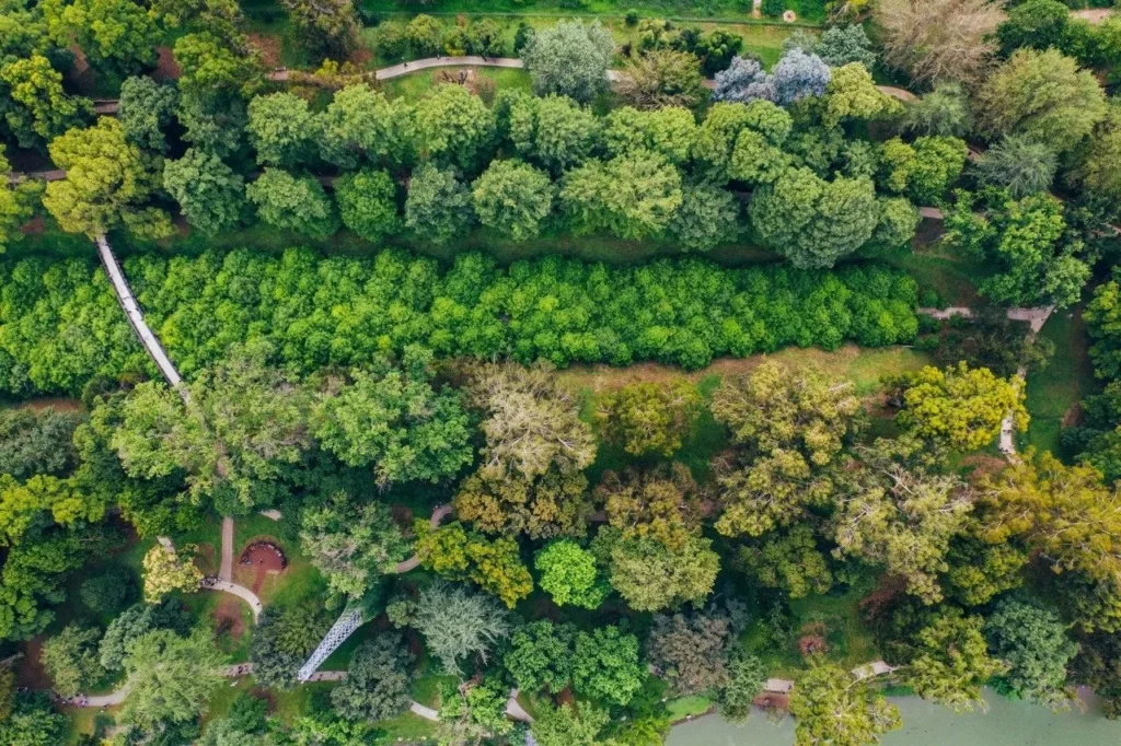

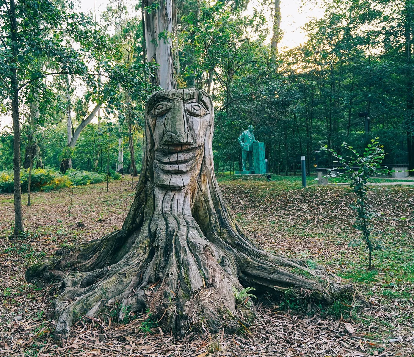
The “Musicians’ Park” is spread over 21 hectares and features unique perennial plants, beautiful paths, resting areas, and various interactive zones.
The main uniqueness of the park is that it houses monuments to Georgian and foreign musicians, with music performed by these artists constantly playing nearby.
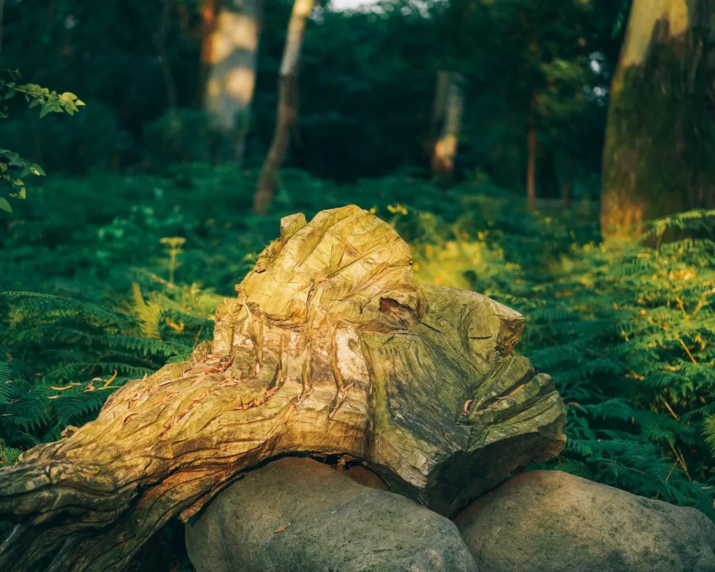
Ureki
The resort of Ureki is located in Ozurgeti Municipality, Guria, on the Black Sea coast, 4 meters above sea level. It is one of the popular seaside resorts that attracts many vacationers. The clear blue sea, sandy beaches, well-equipped hotels and green pine forests create a wonderful environment for lovers of seaside recreation. Ureki is a seaside climatic resort. The sea has a subtropical climate, with warm, snowless winters and hot summers. The average annual air temperature is 14.5°C, in January – 5.8°C, and in July – 22.6°C. The resort is distinguished by magnetic sand with healing properties. The depth of the sea is shallow for a long time, which is especially convenient if you are vacationing with children. For those who are attracted by chocolate tans, warm seas and sunny beaches, Ureki is one of the best places. If you want to relax and have a varied holiday with friends or family in a comfortable environment, here you will definitely be able to fill yourself with positive emotions and spend your time in a fun and colorful way.

Gogieti Waterfall (Ochenchkiri) (ოჩენჩქირი) is located in the village of Gogieti, in the Makvaneti community of Ozurgeti municipality, Guria, on the Agidakva River. The starting point of the waterfall is located at 600 meters above sea level, and the point of descent is at 520 meters above sea level. The last section of the road to the waterfall is a canyon, and in the last 20-30 meters there is also a small waterfall and then the canyon turns, which is why it is difficult to reach the point of descent of the waterfall without equipment.
View on map