Kvemo Kartli Region

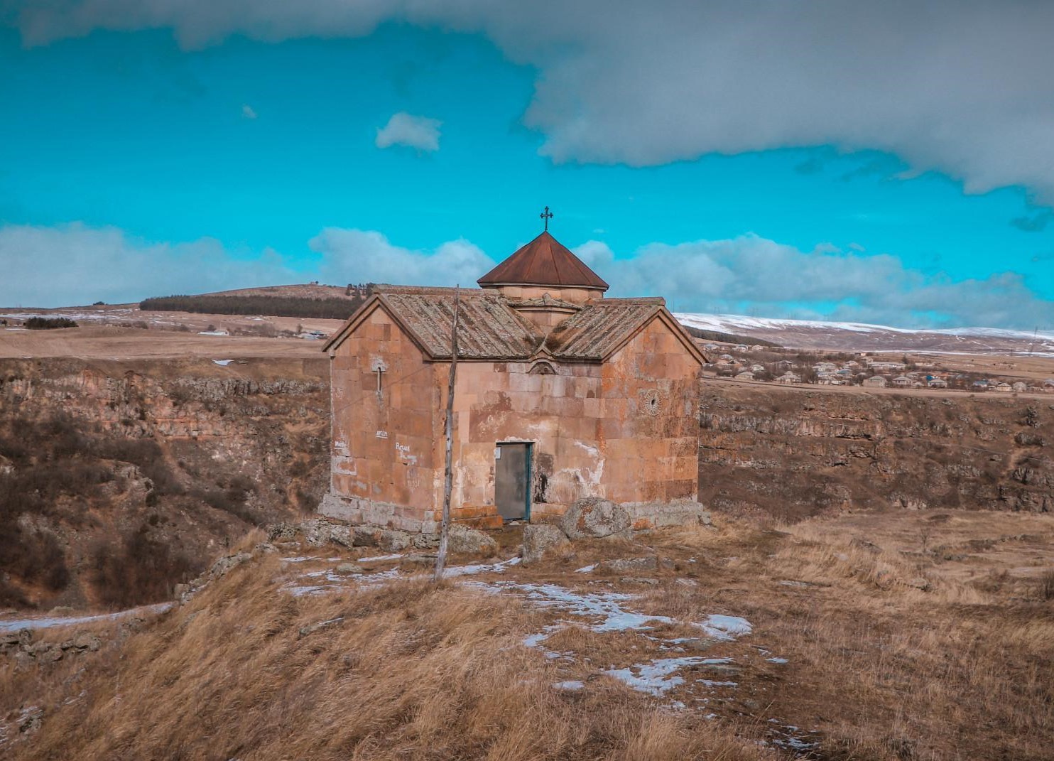


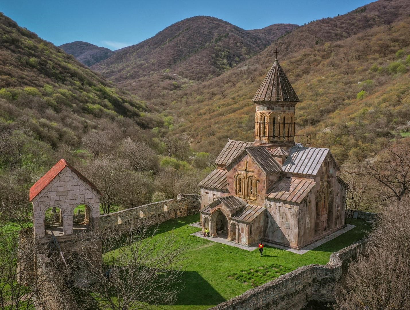
Kvemo Kartli is located in eastern Georgia, which covers the territories of Kvemo Kartli and Trialeti.
Kvemo Kartli is a region with ancient history. The region has kept the traces of each stage of human life. People lived here, even 1,800,000 years ago. The “first Europeans” were discovered in Dmanisi, whose names were Zezva and Mzia. The world knows them as the species, Georgian people (Homo Georgicus)
The Golden Mill of Sakdrisi from the IV Millennium is also here. Kvemo Kartli is rich with many interesting cultural monuments, beautiful and diverse nature, forests, lakes, mineral and thermal waters and resorts.
The territory of Kvemo Kartli has been settled by Kartvelian tribes since ancient times. Georgian people originated as a result of their long interaction and interconnections. The most known Kartvelian tribe from those times is Gougars or Gogars.
Kvemo Kartli is located in eastern Georgia and it is bordered by the ridges of Trialeti, Javakheti and Bambak-Yerevan. It is bordered by Kakheti on the east, Shida Kartli and Mtskheta-Mtianeti on the north, Samtskhe-Javakheti on the west, Armenia and Azerbaijan on the south.


Rustavi
Rustavi is a city in the southeast of Georgia, in the region of Kvemo Kartli and 20 km southeast of capital Tbilisi.
Rustavi is one of the ancient towns of Georgia. The history of Rustavi has two phases: an early history from ancient times until the city was destroyed in the 13th century and modern history from the Soviet era to the present.
Rustavi is mentioned among such ancient towns as Uplistsikhe, Urbnisi, Mtskheta and Sarkineti. It could be assumed that Rustavi as a city had been founded at least in the 5th–4th centuries B.C. Besides the manuscripts, the excavations of the castle Rustavi prove that Rustavi was an important political and administrative center of Iberia.
Rustavi was rebuilt as a major industrial center during the Soviet era. The development of Rustavi was part of Joseph Stalin’s accelerated industrialization process, and included ironworks, steelworks, chemical plants and an important railway station on the Tbilisi–Baku railroad line. Rustavi is the site of approximately 90 large and medium-sized industrial plants.
Rustavi Park & Fortress
One of the sights of the city is Rustavi Park, where the best space for recreation is arranged with basketball, football and volleyball courts, skate park, wooden decorative Panchaturi, picnic spaces, fountains and bicycle paths. The V-VIII centuries’ fortress and historical site of Rustavi are located in Rustavi Park.
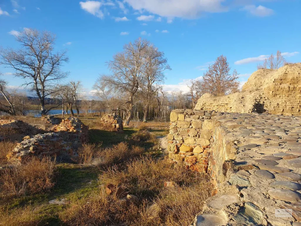
Rustavi Fortress is an old town, which was discovered by archaeological excavations and is included in the list of cultural heritage of Georgia. It is located in Rustavi Park.
Rustavi Fortress was one of the fortresses built around Tbilisi to protect the capital. During its existence, the fortress has had three different walls. The first wall (V-VIII centuries) had rectangular towers. The second one, the so-called “Internal wall” had semicircular towers. Later, these two walls were combined into one (IX-XI centuries). Third, the so-called “External wall” had a tunnel gate (XII-XIII centuries.). On the eastern side of the fortress, there were two walls surrounded. Rustavi Fortress is the only fortress in Georgia where you can find frescoes. In all historical sources, the fortress is mentioned as Rustavi Fortress-City or Rustavi Fortress.
By the time of writing this article archeologists discovered medieval armor at the territory of the fortress. See more at the Archeology Magazine Article
View on map
Rustavi Historiy Museum – is located in Rustavi. It was established in 1950, by a famous archaeologist and public figure Giorgi Lomtatidze .
There are 28 711 exhibits in the museum. Mainly those are the exhibits, found around Rustavi and its nearby places, during the excavations, they date back from XIX BC to XVIII AD. Here is their Facebook page.
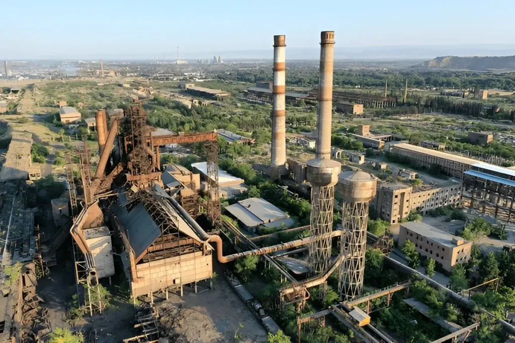
Rustavi Metallurgical Plant- Rustavi Steel is one of the largest metallurgical industries in the entire Caucasus region, located in Rustavi, 30 kilometers away from the capital of Georgia, Tbilisi.
The Rustavi Metallurgical Plant was founded in 1948 and was the first metallurgical factory in the Caucasus that produced steel, seamless pipes, and various constructions of cast iron, aluminum and iron. The plant was producing seamless pipes to meet the requirements of oil fields in Kazakhstan, Azerbaijan, Turkmenistan and the Middle East.
Nowadays, the new management and owners of the Rustavi Metallurgical Plant aim to restore the plant and develop activities in regional and new global markets within the framework of the main investment and restructuring program. The plant is now operating successfully and manufactures a variety of products, including: fittings, seamless pipes, iron casting, metal structures, mechanical details, lime and limestone etc.
Rustavi Metallurgical Plant exports to markets in the European Union, the United States, Russia and the Middle East, as well as to neighboring countries Armenia, Azerbaijan and Turkey.
For those who are interested in industrial history or engineering, the plant offers a unique look into Georgia’s past. While it may not be a typical tourist spot, it attracts people who want to understand the region’s growth and transformation over time.

Marneuli municipality
Marneuli municipality is located in the Kvemo Kartli region. The traces of human life in the municipality begins in the Stone Age, as evidenced by the Imiri hill, the Shulaveri hill, the eneolithic dwelling place of Iron Rock and other settlements. Apart from the stone age, layers of Early Bronze Age and medieval period were also identified, confirming that settlements in the area have in fact continuously been in existence. The remains of a megalithic fortress are still found in the district. Marneuli became a large settlement as a result of the unification of the villages: Lomtagora-Marneuli, Church, Chandar-Sandari and Sarvani. It became a separate district in 1947.
Around Marneuli, Neolithic settlements important in the history and culture of Georgia can be found such as Arukhlo Hill, Khrami Didi Hill, and Shulavri and Imir Hills.
Clay wine vessels and grape seeds, dating back 8,000 years, were discovered on Khrami Hill. Following complex studies, world-renowned scientists came to the conclusion that wild vines were domesticated by man for the first time on the territory of Georgia where wine was pressed from the cultivated vines. In addition, traces of cultivated wheat have also been found in Neolithic settlements, suggesting that Georgia is also one of the oldest centers of origin for cultivated wheat. Along with these great discoveries, here you can also see interesting monuments of the Middle Ages.
Shulaveri Fortress
is a medieval centuries’ building located in the village of Shulaveri, in Marneuli Municipality, Kvemo Kartli region. It is built on a rock of bare limestone. There are small fragments of the wall of the rock-based wall. The longitudinal axis of the fortress must have been developed from north to south, but today the shape of it is no longer clear. The remains of the wall were built of brick and flat stone, with a thick layer of lime. The walls survived about a meter high above ground level.
Kvemo Tserakvi monastery complex

Tsopi fortress
is located in Kvemo Kartli region, near the village of Sadakhlo, Marneuli Municipality. It dates back to the V-VI centuries. The fortress is built on a rocky mountain. The ruins of the upper fortress and fragments of the fence wall, which occupies a big area of the southern rocky slope, are preserved. The upper castle is divided into two parts by a wall. There are four semicircular pillars around the fortress. Pillars are also put in the walls to fortify the construction. You will find the remains of residential complexes and the ruins of a small church here as well. The walls of the fortress are made of white limestone with rectangular frames. Traces of human life in the surroundings of Tsopi Fortress have been confirmed since the Lower Paleolithic. The settlements dating to the Late Bronze and Early Iron Ages are found in this area. There is a village near the fortress, where there are two hall churches dating back VI-VII centuries.
View on map
Bolnisi Municipality
Bolnisi Municipality is located in Kvemo Kartli region.
The traces of human life started here from ancient times, dating back to the Stone Age. It is also proved by the settlements of this period. One of the well-known and important settlements is the hill of Araukhlo, where round buildings, stone sculptures, dishware, and stone tools were discovered. Bronze Age tombs, the remains of megalithic buildings were also found in Bolnisi, which shows that these areas were always inhabited. The name Bolnisi itself comes from the word “Bovi”, which according to Sulkhan-Saba(Georgian writer and diplomat) means ore.
Bolnisi has long been the seat of a bishop or archbishop, and is the home of the oldest dated Christian structure in Georgia. It is known as Bolnisi Sioni (Sioni being Georgian for Zion and a designation used by many of their churches).
There are still remnants of the German past in Bolnisi. A small graveyard and plaque acknowledges the German influence in the village. A small street called Mill Street has evidence of 19th-century German architecture and a few signs in the German language that date from the early 20th century
Bolnisi is one of the most interesting and diverse districts of Georgia and you can plan hiking and cultural adventures.
Bolnisi Sioni Church
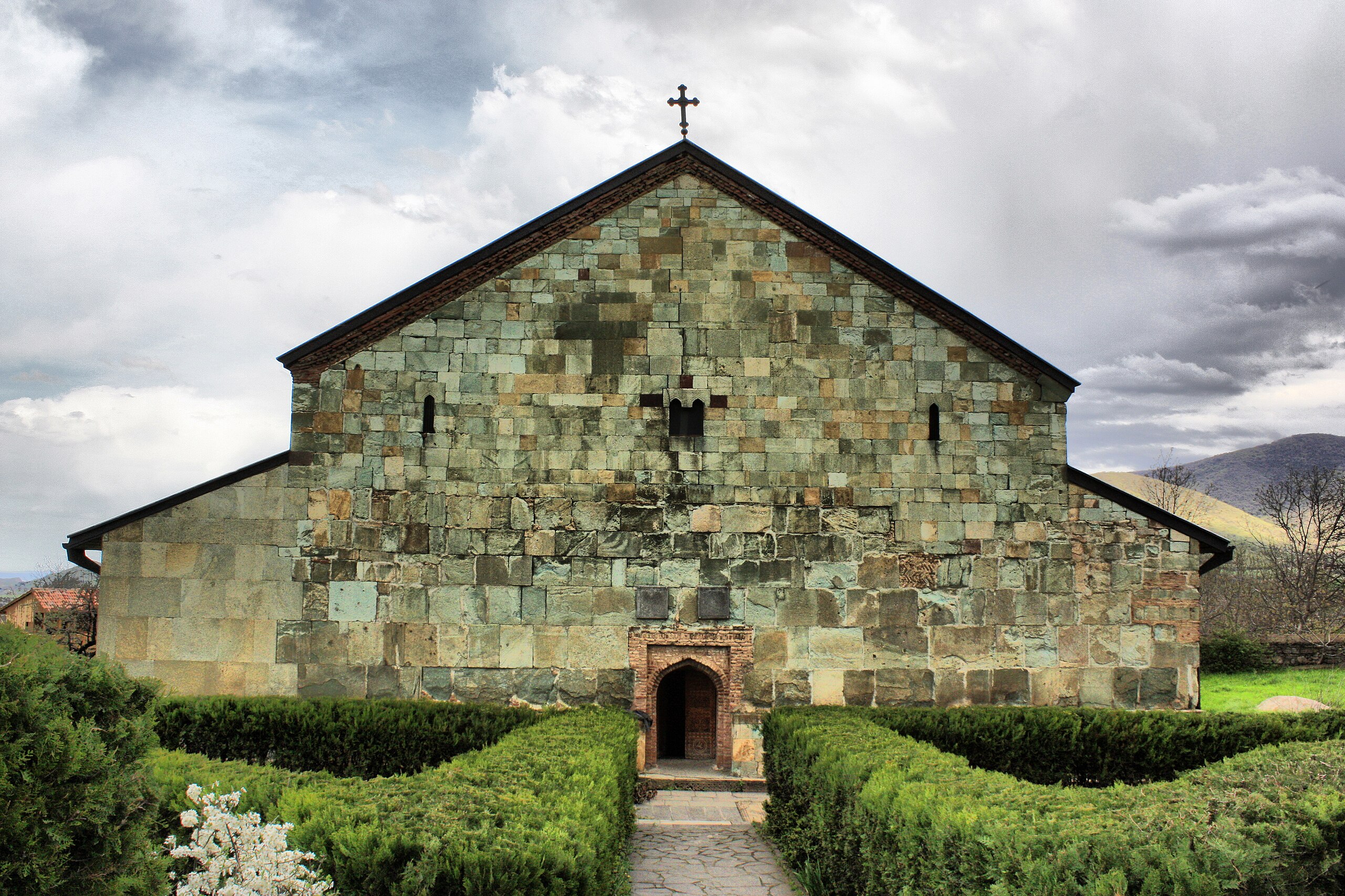
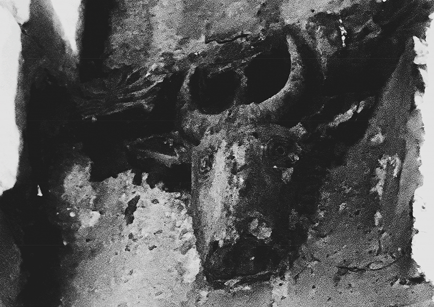
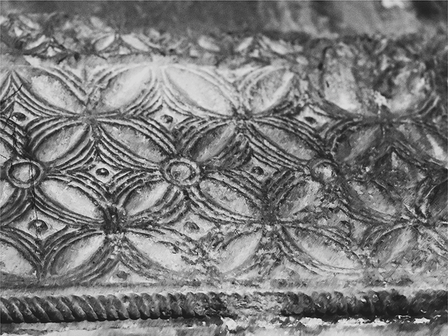
The tree-nave basilica dates to the 5th century AD and features some pagan elements in its stonework. The Bolnisi Church facade has saved the oldest Georgian inscriptions. For the first time in Georgian architecture, at Bolnisi Sioni we meet relief sculpture images (bull’s head, various birds and animals), which are related to the pre Christian era, however are assimilated by Christian Faith. At church we also meet the Christian symbol, Crosses of different shapes. One of the crosses (the cross in a circular frame with extended ending) is known with name of
“Bolonian Cross”
Bolnisi Sioni is one of the biggest basilica in Georgia. In the VII century, on the east side of the church was built a small chapel. Over some time, the north arches stoa-gallery collapsed. The temple was very damaged during the Persian invasion in 1634.
A dedication Bolnisi inscription from the Bolnisi church, carved in the late 5th century, is one of the oldest dated specimens of Georgian writing. The exact date of the church construction was determined by the inscriptions on the facade of the church. The inscription reads: “20 year old king Peroz, started to build this church and passed away after 14 years”. Today the inscribed tile is preserved in the Georgian Museum of Art (the one on the facade is replaced with a copy). The temple’s last restoration-conservation works were held in 1970-1971.

Tsugrugasheni
XIII century dome temple, located in Kvemo Kartli region, Bolnisi Municipality, on the right bank of the river Bolnisistskali, a few km from Bolnisi Sioni church, on a hill slope. The plan of the church is right-angled. The church is rich with the Georgian traditional ornaments.
In the church inscriptions are mentioned king Giorgi and the builder of the church Hasan son of Arsen. According to Rene Schmerling’s opinion, the mentioned king Giorgi must be the same as king Giorgi-Lasha, this means that the temple was built during his reign in 1212-1222.
In the temple, on the south wall, there is a so-called “hidden place” (it’s so narrow, that only a hand can reach it), where a stone is inserted, which depicts a Bolonian cross in a carved circle and Georgian inscription.
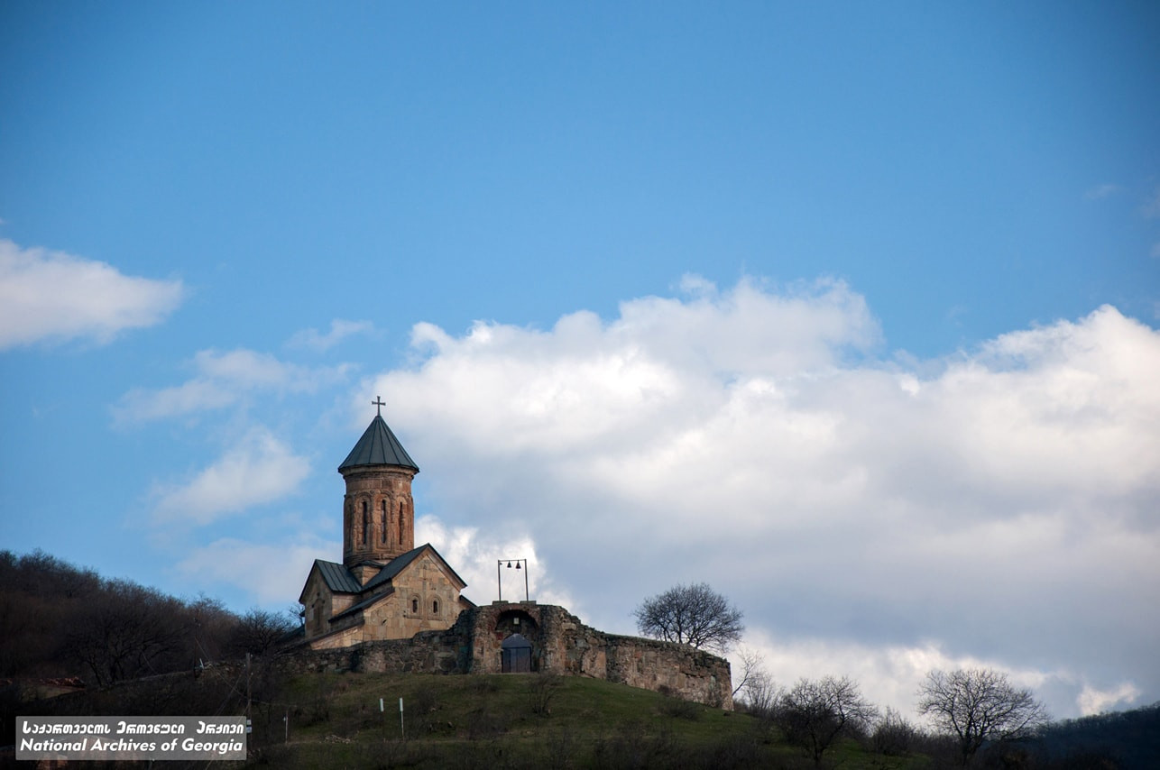


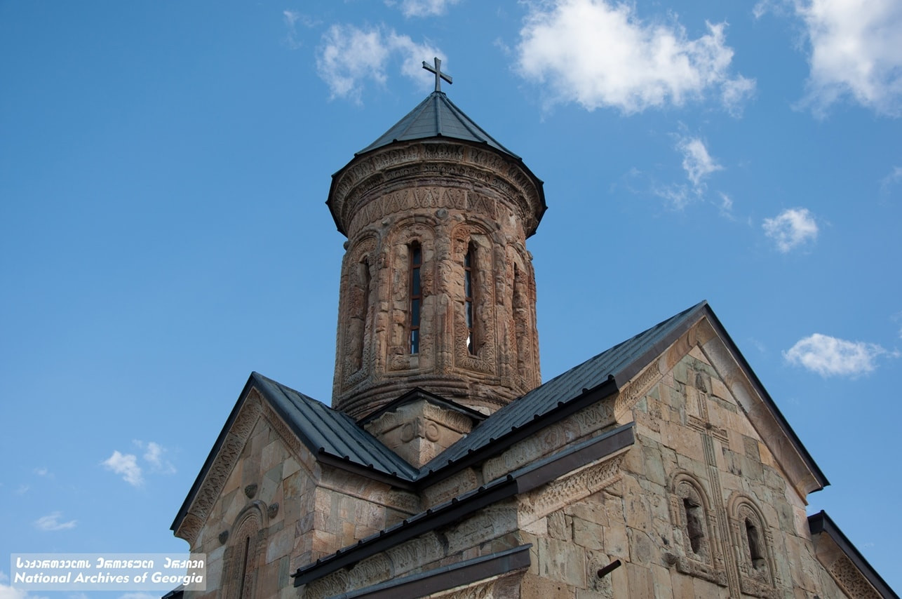
Akaurta Church— V-VI სს. Virgin Mary Assumption church is located in Kvemo Kartli region, Bolnisi municipality, village Akaurta, 720 meters above sea level. Akaurta church is built with large square blocks. It has the abscess on the east side. As it seems the church nave was divided by columns. There are vegetation reliefs on the north facade. The ornaments and decoration styles are related to Bolnisi Sioni. The monument was rehabilitated in 2007-2008.
Berdiki (Poladauri) Castle — historical castle which is located on a high rock hill, on the right bank of the river Bolnisistskali, near the village Poladauri in Bolnisi municipality, Kvemo Kartli region. It was named after the historic village Berdiki. There is a curtain wall and two towers, one of which is four floors. The castle was built in the medieval period. The castle controlled the shortest road passing in Poladauri gorge , which was connected to Ghoreshi through “Mgliskari” pass.

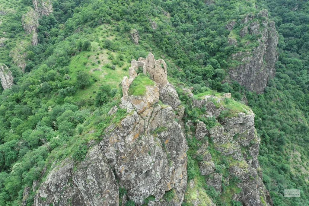
Kveshi Fortress is a medieval century fortress in eastern Georgia, Kvemo Kartli region, on the left bank of the Mashaveri River (near the village of Kveshi). The castle is built on a high rock that is naturally erected on the valley. The cliff is hard to reach from every side. Due to its location, it controlled the roads from Samshvilde to Tashir and Zurtaket-Javakheti .The fortress was built to match the landscape and is encircled by a 220 meters long wall, reaching a height of up to eight meters in some places. You can enter the fortress through a tunnel carved into the cliff. There is a small court church in the fortress yard, along with the remains of various other buildings, leading us to believe that it was also used as a living area. From the top of the fortress, there’s an amazing view of the surrounding villages, beautifully-tended vineyards, and green mountains.
Chapala Fortress (ruins) – Is located near the village Chapala, Bolnisi municipality, Kvemo Kartli region. At the right side of the confluence of the rivers Mashavera and Bolnisistskali.
Chapala fortress is built on the cliff gorge, which is rising in the valley. In the history it is mentioned in 1664, when the king Vakhtang V gifted the fortress to Elizbar Sologhashvili. In 1749 it was bought by the lord Dimitri Orbeliani. To our days the upper fortress and a yard with different buildings in it, surrounded with a wall. During the archaeological excavations the different buildings, water storage(XI-XII). At the bottom of the fortress are the remains of the village and two churches. Near the fortress, on the river Mashavera is an XVII century arch bridge.


Dmanisi Municipality
Dmanisi Museum-Reserve
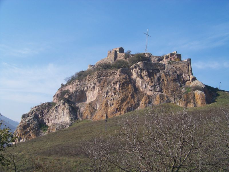
is located in Kvemo Kartli region, Dmanisi municipality, in the village of Patara Dmanisi. The museum-reserve includes: a medieval town, archaeological layers of the Late Bronze Age and the Early Paleolithic monument of Dmanisi. It was introduced to the world after archaeologists discovered fragments of 1.8 million-year-old human bones during archaeological excavations. The person found in Dmanisi is the first European. The medieval town included the inner fortress, the secular and worship buildings of the city, the secret tunnel and the suburb buildings. VI century Dmanisi Sioni has a unique gate decorated with XIII century ornaments and inscriptions. Dmanisi was one of the most powerful cities. It was located on the trade crossroads and was one of the most important towns and commercial centres in medieval Georgia, with fortifications, churches, Muslim and Christian cemeteries, bathhouses, and workshops.
View on mapAmamlo Tamar’s Church is a 12th-century church located 1 km from the village of Amamlo in the Dmanisi municipality, south of the village, on an old settlement with a small cemetery. The church, both in terms of its wall structure and decoration, reflects local building traditions. It is a single-nave hall building, with a rectangular apse on the east side, in the wall of which there is a niche (tsalo) on both sides of the window. The entrance is from the south. There is also a window on the western and southern walls. A stone altarpiece has been preserved in the sanctuary, which is decorated with a large relief image of a cross on a pedestal.
On the western facade, in a small Asomtavruli script, a construction inscription mentions Queen Tamar and Eristavi Kakha, her mother Kravai, and the builder of the monument, Okropiri, son of Beghela. The inscribed stone is preserved in the Georgian State Museum.
View on map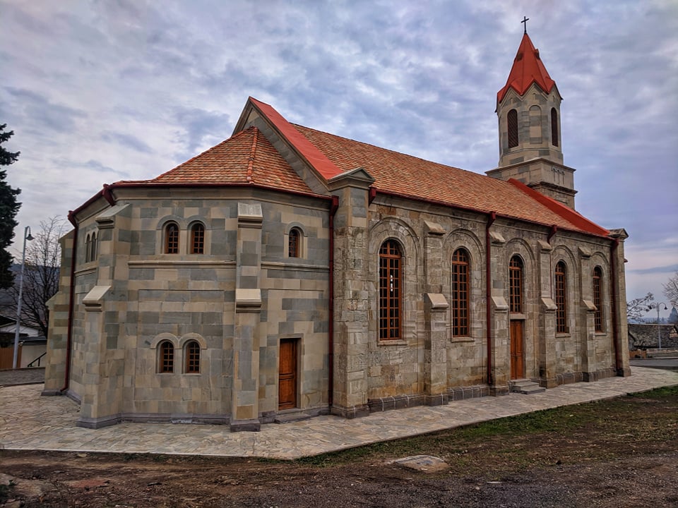
Tetritskaro Municipality
Located in Kvemo Kartli region, eastern Georgia. The administrative center is the town Tetritskaro, which is located on the site of the historic village of Garisi. The famous Garisi battle against the Qizilba tribes took place in this village in 1556. This region is characterized by beautiful nature and many ancient cultural monuments. There are cool forests, small lakes and steppe and sub-alpine meadows. The valleys of Khrami and Chivchavi are wonderful. You will discover mysterious megaliths, old churches, inaccessible castles and amazing views. The Ldiverse nature and culture of this area leave the visitors with an unforgettable impression.
Asureti village
is located in Kvemo Kartli region, belongs to Tetritskaro municipality. It is located on the right side of the river Assuretiskhevi, 760-800 meters above sea level. It is an old Georgian village, which was destroyed by invasions in the 18th century. In the 20s of the XIX century, German colonists were settled here by Tsarist Russia in the village and created a German colony – Elizabettali, as a pillar of its policy. The village was called “Elizabettali” until the beginning of XX century and later it got its original name – Asureti. You will meet the German architecture here. Also, there are the remains of the German church, built in 1871. There is a cemetery for Germans. The German settlement was here until 1941, and later Stalin ordered to deport Germans from Georgia and they settled the village with people from Ambrolauri and Oni.
Asureti is also distinguished by its beautiful nature. The forests, valleys and beautiful views create a peaceful and pleasant environment. One of the sightseeing spots in the village is the Asureti waterfall. (hiking distance)
Kabeni Monastery
Kabeni is located in Tetritskaro municipality, Kvemo Kartli region, near the village of Kiketi, in the Asuretistskali Gorge. The complex consisted of several monuments: the cupola-shaped church of the Virgin Mary, the Great Cathedral, the church of Svimon Mesveti and the Hall church of the Archangel Michael. There are some pictures and paintings saved that show that the Church of the Virgin Mary was an important monument of Georgian architecture of the first half of the XIII century. It almost repeated the plan of the church of Betania, but at the same time it was completely different by the facade decoration. In 1851 the church was painted. There is a small hall church to the north-west side of the fence. It is built with fragments of stones and has a yellow color. The decoration of the temple is based on the decorative system developed in XII-XIII centuries. An inscription on the east facade informs us that the sons of George Kabeni – NiKoloz, Vasil, Okropiri and Grigol completed the construction of a church that had begun during the reign of King Tamar.
View on map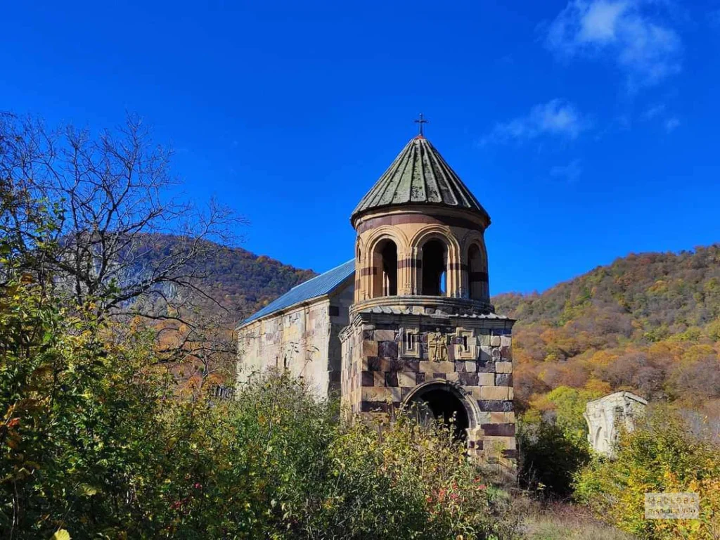
Khuluti Fortress
A monument of Georgian architecture, Castle Hall in Kvemo Kartli, Tetritskaro Municipality. It is located in the deep valley of the river Khrami, in the vicinity of the Pitareti monastery. The fortress has quite a strategic location and the passer in the valley could not avoid it.
It was built in the first third of the XVIII century by Kaplan Baratashvili-Orbelishvili. It consists of 2 parts; There are two towers in each and 5 towers in the fortress wall. Each of them is, first of all, for residential purposes, and then for fighting purposes. The Northwest tower is like a palace and there is a wall in the middle of which the steps are arranged. One side has 6 floors, the other – 7. The last floors are for fighting purposes and the rest of them are residential. The whole castle is built of local rock.
The tower overlooks the river from a pretty high cliff. It can be accessed through an uphill tunnel. There is a single-storey dwelling place, which seems to play the role of distributor. It could get in two different towers, in the tunnel that descends on the river, toilets and elsewhere. There is a big reservoir between this place and the tower. Above them is a flat roof and embrasures in the walls.
Pitareti monastery complex
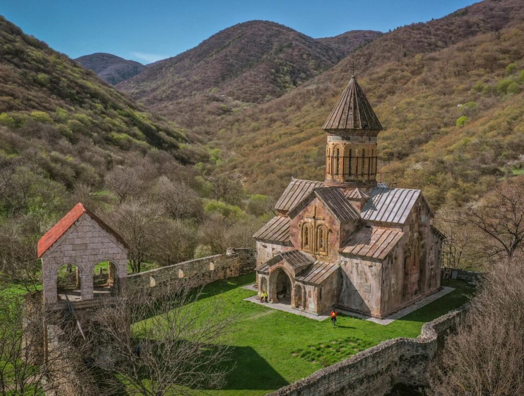
Located in Eastern Georgia, in Kvemo Kartli, Tetritskaro Municipality, 12 km southwest of Tetritskaro, in the gorge of the river Kcia. Nowadays, the monastery is functioning and falls under the subordination of Manglisi and Tsalka Eparchy. The monastery, which dates back to 1213-1222, was constructed during the reign of King Lasha-George. Pitareti monastery complex includes: church, the bell tower, wine cellar, fortress wall, platform, tomb, and various agricultural buildings, which are more or less damaged.
Pitareti monastery is also known for its diverse ornaments, which is characterized by high mastery of performance and that also sets this temple apart from other monuments of its era.

Algeti National Park
National Park in Eastern Georgia. It is located in historic Kvemo Kartli, in Tetritskaro municipality. It is situated in the valley of the Algeti River and covers the southern slopes of the eastern part of the Trialeti Range. Located at an altitude of 1100-1950 meters above sea level. The highest point is the rock (2000 m). It is distinguished by its landscape and biological diversity.
There are currently five eco-tourism routes in the area of Algeti National Park. Horse riding and hiking. Only one of them is marked as a tourist trail-” Royal Ridge”. 16 kilometers circular route.
Gokhnari Lodovani
is located in the Kvemo Kartli region, belongs to Tetritskaro municipality, near the village of Gokhnari, in the Algeti valley, 1500 meters above sea level. It is one of the biggest cyclopean complexes in Georgia and dates back II-I centuries BC. The complex consists of three main parts: crack-tunnel, old settlement and fortress. The monument is inaccessible from all sides except the northwest, from where there was the water road.
Gokhnari Lodovani’s area occupies 0,25 sq. km. There is a huge columnar monolith in the center, which is visible from all sides. The building has a rectangle shape. It is built by large blocks of unprocessed andesite rock. There are cylindrical towers on the southern margin. Also there are four truncheons in all three sections of the building with artificially arranged entrances. Here are five dolmens, fissure-tunnels, columnar monoliths of different sizes and a remnant of “Eratipa.” Gokhnari Lodovani is included in the whole complex of megalithic monuments around Sakrisi Mountain and belongs to the Early Bronze Age.
Algeti GoknariDidgori Monument
is located in Kvemo Kartli region, Tetritskaro Municipality. The memorial complex, which consists of many elements, is dedicated to one of the most important and famous battles in the history of Georgia, the Battle of Didgori. In 1121, the king David the Builder won the great victory in the battle of Didgori against numerous Turkish-Seljuk army. Historians have called this battle “A Miraculous Victory”. This victory in the Battle of Didgori gave Georgia a possibility to be liberated and it was the beginning of the golden era in Georgian history. The memorial occupies a large area. There is a monument with a lion depicted in the center of the complex, surrounded by large swords, ceremonial pillars, bells and other elements. The Didgori monument is erected in the open area and it makes a great impression on the visitors. Apart from the monument, you will enjoy the beautiful views of Shida Kartli and Kvemo Kartli from here. There is celebration of the Great Victory of Georgians at Didgori valley on the 12th of August every year, a variety of events are organized during the day. Many people from all over Georgia visit the Didgori Battle Memorial on this day. There is a road to drive to the Didgori Monument.
View on map


Manglisi Sioni Cathedral
According to historical sources, the first stone cathedral was built in this place during the proclamation of Christianity as a state religion in the 30s of the IV century. According to Leonti Mroveli, bishop John, who was sent by Constantine Caesar to Mirian King, brought sacred relics and abundant treasures to build churches in Georgia. He delayed at Manglisi before arriving in Mtskheta and started to build the temple, where he left part of the Holy Cross of Christ.
The monument has two distinct layers of construction. The first is a simple tetraconch type (Tetraconch is a type of Christian architecture and the basis of the plan represents a cross made of apse) temple, which was octahedron on the outside and covered with a dome. Probably, the first layer should be related to the Vakhtang Gorgasali period.
It should be noted that Manglisi is the earliest pattern, among the same type of temples. Therefore, from an architectural point of view, its details are a starting point for the development of this type of architecture in Georgia.In the VII century, Manglisi was destroyed during the invasion of Byzantine Emperor Heracles, and the sacred monuments, which were preserved here, were robbed. Historical sources say nothing about Manglisi until the first quarter of the XI century. During the reign of George I (1014-1027), the architecture of the temple was radically changed.Manglisi Sioni made its final changes (to which it has come to this day) during Russian rule, by the initiative of the Exarch Isidore and the efforts of the officers of the local Russian regiment in the mid-nineteenth century. The damaged temple was cleaned and repaired. Although the liturgy was restored after that, many important details of the temple were lost forever.
Samshvilde Canyon
This natural monument is the combination of river Chivchavi canyon and the gorge of lava locks in the middle of Khrami River. The depth of the canyon is 300 meters on average. The valleys lying in expanding space make a spectacular view. There is excellent scenery of the canyon from the area of Samshvilde. The combination of historical sites from different periods and beautiful nature attracts many visitors. This place is interesting for both nature lovers and people who are interested in historical and cultural monuments. Samshvilde Canyon includes the 5-6 km long River Khrami Canyon and 3-4 km long river Chivchavi Canyon.
Reaching to Samshvilde Canyon is very easy. There is a driving road to Samshvilde village. The monument of Samshvilde Canyon is about 1 km away from the village.
Samshvilde Fortress
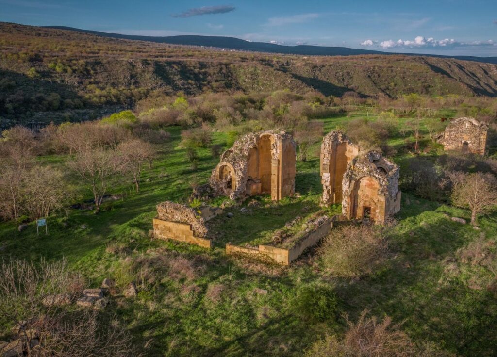
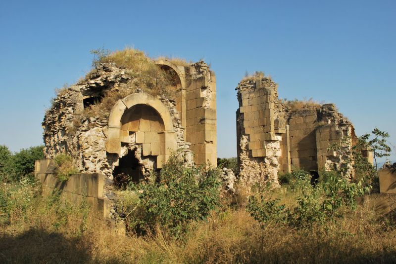
One of the oldest historical castle towns in Georgia, near the current village of Samshvilde, in Tetritskaro municipality, Kvemo Kartli.
The town castle is preserved as ruins. For the city was selected the naturally fortified cape at the confluence of the river Chivchavi and Khrami. On both sides are rocky ravine and on the third side is a fortress wall.
There are ruins of many fortifications, cults, and other purpose buildings in Samshvilde. The most important is the monument of Georgian architecture of the VIII century, which is the Great Episcopal Cathedral of Samshvilde Sioni with Central-Dome.
The fortress complex of Birtvisi
Birtvisi fortress is witness to the great history of Georgia. In its time, the fortress was considered to be impregnable. It is located in a naturally inaccessible place. Birtvisi is not a usual fortress which is surrounded by fortress walls and towers. There is a large territory surrounded by high and rocky mountains. The builders chose this natural fortress. After that they did a lot of work to artificially strengthen all exits and suspicious places. All necessary places are covered with a wall and organized for protection. At the entrance to the slope there is a cylindrical observation tower, which is so-called “Stubborn” the walls of which are equipped with an embrasure.
In addition to defensive structures, residential and agricultural buildings and also reservoirs are visible among the ruins of the fortress. In the late feudal period Birtvisi belonged to the feudal family of Baratashvili.
View on map

Gudarekhi Monastery Complex
It dates back to XII-XIII centuries. The monastery complex includes several buildings: the main church, bell tower, fireplace, building with a cross, the ornamented building, fence, gate, palace, stable, wine cellar, Cell I, Cell II, Cell III, building I, building III, pilasters building, rocky buildings , Shalva’s Church. Most of the buildings, except for the cult buildings, were built of stone. The monastery area covers about 4.5 hectares. The main church of Gudarekh was built during the reign of Rusudan, but the inscriptions on the wall of the church inform us that it stands on the site of an earlier temple. A two storey bell tower was built in 1278 by Demetre Tavdadebuli(Dedicated). Gudarekhi Monastery Complex is one of the important monuments of Georgian architecture.
Kldekari fortress
It was located at an important crossroads and controlled the caravan road. The territories of Tsalka and Manglisi, as well as the gorges of the rivers – Tana and Tedzami are visible from here. The fortress is built on the Trialeti Ridge and has two entrances cut in the rock. Klde in Georgian means rock, kari means door, the combination of two words mean door in the rock so the name of the fortress comes from here.
The fortress was the main fortress of the Baghvashi and it was built after the feudal Liparit I Baghvashi moved to Trialeti in the second half of the IX century. He has witnessed many battles. The history of Kldekari fortress is directly related to the Baghvashi ancestry and their conflict with the king and the local feudals. The fortress is heavily damaged and its original form is difficult to recover, it remains to show that it was a large-scale structure. Today there are traces of towers and palaces here. The fortress, its location and amazing views always impress the visitors.
Tsalka Municipality
Tsalka Municipality is located in Kvemo Kartli. The traces of human life in Tsalka municipality date back to the Stone Age, which is confirmed by ancient petroglyphs found in the village of Gantiadi. The petroglyphs of the Patara Khrami contain up to a hundred scribbled images and is an important cultural monument. Tsalka Municipality, historical Trialeti, is also a hub of Trialeti culture. Many Bronze Age kurgans have been discovered here, most of which are currently covered by the Tsalka Reservoir. Much of the gold fund of Georgia and other museum exhibits are found in the Trialeti Kurgans, including the famous Trialeti Gold Cup and Trialeti Silver Cup, which reflects the highest level of development of goldsmithing in Georgia in the II millennium BC. Historical Trialeti, the territory of today’s Tsalka municipality, is first mentioned in historical sources in the I century.
Tsalka Reservoir
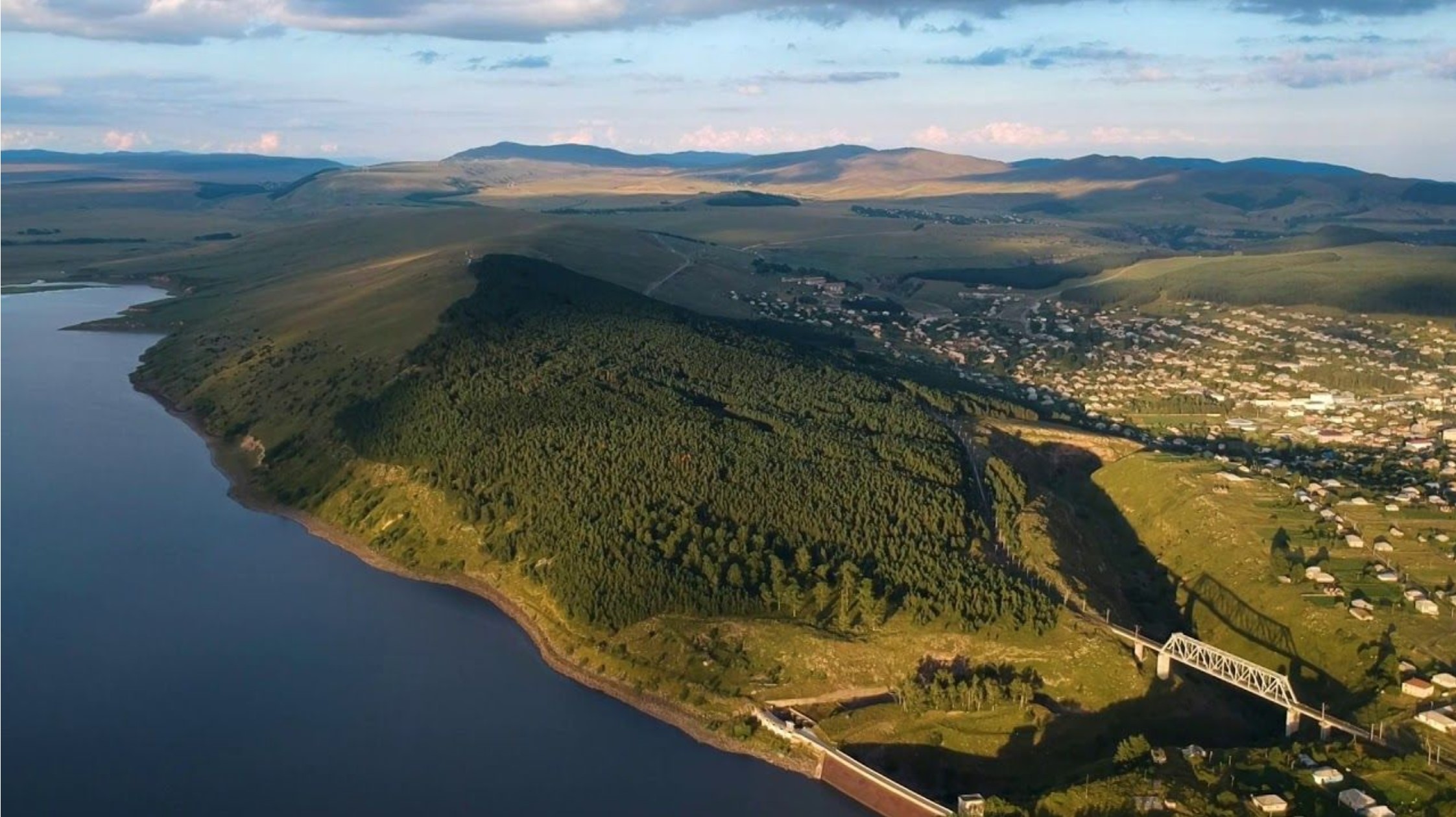
the biggest reservoir in Georgia, located in Tsalka Municipality, at an altitude of 1506 m above sea level, in the gorge of the river Khrami. It is stretched from the west to the east. Most of the shores are low and steep, on the south-eastern part of the shore – steep and high. It takes water from Khrami and other small rivers, as well as groundwater, snow and rain. It was designed with a concrete dam in a narrow and deep valley, for energy purposes in 1946. It is seasonally regulated. An ice cover is created on the reservoir from December to the end of March. The river Ktsia-Khrami flows into the reservoir.
Dashbashi Canyon
is located in Kvemo Kartli region, Tsalka municipality, in the gorge of the river Khrami, near the village Dashbashi, at 1110-1448 meters above sea level. It is a natural monument on the volcanic height of the river, Ktsia (Khrami). It is a rare canyon gorge, characterized by biodiversity. The Dashbashi waterfall hidden in the green attracts many visitors with its perfect atmosphere, like a paradise beauty. The canyon is also popular due to the fact that the walking distance is short and anyone can easily visit this amazing place without much effort. The most famous place in Dashbashi Canyon is the greatest waterfall. But the canyon is 8 km long and you can discover many more interesting and beautiful places, if you are an adventurer and you are not afraid by the relief. The nature and picturesque waterfalls on the steep slopes of the canyon create a completely different micro-landscape. You can discover natural and man-made caves in the Khrami Valley.
In summer, the average temperature in these places is +16 degrees, and in winter, when the temperature drops to -6, the waterfall freezes, creating a fabulous natural sight.
There is a 240-meter-long glass bridge over the canyon, called Diamond Bridge complete with a bar and restaurant at its center.
Visitors wishing to extend their stay can find small cabins situated along the canyon rim.

St. George’s Domed Church
“Free Cross” type domed building. It is located in Kvemo Kartli, Tsalka municipality, in the village of Dashbashi. According to the inscription, in the X-XI centuries it was built by order of Eristavt-Eristavi (Georgian: Duke) Rati.
St. George’s Church stands to the north of the village, on the banks of River Khrami. The domed church is built of hewn stone and it has the shape of a cross. The church has two entrances – the south of the west arm and the west of the north arm. The south door is covered with a large carved stone. There are inscriptions on the top of the south door and on the east wall. The church has been restored. There are tombstones and horse statues to the south and north of the church.
View on map
Lake Bareti
Is located in the village of Bareti, Tsalka Municipality, Kvemo Kartli Region, at 1,612 meters above sea level. Its mirror area is 1.24 km. The lake has no permanent tributary and it has an atmospheric precipitation. Lake Bareti is beautiful during all seasons. The blue lake with its open spaces creates wonderful scenery. This is a wonderful place for a picnic, for those who want to relax in nature.
The Avranlo fortress
Is a megalithic structure in the Tsalka Municipality in Georgia’s south-central region of Kvemo Kartli. A cyclopean fortification built using a dry masonry technique, it is located 0.5 km northwest of the eponymous village, on the left bank of the Ktsia river, at 1640 m above sea level. It dates to the last quarter of the 1st millennium BC. The fortification system is built on three terraces that run to the river. The first terrace is located on the bottom of the mountain, on the left bank of the river, the second one is created directly on the mountain slope, and the third one passes through the open field at the top of Ktsia Canyon. The castle consists of a citadel and the system of separated yards and small terraces, which are connected to each other by narrow exits and gates. The thickness of the fence walls reaches 3-4 meters in a particular area. There are the ruins of residential buildings in the fortress.