Tusheti & Khevsureti



Tusheti
Abano Pass & Bath
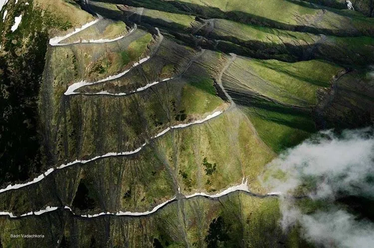
The only drivable road leading to Tusheti is through Abano Pass. Located at 2,950 metres, it is the highest drivable mountain pass in the Caucasus. Due to high altitude and snowy winters the pass is closed from mid-October till mid-April (depending on snow amount and road conditions). The damaged road surface allows only 4×4 cars to go through. Road closures can be frequent, so check conditions before traveling to this area.
The road to reach the pass starts in village Pshaveli and ends in Omalo. It has a length of 84,5km, but the expected driving time is more than 7 hours. It’s one of the top 50 highest mountain roads in Europe.
It’s a real challenging road and a true test of your vehicle and your stamina because the road abounds in twists and turns with wheels sometimes hanging above the precipice. On the way up to the pass you will see by the roadside a sign pointing out a local Spa – Bathhouse. Although basic, this Spa is known by Tushs as a “giver of life” with the potential for revitalizing the body and sorting out all manner of ailments. You can enjoy the indoor swimming pool with natural hot water for modest price of 5 GEL (2USD). Actually, the name of the pass – Abano (in Georgian means bathhouse) is derived from this facility.
Omalo
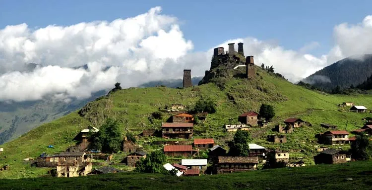
Omalo is a principal village in the historical region of Tusheti.
Omalo is located on a natural plateau, connecting 4 main gorges: Chanchakhovani gorge (with villages Shtrolta, Khiso, and Khakhabo), Chaghma gorge (with the villages Omalo, Shenako and Diklo), Pirikiti gorge (with villages Dartlo, Chesho, Parsma and Girevi), and Gometsari george (with villages Dochu, Beghela, Jvarboseli and Verkhovani).
The fortress of Keselo with its towers is a landmark in Omalo. It served as refuge for families when attacked. In Omalo you will find many guesthouses and a tourist information center where you can get maps and information about the whole area.
Shenaqo & Diklo
Shenaqo is one of the few villages in Tusheti where locals stay during the winter time (1 family). It is overlooked by Mount Diklo and contains a series of buildings of Georgian folk architecture and the old church of the Holy Trinity. We highly recommend to stay in this village in Oliko’s guesthouse.
Diklo is interesting for its fortress, standing on the cliff right at the border with Daghestan. Also here you can start a one day walking trail leading through remote village Chigo down to village Dartlo (the trail is very long and requires good physical shape).
Dartlo
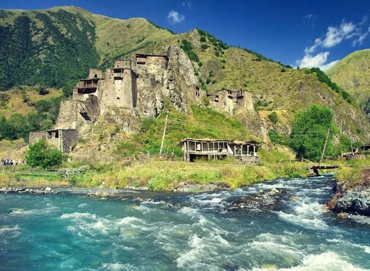
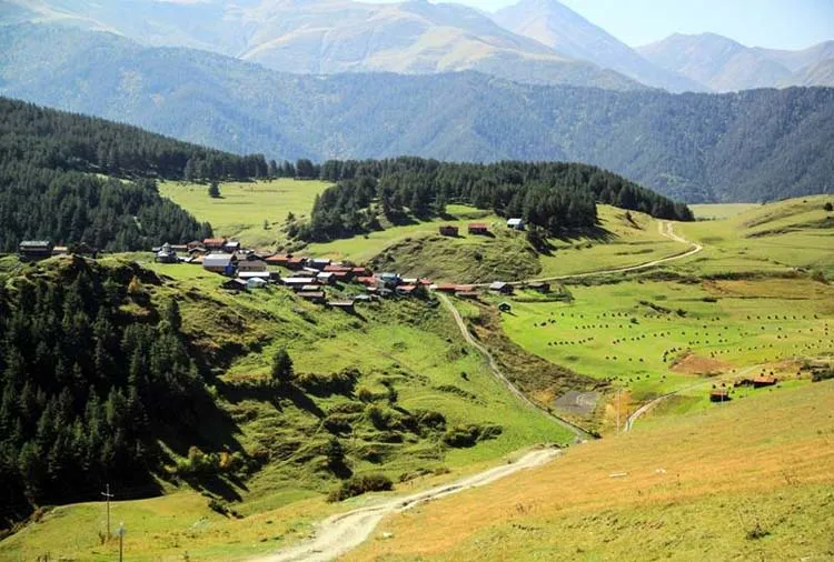
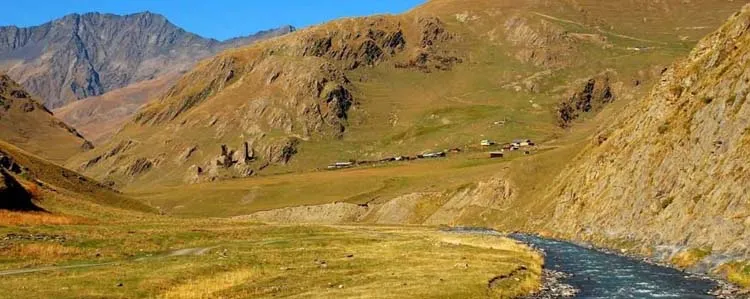
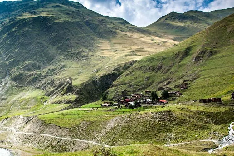
Dartlo is the most popular village in Tusheti and one of the biggests. Its situated on the beautiful alpine slopes of Caucasus Mountains at the level of 1850m; Apart from well preserved towers and stone houses here you will find lots of homestays, cafe with a perfect location, camping areas, tasty mountain cheese, view to waterfall, interesting petroglyphs. There are both Pagan and Christian religious buildings in Dartlo which are both considered as sacred. Dartlo used to be the main village to hold the court and council for the whole region.
Currently, 9 familys live in Dartlo. Don’t miss visiting abandoned village Kvavlo overlooking Dartlo. Short but steep ascend from 1850 to 2150 m.
View on mapChesho & Parsma
Chesho is a next small village with several guesthouses, good place to rest on the way to Girevi.
Village Parsma offers beautiful towers and amazing views of the valley.
Girevi
Girevi is a last inhabited village in the valley, has several guesthouses and a military blogspot (Must check in, if you are heading towards Atsunta pass and Khevsureti trail) can be reached by crossing the river by car or rocky narrow trail by foot. From here we recommend taking a 2 hour trip towards abandoned village Chontio or even further 3 day trek over Atsunta pass towards Khevsureti province village Shatili.
View on mapAtsunta Pass
One of the highest walking passes (3430m) in Georgia connecting Tusheti province with Khevsureti region. Offers amazing landscapes although requires pretty strenuous 3 day trekking time to reach the other side. No phone connection but beautiful landscape. In Tusheti we recommend also visiting Gometsari george with villages Jvarboseli and last one in the valley Indurta.
Here’s a nice video that features trail from Tusheti, over Atsunta pass (3430m) to Khevsureti Region, village Shatili.
Thanks to the author, Konrad Fersterer for great footage!
For information and details about trekking in Tusheti we highly recommend following website:
http://www.caucasus-trekking.com/regions/tusheti
Khevsureti
Shatili
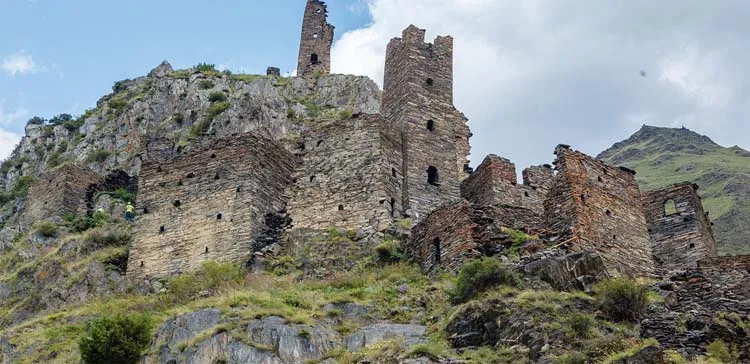
Shatili is a historic highland village in Georgia, near the border with Chechnya. It is located on the northern slope of the Greater Caucasus Mountains, in the historical Georgian province of Upper Khevsureti. Located in the deep Arghuni gorge at 1,400 meters, the village is a unique complex of medieval fortresses and fortified dwellings of stone and mortar which functioned both as a residential area and a fortress guarding the northeastern outskirts of the country. The fortress consists of the terraced structures dominated by flat-roofed dwellings and some 60 towers which cluster together to create a single chain of fortifications. Shatili is still inhabited by a dozen or so families, but is inaccessible by road during wintertime. The village is a favourite destination for tourists and mountain trekkers. According to a legend, in the early 19th century a large force of about 5000 Chechen and Dagestan warriors attacked Shatili, which was defended by only 50 Khevsurs.
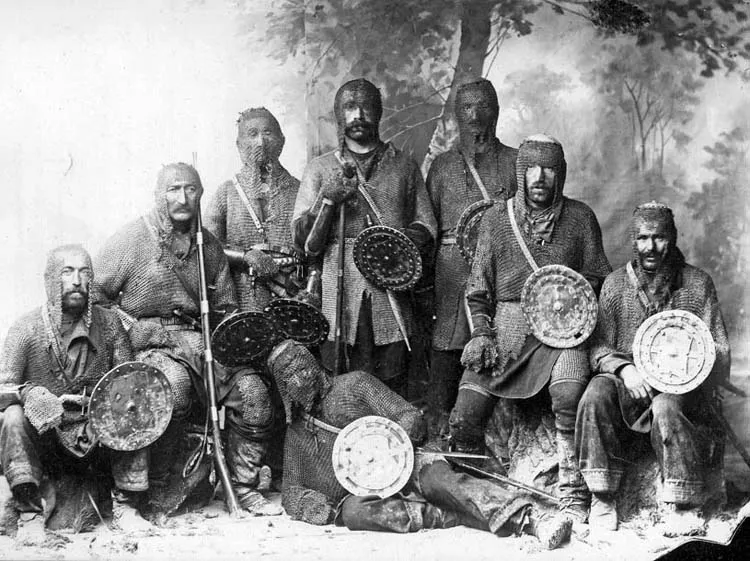
The Khevsurs were exceptional warriors with traditional Georgian qualities of courage, openness and honesty, fraternity, independence and love of freedom. In 1953 the Soviet authorities “convinced” all twenty families living in Shatili to move to Tbilisi but in the 1980s some new houses were built a couple hundred yards from the old village and some of the original inhabitants moved back.
Public Transport to Shatili from Didube bus station:
Tbilisi – Shatili (Khevsureti): Wednesday 9:00; Saturday 9:00
Shatili – Tbilisi: Thursday 12:00; Sunday 12:00
Mutso & Ardoti
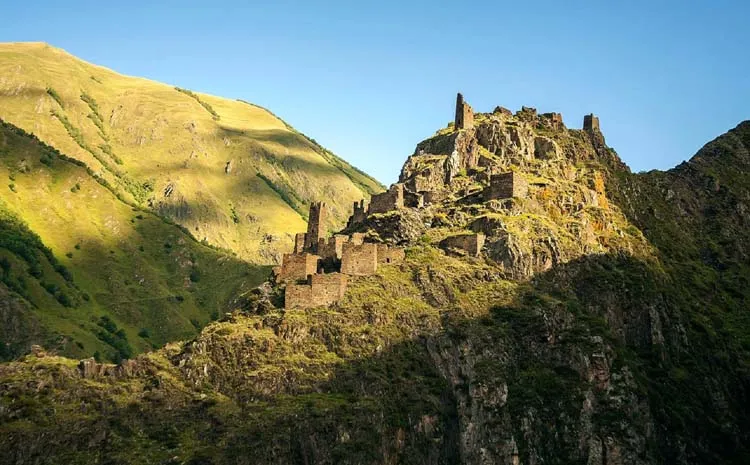
While in the area another must see former stronghold is Mutso. It is located on a rocky mountain (1880 m) on the right bank of the Andakistskali River. The village, almost completely abandoned more than a century ago, is a home to approximately 30 medieval fortified dwelling units arranged on vertical terraces above the Mutso-Ardoti gorge, four combat towers and ruins of several old structures and buildings. Difficult to access, the village retains original architecture, and is currently being rehabilitated.
A legend has it that the villagers worshiped the Broliskalo Icon of Archangel. They were renowned as fighters and hunters, and considered themselves permanent members of the army of the sacred flags and guardians of fabulous treasury donated to the Icon over the centuries. The legends say the treasury that is still kept in the high mountains around Mutso waiting for the chosen one to come.
From Mutso you can continue further to almost abandoned village Ardoti. There is a car road which often gets closed because of low maintenance
Roshka & Abudelauri Lakes
Village Roshka is another popular remote destination in Khevsureti Region. It can be reached by private transport (no public transport) from Barisakho or Tbilisi. Roshka is popular for its beautiful surroundings and nature. From Roshka 2 hours long trek leads travelers to the foothills of Chaukhi mountain massif (Khevsureti Side) and beautiful Abudelauri lakes. Abudelauri lakes are three lakes of different colors (Green, blue and white) located very close to each other in the beautiful alpine surroundings. Good place for camping and climbing. Also a destination for a trek over the Chaukhi pass to village Juta in Kazbegi Region
View on map