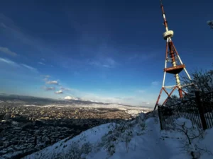
Kazbegi Area & Military Highway
The Georgian Military Highway is the historic route linking Tbilisi with Vladikavkaz, running for about 212 km through some of the most dramatic landscapes in the Caucasus. Long before it became an official road, traders, mountain clans, and invading armies used this corridor. Russian troops first marched through here in 1769, and the route later gained its modern form in the early 19th century when the Russian Empire rebuilt it as a strategic military road.
From the Russian side, the road climbs through the Terek Valley and enters Georgia through the narrow Dariali Gorge. It continues past Stepantsminda and crosses the Greater Caucasus at the Jvari (Cross) Pass, reaching 2,379 meters. Not far from the pass stands the huge Soviet-era Russia–Georgia Friendship Monument from 1983. The road then drops toward Gudauri—today a busy ski resort and a growing summer hub for mountain bikers—before following the valley of the Tetri Aragvi River to the turquoise Jhinvali Reservoir and the medieval Ananuri Fortress. Near Mtskheta it merges with Georgia’s main East–West highway.
Travel writers admired this route even a century ago—Baedeker’s 1914 guide called it “one of the most beautiful mountain roads in the world.” Its importance decreased for a while due to landslides, delays at the border, and Russia’s 2006 border closure. But since the crossing reopened in 2013, the highway has regained its role as a key link, especially for freight moving between Armenia and Russia. Despite its heavy traffic today, it remains one of the most impressive road journeys in the region.
Currently major construction work is in progress which will avoid climbing the Jvari pass through Gudauri and will offer a passage through the tunnel which is being dug out at the moment. So passing the ancient town of Mtskheta, taking a right turn from the main highway towards village Natakhtari, the route continues all the way north, to the border with north Ossetia.
Bazaleti Lake
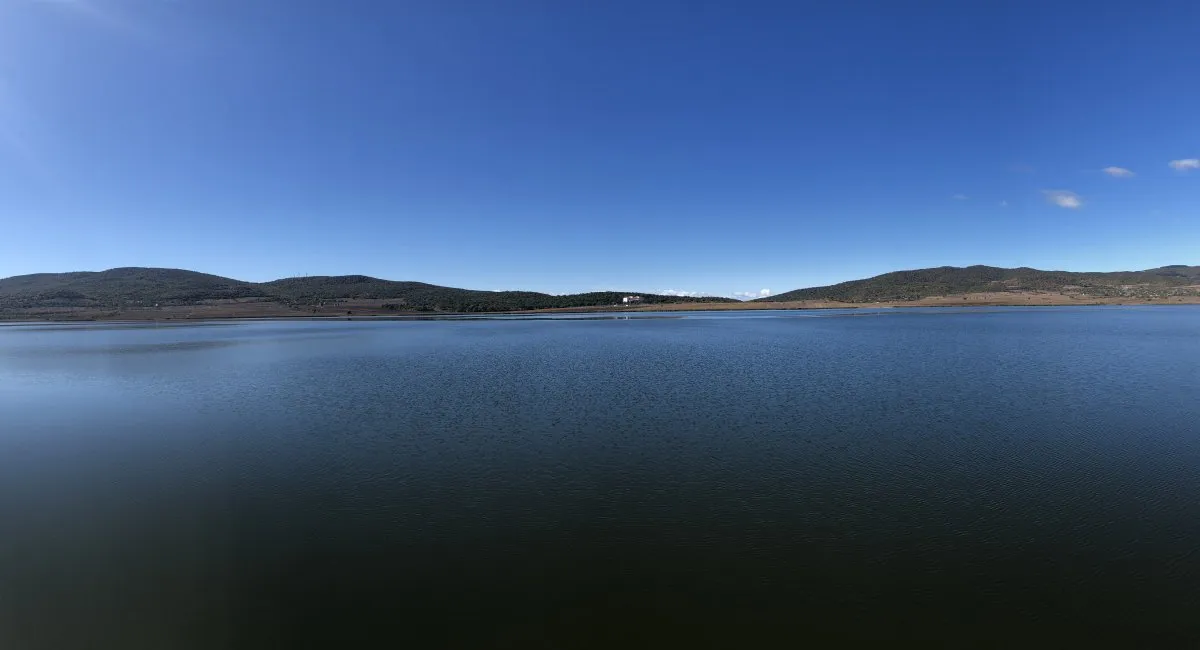
Bazaleti Lake is a lake in eastern Georgia some 60 km northwest of the nation’s capital Tbilisi and 5 km south of the town of Dusheti. The surface area of the lake is 1.22 km2. and its maximum depth is 30 m. It is known that Bazaleti lake has an outflow but it has not been discovered. The lake is used for fish culture, irrigation and recreation.
The nearby village and the historical district around the lake are also known as Bazaleti. In 1626, the Battle of Bazaleti between two rival Georgian factions took place there. The area around the lake housed a flourishing medieval town and is surrounded by many legends. According to local legend, a golden-lipped child is lying in a golden crib on the bottom of the lake. The lake was formed from his mother’s tears. The story is retold in a Georgian poem. Locals claim that the water in the lake recirculates. They tell a story about a bull which was drowned in the lake and was later found in a well in the nearby village.
Currently, the area is a popular recreational area served by a modern tourist complex.
Both the excavations and The Georgian Chronicles tell about considerable construction in the Hellenistic period: residential houses, palaces and fortifications. A new wall around Mtskheta was built by the first Georgian king, Parnavaz, in the beginning of the 3rd century BC, and later strengthened by his son Saurmag in the late 3rd – early 2nd century BC. In late 2nd – early 1st century BC, king Parnajom strengthened his relations with Persians and invited Zoroastrian priests to settle in Mtskheta. This probably led to construction of Zoroastrian temples in the city. Meanwhile, no such archeological evidence exists…
View on mapZhinvali Water Reservoir
Zhinvali Water Reservoir is located in the Mtskheta-Mtaineti region, Dusheti Municipality, north of the small town of Zhinvali, in the middle of the Aragvi River. It is one of the most beautiful places in Georgia and attracts many tourists. There is an important monument of Georgian architecture on the shore of the reservoir – the Ananuri complex, which makes this place even more interesting. Another monument located here is also noteworthy: during the construction of the Zhinvali hydroelectric complex, the 12th century Church of the Cross, which is submerged in water for 6 months and can be seen for 6 months, was flooded. Zhinvali Reservoir is a perfect place to unwind in nature, for a picnic or to escape from the summer heat. The reservoir and its surroundings are beautiful at any time of the year. Here you can get acquainted with important samples of Georgian culture, swim in blue water, sunbathe and enjoy the beauty of nature. The expansive space and the blue-green, rippling water between the mountains create amazing views. Zhinvali Reservoir is located between Alevi, Gudamakari and Kartli ridges. Its surface area is 11.5 km² and the maximum depth is 75 m. The reservoir is of great importance for the water supply of the city of Tbilisi, it supplies drinking water to about half of the population of Tbilisi.
View on map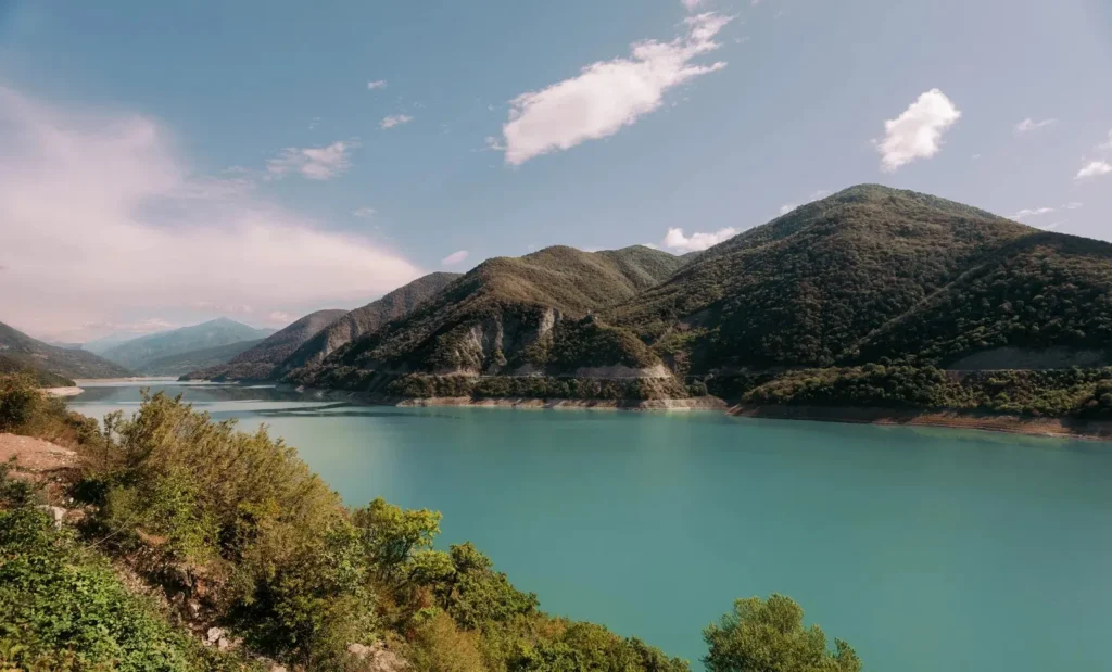
300 Aragveli Monument
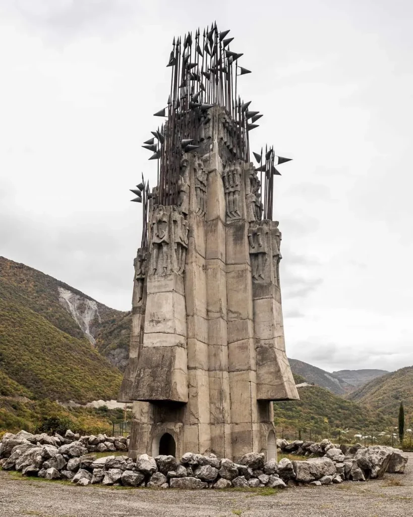
This is the 300 Aragveli Monument on the Georgian Military Highway, right by the Zhinvali Reservoir is a striking example of late-Soviet Georgian brutalism and one of the most dramatic but underrated monuments on the entire route. It was built to commemorate the 300 fighters from the Aragvi region who died defending Tbilisi during the 1795 Battle of Krtsanisi, when Persian forces under Agha Mohammad Khan invaded the kingdom of Kartli-Kakheti. These men from the Aragvi gorge were among the last to stand their ground.
The monument stands on a quiet roadside plateau above the Zhinvali Reservoir. The contrast between the calm turquoise water and the severe concrete tower creates a powerful mood.
During the Soviet period, Georgia became known for distinctive monumental art, and this piece is part of that legacy. It’s not as famous as the Friendship Monument near Gudauri, but architecturally it’s one of the most compelling. It binds together history, mythology, and landscape—the story of the Aragvi warriors placed right at the entrance to their homeland valley.
Ananuri Fortress
Ananuri Fortress Complex – a fortress of the feudal era (XVI-XVIII centuries) near the village of Ananuri. It is located in eastern Georgia, in Dusheti municipality of Mtskheta-Mtianeti region, on the historical side of Mtiuleti, on the Georgian military road, at the beginning of Zhinvali reservoir, at 900 meters above sea level.
In the past, this place was the main key point of Aragvi Saeristavo, where it gathered, on the one hand from the north – Tergi-Aragvi valleys and on the other hand, from the middle of Kartli, the main roads coming through Dusheti.
The buildings included in the complex are: upper and lower fortress, fence, towers, Church of the Mother of God, Church of the Deity, “Mkurnali” Church, bell tower, octagonal cell and reservoirs.
Ananuri Architectural Ensemble is one of the best monuments of the late feudal era of Georgia. This area (village) has been inhabited since ancient times. However, no traces of early buildings have survived. After the creation of Aragvi Saeristavo, it was included in this Saeristavo. Here was the main fortress of the Aragvi nobility. Its strategic importance increased even more after the weakening of the central government in Georgia (XVII-XVIII centuries). It was the residence of the nobles of Aragvi. The strengthening and restoration of the Ananuri fortress also belongs to this period.
The earliest building of the ensemble is the Khevsurian tower, which is located in the center of the upper fortress. It dates back to the XIV century. Zeda Tsikhe (upper fortress) (citadel) was built in the XVI-XVII centuries, and Kveda Tsikhe (lower fortress) – later, in the XVIII century.
In 1803-21 Ananuri was the provincial center. During the Kakheti uprising of 1812, it was burned down by Russian troops.


Mere Castle
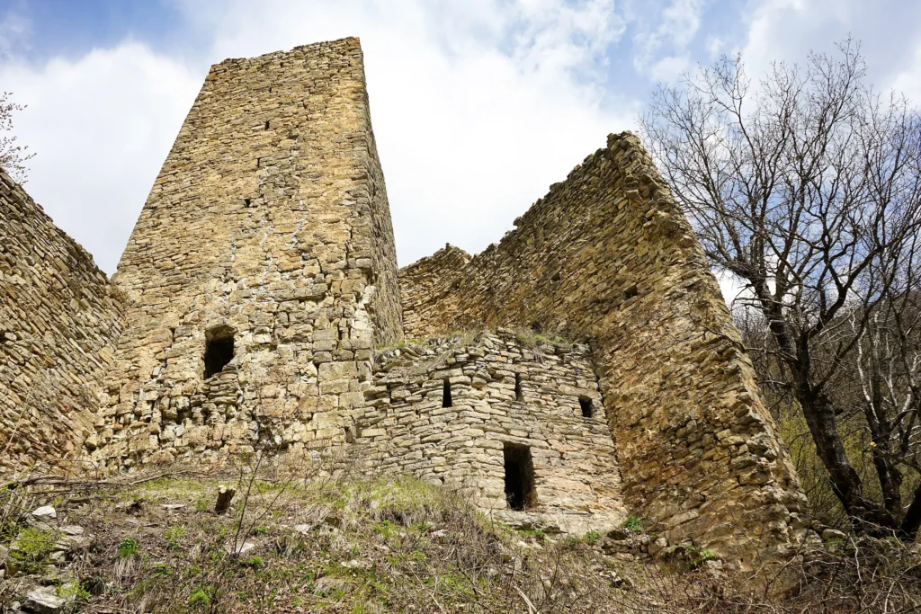
Mere Castle is located in the Mtskheta-Mtianeti region, Dusheti municipality, in the historical Mtiuleti, 200 meters north of the village of Buchaani, located south of the Pasanauri settlement, on the left bank of the Aragvi River, on a forested slope.
Initially, only a turreted tower stood here. In the second half of the 17th century, one of the feudal lords who rose from Bari, in order to make the tower more defensive, enclosed part of the slope below it with a high fence and built several buildings. He also took control of the Vashloba and Chartli gorges and taxed the local population with tribute. The Mtiuleti could not accept the arbitrariness of the feudal lord who had fortified himself in the castle and, with the help of the Khevsurs, expelled him from the castle. Later, the castle served to protect the Chartli and Vashloba communities from non-Georgian mountain raiders.
View on map
Resort Pasanauri & Black and white Aragvi junction
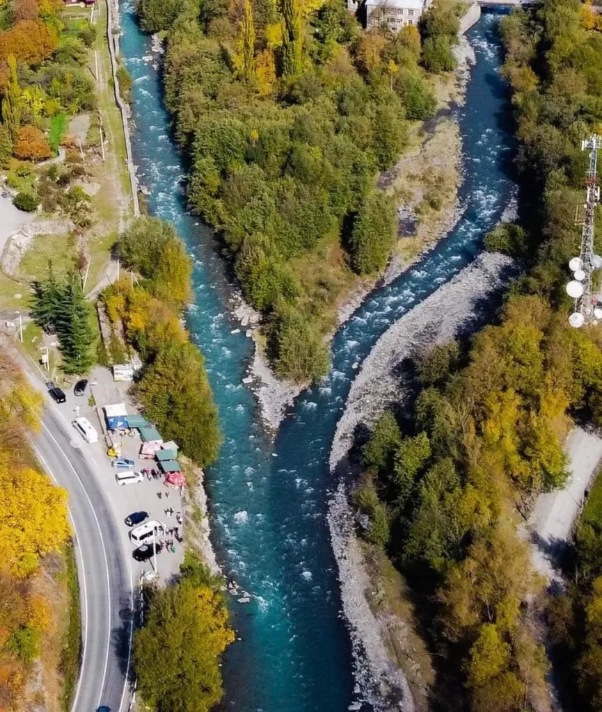
Resort Pasanauri is located in the Mtskheta-Mtianeti region, Dusheti Municipality, at the confluence of the rivers Mtiuleti Aragvi and Gudamakari Aragvi, at 1050 meters above sea level. It is the center of the historical-geographic region Mtiuleti and according to the legend, it was one of the centers of trade in ancient times. Pasanauri is famous for its natural beauty. Forests, mountains and amazing views attract many tourists. It has a moderately humid climate, with moderately cold winters and long, cool summers. The average annual temperature is 7.8 ° C, January – -4.1 ° C, and July – 18.5 ° C. There are hotels, a visitor center, a hospital, a library and other cultural and educational institutions in Pasanauri. If you love to relax in the mountains, the mountain climate, fresh air and beautiful environment are perfect for unwinding. Here you can also taste Mtiuletian cuisine, khinkali from Pasanauri, which is especially popular. In Pasanauri you will be able to relax in a comfortable, healthy environment and be filled with positive impressions and emotions.

Khada Gorge
Begotkari Archmartyr Church Complex
an architectural monument, located in the Mtskheta-Mtianeti region, Dusheti municipality, in the historical region of Mtiuleti, in the Khada Gorge, 4.4 kilometers east of the town of Gudauri.
The Begotkari complex is the main shrine of the Khada Gorge and is called “Mtavarmotsame”. The complex consists of a hall-type, rubble-stone-built, currently renovated church, a two-story bell tower and a stone-built fence.
The monument was built in 1908, commissioned by the local population.
The Bursachiri waterfall is located in the Mtskheta-Mtianeti region, in the Dusheti Municipality, east of the abandoned village of the Gudamakari community, Salagobo, in the middle of the Bursachiri river, at 2,170 meters above sea level. The total height of the waterfall is about 20 meters. It falls in two steps, the upper step is 3-4 meters high, and the lower step is 16-17 meters. The waterfall flowing among the huge rocks creates a delightful sight. Bursachiri Fall is a very impressive place and is perfect for a short trip. Alpine meadows, mountains, cliffs and a stunning waterfall attract many lovers of nature and wandering. The walking distance is only 2-2.5 km, so pretty easily you can make an unforgettable adventure and unwind with friends or family.
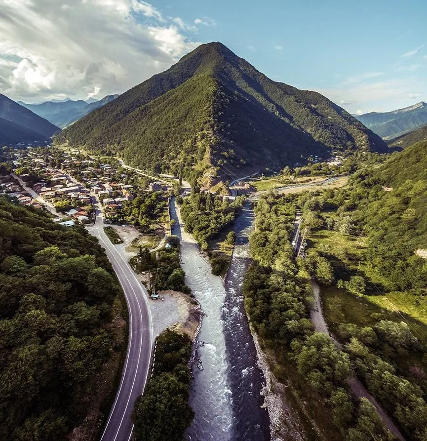
Nestled not far from the bustling city of Gudauri, Khada Gorge is a stunning tributary of the expansive Aragvi Gorge. The gorge derives its name from the Khadiskhali River that flows beneath it. While it might seem unassuming compared to its neighboring gorges, Khada is distinguished by the ancient towers that dot its slopes. Locals recount tales of nearly 60 towers once standing in this area, though today only about a dozen are still visible, and many remain hidden from view at the gorge’s base.
The village of Bedoni is the only settlement that boasts year-round residents. The entrance to Khada Gorge begins at the village of Kvesheti, located about 90 kilometers from Tbilisi. Near Bedoni, visitors can find a mineral spring rich in iron, though the taste of this water may not appeal to everyone. Once, a temple stood beside the spring, but now only its foundation remains.
The iconic towers of Khada Gorge have long been shrouded in mystery and have traditionally been off-limits to visitors. Their doors would only open during religious holidays, and access was restricted to men. Each tower is said to house a sanctuary, and one captivating legend speaks of golden sheep that once grazed near the farthest tower at the gorge’s end, echoing the myth of the Golden Fleece.
Khada Waterfall – is located in the Mtskheta-Mtianeti region, Dusheti municipality, in the historical region of Mtiuleti, in the Khada Gorge. The waterfall flows in several steps and creates small pools in the rock in the Khadistskali River Gorge. At the foot of the waterfall is a gorge into which the river flows, after the waterfall.
Waterfall Bedoni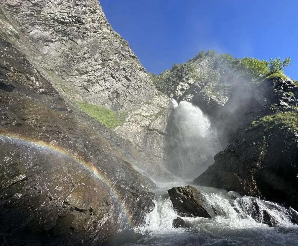
Lomisa Church
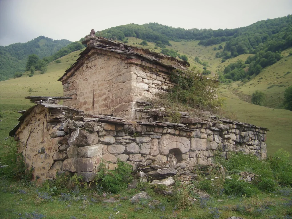
Lomisa Church (Lomisa Shrine) – The oldest shrine, Church of St. George, a monument of Georgian architecture, is located in the Mtskheta-Mtianeti region, Dusheti Municipality, in historical Mtiuleti, on the pass of River Ksani and River Argvi, 6 kilometers to the south of the village Lower Mleta.
Georgian architecture monument of St. George of Mleta belongs to the IX-X centuries. The complex includes the following buildings – a church, a bell tower and crypts. The plan of the building is a simple three-aisled basilica (14.5X7.8 m). It is built of rubble stone. The roofing chamber leans on a support arch raised on pilasters. There are niches in the longitudinal walls. Remains of various buildings are preserved around the temple.
To the south of the church stands a two-story bell tower of late medieval stone buildings. Currently, only the northern half of it is survived (both of the first floor towers and part of the second floor outer towers). The piers on the second floor are relatively narrow, with one similar pier placed between them. The first floor of the bell tower was covered with a low arch. The shape of the roof of the second floor is not determined.
Lomisa was a pre-Christian deity in Mtiuleti. According to the tradition, the name is associated with the lioness. Later, this cult was associated with the deity of the moon. This is evidenced by the fact that cult images of bulls (horns) often have the appearance of a new moon. According to legends and rituals, Lomisa deity was the hunter and the rider.
After the Christianization of the mountain, a Christian church was built on the site of the Temple of the Moon. The signs of a pagan cult got associated with St. Contacted George. He is a warrior, a rider of Christ. At the same time, the bull is known to be one of its symbols. Lomisa was the first shrine of the population of Mtiuleti and Ksani valleys. Many economic, political and military issues were resolved here.
Lomisoba – The Lomisoba celebration was held on Wednesday of the 7th week of Easter (and is still held). On this day, worshipers from all over eastern Georgia gathered in Mleta. The deacons were carrying out the flag and singing the song “Ferkhisa” while bringing the flag to the mountain, where the festival was held with a sacrifice. In the form of a Lomisa, they worshiped the leading cross, which was attached to the handle and had solar symbols – balls attached to the four ends.
There is a 6 km long hiking trail from Mleta village to the Lomisa shrine.
View on map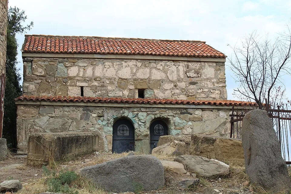
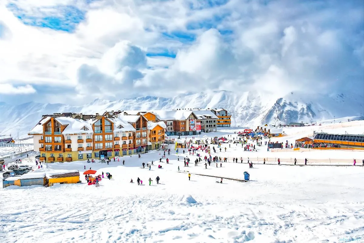
Gudauri SKI Resort
Georgia is home to many exceptionally beautiful winter resorts, but Gudauri might be the most well-known of them. Situated 120 kilometers away from Tbilisi, this amazing mountain and ski resort is especially popular due to its accessibility. You can depart from sunny Tbilisi and be on the slopes before lunch. Gudauri is covered with snow for about five months out of the year, making it perfect for skiers, extreme sports enthusiasts, active travelers, and people who are drawn to the alpine charm of Georgia’s mountains.
Here you can see amazing panoramic views from so called “Georgian-russian Friendship Monument” – a monument built in 1983 to celebrate the bicentennial of the Treaty of Georgievsk and the ongoing “friendship” between Soviet Georgia and Soviet Russia. Located on the Georgian Military Highway between the ski resort town of Gudauri and the Jvari pass, the monument is a large round stone and concrete structure overlooking the Devil’s Valley in the Caucasus Mountains. Inside the monument is a large tile mural that spans the whole circumference of the structure and depicts scenes of Georgian and Russian history.
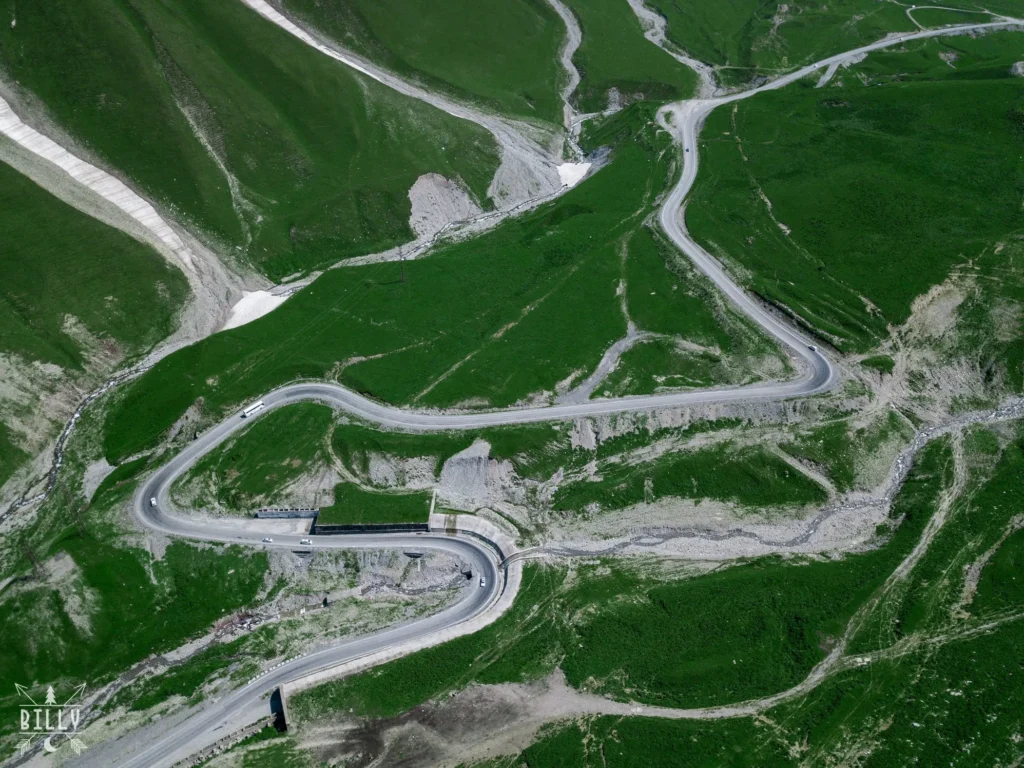
Jvari Pass
Jvari Pass Travertine Natural Monument is calcareous sinter or tufa in Baidara River valley on the left bank of the road tunnel of the Kobi-Gudauri motorway at 2197 meters above the sea level in Kazbegi Municipality, Georgia. This limestone was formed when carbonate minerals precipitate out of ambient temperature water. Travertine in some places is covered with a thin layer of transparent water on the white surface of the slopes where the intensive development process is still ongoing. It is part of Kazbegi Protected Areas.

Truso Gorge
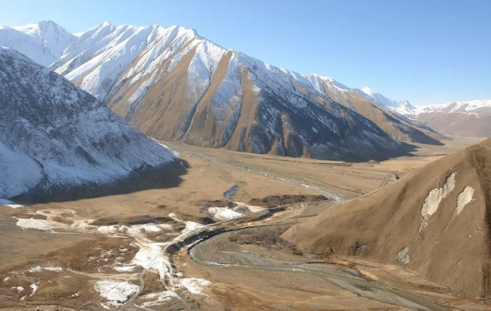
Truso Gorge is one of the quieter, more atmospheric corners of the Kazbegi region – an open valley filled with mineral springs, abandoned stone villages, and wide alpine views. It lies just south of the border zone near the Georgian Military Highway, but once you enter the gorge, the landscape shifts into something far more peaceful and untouched.
The route follows the Terek River upstream through a long, flat valley lined with colourful travertine formations created by natural mineral waters. In places, the ground glows orange, yellow, or white from centuries of deposits. Small streams run warm and milky-blue, giving the whole gorge an unusual, almost otherworldly look.
For visitors, Truso Gorge is ideal for a half-day or full-day hike: relatively flat, rich in history, and striking in its mix of wild nature and forgotten architecture. It’s a place where silence, wind, and wide valley landscapes do most of the storytelling.
Truso Travertines Natural Monument is a calcareous sinter or tufa in Truso valley on the right bank of Terek river at 2093 meters above the sea level in Kazbegi Municipality, Georgia. It is located about 2 km from village Keterisi where the local population lives only seasonally.
This limestone was formed when carbonate minerals precipitate out of ambient temperature water. Travertine in some places is covered with a thin layer of transparent water on the white surface of the slopes where intensive development is still ongoing.
Abano Mineral Lake Natural Monument is a small karst lake in Kazbegi Municipality in Truso valley on the left bank of Terek River, to the east of the village Abano at 2,127 m above sea level.
The lake was created by a carbon dioxide filled underground stream flowing to the surface through carbonate rocks from the late Jurassic period. The lake “boils” loudly with carbon dioxide bubbles bursting. The outflow of the stream is 2.5 million liters per 24 hours. The total surface area of the lake is 0.04 ha. The emission of gas in calm weather causes carbon dioxide to accumulate in lower levels. Small animals suffocate when they get near the lake, which is why there are dead animals there, such as mice, lizards, frogs and some birds
Keterisi Mineral Vaucluse Natural Monument is a cluster of powerful artesian aquifers pouring out mineral water at the foot of the Greater Caucasus, known as Narzan vaucluse: these mineral springs provide 25-30 million liters of hydrocarbonate-calcium water per day, (300-350 liters per second). It is the source of a stream with waterfalls in the village of Keterisi.
View on map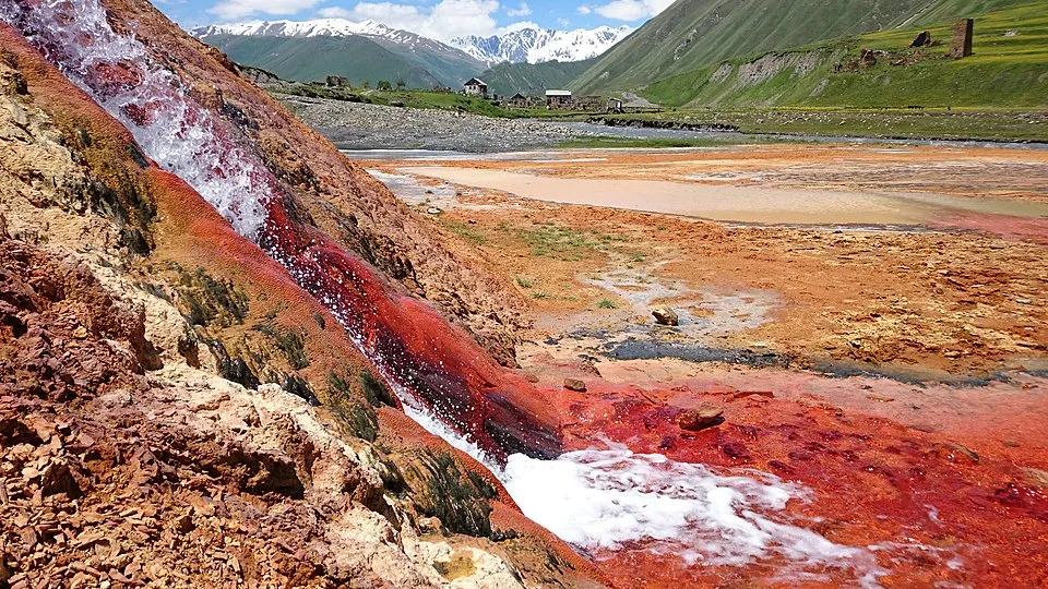

Zakagori – a fortress-town, a settlement in Kazbegi Municipality (Kobi Community), located in the Truso Gorge, on the left bank of the Tergi River. 2240 meters above sea level. 35 kilometers from Stepantsminda.
Abano Nunnery is located in the village of Abano, in the Truso Gorge, Kazbegi Municipality. The complex includes towers of the 17th-18th centuries and a basilica of the 19th century.
The southwest tower is five-story, 20 meters high, narrowing sharply at the top. The entrance is from the north, 3 meters above the ground. The first floor is filled in. There are loopholes in the walls of all five floors. The northwest tower is rectangular in plan, four-story, 15 meters high. The entrance is from the south, 2 meters above the ground. There are windows and loopholes on all floors. The northeast tower is also rectangular in plan. Only the first floor has survived, which is currently being renovated and has nuns’ cells.
The church is a hall (12.9 X 6.4 m), built of finely processed orange tuff squares. The entrance is from the west. The door is covered with a semicircular arch. On the east is a semicircular apse with a pointed arch. It repeats the internal outline from the outside. The apse is directly connected to the longitudinal walls of the hall from the inside and from the west. The church has one arched window on each of the four sides. The hall was covered with a semicircular vault, which rested on a semicircular arched arch supported by corner pilasters. On the wall on both sides of the window, a poorly executed figure of a man in a sharavandi is depicted. On the facades, a simple relief capital is removed by removing the background on the window covering stone. A cross-shaped stone is set in a row above the window, on which a relief cross is drawn. A dirt road leads to the monastery.
View on Map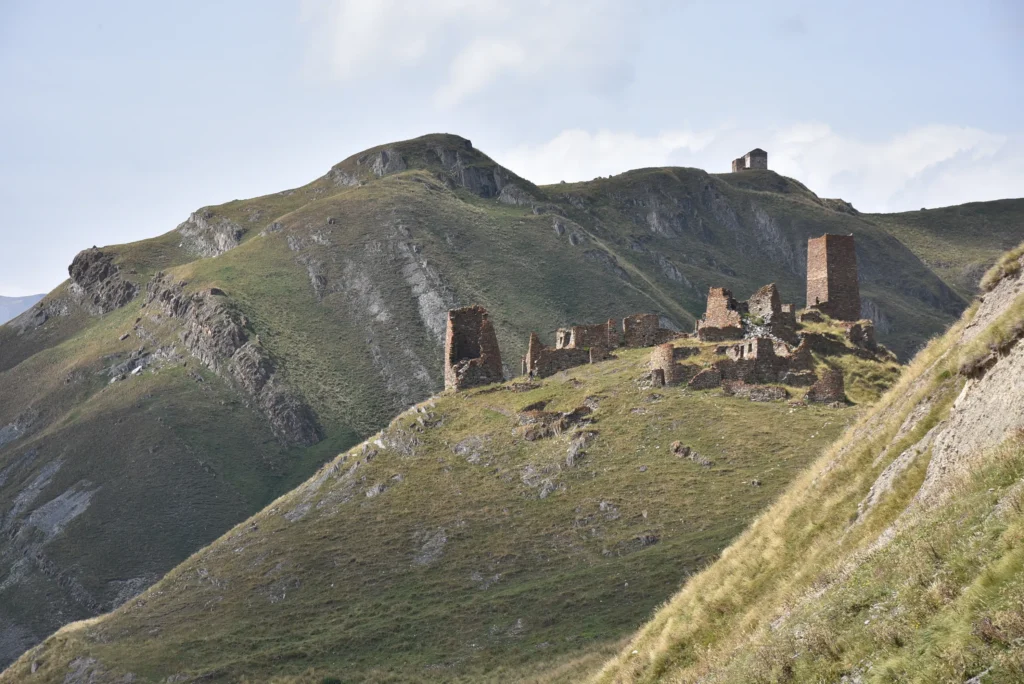
Sno Gorge
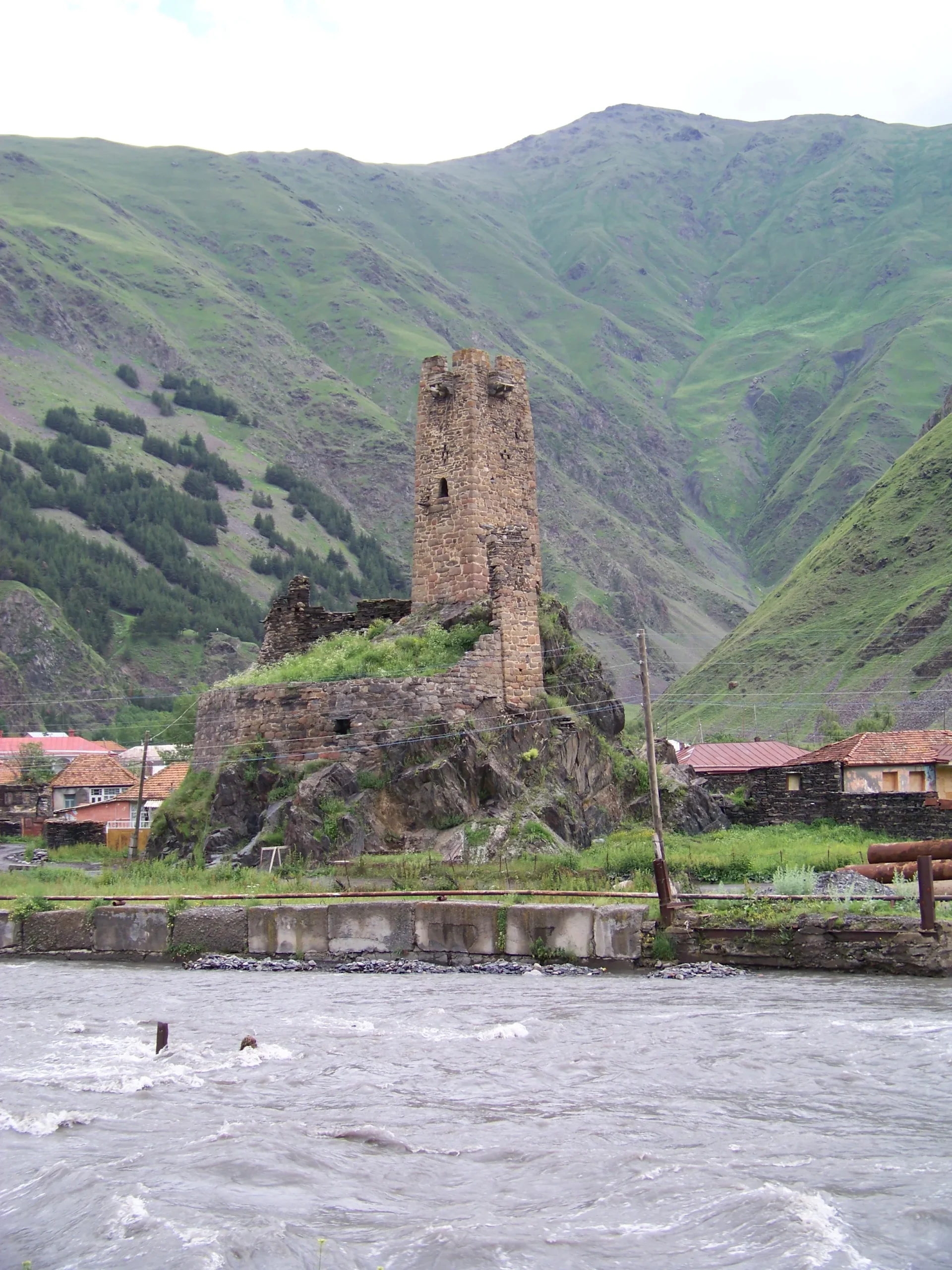
The Khevi Sioni Church Complex is a monument of the 9th-10th centuries and is located on a hill on the outskirts of the village of Sioni in the Kazbegi municipality. The complex includes a church, a wall and a tower. Traces of painting have been preserved on the western wall of the church. The decoration of the facades is poor. Near the church, on the edge of the cliff, there is a four-story watchtower. From the hill, a beautiful view of the Tergsia River and the Kazbegi Mountains opens.
The village of Sioni was a strategically important settlement in the Middle Ages. This complex was built during this period. The Sioni fortress-tower blocked the road to Dariali and was therefore a defensive structure of state importance. Houses from the 18th-19th centuries have also been preserved in the village. In 1804, the mountaineers who rebelled against Russia were fortified in the Sioni fortress.
The church is a rectangular, three-nave basilica in plan. It is built of hewn stone. The church has two entrances, from the south (now demolished) and from the north. Between the naves there are three arches carried on two rectangular piers. The width and height of the arches increase from west to east. The central nave is twice as wide as the side naves. The naves are covered with cylindrical vaults. The central nave has a short platform and a deep apse to the east. Below the window is a stone seat for a high clergyman. Next to the seat is a tall round stone column, on which a stone quadrangular icon is also inserted.
Sno Fortress, built in the 16th/17th century, is on a cliff in Sno village. It has a tower, a wall with gunports, and was part of Shiola Gudushauri’s domain. In the past, Sno Fortress acted as the valley’s main defensive fortification, where the inhabitants of the village could defend themselves during invasions. It is unknown who built the fortress, but its placement at the edge of the village was ideally chosen. The fortress allowed its holder to control the Sno River Valley and the roads that led to Khevshureti, Pshavi, and Mtiuleti through the Gudamakari Valley. Built of crushed stone and black slate, the fortress is composed of one tower and an almost completely circular wall with gunports and murder holes. Defenders would try to repulse the enemy by shooting from the gunports, but if the enemy made it to the base of the fortress, the murder holes were used to drop rocks atop them.
Giant head Sculptures
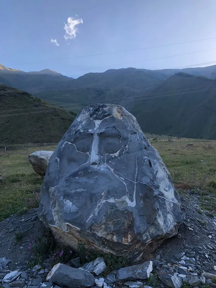
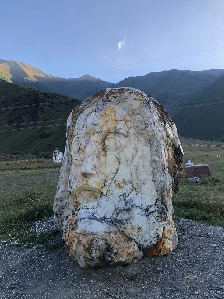
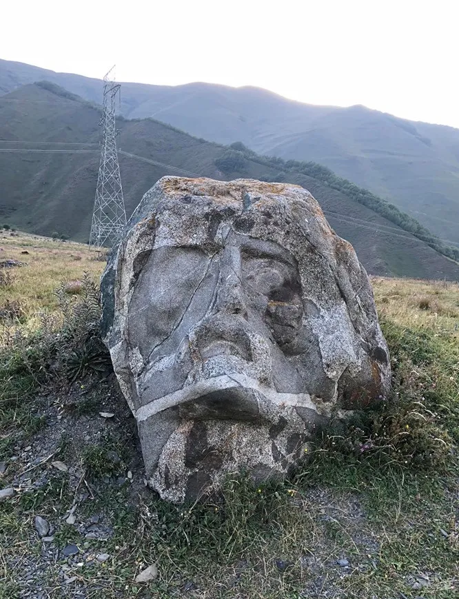
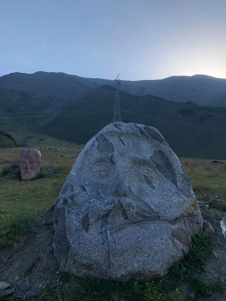
In a village of Sno, near Stepantsminda , lies a captivating open-air gallery of stone sculptures known as the Stone Heads of Sno. Created by self-taught sculptor Merab Piranishvili, these remarkable stone heads pay homage to prominent Georgian figures, such as Ilia Chavchavadze, Akaki Tsereteli, Vazha Pshavela, Shota Rustaveli, and even Jesus Christ. Stone Heads of Sno offer a unique and memorable experience for those who take the time to visit. To support Piranishvili’s artistic endeavors, visitors can leave donations in a small wooden box near the sculptures. Reaching the Stone Heads of Sno is a breeze; a quick drive from Stepantsminda along the E117 (Georgian Military Highway) leads to the Sno-Akhaltsikhe-Juta road, where the open-air exhibition awaits on the right.
Village Juta
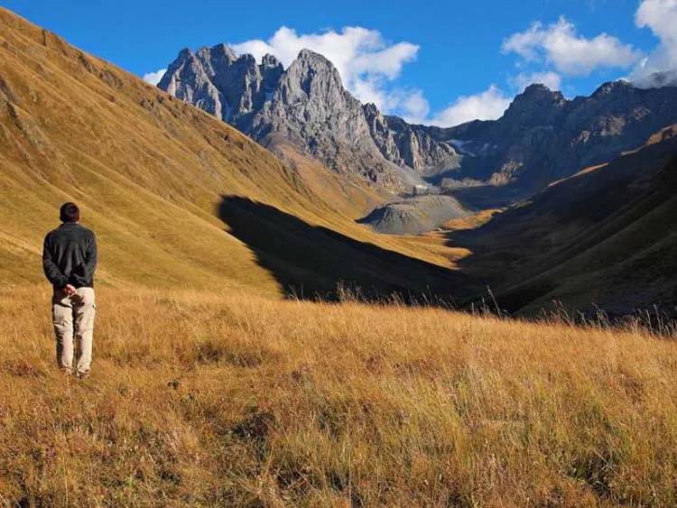
located high in the mountains, at 2200 meters above sea level. In winter, only a few families stay here, but in summer lots of locals and tourists visit the village. Juta is the last village of the valley, from where the footpath will take you to the Chiukh (Chaukh) Massif – which at first glance seems impregnable but is the best place for both beginners and professional climbers and mountaineers. The massif has several peaks higher than 3500 meters, on which routes of different categories and difficulty can be approached. However, this does not mean that Chiukhi is only for mountaineers, there is a 4 km easy hiking trail from Juta to the base of the Chiuhi massif that takes 1.5 hours to complete. On the trail, you will also come across the ice-cold Juti Lake.
Chaukhi Mountains
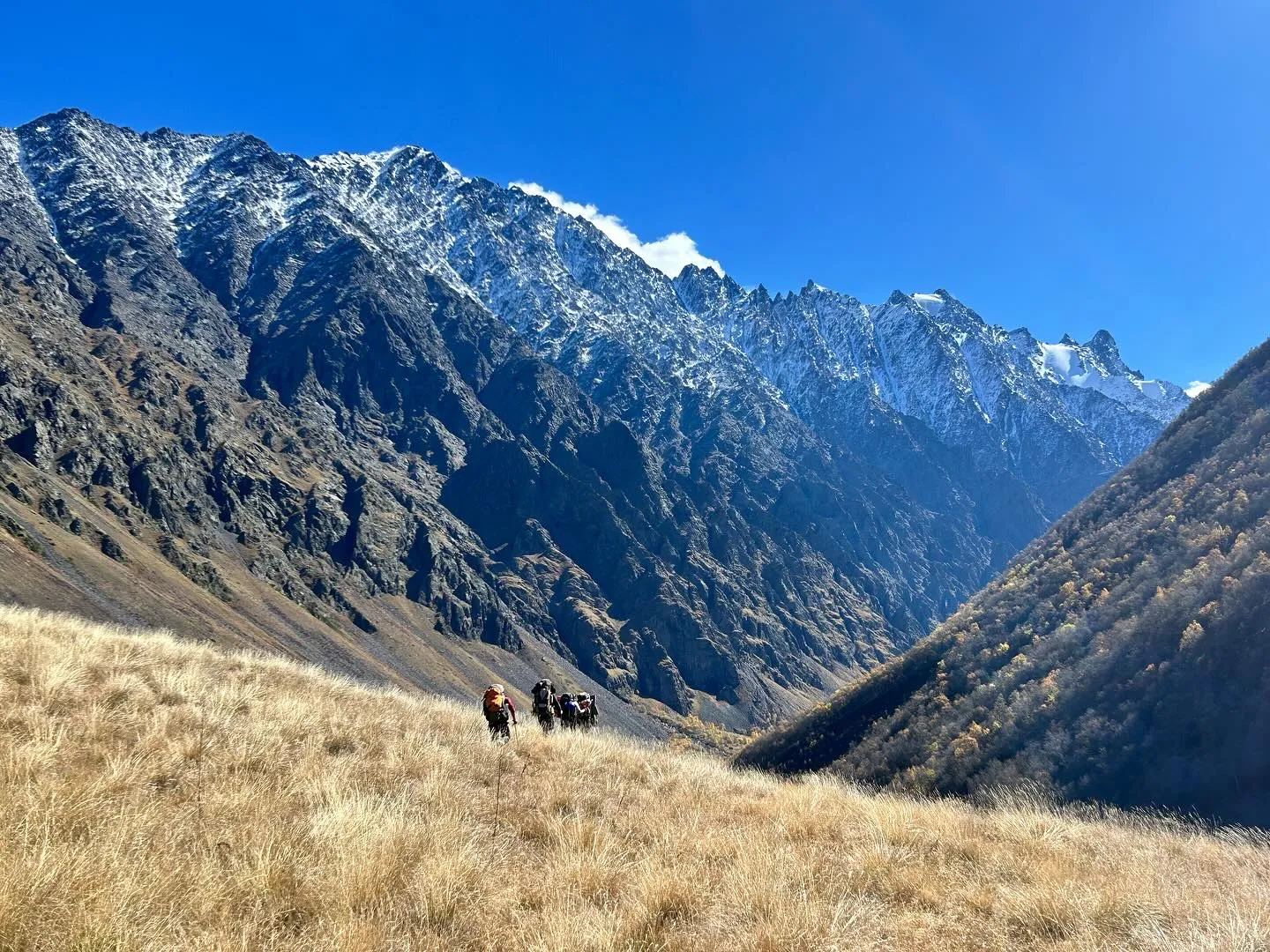
Situated on the eastern part of the Caucasus range, the Chaukhi Mountains form a rugged mountain massif often likened to the Georgian Dolomites. This region boasts 14 summits ranging in difficulty, ascending from the easiest routes to the more technically challenging ones, with the highest point reaching 3800 meters.
Nestled at an elevation of 2550 meters on a verdant grassy meadow between two rivers, the base camp offers a stunningly picturesque setting. This base camp serves as a favored destination for trekkers exploring the area. The trek to the base camp spans 2-3 hours and commences from the village of Juta. For travelers seeking accommodation, the vicinity features the cozy “Zeta” private camping area and the quaint 5th Season hotel.
Kazbegi
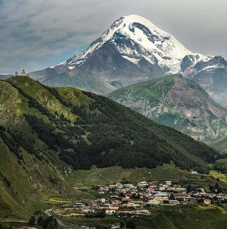
Kazbegi is a district of Georgia, in the region of Mtskheta-Mtianeti in east-north Georgia. The main settlement is Stepantsminda, accounting for about half of the total population. Kazbegi Municipality is situated in the upper valley of the Terek River, which goes on to traverse the Georgia–Russia border to the north and eventually drains into the Caspian Sea in Dagestan, Russian Federation. By the conventional definition of the Europe-Asia boundary as following the watershed of the Greater Caucasus, Kazbegi Municipality is geographically a European part of Georgia.
Kazbegi Municipality is known for its scenic location in the Greater Caucasus mountains, and it is a center for trekkers and mountain climbing. Local attractions include the Stephantsminda Museum of History in town, and the Gergeti Trinity Church outside of town, as well as Mount Kazbegi itself and the alpine meadows and forests of the surrounding Kazbegi Nature Reserve, Juta mountain, Gveleti Waterfall, Truso valley and Abudelauri blue lakes.
Stepantsminda
The small town of Stepantsminda, formerly known as Kazbegi, is situated at an elevation of 1700 meters above sea level in the Mtskheta-Mtianeti region of northeastern Georgia. From both a historical and ethnographic standpoint, the town is intricately connected to the Khevi province. It serves as the central hub of the Kazbegi Municipality.
Resting along the banks of the Terek River, Stepantsminda is positioned 157 kilometers (98 miles) to the north of Tbilisi. The climate in Stepantsminda is characterized by moderate humidity, with relatively dry, chilly winters and extended, mild summers. The town is encompassed by imposing mountains on all sides, with Mount Kazbek, the region’s most prominent peak, situated immediately to the west of the town.
The naming of Stepantsminda, which translates to “Saint Stephan,” is rooted in tradition. Legend holds that a Georgian Orthodox monk named Stephan established a hermitage at this location, which later evolved into the Georgian Military Highway.
The name “Kazbegi” also has ties to the renowned Georgian writer Alexander Kazbegi (1848–1893). Alexander Kazbegi was the great-grandson of Kazibek Chopikashvili, a local feudal magnate who was responsible for collecting tolls on the Georgian Military Highway. After studying in Tbilisi, Saint Petersburg, and Moscow, Alexander Kazbegi returned to his hometown and took on the role of a shepherd to gain insight into the lives of the local people. He subsequently pursued a career as a journalist, followed by a transition into being a novelist and playwright. The final resting place of Alexander Kazbegi is within his ancestor’s former residence, which now serves as a museum in his honor. A monument dedicated to the writer stands in the heart of the town. When in town, do not miss:
- An afternoon beer at cafe 5047 in the very center of the town
- Dinner on a terrace or library of Rooms Hotel Kazbegi
- A swim in the natural, carbonated swimming pool, 2km from the town
- Hike to Gegreti Trinity Church and higher towards alpine cottages on the slopes of Mt. Kazbegi
Gergeti Trinity Church
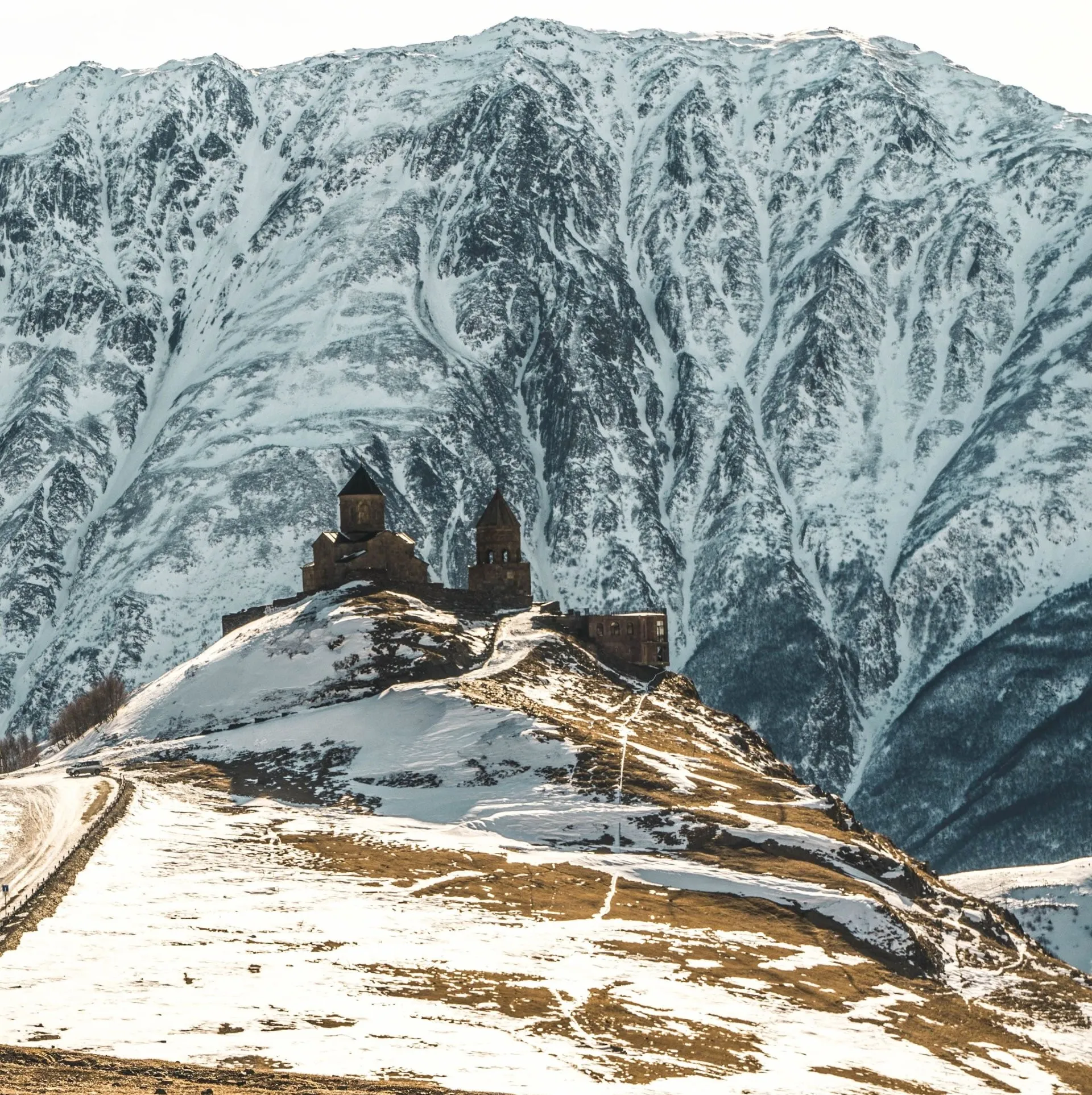
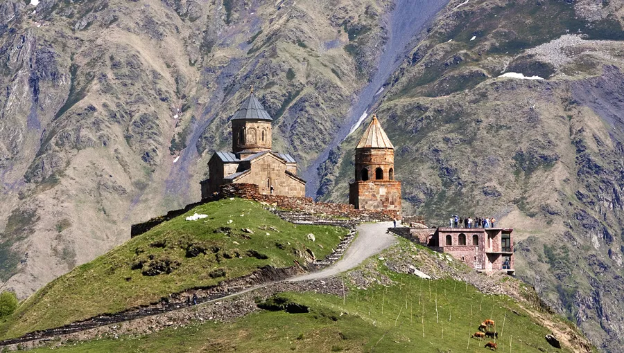
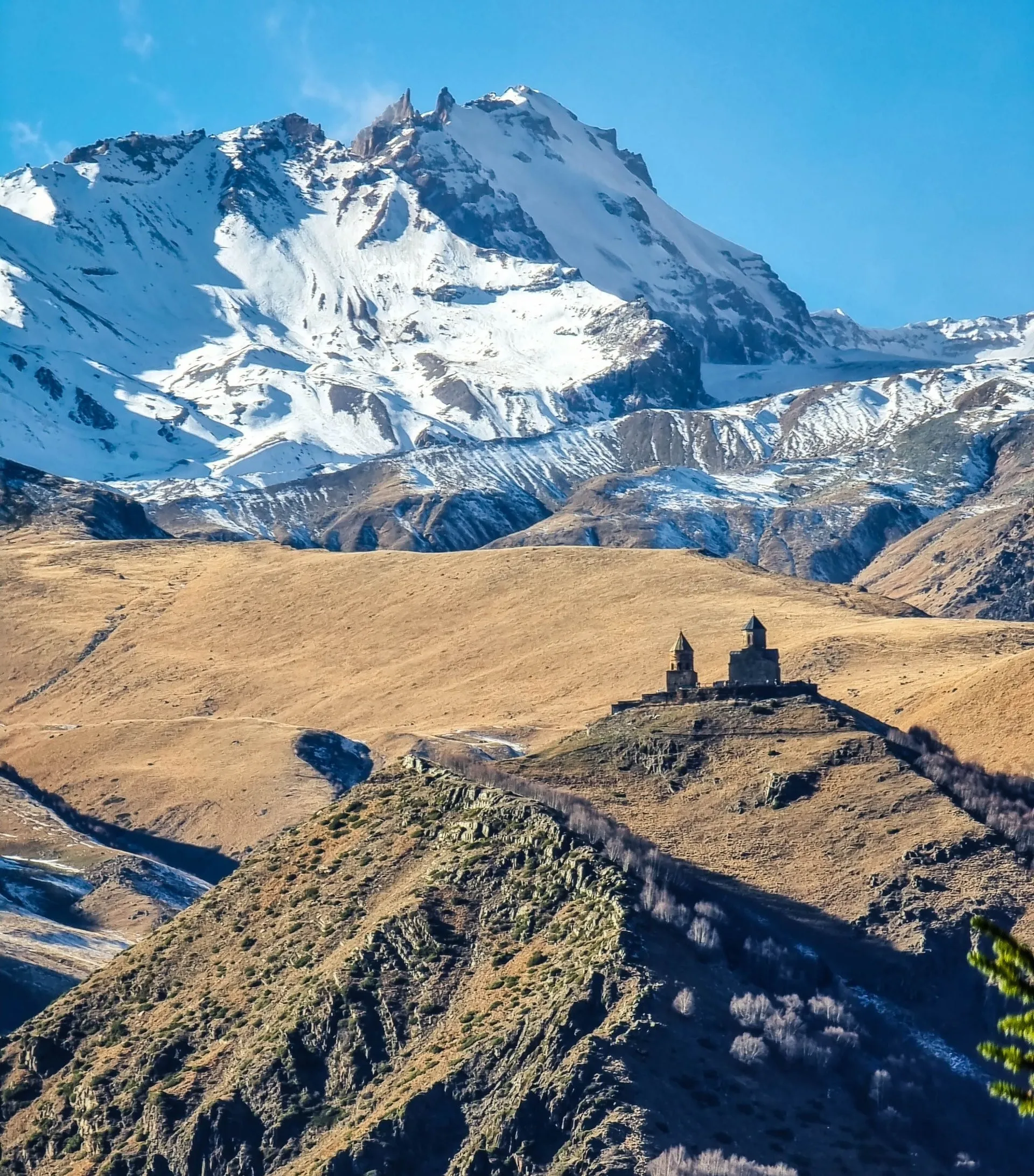
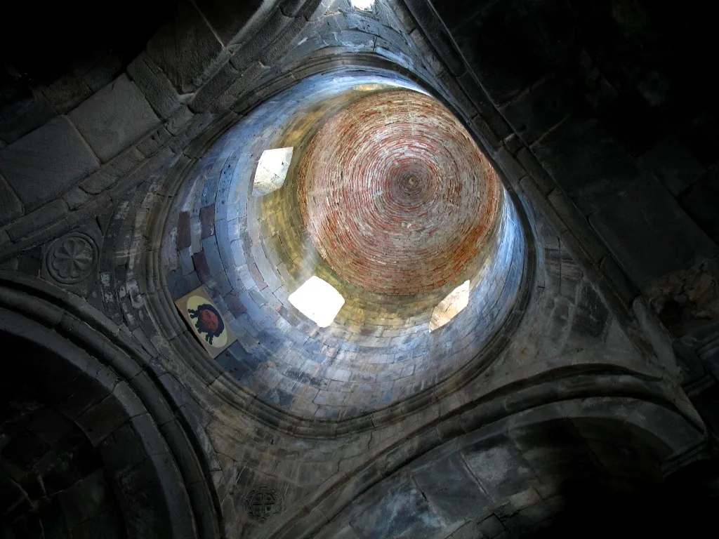
Gergeti Trinity Church is a popular name for the Holy Trinity Church near the village of Stepantsminda in Georgia. The church is situated on the right bank of the river Chkheri (the left tributary of the river Terek), at an elevation of 2,170 metres, under Mount Kazbek.
The Gergeti Trinity Church was built in the 14th century by an unknown architect, and is the only cross-cupola church in Khevi province. The separate belltower dates from the same period as the church itself, but built somewhat later. Its isolated location on top of a steep mountain surrounded by the vastness of nature has made it a symbol for Georgia. The 18th century Georgian author Vakhushti Batonishvili wrote that in times of danger, precious relics from Mtskheta, including Saint Nino’s Cross were brought here for safekeeping. During the Soviet era, all religious services were prohibited, but the church remained a popular tourist destination. The church is now an active establishment of the Georgian Orthodox and Apostolic Church. The church is a popular waypoint for trekkers in the area, and can be reached by a steep 1.5-hour climb up the mountain.

Mt. Kazbegi (Kazbek)
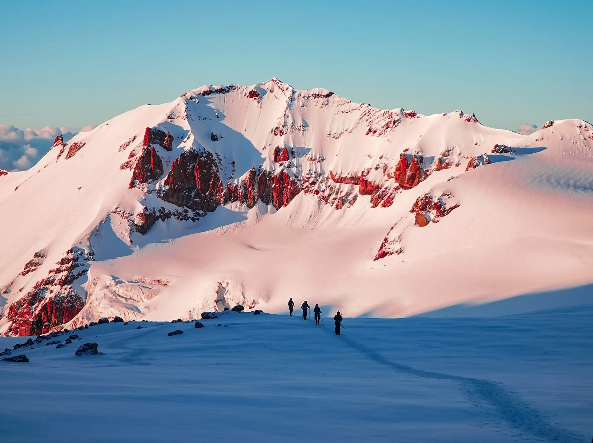
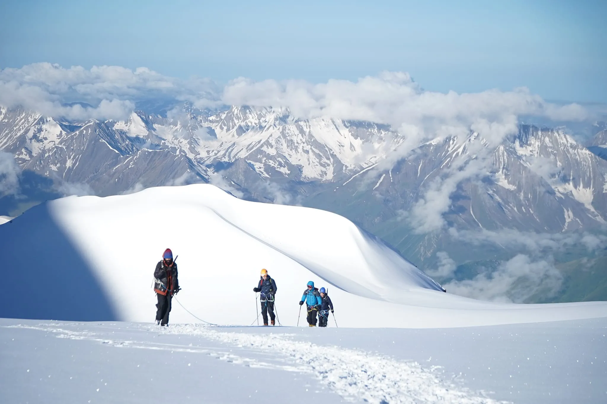
Standing at a height of 5047 meters, Mt. Kazbek, known as Mkinvartsveri in Georgian, which translates to “ice peak,” is a prominent attraction in the region. This dormant stratovolcano holds a significant place in the Caucasus, representing one of the major mountains in the range. Despite not being the tallest, Mt. Kazbek is the most renowned peak in Georgia and draws the admiration of mountaineers and nature enthusiasts alike.
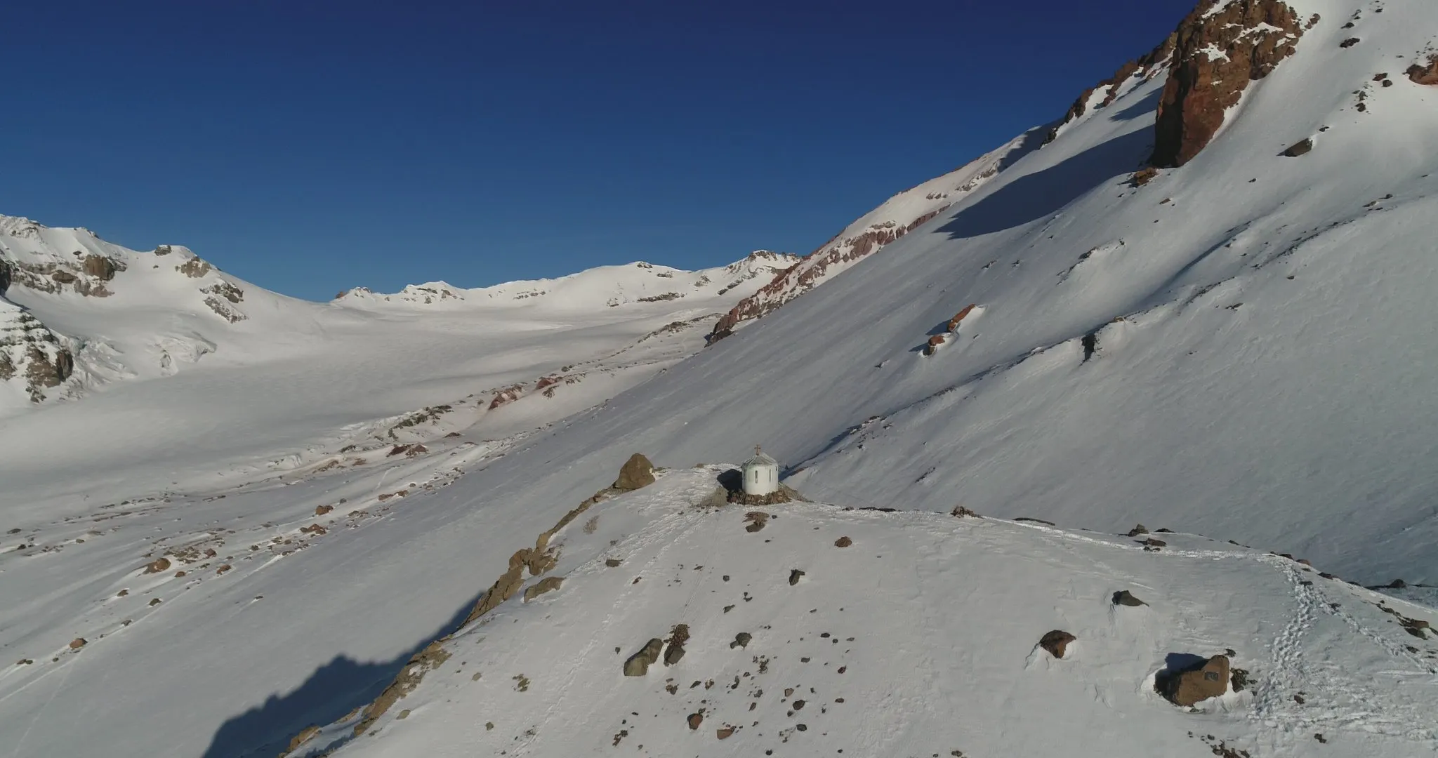
In Georgian folklore, Mount Kazbek is intricately linked to the story of Amirani, the Georgian equivalent of Prometheus. According to the tale, Amirani was punished by being chained to this mountain for stealing fire from the gods and bestowing it upon humans. This mountain’s slopes later became the backdrop for an Orthodox hermitage established within a cave named “Betlemi” (Bethlehem) at an altitude of around 4,000 meters. This cave, called “Bethlem Hut” today, was believed to house sacred relics and can be accessed by ascending the cliffs near the former meteo station, now serving as a shelter for alpinists ascending Mt. Kazbek.
View on mapClimbing Mt. Kazbegi
– Georgian Mountain Guides Association https://www.facebook.com/georgianmountain.guides

Dariali Gorge
he Dariali Gorge is the picturesque gorge on the border between Russia and Georgia. It is at the east base of Mount Kazbek, pierced by the river Terek for a distance of 13km between vertical walls of rock and is located south of present-day Vladikavkaz.
Gveleti waterfalls, which can be translated as the Snake’s Waterfall, is one of the most splendid waterfalls in Georgia. It is located in Kazbegi, in the Gveleti village. It’s really very easy to get there. The traffic road from Kazbegi to the village is only 7 kilometers and the path from the Gveleti village to the waterfall- less than 1 km. There are many wonderful places for a picnic near the waterfall, from here one can see picturesque views all over the Caucasus. Also, in the village there is the remnant ancient castle of feudal Georgia.
The early part of the hike takes you along a service road, but this soon gives way to walking trails that weave over streams, beneath towering cliffs, and between ferns and stubborn alpine scrub. As you draw nearer to your destination, you’ll begin to hear the throaty roar of the waterfall
There are two waterfalls side-by-side – the Small and Large Gveleti Waterfalls. There is about 750 meters between the two.
The construction of the monastery was underpinned in 2005, with the initiative of the patriarch of Georgia. Later, in 2011, the Catholicos-Patriarch of all Georgia and the spiritual leader of the Georgian Orthodox Church, the Archbishop of Mtskheta-Tbilisi and Metropolitan Bishop of Bichvinta and Tskhum-Abkhazia, His Holiness and Beatitude Ilia II blessed and consecrated the temple of Archangels.
The Monastery Complex is 10 kilometers away from the center of Stephantsminda/Kazbegi, and 150 kilometers from the capital city.
Khde Valley
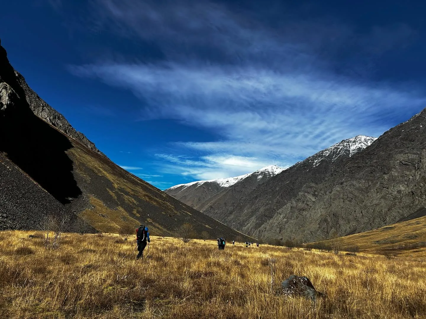
The valley begins not far from Stepantsminda, but access is restricted because of its proximity to the border. When it is open, the route follows a rugged path along the Khde River, passing through a tight canyon where the mountains close in sharply. This part of the Caucasus is known for its unstable terrain, sheer rock walls, and sudden weather changes, which is why only experienced hikers or guided groups usually venture there.
Khde used to have seasonal shepherd huts and small pastures, but today the valley is largely untouched – no permanent villages, no tourism infrastructure, just raw mountain scenery. The silence is deep, broken only by the river and occasional rockfall. In good conditions, the views open toward glaciers and high ridgelines that feel far removed from the busier parts of Kazbegi.
Because of border regulations, trail conditions, and safety rules, Khde Valley remains one of the hidden, harder-to-reach places in the region. For travelers who prefer dramatic landscapes and a sense of true wilderness, it’s one of the most striking valleys in the area – if you’re able to access it.