Imereti Region – West



Western Imereti is mostly represented by the city of Kutaisi. Its the most significant city of the whole western Georgia and second most significant city of the country, often even called by locals a nickname – a “father city” (the capitalof the country in Georgian is called mother-city, like motherland, hence the funny twist)
Tskaltubo Municipality
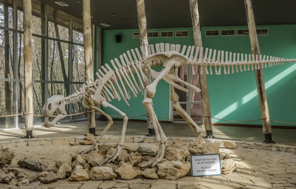
Tskaltubo is a municipality in the Imereti region. People have lived on its territory since the Stone Age, as evidenced by numerous settlements discovered during excavations. The earliest weapon in the Caucasus was found in the White Cave – a copper arrowhead, dating back to the 4th-5th millennium BC. Tskaltubo is a region distinguished by its natural beauty and abundance of historical and cultural monuments. Here you will find fortresses, medieval temples and the remains of the royal palace. The nature of the region makes a great impression on the visitor with blue lakes hidden in the greenery and fabulous caves, whose millions of years old stalagmites and stalactites create such a magical world that it is difficult not to doubt their reality. The Sataplia State Reserve is world-famous for its dinosaur footprints, where you will find yourself in a real Jurassic Park.
The Tskaltubo balneological resort
Tskaltubo, surrounded by mountains from all sides, is 120 meters above sea level. The healing properties of Tskaltubo water were already acknowledged in the 7th-9th centuries. During the reign of Queen Tamar, the baths of Tskaltubo belonged to the Royal House.
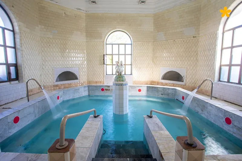
The central park of Tskaltubo, stretched over 70 hectares and had nine functioning baths supplied by underground mineral springs. The park has several attractions, including “the Spring of Beauty” fountain, amusement rides, tennis courts. The park has footpaths, bridges, beautiful alleys, evergreen and rare trees, and decorative flowerbeds.
There is no analogue of the mineral springs of Tskaltubo among the healing waters in the world. The healing waters are called the “source of immortality” because people with various diseases who come here return completely healthy.
Here they mainly treat the musculoskeletal system, heart diseases, skin diseases, infertility, gynecological diseases, and metabolic disorders.
Several baths operate in the Tskaltubo Mineral Water Park, where various healing procedures can be performed.
Both adults and children are treated in Tskaltubo. The recommended duration of resort treatment is 14-21 days.
View on map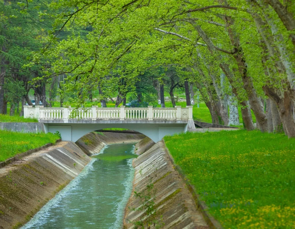
Tetra Cave
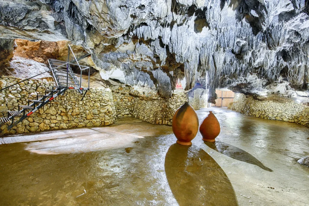
Tetra Cave, Tskaltubo Cave — a karst cave in Georgia, in the Tskaltubo municipality, 1.5 km northeast of Tskaltubo. It is located on the Tskaltubo massif, at an altitude of 80 m above sea level. It was formed in Lower Cretaceous limestones. The cave was formed in the phreatic regime by the active action of pressurized waters. Later, temporary water flows played an active role in its formation. Currently, the cave is in the dry-talan stage of development. Tetra Cave is interesting for the diversity of ancient siphon channels.
The natural entrance to the cave is represented by a 7 m deep and 2 m diameter hollow hole. The cave is also connected by an artificially cut horizontal tunnel to a vast, horizontal-bottomed hall, which is approximately 100 m long, 10–25 m wide, and the ceiling height varies in the range of 6–10 m. The single space is conditionally divided into three halls of different sizes.
Tetra Cave is the first ecotourism space in Georgia, where you can taste aged wine in the most beautiful and ancient cave.
For the first time in Georgia and European countries, a quite successful and attractive innovative service was introduced and established in “Tetra Cave“, which means: – wine aging at the constant temperature of the cave, under natural conditions and tasting the wine aged here. Also, it is possible to conduct a speleo-rehabilitation session in the cave.
A new adventure awaits you just 1.6 km from the world-class balneological resort of Tskaltubo
View on map
Sataplia Managed Reserve
Is located in Imereti, in the territory of Tskaltubo municipality’s villages Gumbra, Banoja and Khomuli, on the hill of Sataplia 500 meters above the sea level. It was founded in 1935. The reserve itself has a complex structure and contains geologic, paleontological, speleological, zoological and botanical monuments.
Sataplia Managed Reserve is part of the Imereti Protected Areas and its infrastructure includes Visitor Center, Dinosaur Footprint Conservation Building, Exhibition Hall,Glass Panorama view, Cafes, Souvenir Shops, well-organized Caves and Marked Trails.
Visitors can visit the dinosaur footprints, Sataplia karst cave with a length of 900 meters, a height of 10 meters, a width of 12 meters, rock trail, Colchic forest, and panoramic views.
The word Sataplia means “honey place”. The name originated from the Sataplia Mountain, which derives its name from the bees living in the mountains and the ancient tradition of collecting honey.
View on map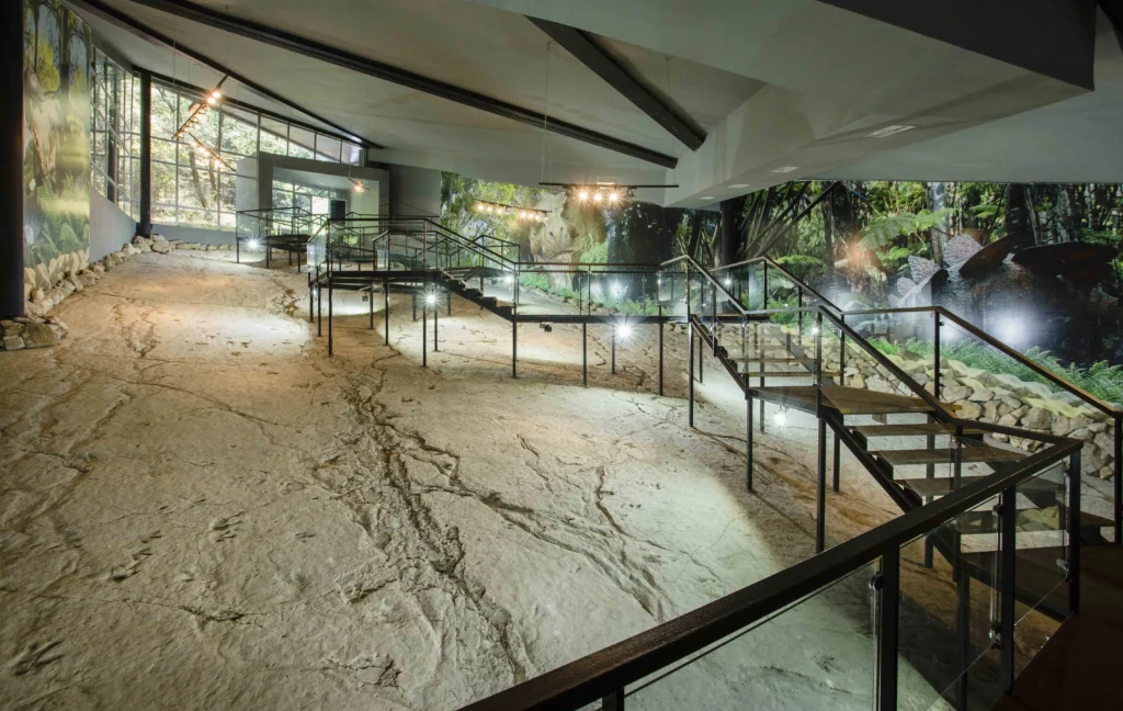
The Prometheus Cave
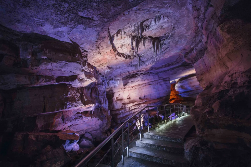
Is located in Tskaltubo municipality in the Imereti region. Its length is 1,8 km and is formed within the depth of 40 meters.
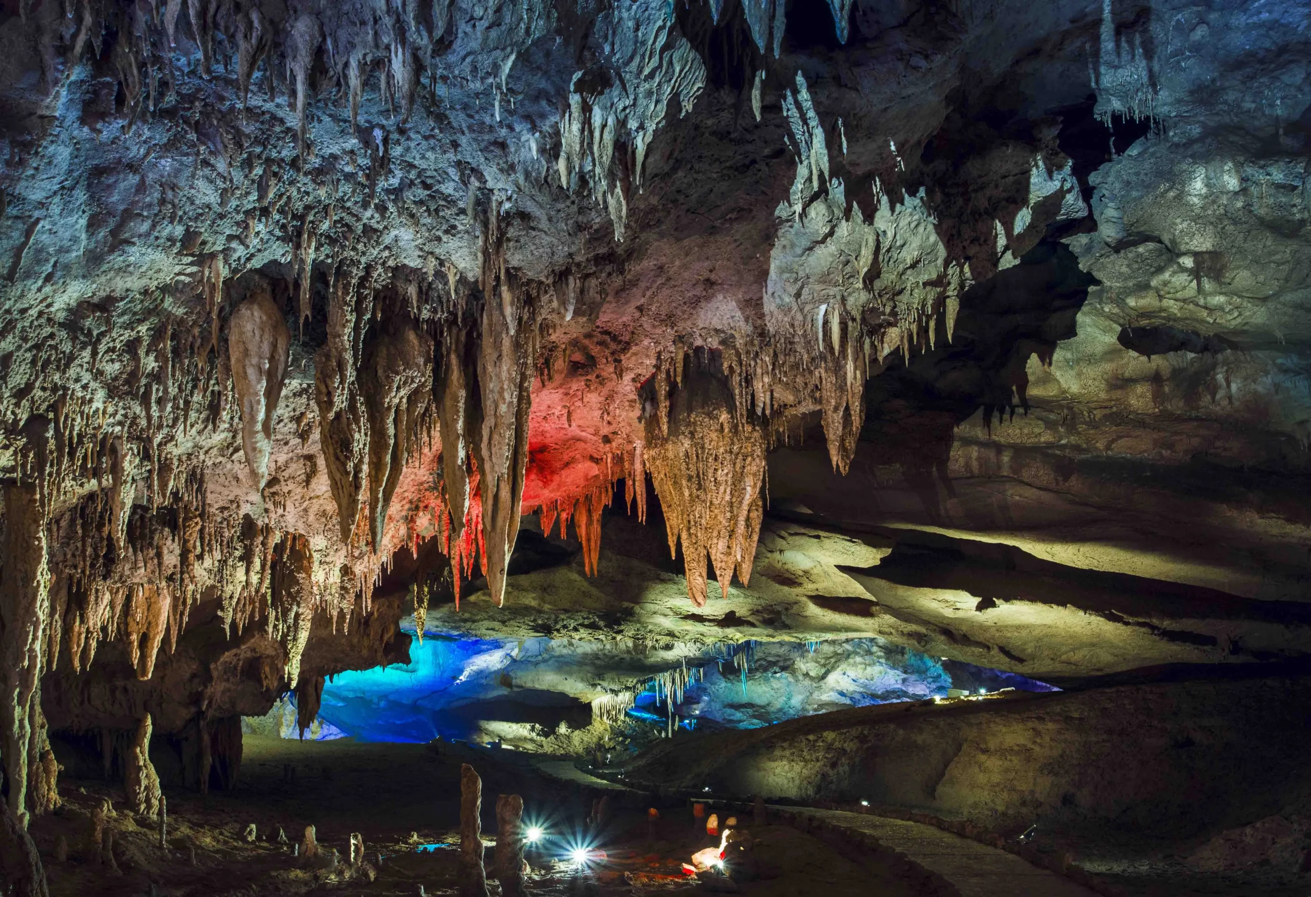
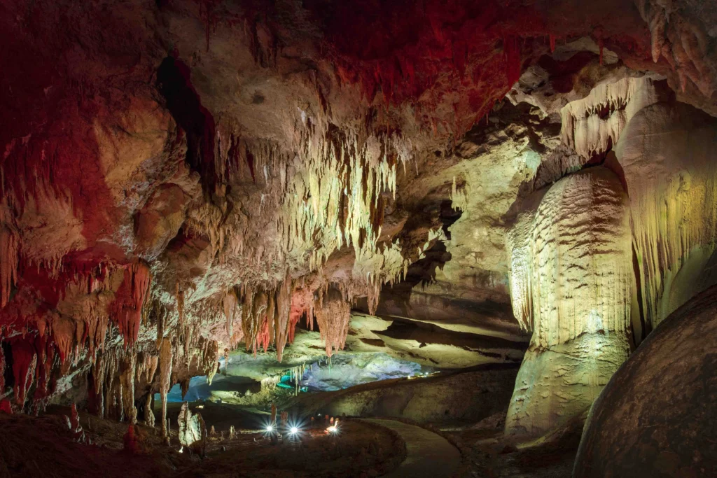
The Prometheus Cave is a notable beautiful natural monument of the world. It is about 60-70 million years old. This beautifully shaped karst cave with stunning strips of stalactites and stalagmites once again will convince you of the enormous power of nature and will travel you in the fairy world.
Prometheus cave is located in the village of Kumistavi in Tskaltubo municipality, in the basin of Kuma River. In the cave are found 22 halls, from which only 6 are open for tourists. In the cave, it is possible to walk through the length of 1420 meters, see the halls and travel by boat on the river flow.
In the Prometheus Cave, you will meet a lot of real masterpieces of nature – stalactites, and stalagmites, beautiful forms of it leave the impression of the fairy environment. Also, When walking in the cave, there are “petrification waterfalls,” “hanging stone curtains,” helictites, etc.

Gabzaruli Lake
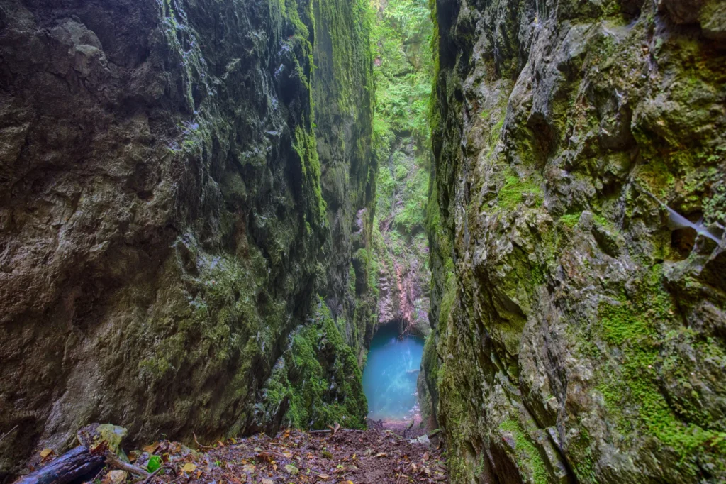
The natural monument is located in Imereti, Tskaltubo municipality, in the village Kumistavi, 166 meters above the sea level.
Surrounded by verdant forest, the cleft is sixty metres long and up to two and a half metres wide. The cliffs on either side soar to thirty metres, while the lake is 45 metres deep. This unique natural wonder can be found near the village of Kumistavi in Imereti.
There is a cliffside path to get down to the lake, but it is steep and fairly difficult. As there is no infrastructure in the area, you’re advised only to visit the lake with suitable equipment and under the watchful eye of an experienced guide.
Khomuli Cave Natural Monument
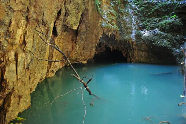
More than 600 karst caves have been discovered on the territory of Georgia, one of which is located near the village of Khomuli, Tskhaltubo municipality, in Imereti. Khomuli Cave is considered one of the most beautiful, and you can travel through it without special equipment.
Khomuli Cave is located at an altitude of 160 meters above sea level, and its area is 1370 square meters. At the entrance to the cave there is a lake five meters deep, which, thanks to underground currents, is connected to the Tskaltubo reservoir.
A four-meter step divides this small cave into two halls. In a wide hall, with karst funnels, you can stand up to your full height, and in a narrow one, movement is possible only by crawling. At the end of the second part there is a small lake. An underground river flows under the bottom of the cave, which rises to the surface after a kilometer and merges with Gubistskali river.
Please note that for a trip to the cave, it is mandatory to obtain permission from the administration of Imereti Caves Protected Areas. There is no tourist infrastructure in the cave.

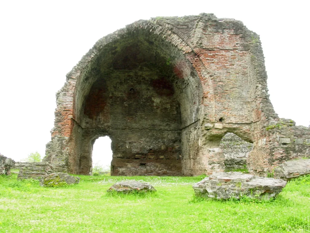
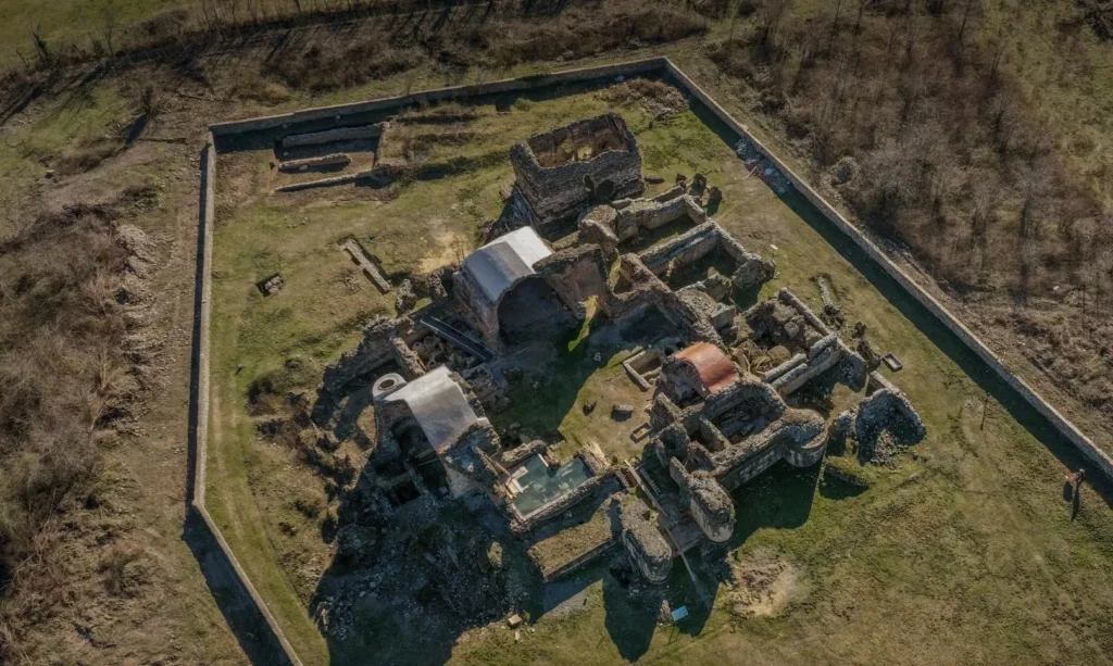
Geguti Palace – The monument of the Georgian architecture of the Feudal Age is located in Tskaltubo municipality, village Geguti, 7 km south of Kutaisi, on the Rioni River. The earliest historical reference to the Geguti Palace belongs to the VIII century.
After the collapse of the Kingdom of Georgia, Geguti palace was the residence of the kings of Imereti (mentioned in the 1737 map of Imereti Kingdom).
The palace was damaged in the first half of the XIX century. After the annexation of the Imereti Kingdom by the Russian Empire, its destruction continued, and the Empire’s officials used the palace materials to build buildings in Kutaisi.
The first researcher of the Geguti Complex, Swiss Frédéric Dubois de Montpéreux, in 1833 established a plan of the surviving part of the palace and defined the function of separate lodging.
The archaeological campaign of 1937 partially cleaned some of the lodges and clarified the details of the existing plan. Up to 60 artifacts of various times discovered during excavations are preserved in the Georgian National Museum. From 1954 to 1962 the complex was cleaned and was carried out. From 1953 to 1956 it was possible to determine the architectural forms of the palace as a result of restoration and research works.
There are several construction layers in the palace hall. The plan of the earliest part (VIII – IX cc) is simple, one-room, with a large fireplace so-called “Hunting house”, Later, it performed different functions.
The whole building is surrounded by a massive pier. The western part of the main building and the palace church belong to the XIII-XIV centuries.
View on map
The Church of St. John the Baptist of Derchi
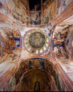
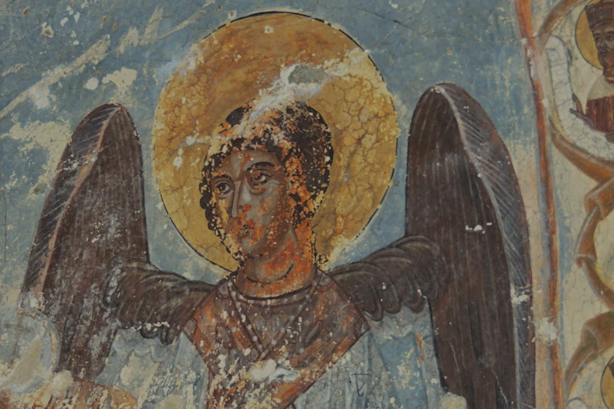
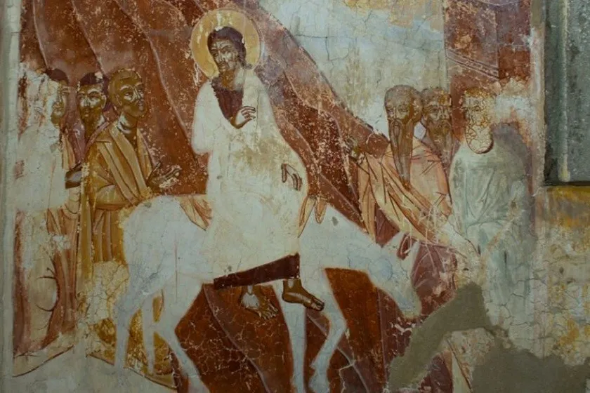
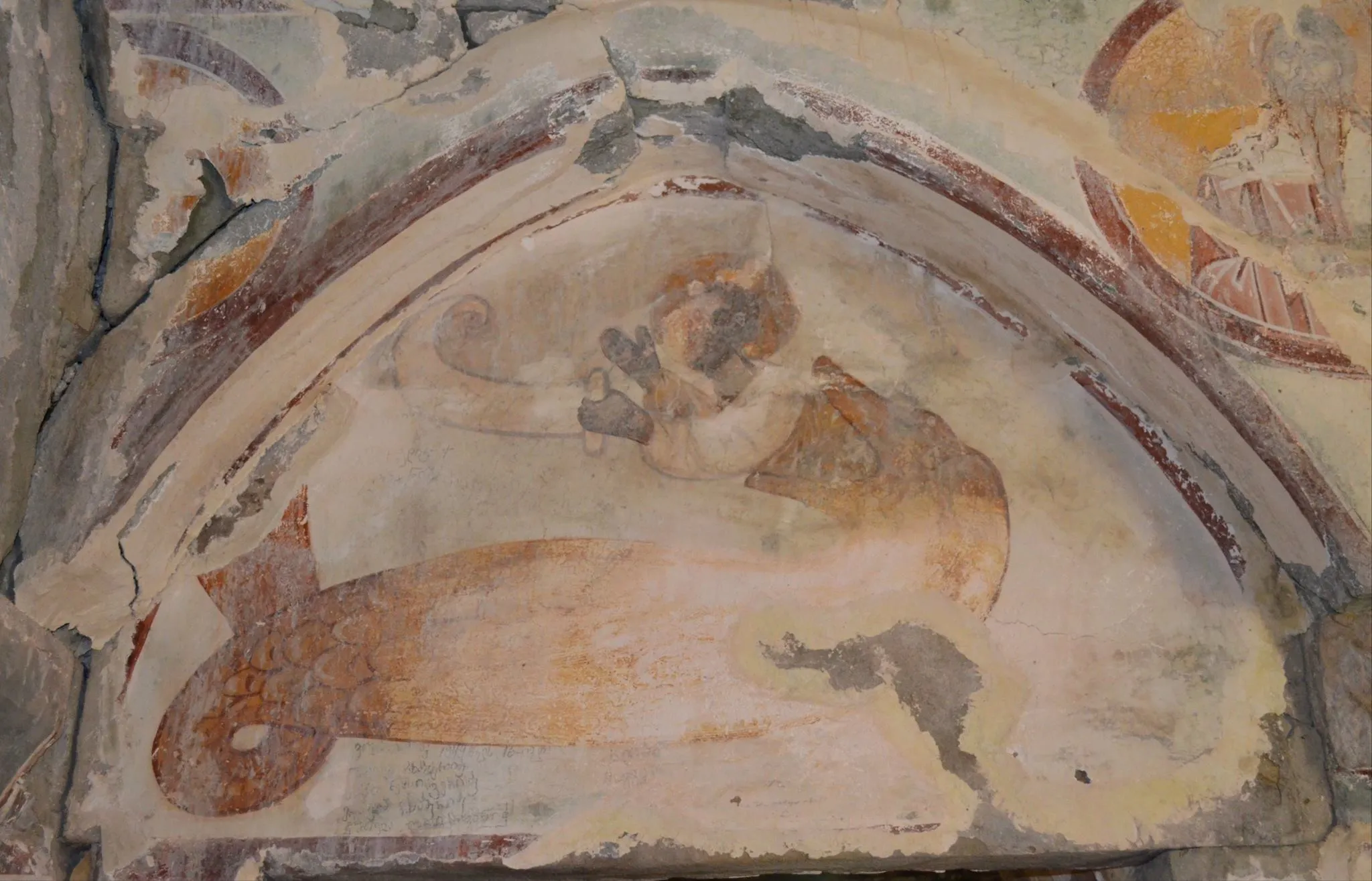
Is located in the village of Derchi, Tskaltubo Municipality, in the Imereti region. Its construction date is considered to be the 14th century. The building is erected on a two-tiered plinth. It is a hall-shaped building, with a glass building on three sides. The main nave ends with a sloping apse on the east. The central nave is connected to the side naves by wide arches. The interior space is lit by four windows. The central space and the glass building are roofed with an arch. The western storage room – narthex is connected to all three naves by a door. Only the western window has decorations. The facades are finished with a shelf-shaped pediment. The interior was completely painted, although today the frescoes are partially damaged.
View on map
Vartsikhe reservoir — is located in Bagdati municipality, Imereti region. It is located on the river Rioni, at the confluence of Khanistskali and Kvirila rivers. From the east side is bordered by Ajameti managed reserve. The reservoir significantly causes erosion of the river banks. It is used for energetic purposes.
View on map
Khoni Municipality
Khoni Municipality is located in the Imereti region, in the northeast of the Colchis Lowland, on the southern slopes of the Egrisi Range, between the rivers Gubistskali and Tskhenistskali.
Khoni is a part of historical Colchis and its origin and development are connected with the trade and caravan routes passing through this territory. The remains of ancient metal smelters have been discovered in the region, as well as ancient gold coins, a stater of King Akes, a hoard of “Colchian Tetri” coins, and Byzantine coins. The pier of the “Bumbua Bridge” (also known as Pompey’s Bridge) on the Tskhenistskali River has been preserved in Khoni. Here in 65 BC, the Roman commander Pompey passed through and a drawbridge was built. The territory of the district was developed in the Middle Ages, as evidenced by the churches built in the first centuries of Christianity. In 1529, Khoni became an episcopal center, which contributed to its territorial growth and economic and political development. In the 18th century, Khoni was an important trading post, which had trade and economic ties with the South and North Caucasus. In the Middle Ages, the territory of the district was the property of the king. During the conquest of the Kingdom of Imereti by Russia and the period of Russian rule, Khoni was part of the Vake district, and the town of Khoni was the center of the district. Since 1846, this territory has been annexed to the Kutaisi province. The town of Khoni developed particularly well in the 19th century.
Khoni Church is a historical monument in the city of Khoni, Georgia.
It is rectangular in shape, built of hewn stone. It is domeless. Walls were built on the south and north sides to enlarge the church. At the beginning of the 20th century, fragments of old frescoes and inscriptions were preserved. The church was previously covered with stone, and then the roof was replaced with tin. The church is surrounded by a high stone fence. On the south side, near the fence, there is a bell tower, built of the same hewn stone as the church. The first floor of the bell tower is rectangular, and the second is polygonal with six open arches. The church was built in the 11th century, during the reign of George I, and was renovated in the 12th and 14th centuries. The last renovation took place in 1862 during the reign of priest Vasil Kutateladze. On March 15, 1884, the Khoni Church was robbed and many valuables were taken.

Gordi Resort
Gordi Resort is located in the Imereti region, Khoni municipality, on the territory of the village of Gordi, 800 meters above sea level. It is distinguished by its natural beauty and attracts many tourists. In the vicinity of the village is the Okatse Canyon, in which several waterfalls and lakes can be found. The enchanting valley, boxwood trees, tranquility, fresh air and magnificent views create the best place for lovers of relaxation in nature. In the village you can visit the 19th century Gordi Palace, which belonged to David Dadiani and was the summer residence of the Dadiani family. Gordi is located in a subtropical climate zone, characterized by mild winters and warm summers. The natural healing factor of the resort is the low mountain climate. The environment surrounded by greenery, climatotherapy and beautiful places are perfect for hiking if you want to relax in the peace of nature
View on map
Okatse Canyon
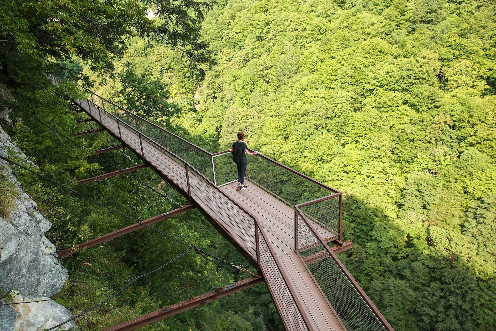
The first canyon in Georgia with winding paths, rich in lakes and waterfalls, is located in Imereti, near the village of Gordi, Khoni municipality, in the Okatse River gorge.
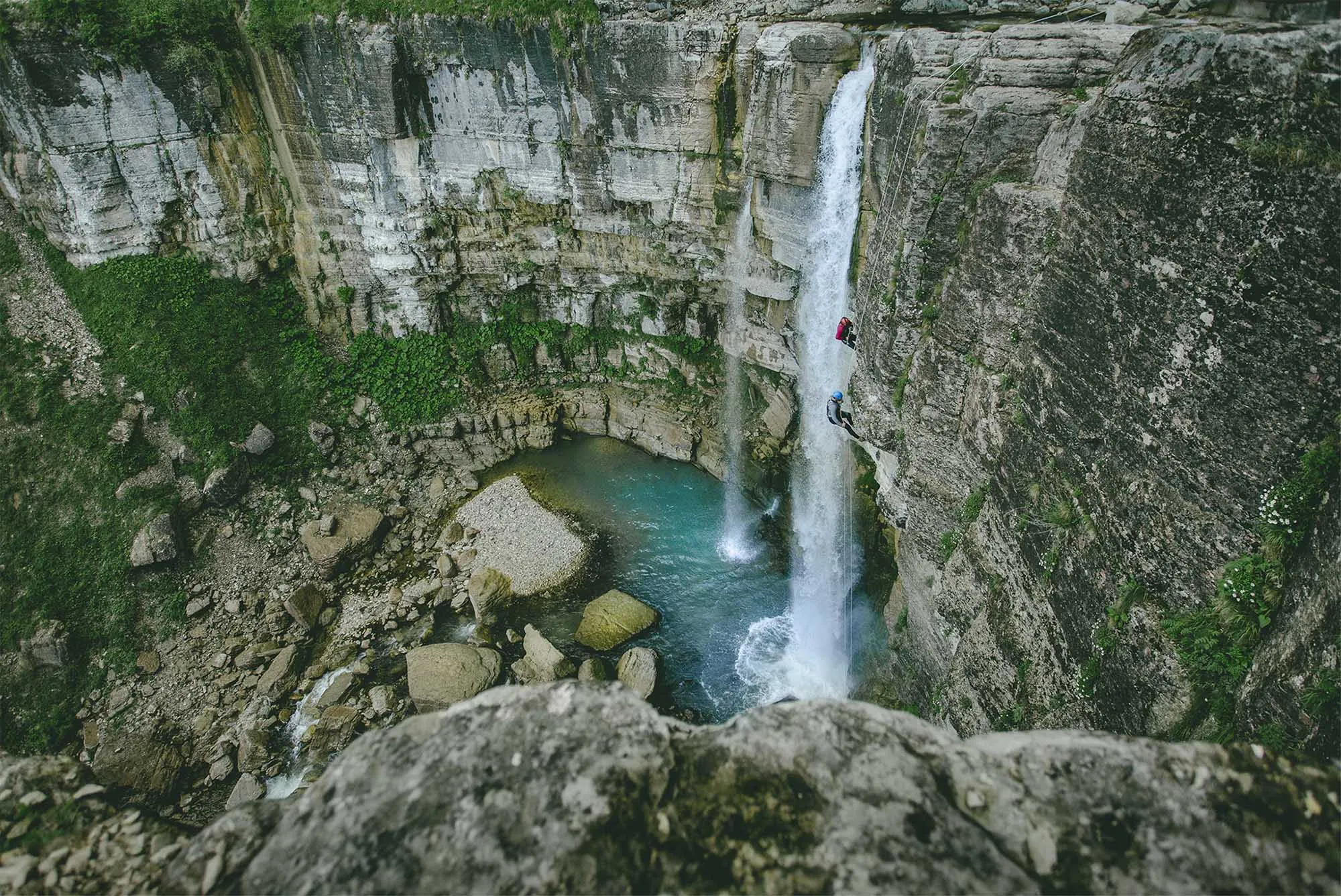
The length of the Okatse River is 14 kilometers, and the canyon is 2 km, its width is 3–6 meters in some places, 15–20 meters in others, and the depth varies from 20 to 100 meters. The canyon is decorated with several waterfalls, the largest of which is the Okatse (Kinchki) waterfall. The length of one of the lakes, “Oskhapo”, is 60 meters. There are several natural stone bridges over the Okatse River, one of which is “Boga”. The canyon has caves from which karst waters flow.
Quite large boxwood trees grow on the rocky shore of the canyon. The banks of the gorge are covered with forest thickets.
The Agency for Protected Areas of the Ministry of Environmental Protection and Agriculture organized ecotourism infrastructure, trails, platforms, and a visitor center.
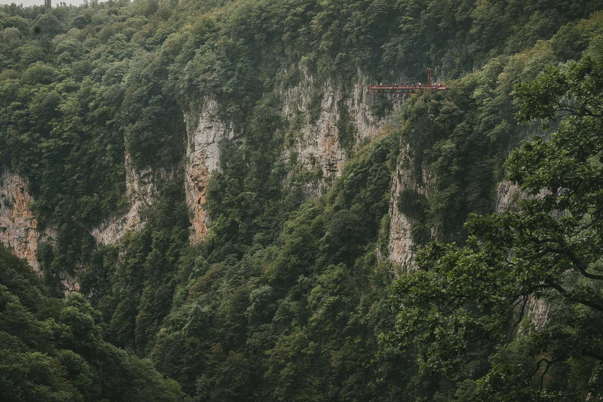
For fans of extreme tours, there is a trail on the Okatse Canyon, which takes about 2-3 hours to complete. The hiking route will pass through the Dadiani Historical Forest Park and a 780 m long trail and ends with a panoramic view, where visitors can take a memorable photo with a smart selfie camera installed nearby. The cover of the Okatse Canyon trail is transparent, which makes the trip even more extreme.
View on map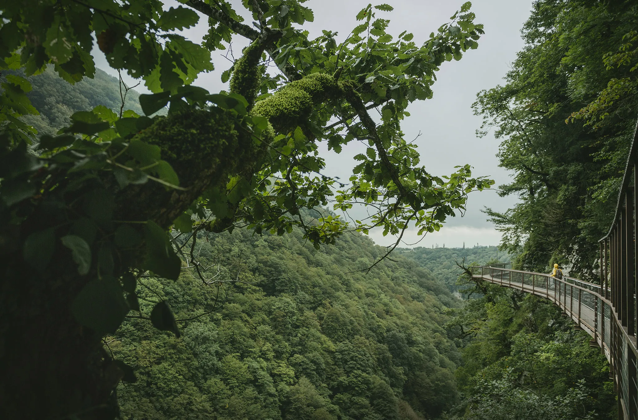
Okatse (Kinchkha) Waterfall
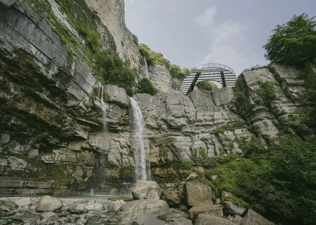
Okatse (Kinchkha) Waterfall – one of the largest waterfalls in Georgia, in the Khoni municipality, near the village of Kinchkha, at 843 meters above sea level. The Okatse Waterfall natural monument is a cascade of waterfalls flowing in three steps from the eastern slope of the Askhi limestone massif in the Satsiskvilo River gorge. The upper two steps are formed on the right tributary of the Satsiskvilo River, the height of the first is about 25 m, and the height of the second waterfall reaches 70 m. 20 meters after the stream joins the Satsiskvilo River, the third step of the cascade is formed, approximately 35 m high.
View on map
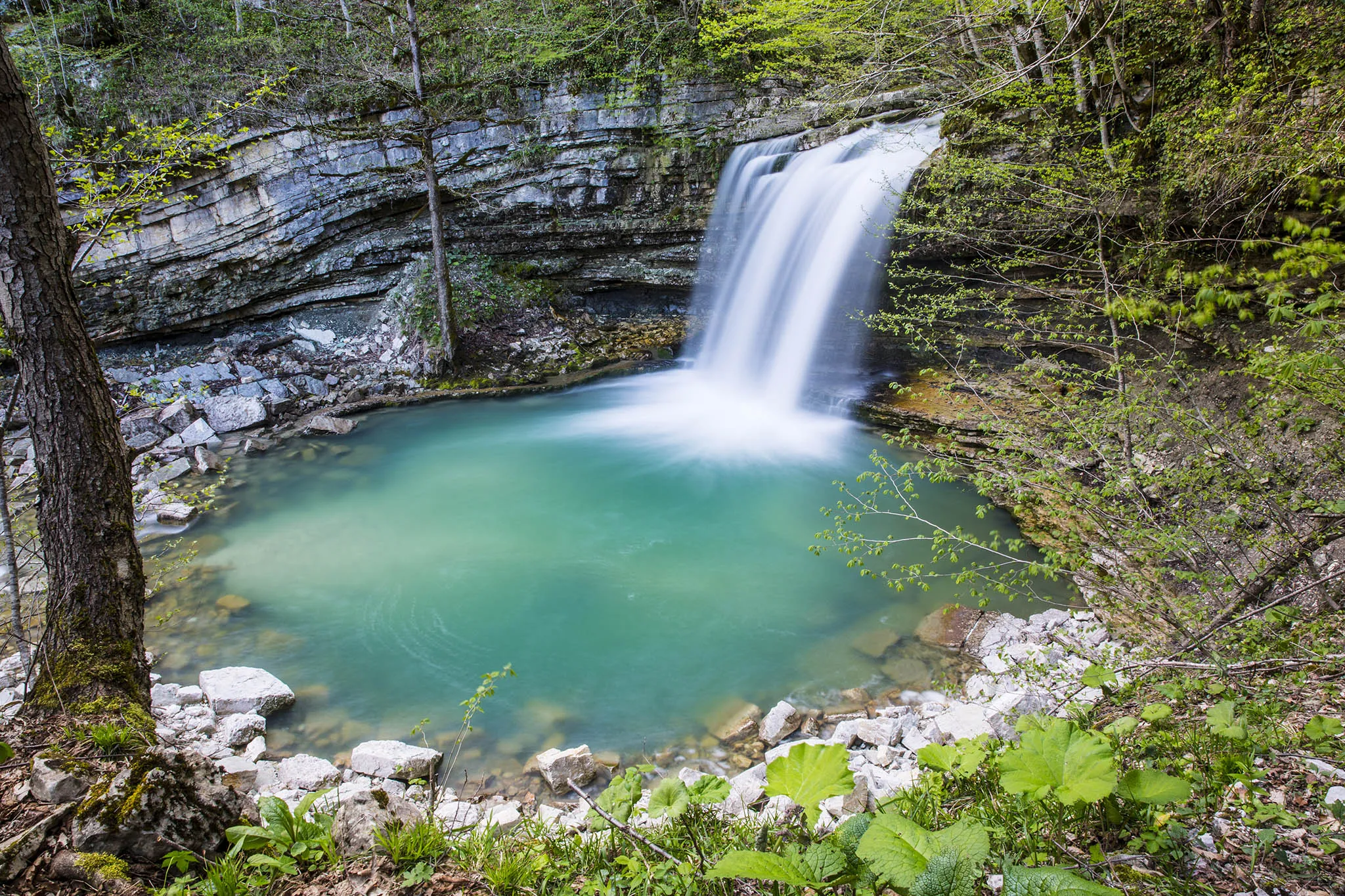
Lomina Lake and Waterfall – beautiful nature in Okatse Canyon. It is located in Imereti, Khoni Municipality.
View on map
Lake Oskhapo is located in the Imereti region, in the Khoni municipality, in the Okatse River gorge. There are many lakes and waterfalls in the Okatse Canyon, one of the largest of which is Lake Oskhapo, which is 60 meters long. The lake hidden in the gorge is a beautiful sight, both in the greenery of summer and surrounded by the colors of autumn.
View on mapBaghdati Municipality
Baghdati Municipality is located in the Imereti region. It was first mentioned in historical sources at the beginning of the 18th century, although traces of civilization on the territory of the district date back to the 4th century BC. According to sources, the oldest place in Baghdati is the village of Dimia. Here, the first unifying king of Georgia, Parnavaz, built a guard fortification and named it Dimna. There are several versions regarding the origin of the name Bagdati. According to one version, it is an old Persian word, which means “given by God”, and its correct form is Baghdadi. According to another version, the name is associated with a woman’s headdress – bagdadi. This word was an epithet for “beautiful” in the Turkish language. There are other opinions as well… Bagdati became a separate district in 1930. On April 14, 1940, 10 years after Vladimir Mayakovsky’s death, his house-museum was founded in Baghdad, and Baghdadi was renamed the Mayakovsky District. It regained its old name after the 1990s.
Baghdati Municipality is distinguished by its natural beauty and abundance of cultural monuments. The Khani Waterfall, nestled among rocks and trees, is particularly popular. A very interesting place is the volcanic stone pillars, which the locals call “Kvasakdara”.
Khani Waterfall
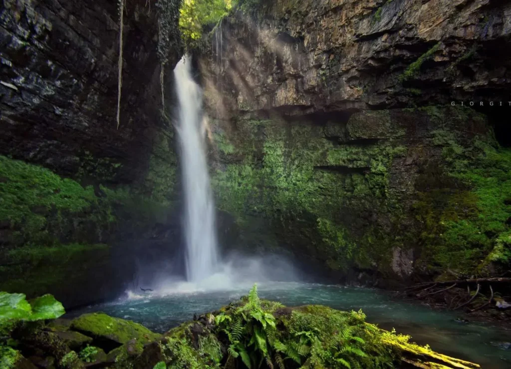
4 km southeast of the village of Khani, in the valley of the Khanistskali River, is the most abundant and highest waterfall in Baghdati Municipality. The waterfall is about 25–30 meters high. In the sunlight, water droplets turn into rainbow colors and create a beautiful sight. Being near the waterfall in the hot summer is as refreshing as an oasis in the desert. Near the waterfall, the river descends into the rock and after a few meters emerges again, the locals call this place “Kvakhvelia”. Seeing, touching and feeling these wonders of nature is the elixir of life.
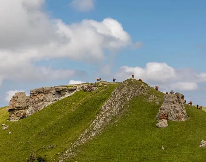
Kvasakdara
On the southern slope of the Meskheti Range, in the subalpine and alpine zones, there are a number of volcanic rock formations that have been preserved as denudation rocks. The rock formations were transformed as a result of the influence of natural climatic conditions and atmospheric precipitation and took the form of interesting natural rock formations. To the southeast of the resort of Sairme, in the basin of the Tsablara River, at an altitude of 2205 meters above sea level, in the upper part of the place “Tsitelmindori”, there are several stone columns, which the locals call “Kvasakdara”. This tourist object is located in the middle section of the Bagdati-Sairme-Abastumani-Akhaltsikhe highway. From this place, interesting panoramic views open up both in the direction of the Meskheti Range and into the Tsablarastskali River gorge. It is an interesting place for birdwatchers (ornithologists), as various birds of prey mainly migrate from north to south in this area, which is of greatest interest to visitors.
Ajameti National Park
Is located in the Imereti region, in the Baghdati and Zestaponi municipalities on the Kolkheti Plain. It consists of the Ajameti, Vartsikhe and Sviri districts.
In 1928, 20 hectares of the Kutaisi forest area were declared a nature reserve, and in 1935, the Ajameti Botanical Reserve was created on the basis of the Ajameti forest massif. Ajameti was established as a state reserve in 1946, and the purpose of its creation was to preserve rare relics – Imereti oak and elm. The famous oak grove of Ajameti is very old. Some trees are more than 250 years old. Of the mammals found in the Ajameti State Reserve, roe deer, fox, white-necked marten, badger, hare, squirrel. Among the birds, the wood grouse is noteworthy. The main goal of the Ajameti Reserve is the protection, reproduction and scientific study of the Colchian forest specimen and the Tertiary Imereti oak, Hartvis oak, and linden, as well as fauna. Ajameti National Park is a unique natural monument of Georgia.
View on map


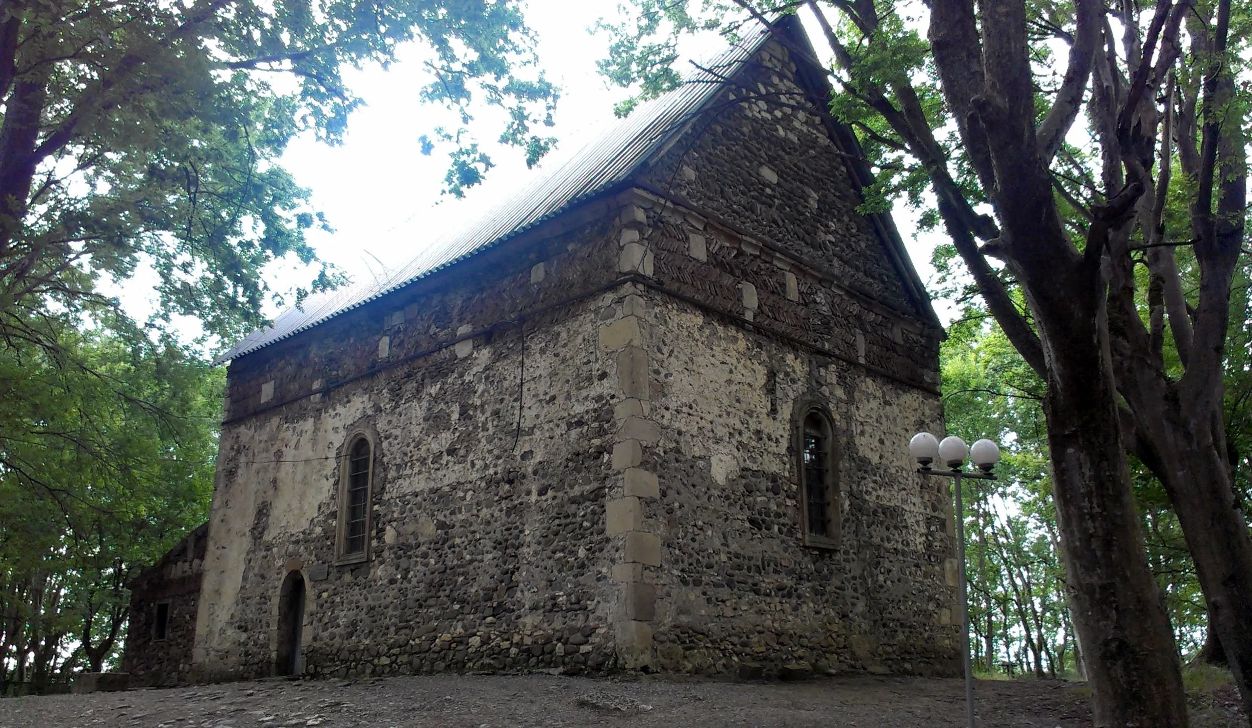
Vartsikhe
In the Middle Ages, it was one of the important cities of the Kingdom of Egrisi (in Greek sources, Rhodopolis, in Georgian sources, Vartsikhe, Vardsikhe). It was first mentioned in Byzantine sources of the 6th century. Due to its favorable geographical location, Vartsikhe had great strategic and economic importance. An important international trade route passed through here. In the middle of the 6th century, during the Great War of Egrisi, the city passed from hand to hand. For the first time, the city wall was breached before the Iranian attack, so that the enemy would not use it as a springboard for new conquests. In the 9th-11th centuries, the city flourished. In the late Middle Ages, Vartsikhe was the summer residence of the kings of Imereti. They hunted together in the nearby Ajameti forest. In the 19th century, fortresses, towers and other buildings in Vartsikhe were demolished. The unique Dzelkva grove is located near Vartsikhe. A palace was built in the middle of the grove, which was the summer residence of the kings of Imereti. It now exists in fragments and is called “Napalatevi”.
View on mapTsitelkhevi White Church
Is an architectural monument in the village of Tsitelkhevi, Baghdati Municipality. The Church of the Assumption of the Virgin Mary was built in the 19th century.
The village hall church is built from the inside with roughly hewn stone, the facades are faced with perfectly hewn squares of yellow Eclair. The layout is balanced. The church is architecturally an elongated rectangle, with a three-aisled apse, sloping to the east. High arched windows are cut in all three apses. Three niches of different sizes are arranged in the north.
View on map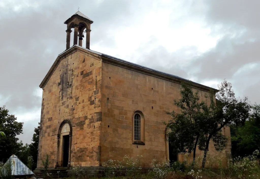
The resort Zekari
Is located in the Imereti region, in the Baghdati municipality, on the northern slope of the Meskheti Range. It is a balneo-climatic resort. The healing factors are sulfuric thermal waters and passive climatotherapy. In addition to its healing properties, Zekari is also distinguished by its very beautiful nature. If you are a fan of mountain relaxation, this place is perfect for relaxation. The beautiful views of the Meskheti Range, fresh air, tranquility and healing waters create the best environment for stress relief and a restful vacation.
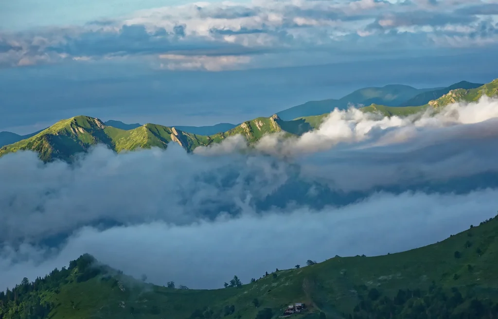
Sairme Balneological and Climatic Resort
Is located in Baghdati Municipality, on the northern slope of the Meskheti Range, in the Tsablaristskal River Gorge, at an altitude of 800 meters above sea level. Distance from Tbilisi 245 km. from Baghdati 23 km. from Kutaisi 50 km.
In the forests belonging to the Eristavi, a place chosen by deer was first noticed by hunters. According to legend, the water was discovered by brothers following the tracks of a wounded deer. The spring flowed over stones reddened with rust, and everything around it was whitened with salt. Herds of deer took turns carrying salt and water. That is why the place was called Sairme. Shepherds also paid attention to the place and discovered another unusual thing – about 3 km from the Deer Spring, in one place the grass always remained green. There was no snow, and the ground dried up within a few minutes of the rain. The mystery of the “magic” field was revealed in the 1920s, when geologists discovered hot mineral water deep in the ground. In the 1930s, Sairme was officially granted the status of a resort. The first sanatoriums were built. Infrastructure was also started. The healing factor is the “Narzan” type carbonic acid hydrocarbonate calcium-sodium (spring No. 1 and No. 3) and “Borjomi” type carbonic acid hydrocarbonate sodium (well No. 4 and No. 5) mineral water “Sairme”. There is a sanatorium, a recreation center and a resort polyclinic in Sairme. Season — May-November.

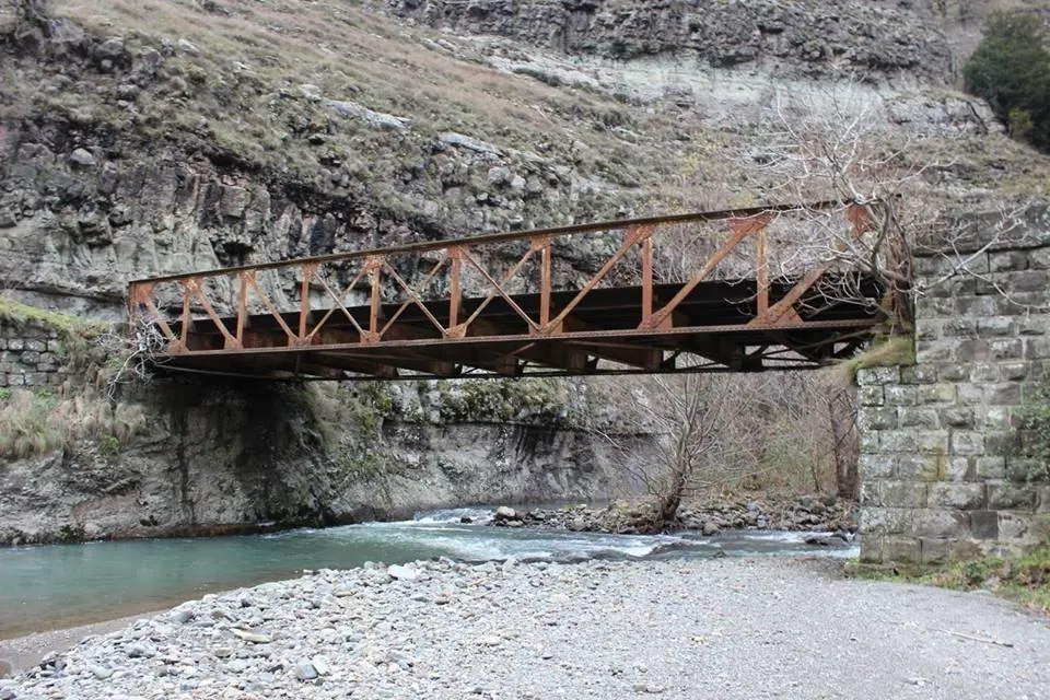
Kakas Bridge
Kakaskhidi – South of the village of Kakaskhidi, on the left side of the Khanistskali River, 600 meters above sea level. An iron road bridge, cast in the 19th century in France at the Gustave Eiffel factory, is still functioning over the Khanistskali River, connecting the “Zekris Kheoba” with the villages of Baghdati. “He has crossed the Kakas Bridge,” they say in Imereti when a business is sure to fail or goods are lost. An ancient caravan route to southern Georgia passed over the Kakas Bridge. If the pursuer of a captive captured in Lower Imereti reached the Kakas Bridge, he should still have hope of his return, but if the captive crossed the Kakas Bridge, his hope of survival was exhausted.
View on mapKutaisi
The city of Kutaisi is located in the Imereti region, on the banks of the Rioni River. Kutaisi is the administrative center of the Imereti region. It is one of the oldest cities in Georgia and the fifth among the oldest cities in Europe. The territory of the city has been inhabited since ancient times. The existence of Colchis culture is confirmed here from the 15th-13th centuries BC. The documentary history of Kutaisi begins in the 3rd century BC, although ancient authors considered it the capital of the Kingdom of Colchis (8th century BC). The old names of the city are: Aia, Kutaia and Kutatisium. Traces of an extensive settlement have been preserved on the right bank of the Rioni River. In the 6th century, Kutaisi was the capital of Egrisi. By the end of the 8th century, it was already the capital of the United Kingdom of Egrisi and Abkhazia. In the 10th century, Kutaisi became the capital of the newly united Georgia. David the Builder was crowned king here. It was David the Builder who built the Gelati Temple near Kutaisi, which became one of the most important educational centers of Georgia. Kutaisi maintained its status as the capital of a united Georgia for 124 years. In 1122, David the Builder moved the royal throne to Tbilisi, although Kutaisi still remained an important city, both culturally and historically. Today, Kutaisi is the second city in Georgia with a developed infrastructure and culture. Higher and vocational schools, a museum, a theater, galleries, etc. operate here. The city also has restaurants, cafes, hotels, a cinema and other important facilities where you can comfortably relax and spend time pleasantly. Kutaisi attracts many tourists with its abundance of historical and cultural monuments.
Bagrati Cathedral
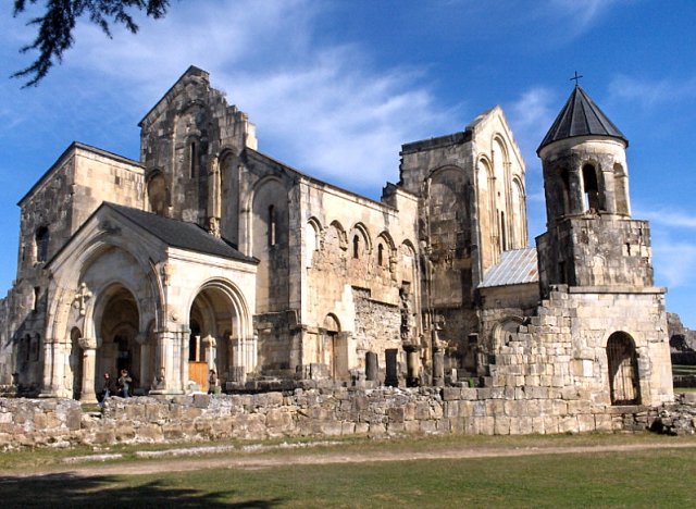
Is located in Kutaisi, Imereti region, on Ukimerioni hill. It was built in 1003, during the reign of Bagrat III. Bagrati Temple is an important monument of Georgian culture, both in terms of architectural solution and symbolic significance. It is a symbol of the unity and strength of our country. “Matiane Kartlisai” tells us that Bagrat III gathered representatives of different parts of Georgia and invited guests from abroad for the celebration of the blessing of Bagrat III temple. “ All the rulers, the Catholics, the priests, and the heads of all the monasteries, and all the nobles of the upper and lower kingdom of the land, and all the other nations, were gathered together “. Doing so, he gave Bagrati Cathedral general national significance. It should be noted that the inscription near the north window of the building, which is the oldest example of the use of Arabic numerals in Georgia, gives the exact date of construction of the church: “ The church was built in 223”. If we put this date in the Christian calendar, it turns out to be 1003 years. Until the end of the XVII century, the monument was safely preserved. In 1692, the Ottomans, entered from Akhaltsikhe, captured the Kutaisi fortress and blew up the Bagrati temple during the battle. They also seized the wealth of the church. In 1770, King Solomon I of Imereti recaptured the fortress and liberated the Bagrati Temple from the Ottomans, although the monument was further damaged during the battle. Nowadays, the church is completely restored. The Bagrati Temple has been on the UNESCO World Heritage List since 1994, but was removed from the list after restoration.
The Bagrati Temple is a triconch-type cross-domed structure with cross-sided arms and four free-standing under the dome piers. The building has a large interior space. The west arm has three naves, the side naves are two-storied, and they have choirs on the second floor. The storerooms next to the eastern altar are also two-storey. The solution of the inner space of the temple is sharply detected in external masses. The south and north arms protrude from the connecting lines of the parts, emphasizing the concept of the cross plan. The architect of the Bagrati temple built the dome on high poles, and used a unified system of fixtures from the flat to the facade, which was a novelty in Georgian architecture. The walls and floors of the building were decorated with mosaics. Richly carved gates were erected on the west and south arms of the church a couple of decades after they were built. In the south gate there are traces of a fresco – the image of the Virgin. The temple was surrounded by a stone wall, inside which were built auxiliary buildings and a stone bell tower. In the north-west corner of the church stands a three-story tower, which was built before the construction of the temple was completed. There is one room on each of the three floors, with fireplaces.


Kutaisi Botanical Garden
Located in the city of Kutaisi, on the right bank of the Rioni River, and due to its age and planning features, it is considered one of the most important objects of park construction. In addition, it is one of the first points of introduction of subtropical trees and shrubs in Imereti.
The garden is represented by several hundred species from different parts of the world. The Kutaisi Botanical Garden is represented by several natural terraces. Geographically, it represents the extreme eastern part of the Colchis Lowland and reaches an altitude of 150 meters above sea level. The main scientific direction of the garden is the preservation and protection of plant biodiversity.
The dendroflora of the Botanical Garden is represented by approximately 700 species of plants, trees and shrubs from all floristic regions of the world. Species of 210 genera of plants belonging to 80 botanical families are presented here.
The Kutaisi Botanical Garden was founded in 1969, but it is the successor to the garden that was established in the city 120-140 years ago. The garden, founded in the mid-19th century, was originally called the “Farm Garden”. Later it was also known as the “Chomi Park”. It is closely connected with the creation of the City Garden (later the “Boulevard, currently the City Park) and the Farm Garden (currently the Botanical Garden) in Kutaisi. The City Garden was established around 1820, and the “Farm Garden” in 1840. This period should be considered the first stage of the introduction of foreign exotic plants in Kutaisi and it continued until 1900-1910. The second stage of introducing new plant species to the Kutaisi Botanical Garden and thus enriching the garden’s vegetation is associated with the name of the Subtropical Institute on the territory of the former “Chomi Park” (also known as the Farm Garden). The most important stage of plant introduction begins with the creation of the Kutaisi Botanical Garden
View on mapWhite Bridge
Located in the central part of Kutaisi, in the old part of the city, on the Rioni River. It is one of the most beautiful bridges in Kutaisi, its construction began in 1850 and was completed in 1852, the author of the project was the military engineer Witte. In 1860, it collapsed, and by 1870, a restoration project for the bridge was completed. The metal parts of the bridge, as well as the railing, were painted white and the newly restored bridge was called the “White Bridge”. Today it is a pedestrian bridge.
The white stones of the river are well matched to the whiteness of the bridge. This place has long been a meeting place for lovers from Kutaisi. Young men wanted to prove their manhood to their lovers, which they did by jumping into the river from a considerable height of the bridge. A young man’s bravery was measured by jumping off the railing.
View on map

The Kutaisi Cable Car
Is located in the Imereti region, in the city of Kutaisi, near the White Bridge. It was built in 1961 and is one of the city’s tourist attractions. The cable car connects the left bank of the Rioni River with a hill on the right side of the river. During the ride, you will look down on Kutaisi from above and enjoy beautiful views of the city. This ancient, very beautiful city and its green surroundings are a very impressive sight, which is why the Kutaisi Cable Car is one of the most popular places and is visited by many tourists.
View on mapThe Royal District of Kutaisi is the historical part of the city. It includes the area surrounding the White Bridge, Tsisperkantselta, St. Nino, Tsereteli and Pushkin streets. In the Royal District of Kutaisi, you will get acquainted with the old, historical architecture of the city. In this part of Kutaisi, you can visit the Historical Museum, the Opera House, the Sports Museum, the Colchian Fountain and other city attractions. The Royal District of Kutaisi is particularly attractive for tourists with various cultural institutions of 18th-19th century architecture.
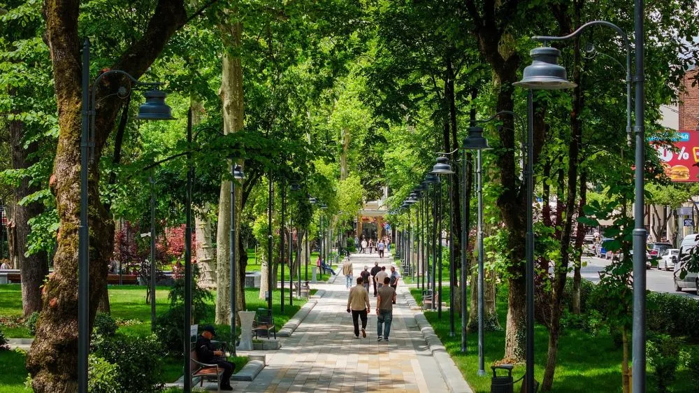
View on mapKutaisi Central park “Boulevard” – a place for walking and relaxing in the city center. The garden was established in 1821 and, along with ornamental plants, contained fruit trees, a vineyard, and even a vegetable garden.
At the beginning of the last century, the city’s central garden was not only a place for walking, but also a gathering place for public figures and was called the “Kutaisi Parliament”. Kutaisi Boulevard is still rectangular in shape and two alleys are built along its entire length. Two more alleys intersect the garden in the middle, which intersect the entire territory of the garden in the form of a cross.
The boulevard houses the monuments of Akaki Tsereteli, Zakaria Paliashvili, Debi Ishkhneli, and the April 9 Memorial.
View on map
The Kutaisi Historical and Ethnographic Museum
Was founded in 1912. The collection was initially housed in the house of the famous figure, the museum director, Grigol Gvelesiani. In 1922, the Historical and Ethnographic Museum was founded on the basis of the collection (then already located in the building of a real educational institution, now a university). In 1948, the museum moved to its current building (Tbilisi St. No. 1). The two-story house, built in the 1860s, was the property of Prince Nikoloz Eristavi. The building received its current appearance as a result of reconstruction in the 1940s.
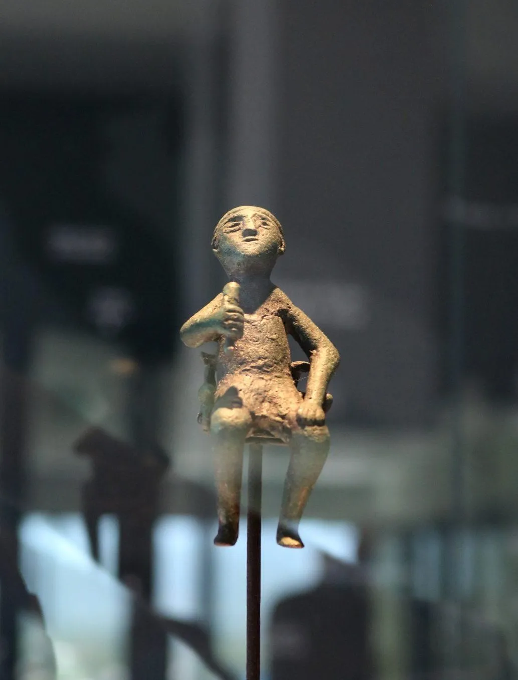
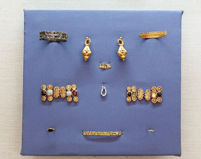
Currently, the Kutaisi Museum houses more than 150,000 exhibits. The archaeological department, which is filled with materials found in Kutaisi and its surroundings, preserves numerous bronze and antique artifacts, including: Colchian axes, bronze buckles decorated with stylized images of animals, a bronze Ithyphal statue of a man from the village of Fersati, a bronze statue of a woman from the village of Geguti, and others.
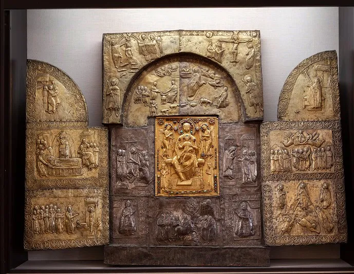
The museum’s treasury contains excellent examples of medieval goldsmithing: a 10th-century silver stavrotheca and scribe, 11th-century loincloths with images of the Ascension and Nativity from Shorapani and Motsameta, a 12th-13th-century icon of the Savior from Motsameta, and others. There are also numerous examples of goldsmithing from the 16th-18th centuries.
The museum preserves the personal archives of public figures (Kirile Lortkipanidze, Giorgi Zdanovich, Aleksandre Garsevanishvili, Dimitri Nazarishvili, Davit Meskhi, Trifon Japaridze, etc.); the archives of the Gelati and Motsameta monasteries, the Kutaisi Diocesan Chancellery, the Georgian Gymnasium, the Historical and Ethnographic Society, the Chiatura Black Stone Manufacturers’ Council, and other public institutions; photographs from the 19th-20th centuries. The ethnographic department houses rich collections of wood, metal, ceramics, leather, glass, and fabric – notably, the 11th-century wooden door of the Lashe Church with biblical scenes; church embroideries from the 17th-18th centuries; rare collections of silver daggers and flintlocks, etc. There are many items related to urban life.
The museum’s library, along with 40,000 books, contains sets of periodicals from the 19th and 20th centuries.
View on map
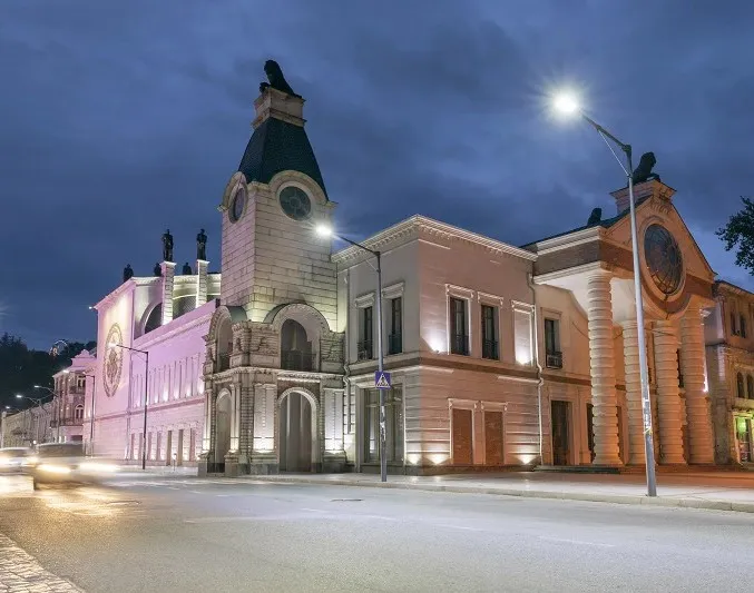
The Kutaisi Opera House is located in the city of Kutaisi, in the Imereti region, on Rustaveli Avenue. The current building of the theater was opened in 1969. Theatrical performances have been held in the city since 1861, under the leadership of Kirill Lortkipanidze, Dimitri Bakradze and Akaki Tsereteli. In 1880, Kote Meskhi formed a permanent troupe, which was located in a building specially built for the theater by Stephane Kharazishvili. The Kharazishvili Theater was destroyed by fire in 1946. The new Opera House was built on the same site, and the wall of the building on the Rustaveli Street side is the only one that has survived from the old theater. The Kutaisi Opera House was solemnly inaugurated on December 27, 1969, with Zakaria Paliashvili’s opera – “Abesalom and Ether”.
View on mapBikentia’s Kebabery
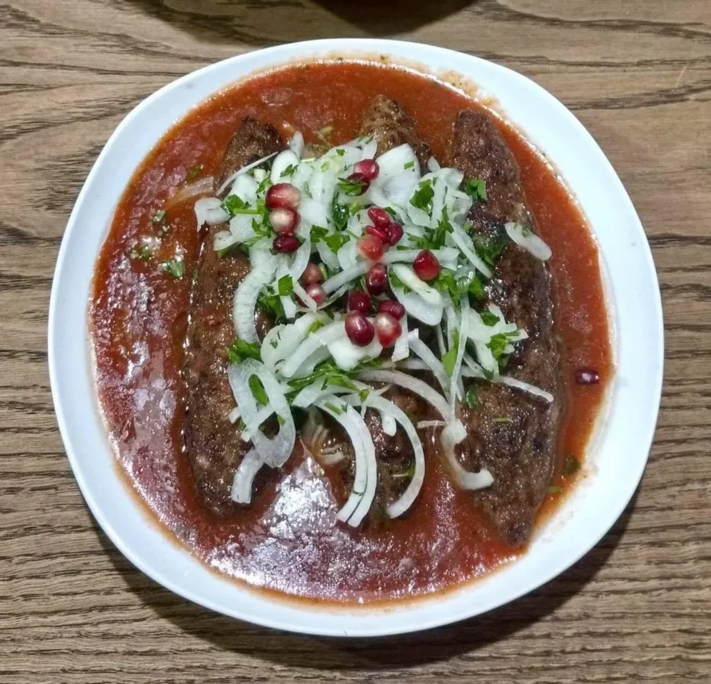
The famous “Bikentia’s Kebabery” in Kutaisi, has been around for 65 years.
Anyone who has been to Kutaisi at least once would have heard about “Bikentia’s Kebabery” and if kebab is one of their favorite dishes, they would have visited it.
“Bikentia’s Kebab” was founded in 1954 in the city of Kutaisi. It quickly became famous for the delicious kebabs prepared by Bikentia Gvishiani. Bikentia Gvishiani was a man from Lechkhumi who worked in Kutaisi, and it was in his honor that the kebab was named Bikentia’s Kebab. It is his merit that the kebab is so distinctive and unique.
The kebab stands out from the others in that it has its own special juice, the recipe of which is a secret. Also, the kebab has become a legend because it has a distinctive taste. It is located on Tsisperkantselta st.9 , in Historical part of Kutaisi.
Here is their FB page
View on map
Kutaisi International Airport
(IATA: KUT, ICAO: UGKO), also known as David the Builder Kutaisi International Airport – is an airport located 14 km west of Kutaisi, the third largest city in the country of Georgia and capital of the western region of Imereti. It is the second busiest airport in Georgia. The airport is operated by United Airports of Georgia, a state-owned company.
The priority of Kutaisi airport is to attract low-cost airlines. A significant growth in the number of passengers was noted soon after the reopening of the airport in 2012, mainly due to Wizz Air’s operations linking Kutaisi with European airports.
A plan to build a railway station 2 kilometres from the airport to connect the airport to Tbilisi, Batumi and any other cities of Georgia served by Georgian Railways was announced in 2018. In April 2022, the modernization of the Kopitnari station was finished. Currently, Tbilisi-Batumi trains stop at the Kopitnari station as well.
View on mapSamtredia Municipality
Samtredia is a municipality in Imereti. This place has been mentioned in ancient historical sources since the second half of the 18th century as the village of Samtredia. Since 1872, after the Poti-Tbilisi railway line was put into operation, it has been referred to as the town of Samtredia. Long ago, the marshland of the district was a swampy forest, the climate was so bad that everyone avoided settling in these places. The construction of the railway contributed to the development of Samtredia, the swamps were drained, the forest was cleared, and the climate improved. Its transformation into a town-city was completed in 1999, when industry grew especially. The territory of the district was previously united in the Kingdom of Colchis, Egrisi, and then the Kingdom of Egri-Abkhazia and the United Georgia. Samtredia is a beautiful district, where we find many interesting cultural monuments.
Gormaghali
A balneological resort of local importance in Georgia, in the Samtredia municipality. 200 m above sea level, 20 km from Samtredia.
Vegetation cover — evergreen deciduous forest. The climate is very mild, with snowless winters (average January temperature 4.7°C) and very warm, humid summers (average August temperature 23.3°C); precipitation per year is 1526 mm. The main healing factor is chloride-sulfate, sodium mineral water, which is used for baths to treat lower limb diseases. Treatment is outpatient.

The Kulashi Synagogue
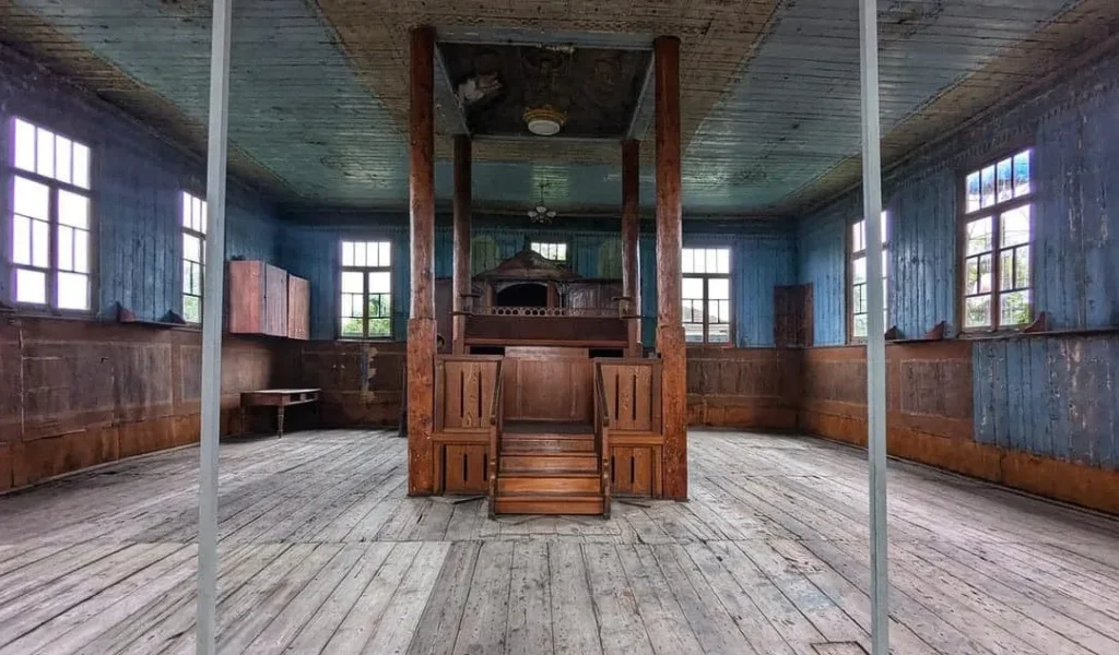
Is located in the Imereti region, in the Samtredia municipality. It dates back to the 18th century. The synagogue is a one-story, plain wooden building. The interior of the building features ornamental painting. Next to it stands a large wooden synagogue, which was built at the beginning of the 20th century. Anyone can enter and explore the synagogue.
View on map

Niko Nikoladze House Museum
A house museum in Georgia, in the village of Didi Jikhaishi, Samtredia Municipality, at 109 Nikoladze Street. The museum was founded in 1951 and is located in the house of Niko Nikoladze (1843-1928), a famous public figure and scientist of the 19th-20th centuries. The house was built in 1886 and stands in a garden planted with plants brought by the scientist from different parts of the world. The museum preserves memorial items of Niko Nikoladze and his family members, a rich library, a wind engine (1910), the first model of the Kodak camera, a sundial, and more. Niko Nikoladze was a Georgian publicist, critic, revolutionary-democrat, political and public figure, and one of Ilia Chavchavadze’s closest comrades.

“Gamochinebuli”-s St. George’s Church
Is an architectural monument in the Imereti region, in the village of Gamochinebuli (formerly Zemo Abasha), Samtredia municipality. The church dates back to the 16th century. It is currently being restored.
The church is a hall-shaped building with a semicircular apse inscribed in a rectangle to the east. The church has a nave from the west, and there was also a nave from the north, although only ruins have survived from it. The church is built of cut stone, the facades are plain. The building stands on a mountain and is distinguished by a vast, beautiful view.
View on mapThe Church of the Nativity of the Virgin Mary of Chagani
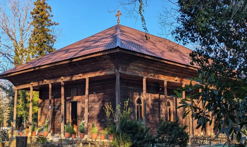
Is a wooden church of the hall type in the village of Chagani, Samtredia Municipality, Georgia.
The church stands on a concrete platform. The roof extends beyond the main hall of the church on all four sides, which creates an imitation of a balcony. The slate roof rests on round wooden columns standing on stone bases erected on a concrete platform. The church has three arched wooden doors and seven windows. Three of these windows are in the sanctuary, and two each are on the southern and northern walls. The wooden walls are built of well-processed planks of almost equal size. The floor is laid with rectangular stone slabs. In the interior, a wooden arched vault rests on a metal structure and the wooden walls of the church. The church was built by Maxim Khvichia in 1871–1884.
View on map

St. George’s Church of Ghaniri
Is an architectural monument in the village of Ghaniri, Samtredia Municipality. The construction of the church began around 1780 and was finally completed in 1804.
The church has a single nave, decorated with beautiful wooden columns and a corridor around it. Previously, it was roofed with thatch, and at the beginning of the last century it was covered with tin. The church rests on 6 chestnut columns. The church building, which is 33 m long, 10 m wide, and 10 meters high, is oval in shape, and was built of elm and chestnut planks without any nails. According to legend, the builders were of the Kakabadze family, and the building material for the church was donated by a certain Elisbar Gogiberidze. There is a closed balcony lined with large stone slabs around the building. The St. George’s Church of Ghaniri is famous throughout Georgia for its antiquity. Before the current temple was built, there was a small church here, the remains of which still survive.
View on map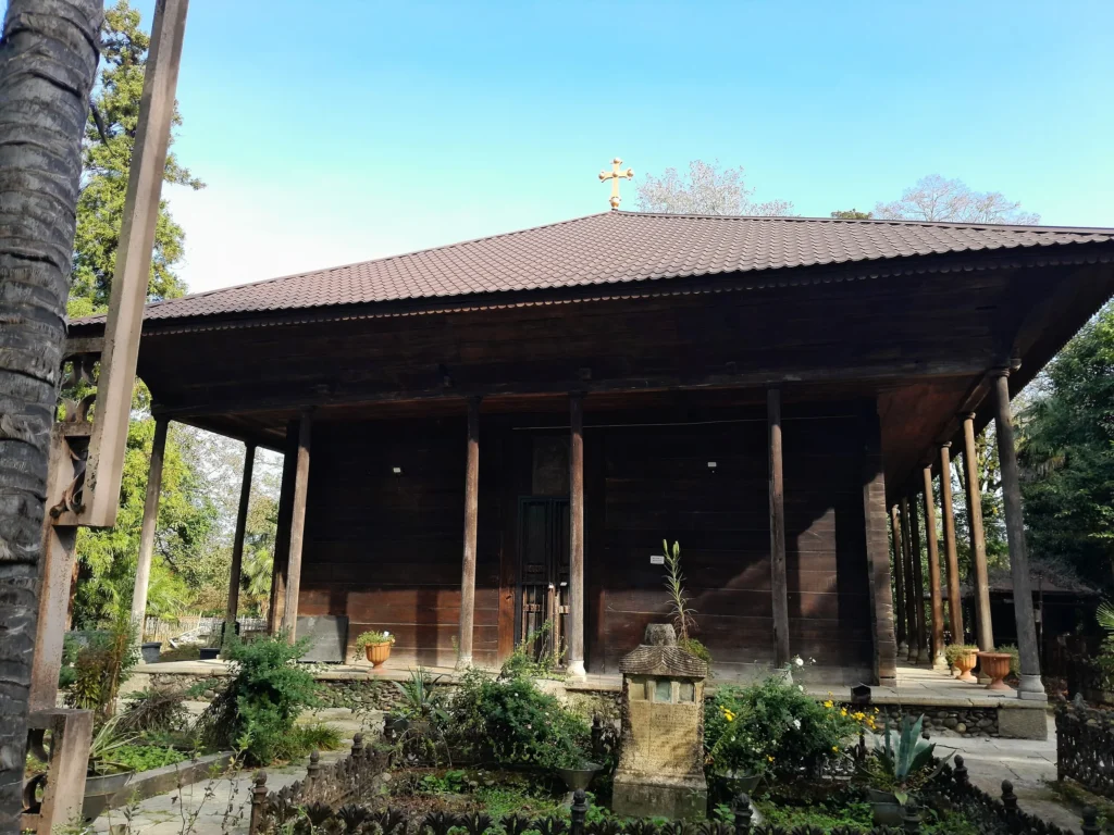
Vani Municipality
Vani Municipality is located in western Georgia, in the extreme southwestern part of the Imereti region. Its administrative center is the city of Vani. In ancient times, on the basis of ancient settlements, one of the important cities of ancient Colchis developed on its territory, which flourished in the 3rd-1st centuries BC. The oldest archaeological material found on the Vani settlement dates back to the 8th-6th centuries BC and is represented by ceramic fragments. The settlement is located on a hill near the city of Vani, from which beautiful views of the Rioni Plain, the city of Kutaisi and the Caucasus Mountains open up. You can also visit medieval fortresses and temples in Vani.
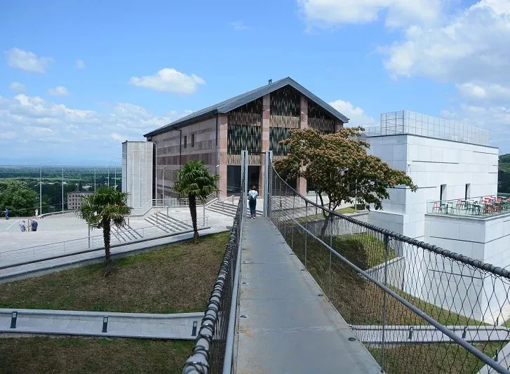
The Vani Archaeological Museum
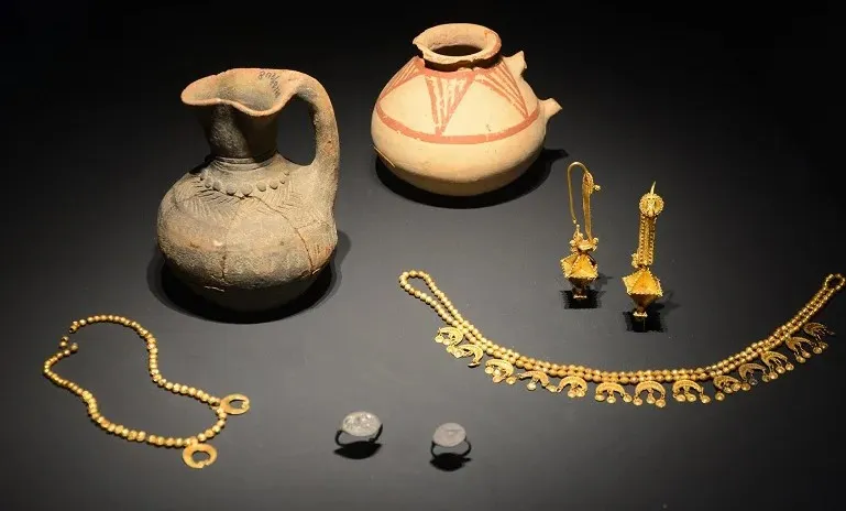
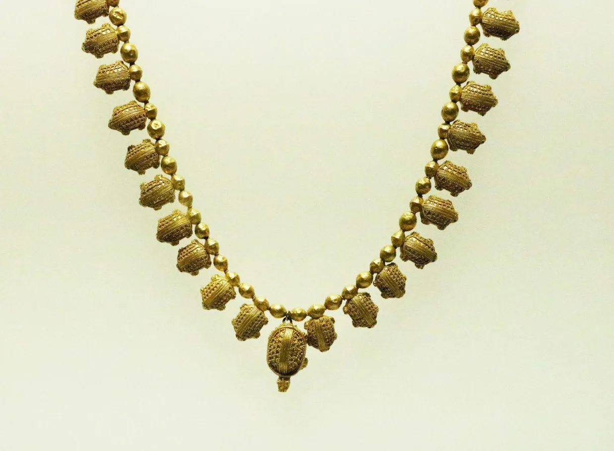
Located in the Vani municipality, in the vicinity of the city of Vani, in the Imereti region. It was founded on September 25, 1985, at the initiative of the head of the Vani archaeological expedition, Academician Otar Lortkipanidze. Today, the museum is named after Otar Lortkipanidze. The material preserved in the Vani Museum covers the period from the 8th to the 1st century BC. Unique examples of goldsmithing, silver and bronze products, numismatic samples, and more are kept here.
View on map

The Vani settlement
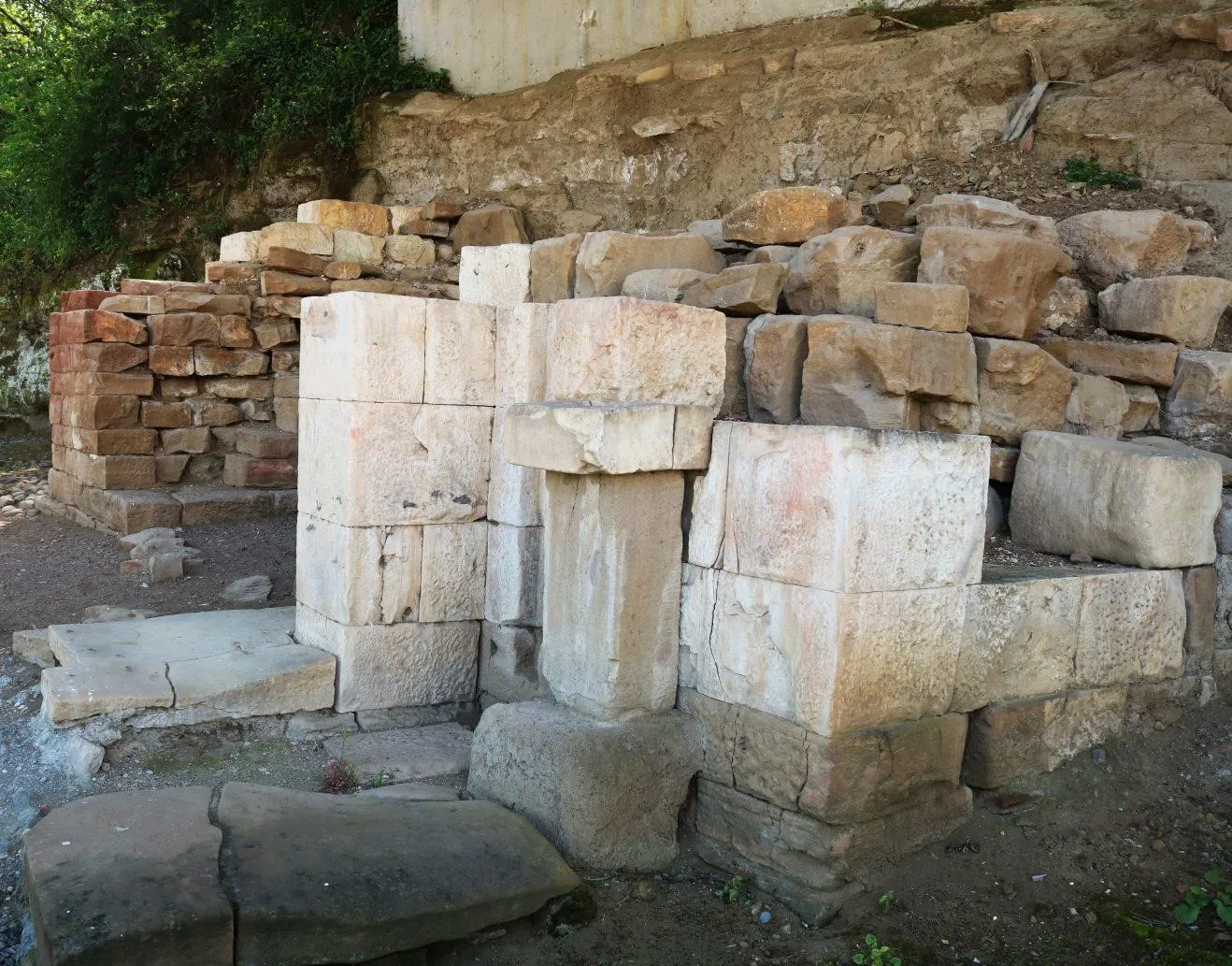
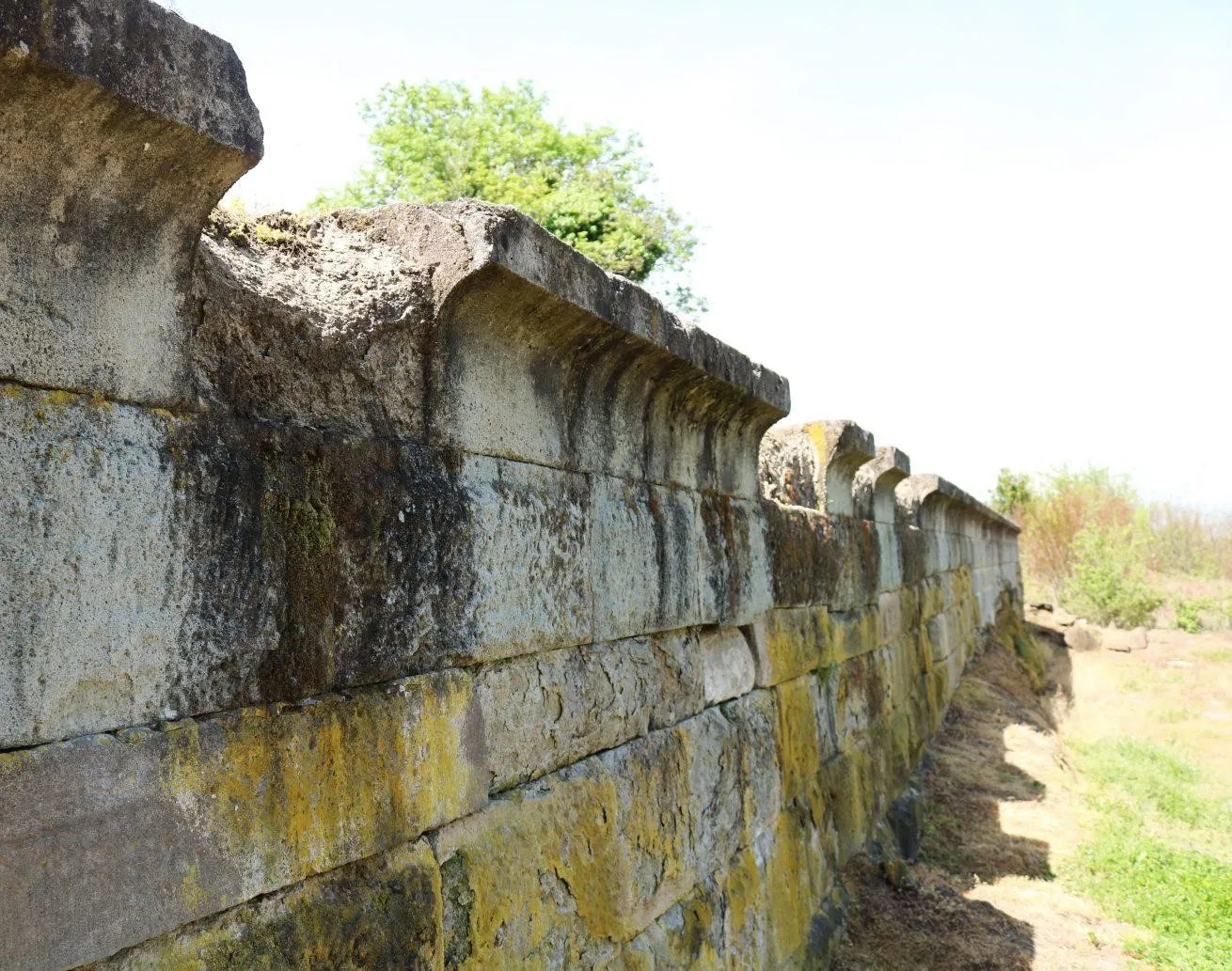
Is a multi-layered archaeological monument and includes cultural layers from the Iron Age to the Hellenistic era. The settlement is located on a hill divided into three terraces, which was protected on two sides by deep ravines. The settlement in Vani existed continuously for eight centuries (8th-1st centuries BC). The earliest stage of the history of ancient Vani dates back to the 8th-7th centuries BC, although the material from this period is relatively scarce. It is likely that the construction activities of subsequent periods damaged the ancient monuments. At this stage, the settlement must have been the cult-religious center of the settlements in its vicinity. The best preserved is the cult complex located on the central terrace of the settlement. The second stage, which includes wooden buildings, a ritual square, a rock-cut complex, luxurious tombs and other monuments, dates back to the 6th-4th centuries BC. At this time, Old Van must have been one of the political and administrative centers of the Colchis Kingdom. A special find of the archaeological excavations is the Colchis goldsmithing samples from this period.
In the third stage of the history of the Vani city-state (second half of the 4th century BC – beginning of the 3rd century BC), under the weakening of the Colchis kingdom, the rulers of the Vani region achieved a certain political independence. This period includes a series of luxurious tombs and chapels near the tomb groups.
In the fourth stage (second half of the 3rd century BC – middle of the 1st century BC), fundamental changes took place. The burial of representatives of the upper strata of society within the city ceased and it became a temple city. All the buildings of this period are of cultic purpose. Old Vani was destroyed in the middle of the 1st century BC, although materials from the late antique period and the Middle Ages have also been discovered.



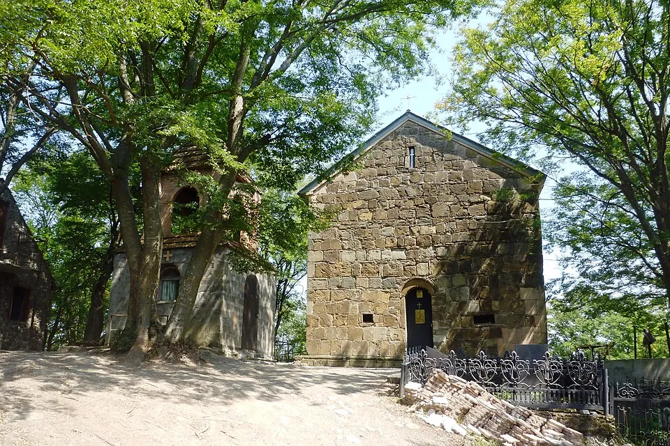
The Church of St. George of Shuamta is located in the village of Shuamta, Vani Municipality, in the Imereti region, on the village cemetery. It was built in 1615. The church is a hall-shaped building. The church was quite damaged, but has now been restored. The building has an arched entrance from the west. There is no decoration on the facades. The church is built of roughly hewn stone. A newly built two-story bell tower stands to the southwest of the church.
View on mapDikhashkho Sulfur Pools
Are located in the village of Dikhashkho, Vani Municipality, in the Imereti region, on the banks of the Sulori River, 180 meters above sea level, 6 kilometers from Vani.
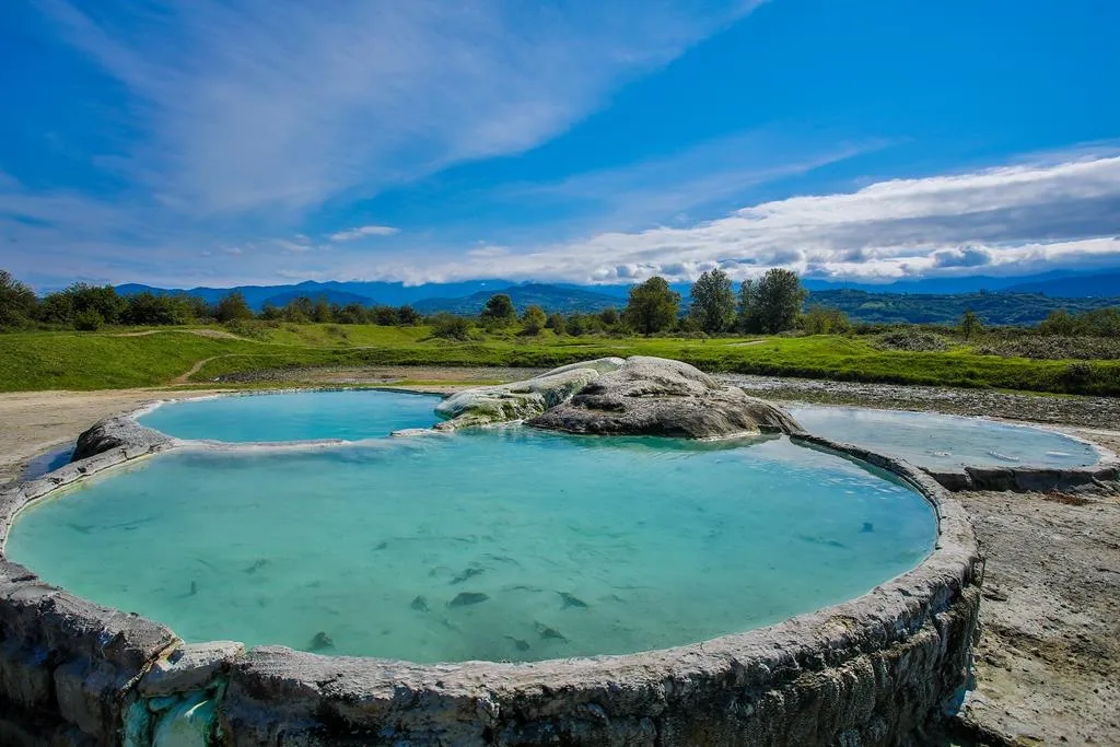
Sulfurous waters are characterized by healing and health-improving properties. Dikhashkho geysers and pools, in addition to their healing properties, are also distinguished by their beauty. The sparkling, blue, hot water flowing in the open air, in the white pools, is an excellent way to relax and is one of the attractive attractions of Vani.
Dikhashkho was first mentioned in historical sources in the 18th century, and the Vashlari Menelsakheble Monastery of the same period stands in the village.
A dirt road leads to the pools.
View on map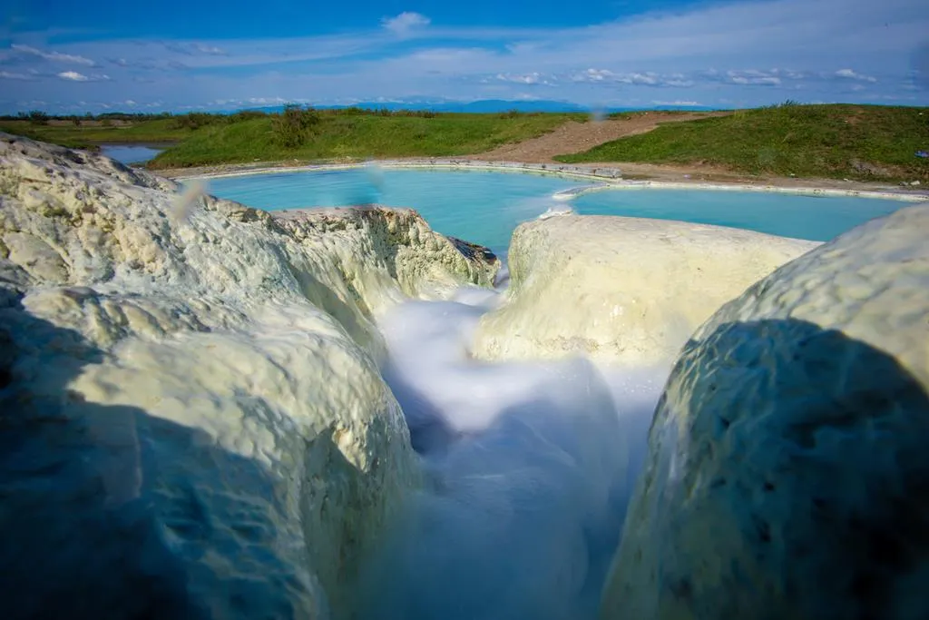


The village of Sulori is located in the Imereti region, in the Vani municipality, 11 km from Vani, at an altitude of 250 meters above sea level. The community was historically part of the Dvalishvili community and consisted of three villages. There is a historical tower in Sulori – Gormagali Castle.
The resort of Sulori is a climatic and balneological resort of local importance, covering an area of 3 hectares. The climate is humid subtropical, with mild, snowless winters and hot summers. Sulori is home to healing, low-mineralized, sulfide, sulfate-hydrocarbonate, sodium mineral water, which is used for baths to treat musculoskeletal, peripheral nervous system and gynecological diseases. The resort season lasts from June to October. The resort has 32 individual baths for balneotherapy treatment and its own polyclinic. There is a road leading to the village.
View on mapThe village of Dzulukhi is located in the Imereti region, in the Vani municipality, on the left bank of the Dzulukhi River, 240 meters above sea level. Dzulukhi is 15 km away from Vani. On the outskirts of the village, on Mount Melouri, there is the Melouri castle and the 14th-century Melouri Church. Inside the fortress walls, there were various storage rooms, and a tunnel led from the fortress to the river.
Melouri Castle — a fortress near the village of Dzulukhi, Vani Municipality, on a high mountain. The fortress overlooks the Melouri Gorge from the east. It is almost circular in shape. It is built of local, roughly processed large blocks, both from the outside and inside. The layout is rectilinear.
Currently, the fortress is partially covered with earth. The western wall has collapsed. The fairly solidly built walls of the fortress fence have survived, 4-5 m high. In some places they are less high. Five gun emplacements are placed at the base of the western wall. The inner territory of the fortress is filled with earth. Apart from the chapel and the barn, no other premises have survived here. The northeastern wall of the fence is also destroyed.

St. George’s Church of Kveda Gori
Is located in the village of Kveda Gori, Vanis Municipality, Paliteti, Imereti Region. It is a 19th-century cross-domed, incised cross-type church, which ends with an apse protruding from the east. The building has a circular, eight-window dome. There are two entrances, from the west and south. Both entrances are rectangular, have plain frames, and relief decorations are placed in the arches above the door. The windows are arched and decorated with frames with a simple profile. The church has a three-story bell tower attached to the west, which also serves as a gate. The first floor is open with arches on three sides, and the fourth side (east) is the entrance door to the church. On the second floor, arched openings are cut from the south and north, the west and east walls are blank. The third floor, which is intended for bells, is open on all four sides with double arches. The arches rest on columns with simple capitals. The facades of the church are surrounded by a simple pediment. The temple is built of cut stone.
View on map
Tabakuro Lake
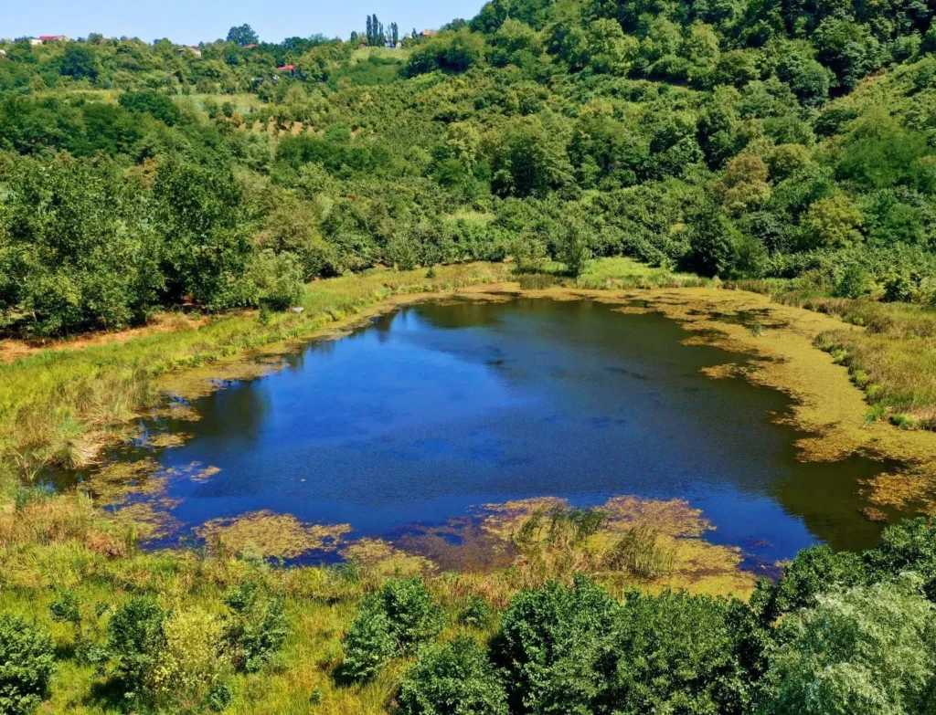
Is located in the Imereti region, Vani municipality, near the village of Zeda Gora, at an altitude of 230 meters above sea level. The lake is very beautiful, both in the spring and in the fall. The environment hidden in the trees and the blue sky reflected in the water create a pleasant place for lovers of nature recreation. A road leads very close to Tabakuro Lake.
View on map