Samtskhe-Javakheti Region



Samtskhe-Javakheti is one of Georgia’s most stark and atmospheric regions, defined by high plateaus, volcanic landscapes, and a sense of wide, quiet space. The climate is cooler and harsher than much of the country, with long winters and open plains shaped by wind and altitude. This is a region of slow rhythms, dramatic skies, and strong contrasts between seasons.
The area is known for ancient sites and raw nature: the cave city of Vardzia carved into rock cliffs, medieval fortresses, alpine lakes, and empty roads stretching through grasslands. Villages here feel remote and self-contained, influenced by Armenian and Georgian cultures alike. Samtskhe-Javakheti is not polished or touristy – it appeals most to travelers who value silence, history, and landscapes that feel untouched and elemental.

Ninotsminda Municipality
Ninotsminda Municipality is located in the Samtskhe-Javakheti region. Traces of human life here date back to the Stone Age, as evidenced by the artifacts discovered here. In Ninotsminda, there are many megalithic structures, burial mounds and settlements from the Bronze Age. The Cyclopean fortresses of Abuli and Shaori are noteworthy, which still make a great impression with their grandeur, planning and construction techniques. Culture and life in the region were developed in the Middle Ages, as evidenced by the many historical and cultural monuments preserved here. One of the central roads from Byzantium, and later from Turkey and Armenia to Eastern Georgia, passed through Ninotsminda.
Lake Paravani
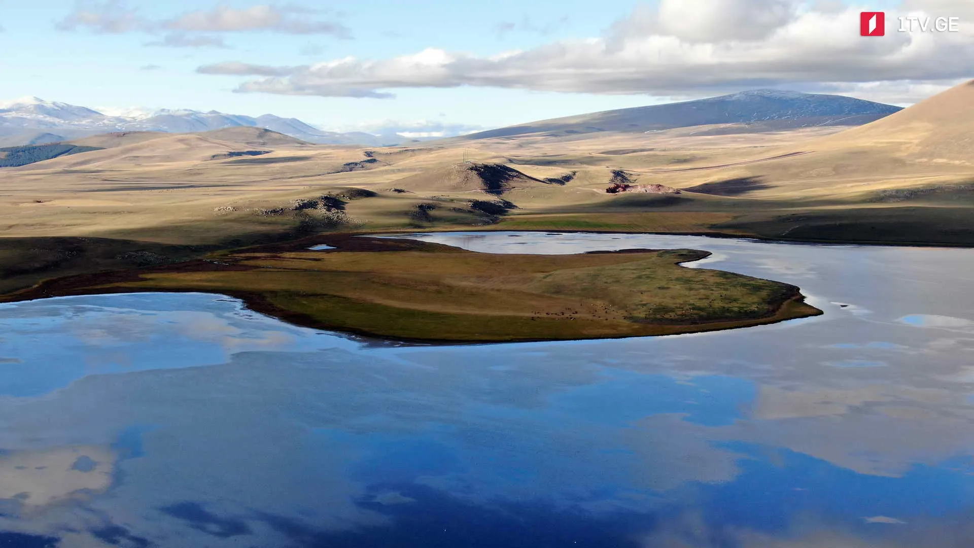
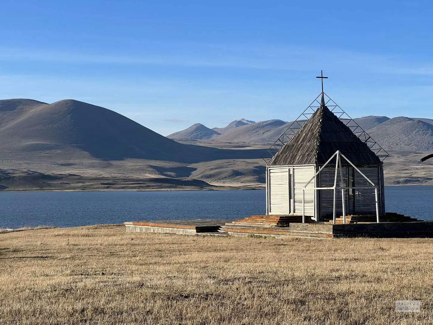
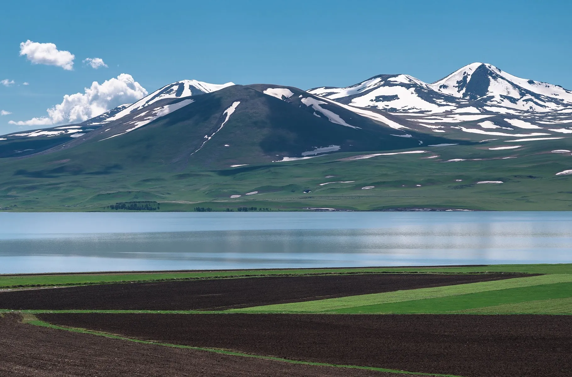
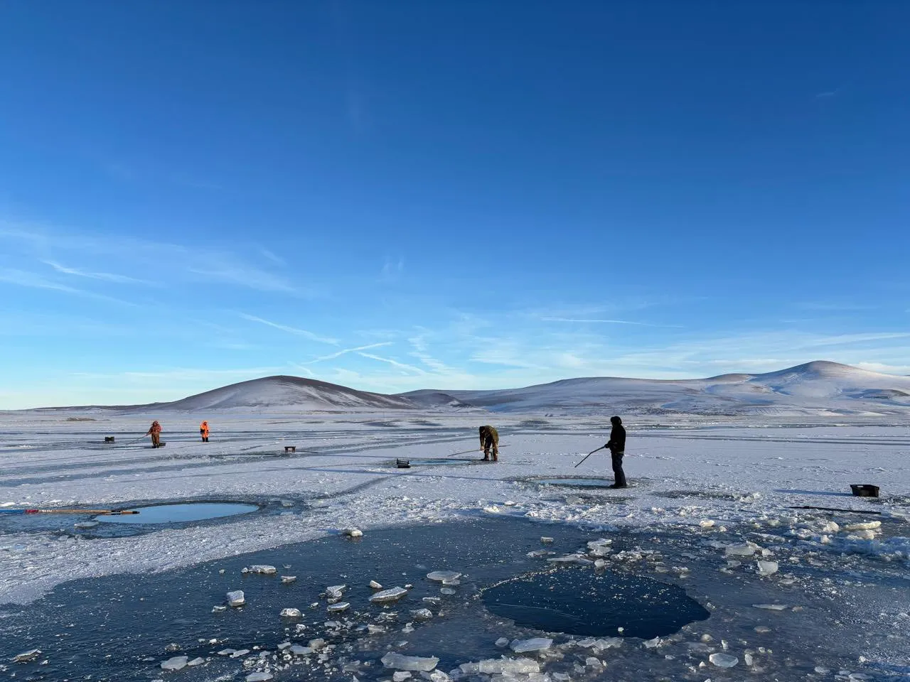
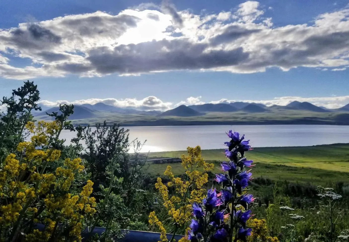
Lake Paravani – a volcanic-tectonic lake in Samtskhe-Javakheti, Ninotsminda Municipality. Located at an altitude of 2073 m above sea level. The lake is frozen in winter, the thickness of the ice varies between 47-73 cm. The rivers: Shaori, Sabadostskali, Rodionovskistskali are connected. The Paravani River originates from the lake. The lake is rich in fish and is quite popular with fishermen. The water is fresh and is used for fish farming.
The villages of Foka, Vladimirovka, Tambovka, Rodionovka, and Aspara are located around Lake Paravani. On the shores of Lake Paravani is the Poka Monastery, and nearby is the Shaori Fortress.

Shaori Fortress
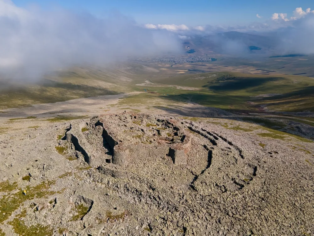
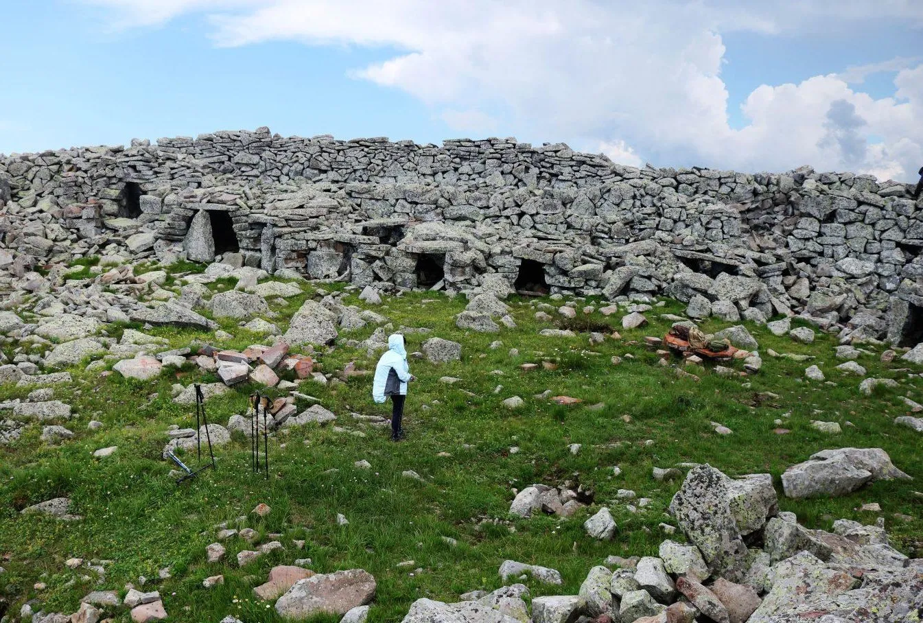
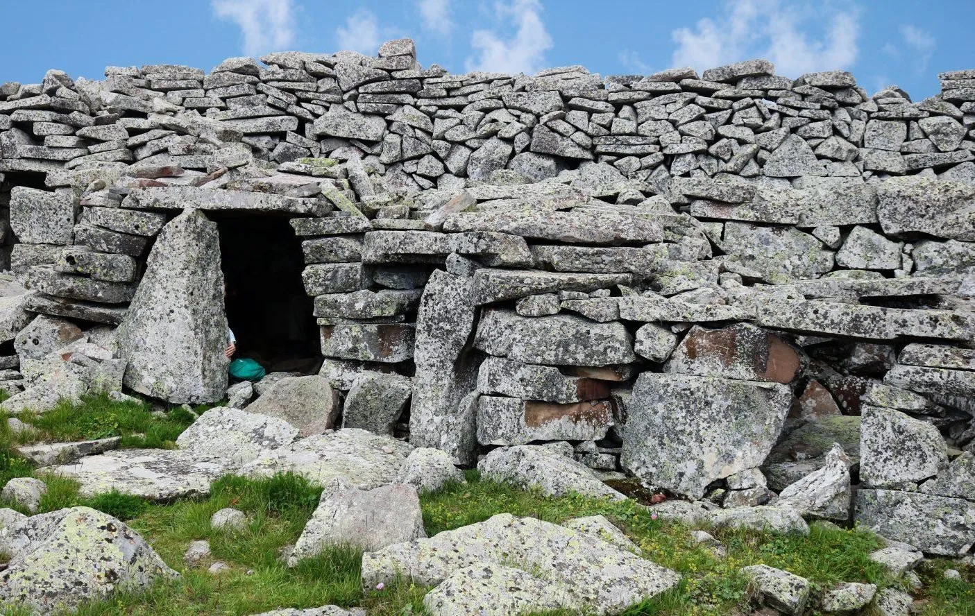
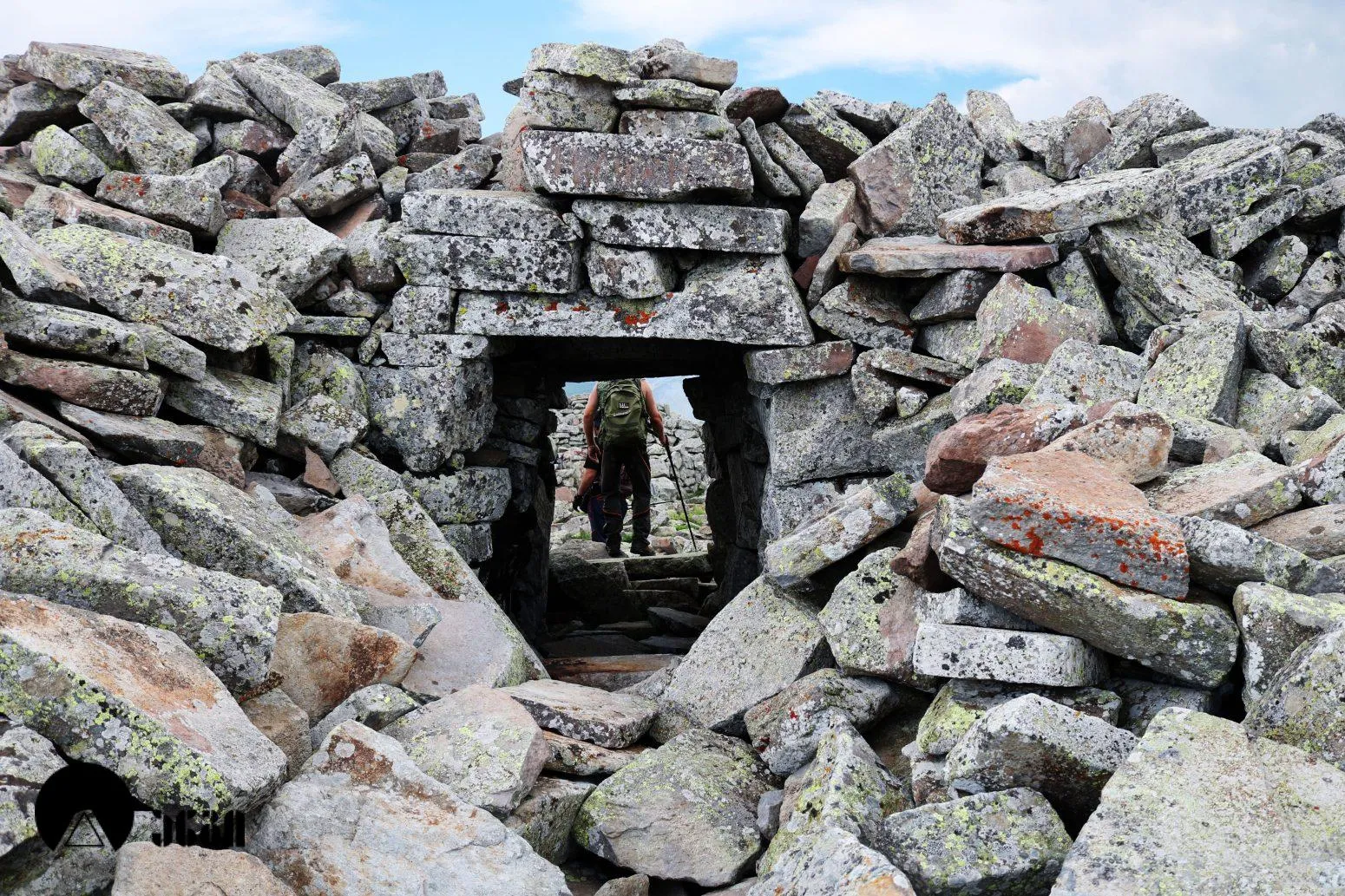
Shaori Fortress is located near the village of Aspara, at an altitude of 2752 meters above sea level. It is a megalithic complex of the 2nd millennium BC. Shaori Fortress is very similar to Abuli Fortress, in terms of natural conditions, construction techniques, uncovered ramparts and access routes. The complex consists of two parts. The “Upper Fortress” is located on a high mountain peak and is built with dry masonry. The thickness of the lower part of the fortress wall is in some cases 3 meters, and the height is 5 meters. Inside the fortress, storage rooms were built, which were located on one or two floors. Most of the storage rooms have separate entrances, while some are connected by doors. The ruins of a staircase have also been preserved here, through which it was possible to climb the wall. Outside the fence, in Karknal, a whole group of hiding places can be found. The upper fortress has only one entrance from the east, from where a wide path paved with large flagstones leads to the low peak of the mountain, the “lower fortress”. This path ends on a flat area to the west of the lower fortress. The lower fortress is also a cyclopean structure. Several menhirs were erected on proven platforms along the road. From the lower fortress, a path descends the mountainside, widens at the foot of the mountain and again turns into a stone path. Traces of a settlement have been confirmed at the foot of the mountain. What the Shaor and Abuli were from a social point of view remains to be investigated, however, it is unlikely that they were permanent dwellings.
View on map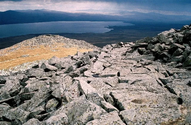


Poka
Poka St. Nino’s Monastery is located in the Ninotsminda municipality of Samtskhe-Javakheti, on the shores of Lake Paravani. It was from this place that the activity of the enlightener of Georgians, Saint Nino, began in our country. Saint Nino entered Georgia from the Armenian side and first stopped at Lake Paravani, where she spent two days. Here she had a miraculous vision: a man with a bright face appeared, who handed her a sealed writing from the Savior and ordered her to go to Mtskheta and give this writing to the king. The awakened saint prayed to the All-Holy Mother of God and headed for Kartli. The Holy Virgin converted King Mirian and Queen Nana to Christianity and soon converted Kakheti as well. That is why our Church calls her Equal to the Apostles.
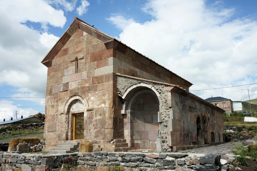
Poka St. Nino Monastery, a monument of Georgian architecture, dates back to the 11th century. Despite its small size, Poka is one of the most important monuments of the Javakheti area, standing out for its artistic value.
A monastery was opened there in 1989 and in 1992 the nunnery was established too. At the moment, the nuns produce fantastic cheese, chocolate and other treats. You can taste and buy them as a delicious souvenir from a holy place.
The church is a hall-type church, with ornamented doors and windows. Fragments of ancient artwork have been preserved in its interior. In terms of technical skill and the artistic value of its ornamentation, Poka Church is one of the most outstanding monuments in Javakheti.
The church, which had been damaged over the course of time, has now been completely restored. In front of its eastern facade, in the place where Saint Nino first set foot in Georgia, a small memorial obelisk made of hewn stone has been erected.
View on map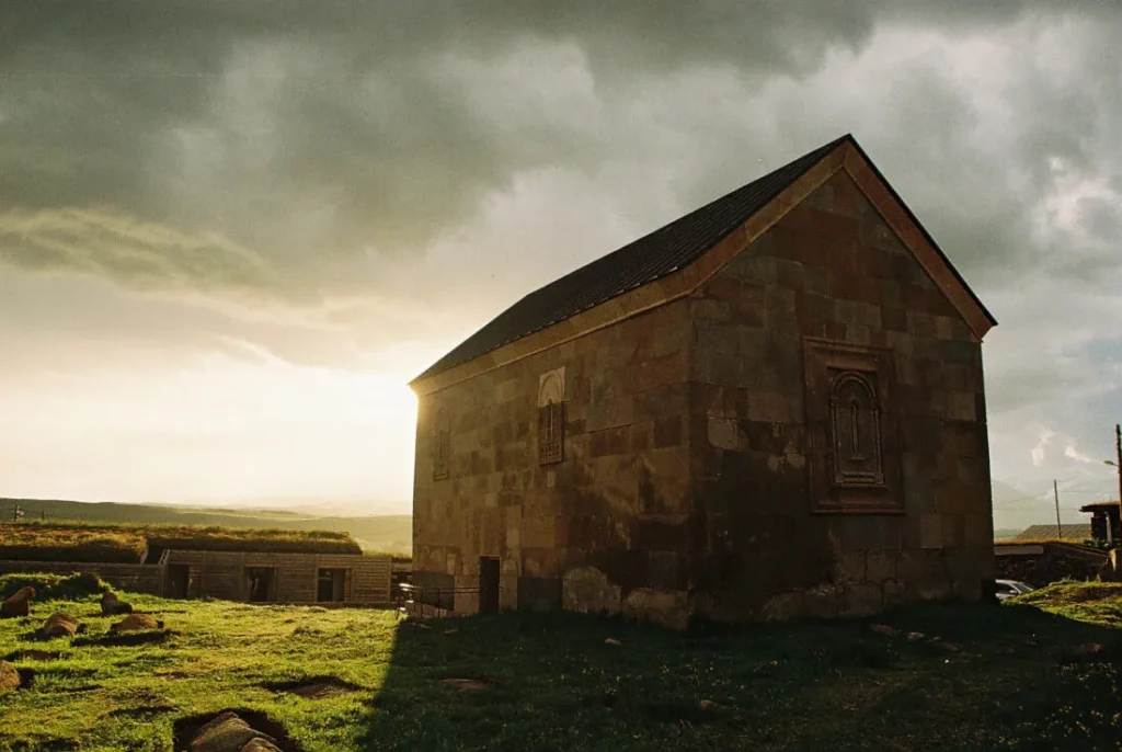
Saghamo village and lake
Saghamo’s Church of the Prophet Jonah is located in the village of Saghamo, Ninotsminda Municipality, Samtskhe-Javakheti region.
The church was built in the 10th century. The monument was quite damaged, the vaults collapsed and most of the walls were preserved at the level of the windows. Currently, the church has been restored, its restoration and conservation was carried out, during which part of the apse was covered with glass in order to visually preserve the decoration of the southern door of the original church. On the south side of the apse’s conch support arch, a human relief figure can be found. On the southern facade of the apse, there are two statues made in high relief, both of which are currently damaged, both have broken heads. The eastern window of the apse is two-part and consists of an oval and a small circular opening located below it. This window is decorated with a relief depicting the swallowing and regurgitation of the prophet Jonah. In the evening, near the Church of the Prophet Jonah, you can visit two basilicas from the developed Middle Ages and Lake Saghamo.
Saghamo lake- is located in Ninotsminda municipality, Samtskhe Javakheti region. It is located on the east part of Javakheti volcanic mountains, in Pravani river basin, on the altitude of 1996 meters.
The watershed of the lake is located in the east part of the Samsari range and at the west part of Javakheti range slopes. The south and south-western shores of the lake, built with andesites are downhill and collapsed. From the north side of the lake is a volcanic uplift, which doesn’t create a high bank. The east and south-east banks of the lake are low. Has a trapezoidal shape. It feeds with underground, rain and snow waters. The highest level of water is in May, lowest in September. In winter it freezes for 4-4.5 months. Near the lake is the village Saghamo.
View on map

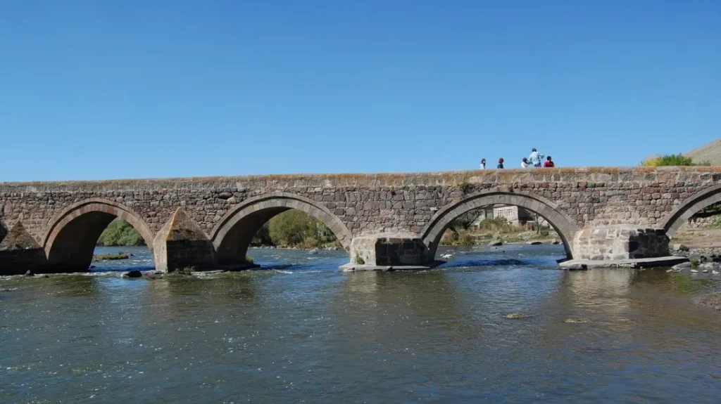
The Tontio Bridge is located in the village of Kaurma, Ninotsminda Municipality, Samtskhe-Javakheti region (historical village of Tontio). The structure dates back to the 13th-14th centuries. The Tontio Bridge is five-lane and is built over the Paravni River flowing in the middle of the village. One of the central roads from Byzantium, and later from Turkey and Armenia to Eastern Georgia, passed through it. Until 1893, an old Georgian inscription was preserved at the bridgehead. The length of the bridge is 72.2 meters, and the width is 4.5 meters. The structure has water gates built on piers on the front side, which protect the bridge from the waves of the rising water and the constant flow. In the village of Kaurma, you can also visit the 11th century church.
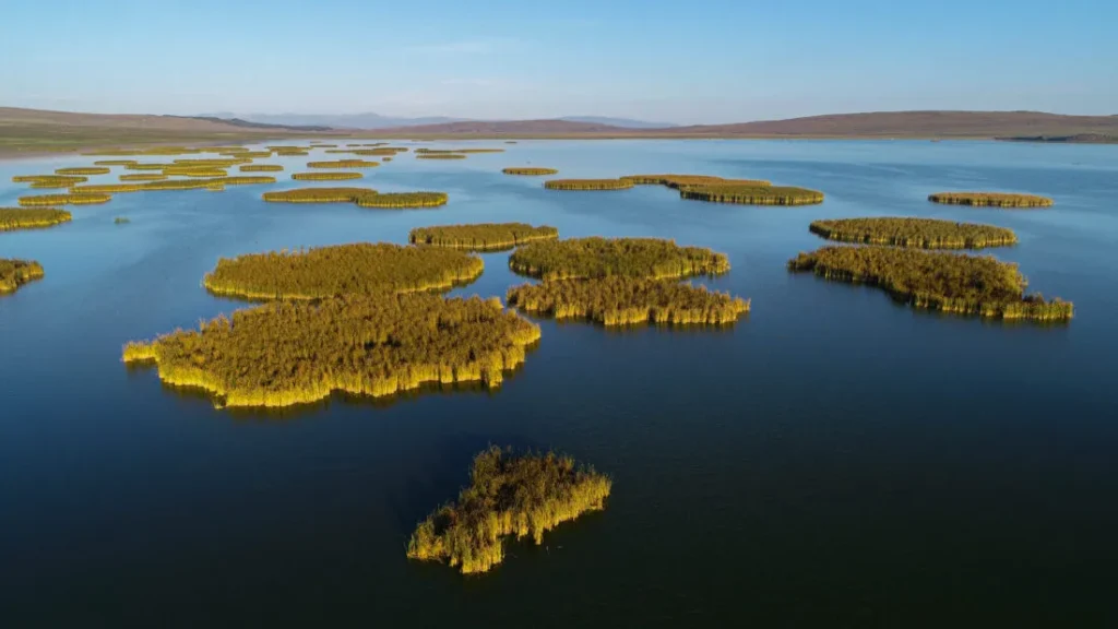
Khanchali Lake is located in the Samtskhe-Javakheti region, Ninotsminda Municipality, at 1928 meters above sea level, in the central part of the Javakheti volcanic mountain range. It is part of the Khanchali Managed Reserve. The vast expanses of Javakheti, the alpine meadows and the flowing blue lake attract many tourists. It is one of the wonderful places to unwind in nature. The diversity and abundance of birds add even more charm to Khanchali Lake. You can see a lot of nesting or migratory birds here in summer. The spectrum of harmonious colors of landscapes and waterfowl make an indelible impression on the visitor. From the end of November to the end of April the lake is covered with ice and if you are a lover of winter travel, here you will find a magical, shining world. Khanchali Lake is one of the most popular places for nature lovers.
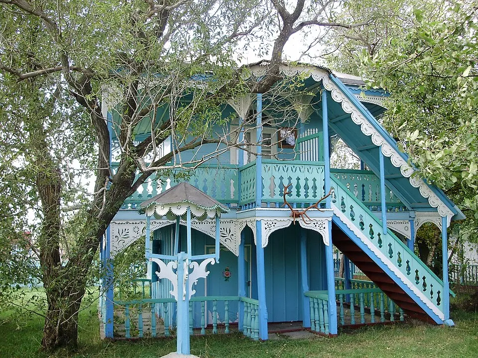
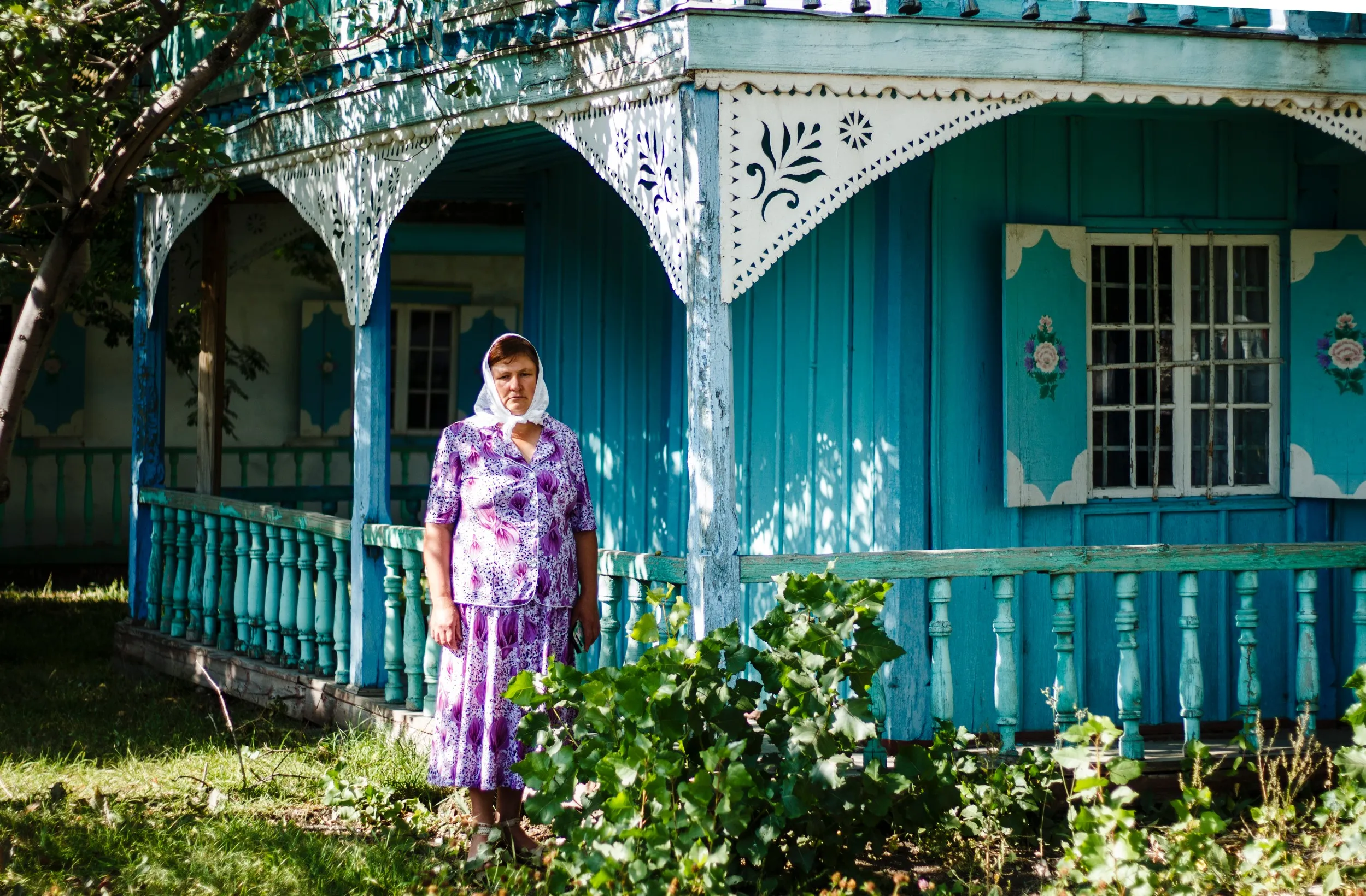
Village Gorelovka – Often called Georgia’s most colourful village, in Samtskhe-Javakheti region remains vibrant and beautiful despite having to endure some of Georgia’s most severe climate conditions and some of its longest winters.
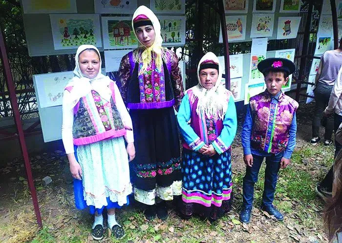
A veritable village museum, Gorelovka’s chief attraction are its gorgeously decorated houses decorated with blue lace and hand-painted shutters. The women of Gorelovka are no less splendidly attired, wearing colourful embroidered clothes that complement the decorated houses and the gorgeous embroidered tablecloths within.
While wandering the streets of this quaint village, you’ll get a sense of its complete harmony. From the beauty of its buildings and inhabitants to the white stork nesting atop electrical poles to the mountains that surround it, it is as if Gorelovka was composed by the imagination of an artist.
Gorelovka was called Budaghasheni until the 19th century, and had been a predominantly Armenian settlement until 1841. It was then that believers in a new religious movement were forcibly relocated here by Imperial Russia.
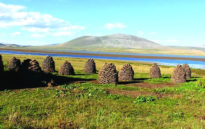
These migrants soon became accustomed to their surroundings, taking up cattle and poultry husbandry and introducing their own unique culture to the region. It was they who began to decorate their houses so colourfully, and they who chose the name Gorelovka for the village. They also planted mountain ash and birch trees in their yards to remind them of their homeland, and opened the orphanage that is today a museum.
The inhabitants of Gorelovka are Doukhobors and strictly follow the edicts of this religious movement. In 1978 there were 3,000 Doukhobors in Gorelovka, but the village is now slowly emptying as everyone tries to return to their historical homeland.

Bughdasheni National Park – includes the lake Bughdasheni and is the part of Javakheti National Park. It includes some territory of Ninotsminda municipality. The national park is located on the south side of the village Gorelovka. Its total area is 126 acres. It was established on 22 of March in 2011. Here you can visit Bughdasheni Lake
Lake Madatapa is located in the Samtskhe-Javakheti region, in the Ninotsminda municipality, at an altitude of 2108 meters above sea level. It is part of the Madatapa reserve. The blue lake, surrounded by the volcanic mountains and open spaces of Javakheti, is a beautiful sight. This place is perfect for birdwatchers. The lake is often visited by photographers, as many nesting and migratory birds gather here in the summer. The vast views, diverse color gamut, and the environment filled with exotic birds attract many tourists. On the way to Lake Madatapa, you can also visit the village of Gorelovka, where you can enjoy the colorful and unique architecture of the Doukhobors. Lake Madatapai is one of the best places for lovers of relaxation and travel in nature. The lake completely freezes over in winter, transforming the colorful surroundings into a fairy-tale, sparkling white world.
View on map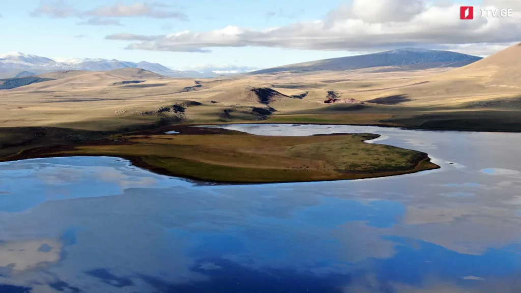
Akhalkalaki Municipality
Akhalkalaki Municipality is located in the Samtskhe-Javakheti region. Traces of human life here date back to ancient times. Stone Age settlements, basalt handaxes and other artifacts have been discovered on the territory of Akhalkalaki. There are also traces of Bronze Age and Pre-Ancient settlements in the region. Megaliths attract attention, of which the Murjakheti menhir, Khorenia fortress and Veshapoid, etc. are especially famous. These territories were developed in the Middle Ages. In the 10th century, Akhalkalaki, along with Javakheti, was a princely estate. In the 11th century, it became the political and economic center of Javakheti and was an important center of trade and production. Remains of a craftsman’s district of the 10th-13th centuries, glazed and unglazed clay vessels, glass objects and coins have also been discovered. Akhalkalaki became a separate region in 1930. Nowadays, a museum, theater, and libraries operate in the district.
Akhalkalaki is distinguished by its beautiful landscape, numerous lakes, and interesting cultural monuments, which determine its great tourist potential. The district is visited by many travelers, and the vast expanses of valleys, mountains, and ancient fortresses and temples make a great impression on visitors.
Akhalkalaki fortress
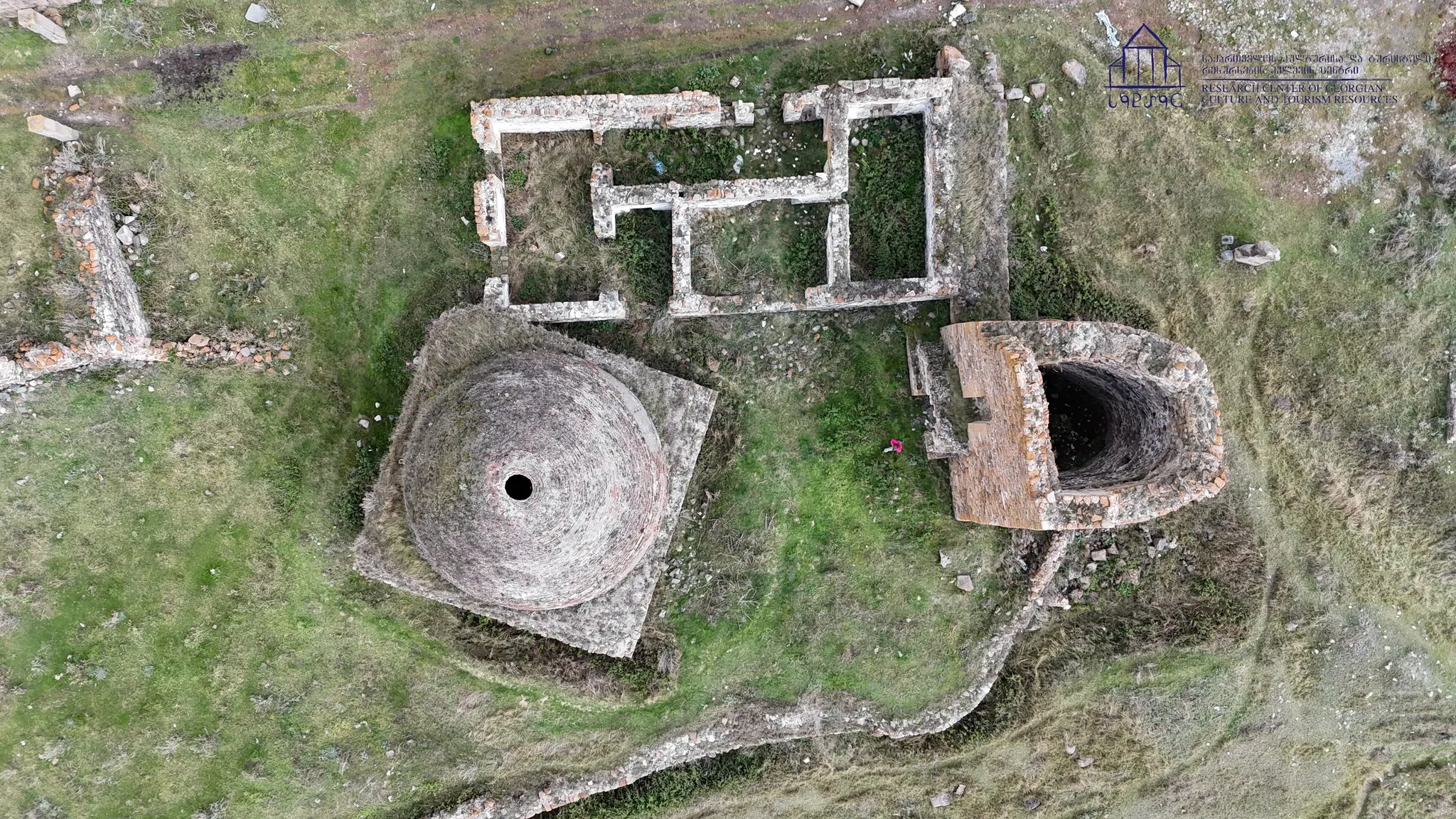
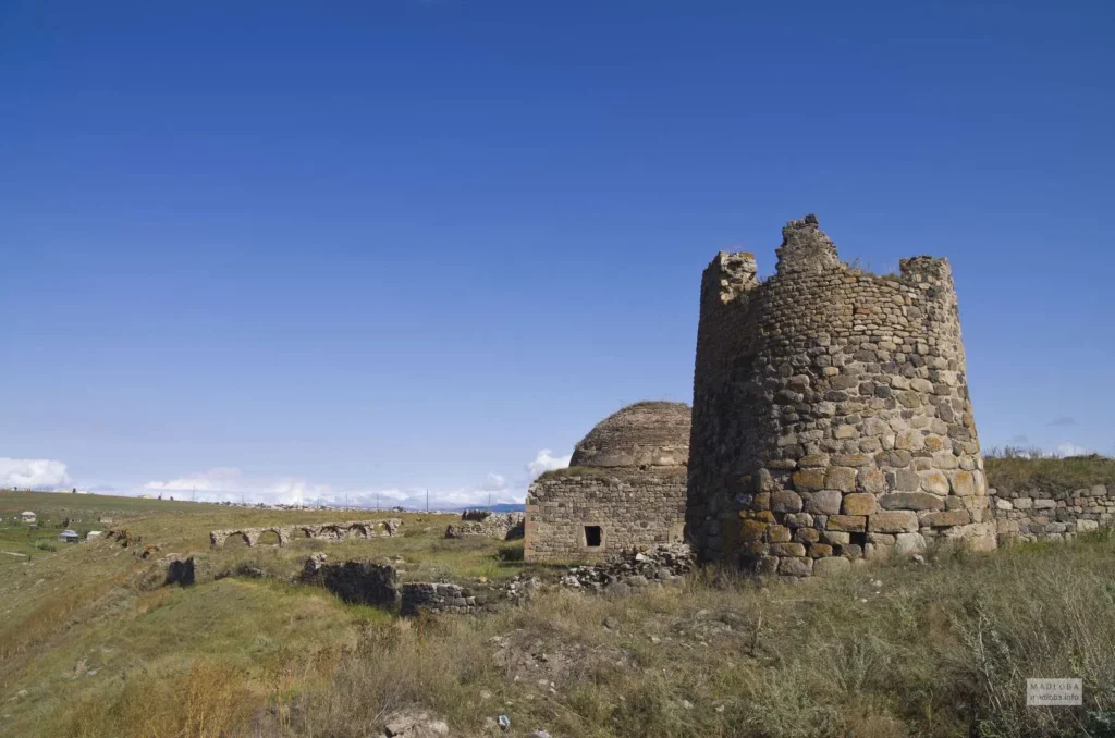
Akhalkalaki fortress is located in the Samtskhe-Javakheti region, Akhalkalaki Municipality. It dates back to the 11th century. The complex includes a citadel, towers, choultry, the church remains, cell and other household buildings and a mosque. Based on archaeological excavations, the settlement on the territory of the town dates back to pre-Christian times, and the remains of the early Cyclopean walls were used in the planning of settlements in the Middle Ages. In the IX century, an unwalled settlement was established here, which later became a large fortified city.


Kumurdo Cathedral
Kumurdo Cathedral is one of the most important Georgian cathedrals of the 10th century, the ruins of which are preserved in the village of Kumurdo in the Akhalkalaki municipality of the Samtskhe-Javakheti region.
The inscriptions preserved on the walls of the temple indicate that during the reign of the Abkhazian king Leon III, in 964, the Georgian architect Sakotsar began construction of the temple under the leadership of Bishop John (Kumurdoeli). During the reign of Bagrat IV (1027-1072), a southern stoa was built for the temple. The inscription on the western entrance mentions the repair and reconstruction of the church in the 16th century.
The Kumurdo temple is a stone-built, domed building. It has a peculiar, transitional plan: it is cruciform on the outside, and inside it has five semicircular apses and one (western) rectangular arm. On both sides of the altar are apsed deacons and a sacristy, while the southern and northern apses are not radially arranged (as in six-apse churches, to which the temple is genetically related).
View on MapBaraleti Church
Baraleti Church — a hall church of the 13th century Georgian architecture in the village of Baraleti, Akhalkalaki Municipality, Georgia.
The church is a three-nave basilica, on the eastern wall of which is an inscription in Asomtavruli: “This church was built in those days, when Lasha sat as king.” The accession of “Javakhtupli” to the throne is especially celebrated in Baraleti. Since basilicas were no longer being built in Georgia at that time (1213), it is likely that this information refers to the restoration or repair of an earlier church.
According to the decree of the President of Georgia in 2006, the Baraleti Church was granted the category of an immovable cultural monument of national importance
You can also visit the XIX century Baraleti Armenian Church in the village.
Art Villa Garikula
Abuli
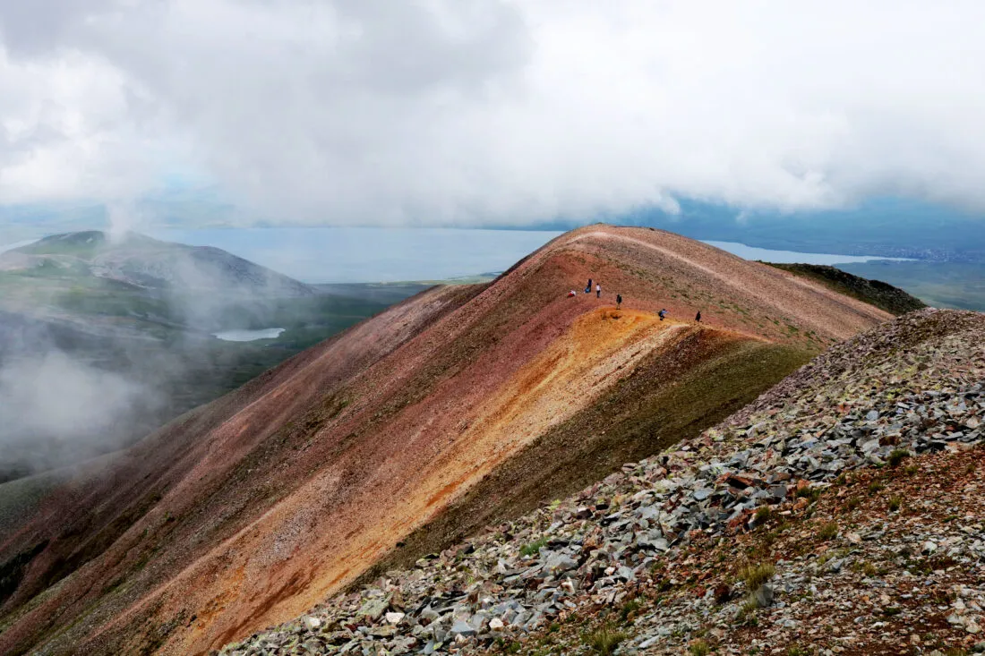
The peak of Didi Abuli is located in Samtskhe-Javakheti, in the Akhalkalaki municipality. It is one of the most beautiful places, from which a beautiful view opens up to the entire Javakheti region.
Its height is 3305 meters above sea level. It is built mainly of Neogene hyalodacites. It is an extinct volcano. The volcanic cone has lost its regular shape due to its antiquity and great height. On the slopes of Didi Abuli, ancient glacial cirques with moraine ridges and small lakes have been formed. Most of the mountain is covered with alpine meadows. Periglacial rocky outcrops are widely developed.
Abuli Cyclopean Fortress
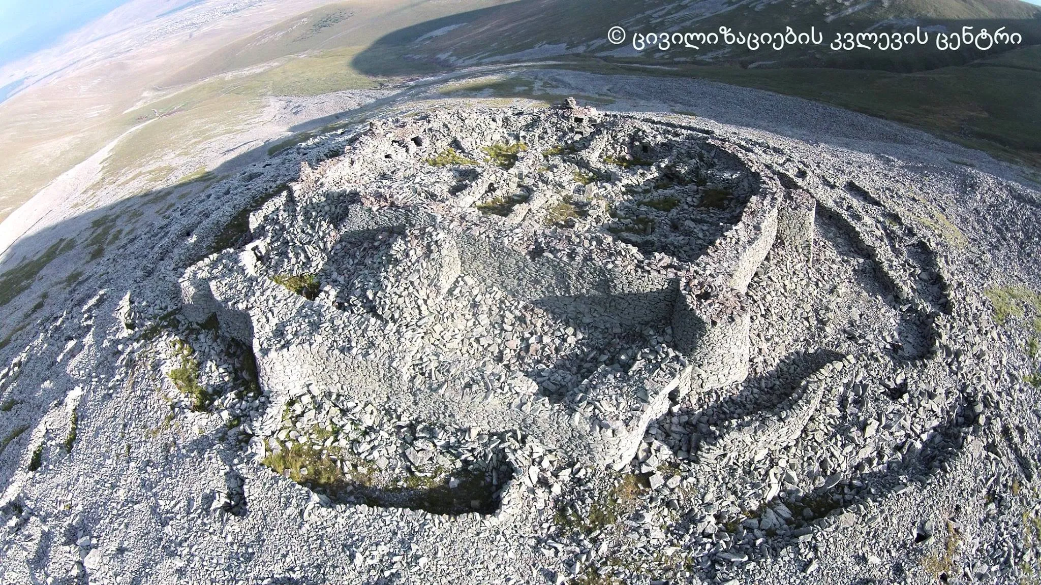
Abuli Cyclopean Fortress — a dry-stone Cyclopean fortress, located on Mount Patara Abuli (Samtskhe-Javakheti region), at an altitude of 2670 meters above sea level. It strongly resembles the Shaori fortress — similar natural conditions, construction techniques, unroofed towers and approaches. But Abuli fortress is still unique. It must have been one of the foremost centers since ancient times. Its size, strength, inaccessibility, and strategic location are striking: the road to the south passes through it.



Lake Levani
Lake Levani is a glacial lake in Georgia, in the Akhalkalaki municipality. It is located on the Samsri ridge, on the southwestern slope of the Godori Mountains, in a deep trough valley, at an altitude of 2815 m above sea level. The surface area is 0.06 km², the basin area is 1.38 km², the maximum depth is 2.8 m. The water volume is 0.12 million m³. The depths increase rapidly near the shore, and then gradually increase and reach a maximum in the southern half. The depths in the lake are almost evenly distributed. The steepness of the slopes of the lake basin is noteworthy. It is fed by snow, rain and groundwater. Its level is high in summer, low in winter. The water is weakly mineralized. The clean and transparent water of the lake is bluish-blue. It is poor in living organisms.

Javakheti National Park
Javakheti National Park– the National Park in Samtskhe-Javakheti, contains the territories of Akhalkalaki and the municipality of Ninotsminda. The area of the park is 14,200 hectares. There are many lakes on the plateau of Javakheti, among them is the biggest table-land in the whole of Georgia – Lake Paravani. The highest point of Javakheti is the mountain of Didi Abuli (which means ” big Abuli”). It is 3, 300 meters from sea level. The highland of Javakheti is the coldest place in Georgia, where people are settled. It is characteristic for this place to be a very dry continental climate, whereas, the mean annual temperature is quite low, for, throughout the wintertime, most of the lakes are frozen for a long period.
There is a lack of forests in Javakheti, actually, it is woodless territory. The most significant natural subalpine wood, which is composed of white birch, Caucasian rowan-tree, loveliest Cotoneaster, and the bushes of sweetbrier and raspberries, can be seen at the boundary of Georgia- Turkey, on the neighborhood of Kartsakhi lake.
In Javakheti National Park, there are seven camping, riding, and cycling routes. You can observe the birds in every season of the year, from the special tower, which was established on purpose. To sum up, one can keep an eye on 140 different dwellers or vagrant birds. The lakes, themselves, are rich with various types of fish, it actually, is an ideal place for those, you adore fishing. Javakheti National Park is the only preserved territory, where you can come across the real flamingo while strolling down the forest.
View on mapAspindza Municipality
Aspindza — a town in Georgia, the center of the Aspindza municipality and community. It is located in the eastern part of the Akhaltsikhe Basin, on the right bank of the Mtkvari River, at the confluence of the Oti River, at an altitude of 1090 meters above sea level, on Highway S-11, 34 km southeast of the city of Akhaltsikhe, 248 km from Tbilisi. Architectural monuments of the 10th-12th centuries have been preserved in the town.
The name came to Georgian from Persian, denoting a hotel, a rest station located on a major road. The year 888 is considered the beginning of Aspindza as a settlement.
Aspindza has a mountain-steppe climate, with cold, little-snowy winters and long, warm summers. The average temperature in January is -2.2 °C, in August 20.3 °C; The average annual temperature is 9.4 °C. The absolute minimum is -29 °C, the absolute maximum is 39 °C.
Aspindza is a balneological resort of local importance due to the thermal waters in the town. The healing factor is the sulfur-hydrogen chloride-sodium-calcium thermal (42 °C) water with a low mineralization (0.9 g/l) (flow rate 0.5 million l/day). The water is used for baths.

Aspindza Fortress
Aspindza Fortress is an immovable cultural monument of national significance in the Samtskhe-Javakheti region, in the Aspindza municipality. It is built on a ridge and consists of three towers connected by a wall. Two of them are rectangular, and one has rounded corners. One of the towers houses the entrance gate to the castle. The castle is heavily damaged, but even now it is possible to distinguish buildings from two periods – the 10th-11th and the 13th-14th centuries.
The castle once controlled the entire Mtkvari Valley. From here, a road followed the Mtkvari, and this way the Kingdom of Kartli was connected to Byzantium through other territories of Georgia. The second road followed the Itistskali River to Tsikhisjvar-Tor, the third road passed through the historical village of Taman, the villages of Alastan and Gokyo to Javakheti and Trialeti, and the fourth road went along the left bank of the Mtkvari River through Sakhudabel-Chobareti to Akhaltsikhe.
According to legend, it was initially ruled by the Shalikashvilis, and then passed into the hands of the Diasamidzes.
On November 7, 2006, according to the decree of the President of Georgia, Aspindzi Fortress was awarded the category of an immovable cultural monument of national importance.
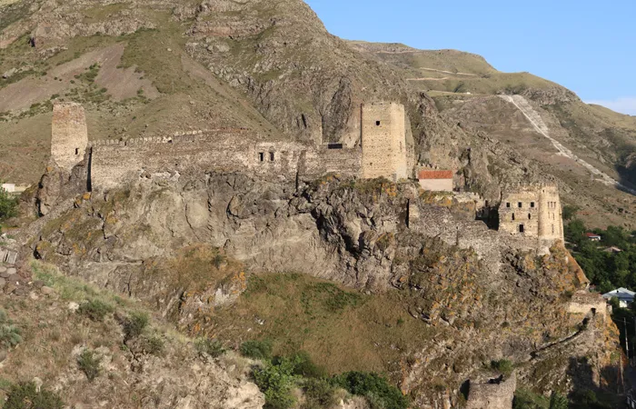
Khertvisi Fortress
Khertvisi fortress – Middle age castle is located in village Khertvisi, on the estuary of rivers Paravani and Mtkvari, on a tall rocky mountain (currently Aspindza municipal territory) in Javakheti, southern Georgia. Khertvisi was an active fortress during the feudal ages.
Since 24th of October, 2007, Khertvisi, together with Vardzia monastery is included in UNESCO world heritage testing list
According to information from chronicler Leonti Mroveli, which is based on oral tradition, during the eastern conquest, in 20’s of IV century BC, Alexander the Great, together with other fortified cities visited Khertvisi as well (Historic science does not agree with the version of Alexander the Great campaigning in Georgia). Khertvisi was located on an important pathway, under its subordination were regions of Mtkvari and Paravani rivers. During the XVI century, Khertvisi was under Kamkamidzes, Khertvisars, Amatakians and Shalikashvili rule accordingly.
During Ottoman expansion in southern Georgia, 1578, Arfaksad, son of Iotham, together with other fortresses in Javakheti, forfeited Khertvisi to Ottomans. Later it was a center of the Ottoman administrative unit. In the 70s of the XVIII century, it was taken by king Erekle II, during the Russian-Ottoman war (1828-1829), in 1828 the fortress was liberated by the Russian army.
Khertvisi was reconstructed several times. The early middle age building layer is noticeable. The fortress consists of the citadel and a wall. Citadel stands on a narrow, rocky edge of the mountain, it is not approachable from the northeastern side. Water was supplied by a tunnel on the northwestern side.
Machikheti Church
The Lower Machikheti Church is located in the Aspindza Municipality, on the 2nd kilometer of the Muskhi-Chobareti-Zveli road, a few meters below the road, on the right side.
The Machikheti Church was built of smoothed squares in the middle of the century. The church has a single nave. It has a later nave on the south. The church was partially destroyed, but has been restored. It is roofed with tiles. The original building stones were used in the church’s facade, some of which are inscribed. The church’s roof arch is made of bricks. The main space of the church is lit by one window, which is cut into the western and eastern walls. One window is cut into the eastern wall of the nave. The entrance door to the church is from the southern nave. The floor is paved with stone tiles.
View on map
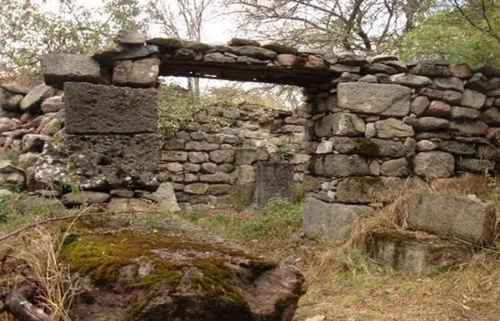
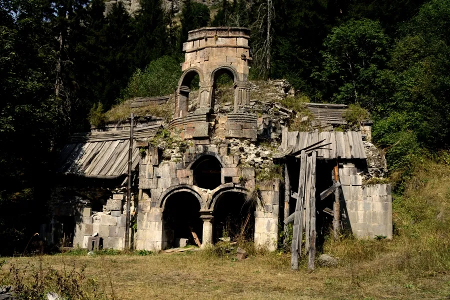
Shoreti Monastery Complex
Georgian architectural complex in Aspindza Municipality, 5-6 km north of the village of Oti. The Shoreti Monastery Complex is located in southern Georgia, on the border of four historical provinces – Samtskhe, Javakheti, Tori and Trialeti, in Aspindziskhevi, 11 km from the town of Aspindzi.
The road was brought to the monument in 1990-1991 to begin restoration. Before that, a narrow horse-drawn trail leading upstream along steep, forested cliffs began near the Sanislo and Sholotistskali gorges.
At the headwaters of the river, on a meadow surrounded on three sides by high mountains, streams, spruce forests and deciduous forests, stands the Shoreti monastery complex, a monument of architectural interest in itself, adorned with a carved hewn stone roof, rare decor, and mosaics. From the north, a high, impregnable fortress-tower and a chapel crown the soaring rock.
View on mapChurch of St. John the Baptist of Tsunda
The Church of St. John the Baptist of Tsunda is located in Samtskhe-Javakheti, Aspindza Municipality, in the territory of the Tsundi town, in the present-day village of Nakalakevi.
The church is built on a rock surrounded by terraces, which are raised by a stone pile. The lower part of the pile is made of roughly hewn stone. The northern part of the specially arranged terrace is entirely occupied by the church, the southern part of the terrace is a fenced open platform. Later, a gate was built on this side of the temple, to which small storage rooms were added from the east and west. The church, gate and other small storage rooms were not built at the same time.
The facades of the temple are made of clean hewn stone. The principle of facade decoration is typical for the turn of the 12th-13th centuries. The decoration is mainly concentrated around the door and windows (the southern door is without a lintel and decoration, it was probably assumed that the gate was built here from the very beginning).
The entrance to the temple is from the west, and the western facade is the first thing that catches the eye. On the high, well-proportioned facade, the door is covered with a green sandstone architrave, which has preserved the construction inscription of the temple. The door and the architrave are surrounded by a plain frame with intervals, in which square capitals decorated with crosses and roses are inserted. On top of the architrave is a small cross with bunches of grapes. The window lintel above the door is held by a double braided shaft and square tiles inserted in the corners, previously decorated with a chain of interlocking circles and rhombuses. Small arched decorative crosses are carved at the edges to fill the empty space on the facade.
View on map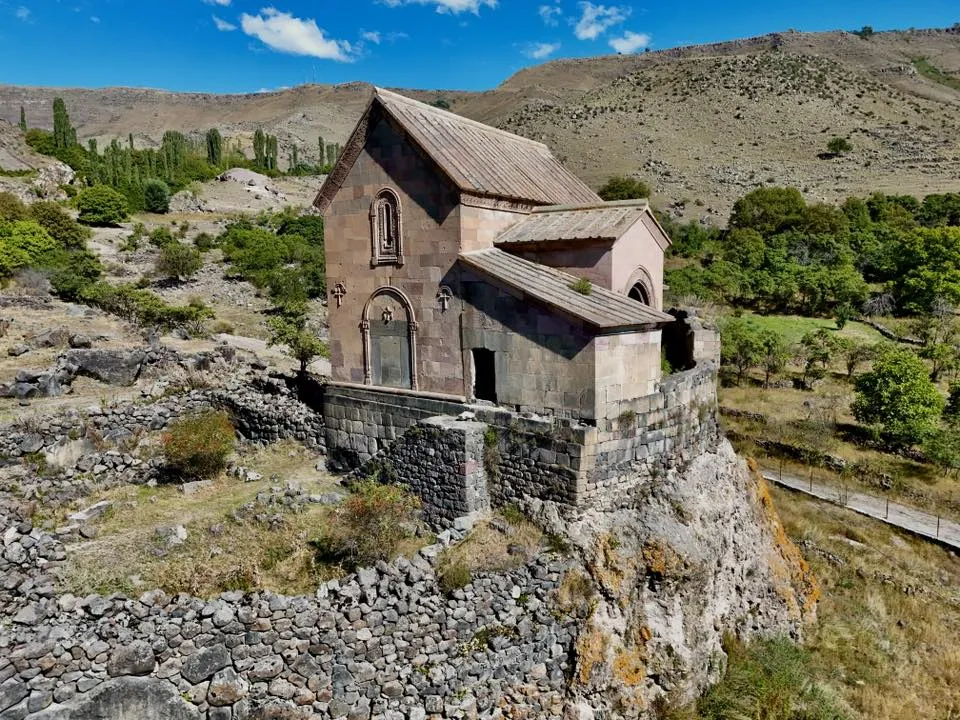

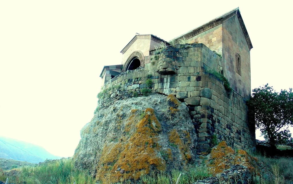
Chachkari Cave — an architectural monument in the village of Chachkari, Aspindza Municipality. Built in the 10th-15th centuries.
There are several caves at the foot of the plateau. The last elongated cave has a stone wall built from the front towards the village. On the inner wall of the eastern side of the same cave, an elongated groove is carved into the rock. There are two more caves to the east next to it. The structures carved into the Chachkari rock are currently dated in the scientific literature to the 11th-12th-13th centuries.
View on map
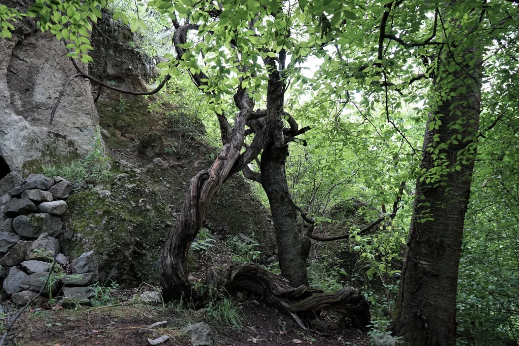
Beriskhevi
A 3th-century rock-cut dwelling in Aspindza municipality, 1.5 km from Vardzia Monastery, on the left bank of the Mtkvari River, at an altitude of approximately 20 m. A sloping tunnel was used for access. The Beriskhevi complex consists of a hall church located on the edge of a ravine, a carved cell, a pantry, a storage room and a fortified defensive post.

Tmogvi Castle
Tmogvi castle is located in Samtske-Javakhet, in Aspindza municipality near the village Tmogvi at the left bank of the river Mtkvari.
Tmogvi Fortress first is mentioned in historic origins in X century, it was controlling a road from Asia to Georgia through Mtkvari valley. Arabs tried to sack it in the X century but failed. At the end of X century and beginning of XI, Tmogvi fortress was under Monarchy rule. Since 1073, nobleman Niania Kuabulisdze and his heirs owned it, in the future centuries, it was under different feudal family’s rule – Torels, Mkhargrdzelis, Shalikashvilis and Jakels. Ottomans conquered Tmogvi fortress in 1578, later the fortress and its territories were under Ottoman political-administrative unit jurisdiction – Akhalkalaki Liva. After the Russian-Ottoman war in 1828-1829, according to the treaty of Adrianople (1829) Ottomans, together with other territories, forfeited Tmogvi fortress.
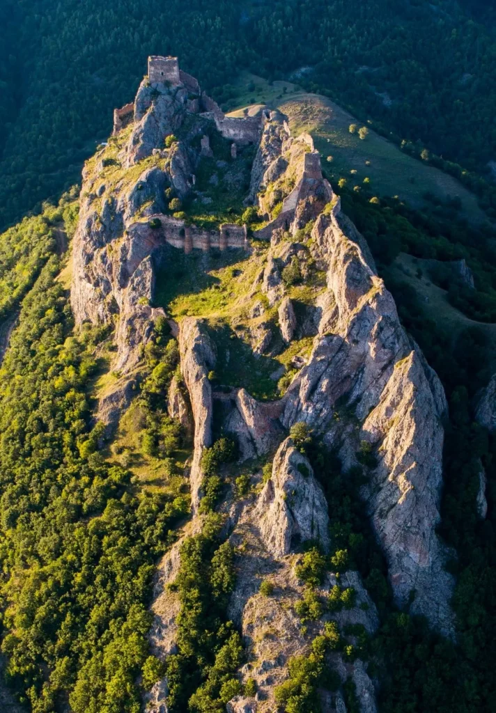
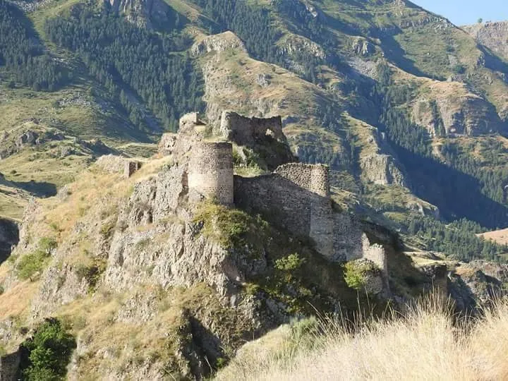
Tmogvi fortress is built on a tall, rocky mountain. Due to landscape differences, its walls stand on different heights. The western side of the fortress is better preserved, here on an incline there are three steps of fortifications. Southeastern walls are leaning on a cave, in which there is a secret tunnel connected to Citadel on the upper side and river Mtkvari on the lower side. The small area in the middle of the fortress is fully occupied by buildings. Two distinct building layers are noticeable, the earlier layer is built by smoothed tufa squares aligned in even rows. Roughly processed stone walls belong to the later renovation age. Outside the fortress walls, in the western gully we can see St. Ephrem church, carved in a rock, with iconostasis also carved in a rock. In the ruins of the second, domed church XIII century mural painting fragments remain.
View on map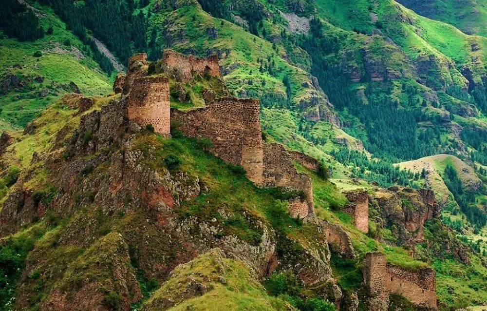
Zeda Tmogvi church— a monument of Georgian architecture of the 11th century, a three-nave basilica. North of the Vardzia and Tmogvi fortresses, on a high mountain plateau. On November 7, 2006, the church was awarded the category of an immovable cultural monument of national importance by the decree of the President of Georgia.
It is built of well-polished gray stone, roofed with louvres. The high and wide central nave is separated from the Gevrid naves by three arches resting on two pairs of pillars. On the south facade there is an entrance decorated with carvings and inscriptions set in a rectangular frame. The southern wall of a small hall church of the 8th–9th centuries with an entrance door is incorporated into the northern wall of the basilica. One of the inscriptions on the basilica indicates that it was built by Eristavt-Eristavi (duke) – Parsman, son of Iovane Chimchimeli, during the reign of Bagrat IV (1027–1072). The monument shows signs of several restorations and alterations.

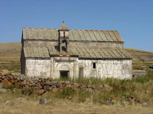
The Church of the Archangels of Saro is a Georgian Orthodox church in the village of Saro, Aspindza Municipality, Samtskhe-Javakheti Region. It dates back to the 7th-8th centuries.
The church is a hall-shaped church, built of gray volcanic stone. The corners of the building, the lintels of the openings, and the surviving window lintels are made of neatly polished tuff. The church is whitewashed from the outside with lime mortar, the interior is covered with quite thick plaster. Despite this, a later, probably 19th-century restoration or reconstruction is clearly visible.
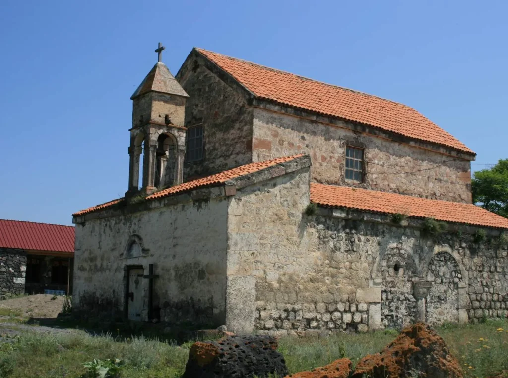
Saro Fortress — a complex of fortifications in the village of Saro, Aspindza Municipality, Georgia. In Javakheti, as well as throughout the Southern Caucasus, fortified settlements must have been a widespread type of settlement at that time (at least the 2nd millennium BC, if not earlier). D. Berdzenishvili considers the Saro settlement, along with the ancient settlements of Abuli and Shaori, to be such a fortified point.
Archaeological material found in the vicinity of the village of Saro clearly demonstrates the fact that the village and its surroundings must have been actively involved in the cultural and economic relations that took place in Samtskhe-Javakheti from the middle of the 2nd millennium BC, including the Hellenistic and feudal periods.
The fact that the village of Saro and its surroundings were one of the most important political and economic centers from the earliest times is evidenced, among other things, by the complex of fortresses preserved on its territory, which is very original in its layout. It can be safely said that each fortress included in this complex was a complex, independent fortified object.
Some researchers consider the fortresses of Saro to be one fortress. In their opinion, the fortress of Saro consists of three parts:
“Subdistrict Fortress”, which is located at the western end of the village (subdistrict); “Upper Fortress”, or the Sakdri Fortress, which is located near the Archangel Church; “New Fortress”, or the tower to the northwest of the Sakdri Fortress. Each of these fortresses can be considered an independent complex with its own layout and construction.
The monuments of historical significance in the vicinity of the village of Saro (burial grounds, fortresses, remains of ancient dwellings, cult shrines, etc.) are evidence that during the early Bronze Age (15th-14th centuries BC) and the Hellenistic period (4th-3rd centuries BC), there was intensive life in historical Javakheti, in particular, on the lower plateau of the Javakheti plateau (the Saro-Khizabavri area). We can say that life here has not died out at least since the 3rd millennium BC to the present day.

Vani Caves Complex
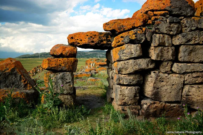
Vani (Vahani) caves complex is located in Samtskhe Javakheti, in Aspindza municipality at the right bank of the river Mrkvari. This ancient complex of caves is dated no later than the VIII century. During the IX-XI centuries caves were expanded. In the central part St. George church and a new group of shacks were carved. As a result of the earthquake in 1089, the central part of the Vani caves, including the church, collapsed. As a result of the earthquake in 1283, Vani caves collapsed again. During XIV-XVI centuries, monastery life was renovated again. In 1551 by Persians and in 1576 by Ottomans, it was taken and sacked again, which resulted in deserting the complex.
There are little less than 200 caves in the Vani complex, which is arranged on 16 stories. The monastery complex includes abodes, caves and agricultural storages, “eukterion” burial grounds, crypt, shelter, tunnels and 6 churches, all carved in the rock. There are three remaining water channels and the remnant of the reservoir, also important historic inscriptions and fragments of paintings. The center of the complex is the St. George dome-like church with mortar gates and a two-storied “Eukterion” burial.
Under the gate, the crypt is located. Ornamentally carved iconostasis details were also found here, together with ornamental stones fused with the main gate. North of the gate, on the same terrace, a dome-shaped mortar church is located. As a result of archaeological excavations – wine cellar with 8 wine jars was discovered, a tough glaze ceramic pottery workshop, agricultural building with small water canal and winepress, carved in rock, two houses built in stone, etc. outside the mortar barrier, on the terrace, oval tower appears, which served as a part of defensive building and overlooked approaches to the barrier.

Vardzia Cave Town
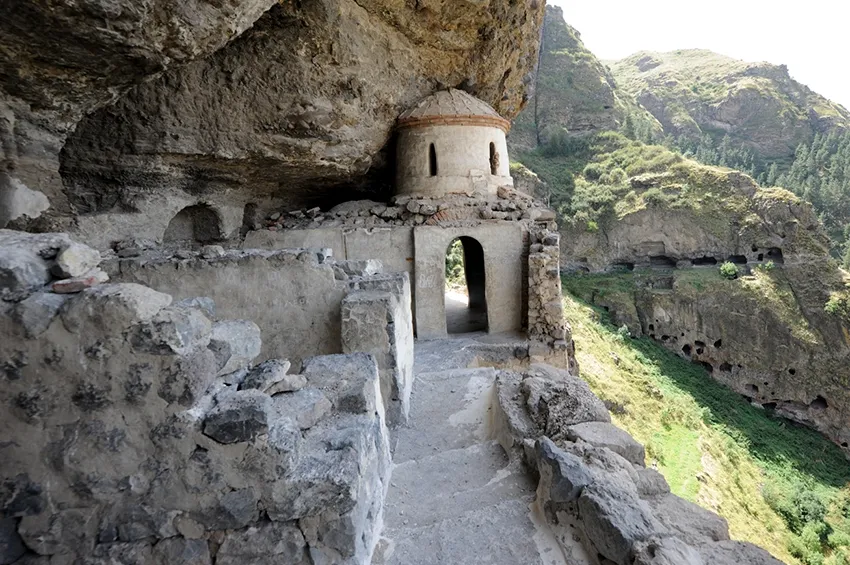
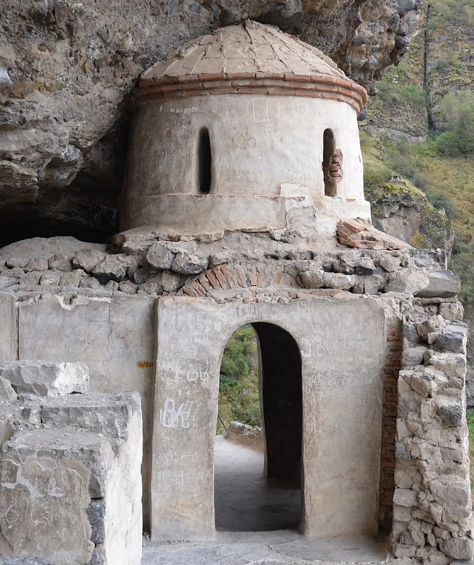
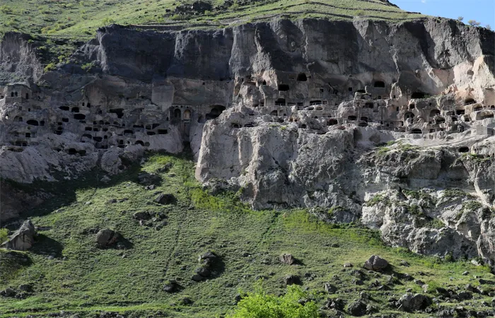
Vardzia — a rock-cut monastic ensemble, a monument of Georgian artistic culture of the XII-XIII centuries. Located in historical Javakheti, in the Aspindza municipality (30 km from Aspindza). On the left bank of the Mtkvari River. 1300 meters above sea level. According to the orographic scheme, Vardzia is located at the end of the eastern branches of the Erusheti Range. The uppermost cave of Vardzia is located at 1462 meters above sea level.
There are many legends about the place:
King Giorgi III went hunting with his nobles, the king took his daughter – little Tamar with him. The hunt began. The king and his retinue, carried away by the hunt, did not remember the child. Tamar, who was busy playing, got lost in the caves. The hunt was stopped. Excited and worried hunters were running here and there, looking for Tamar. – Where are you, Tamar! One of the companions called out. Tamar, who had lost her way in the cave, joyfully shouted “Here I am, uncle!”, and that is why this place was named “Vardzia”.
“So that the enemy would not learn of the whereabouts of Queen Tamar, by Tamar’s order, three hundred and sixty-five rooms were carved out in Vardzia, as many rooms as there are days in a year; one room was carved out every day, and the construction was completed in one year.”
Three moments are noteworthy in the stories about Vardzia: the connection of the foundation of the monastery with the name of King Giorgi III and, especially, Queen Tamar; the change of the place of construction of Vardzia and the existence of old caves here before the foundation of the monastery.
The monastery complex was mainly built in the years 1156-1203. The settlement was consecrated on August 15, 1185, during the reign of Queen Tamar (1184-1213). The royal monastery played a major role in the political and cultural life of the country.
During the Mongol rule (second half of the 13th century), the monks of Vardzia actively fought to preserve their faith and national culture. In 1551, the monastery was raided and destroyed by the Persian army. The famous icon of the Mother of God of Vardzia, the gold and steel doors, and many other cultural treasures were taken away by the enemy. In 1578, when the region was conquered by the Ottomans, the monastery was finally abandoned. After the Russo-Ottoman War (1828-1829), Vardzia was again part of Georgia.
After the establishment of Soviet power in the region, scientific study of this monastery complex began. In 1938, it was declared a museum-reserve. In 1970-1971, archaeological excavations were carried out in Vardzia, and 3 cultural layers were discovered: the Early Middle Ages, the 12th century, and the 13th-14th centuries.
The architecture of Vardzia is based on a pre-developed compositional idea – a multi-story carved ensemble is located around a center – a temple, embedded in the depths of a rock crevice. The caves of Vardzia are longitudinally spread from west to east, with a front of 500 m. The caves are arranged in tiers. In separate sections, five, six, and seven tiers are found. In the eastern part, 13 tiers of caves are confirmed. In a unified system, there are 19 tiers. In the extreme western part, there is a “rock village” with a church – Ananauri.
There are currently 641 rock-cut churches in Vardzia.
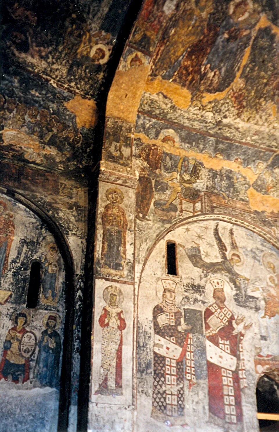
15 rock-cut churches have survived in Vardzia. Vardzia is not distinguished by its luxurious decoration, the only jewel is the wall painting of the chapels. In this regard, the painting of the Assumption of the Virgin Mary Cathedral and the gate (1184-1186) is important, where, along with scenes depicting the life of Christ, portraits of King George III and Tamar are depicted, as well as the Eristavi of Kartli, Rati Surameli. It is noteworthy that among the portraits of Queen Tamar that have come down to us, the Vardzia one is the earliest. Here she is wearing a crown, but without the headscarf of a married woman, and she is holding a building in her hand, which means that she began the construction and care of the Vardzia monastery before her marriage.
View on map

Upper Vardzia church — a monument of Georgian architecture of the first half of the 11th century, the Church of the Virgin Mary in the Samtskhe-Javakheti region, in the Aspindza municipality, 3 km northwest of Vardzia. It is erected on a mountain slope, on an artificially created platform. On November 7, 2006, according to the decree of the President of Georgia, it was awarded the category of an immovable cultural monument of national significance
It belongs to the type of two-nave churches. It has an open stoa on the south. The western nave is of a later period. It is built of well-polished reddish-purple tufa blocks. The inside is lined with large cut stones. The main nave, ending in a deep apse, is high and wide, while the northern one is low and narrow. They are connected to each other by arches resting on two piers. The church was plastered, traces of painting are visible. Both naves are covered with a single, two-tone roof. The church is richly decorated with carvings on the outside. There is a stylized Asomtavruli inscription above the entrance.
View on mapAkhaltsikhe Municipality
Akhaltsikhe Municipality is located in the Samtskhe-Javakheti region. Traces of human life in the region date back to ancient times, as evidenced by the Stone Age tools discovered during archaeological excavations. Settlements and tombs from the 3rd millennium BC have also been discovered here. Akhaltsikhe had great political and cultural importance in the Middle Ages, which was also due to its strategic location. According to researchers, Akhaltsikhe was formerly called Lomsia. The center of the municipality, the city of Akhaltsikhe (then Lomsia), was destroyed during the wars of the 11th century. In the 12th century, the Samtskhe Atabags – the Jakelis – rebuilt the city and named this place Akhaltsikhe. Akhaltsikhe has been mentioned in historical sources since the 12th century. It became a separate district in 1930.
The municipality is located in the Akhaltsikhe Basin, occupying the Mtkvari and Potskhovi valleys. Its administrative center is the city of Akhaltsikhe. The municipality is bordered by Borjomi and Kharagauli to the north, Aspindza to the east, Adigeni to the west, and the Republic of Turkey to the south. The region is characterized by a complex relief, with steep terraces, valleys, small basins, hills and volcanic mountains, which range from 950 to 2964 meters.
Akhaltsikhe Municipality is distinguished by its natural beauty and abundance of cultural and historical monuments. Forests, mountains, rocks and beautiful views create a wonderful environment for travelers and nature lovers.
Rabbath Castle
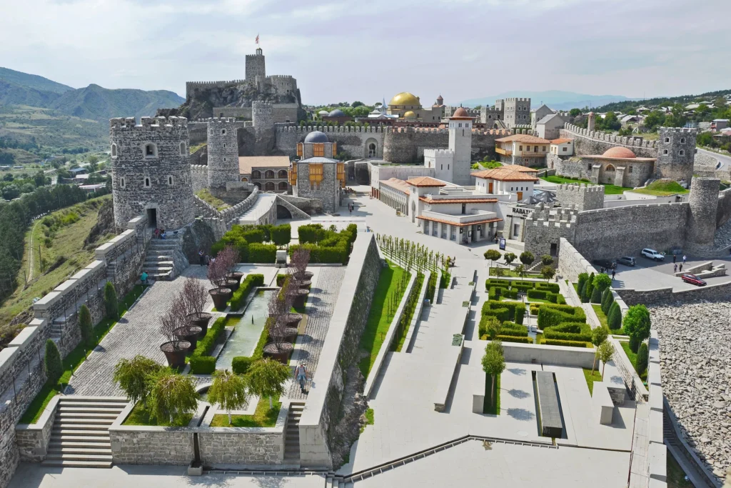
Rabati Castle is a historical castle in the administrative center of Samtskhe-Javakheti region, in the city of Akhaltsikhe, in the historical district of Rabati. It is located on the banks of the Potskhovi River. The Rabati castle complex is currently being rehabilitated, it consists of buildings from various periods of the Middle Ages. The castle complex was the most important defensive structure of the region, its walls remember many heavy battles. For centuries, it was the residence of the owners of Akhaltsikhe. The fortress was surrounded by three walls and was connected to the surrounding area by an underground tunnel.
The history of the fortress begins in the 9th century. In the 12th–13th centuries, the fortress became the residence of the Jakelis, it was restored and expanded. It is from this time that the toponym “Akhaltsikhe” appears.
As a result of the restoration carried out in 2011-2012, the fortress complex was renovated with a rampart, a citadel, an Orthodox church of the 9th-10th centuries, a mosque named after Haji Ahmed-Pasha Jakeli, a madrasah, and the Jakeli Palace, where the exhibition hall of the Samtskhe-Javakheti History Museum is located.
Samtskhe-Javakheti Historical Museum
The Ivane Javakhishvili Samtskhe-Javakheti Historical Museum is located in the city of Akhaltsikhe, Georgia. The Samtskhe-Javakheti Historical Museum was founded in Akhaltsikhe in 1923, on the basis of which the Museum of Local Lore was opened in 1937. In 1972, the museum was named after Ivane Javakhishvili. It is of historical classification. The museum collects a significant part of the cultural heritage of the region: ancient manuscripts, epigraphic, archaeological, numismatic, ethnographic materials and photo-documents. Currently, more than 25 thousand exhibits are preserved in the museum’s funds, including a fund of manuscripts and old printed books. A special place is occupied by Georgian lapidary specimens and carpet-rug exhibitions. State control is exercised by the Ministry of Culture, Monument Protection and Sports of Georgia.
View on map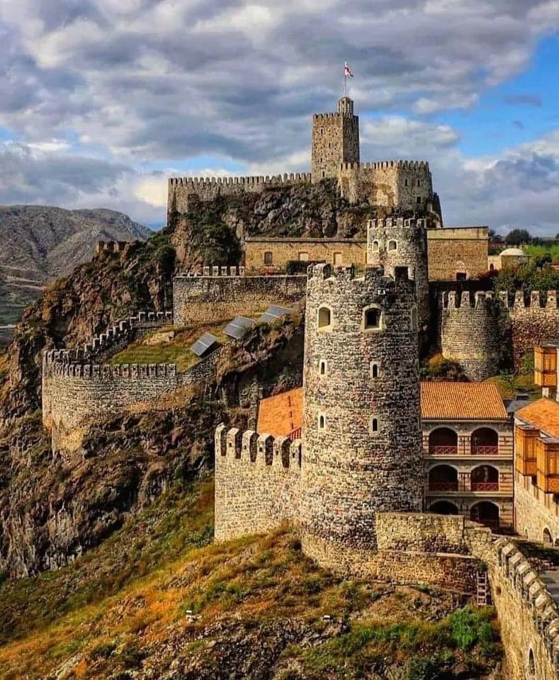
Sologha Bathhouse
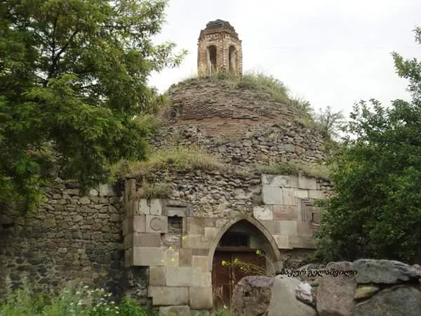
Sologha Bath is located in Samtskhe-Javakheti, in the city of Akhaltsikhe, near the Akhaltsikhe Fortress. It is also called the Turkish Bath. The bath was built in the 18th century. It is a building consisting of several halls and their adjoining rooms. Each hall is covered with a dome. It consists of 7 large halls. The central hall is octagonal, with arms on four sides. It is built mainly of brick. Stone is used in construction areas and in some places in the walls. The halls have a decor characteristic of Muslim architecture (stalactite type). It was previously joined by another row of baths, which are arranged in one line according to the corridor principle and go towards the fortress. only 4 rooms have survived here…

Atskuri Fortress
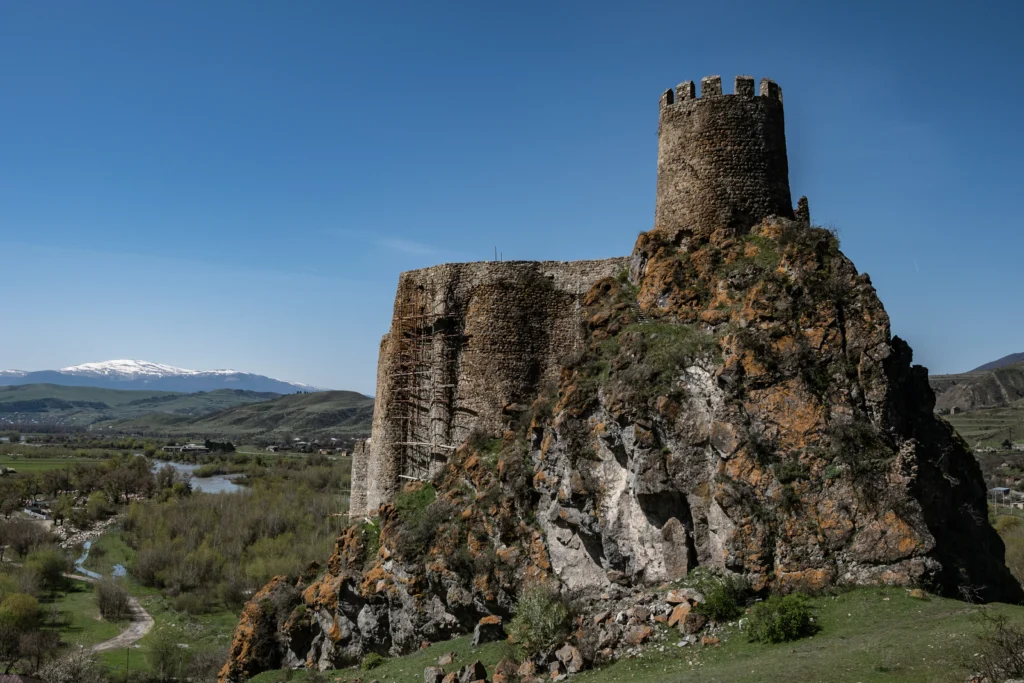
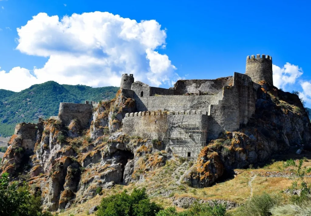
is located in the Samtskhe-Javakheti region, in the Akhaltsikhe municipality, near the village of Atskuri. It was first mentioned in historical sources in the middle of the 11th century.
The builders of the Atskuri Fortress very skillfully used the high and difficult-to-access rocky terrain and created a complex and interesting structure from a construction point of view. The fortress can be entered through a narrow tunnel carved into the rock.
The Atskuri Fortress protected the Borjomi Gorge from the south. In the second half of the 16th century, the fortress was occupied by the Ottomans. In 1770, a joint army of Russians and Georgians tried to take the Atskuri Fortress, but failed. In 1829, according to the Treaty of Adrianople, the Atskuri Fortress was liberated from Ottoman rule.
The fortress has not survived in its entirety, and construction layers from different periods are visible. The castle is currently in poor condition; it collapsed in 2009, and reinforcement work was carried out in 2013, but today there is still a threat of collapse.

Sapara Monastery
Sapara Monastery is a Georgian Orthodox monastery in the Akhaltsikhe District of Samtskhe-Javakheti region, Georgia. It has existed from at least the 9th century, and has numbered among its monks many important figures in Georgian ecclesiastical history. At the end of the 13th century Sapara became a possession of the Jakeli family, whose leader, Sargis Jakeli, was adept at staying on good terms with the Mongols, which enabled Samtskhe to enjoy a peace unusual for the time. When he grew old, Sargis took monastic orders and changed his name to Saba. His son Beka built the largest of the 12 churches here, St Saba’s Church, named after the saint whose name his father had adopted, one of the most architecturally important churches of its time. The 14th-century frescoes inside are of high quality. From the end of the 16th century until the beginning of the 17th century the Sapara Monastery became empty due to the expansion of Ottoman Empire policy into Samtskhe and during this process the monastery’s icons and other treasures were taken to more protected areas of Georgia. Set in a green forested canyon, the monastery is contrastingly distinguished by its pink and yellow stones. The ensemble is composed of church buildings and remnants of a palace and fortifications walls. The most important is the cross-in-square temple of St. Saba. Another significant church is St. Mary’s Assumption Church.
View on map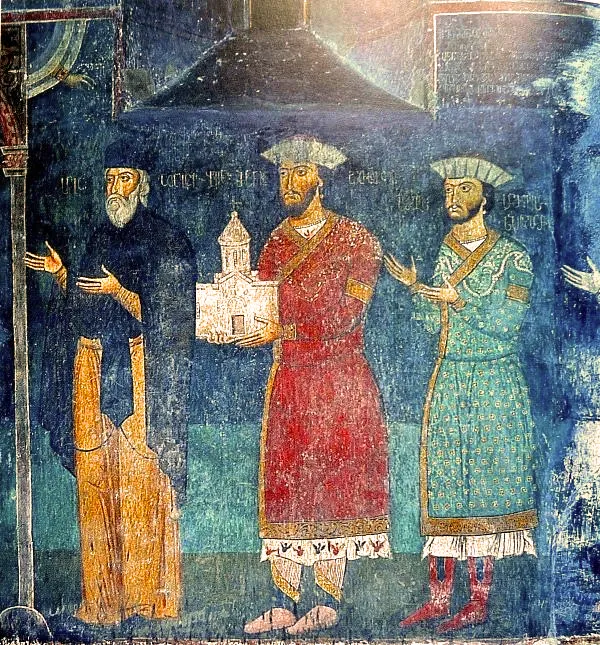
Agara Monastery
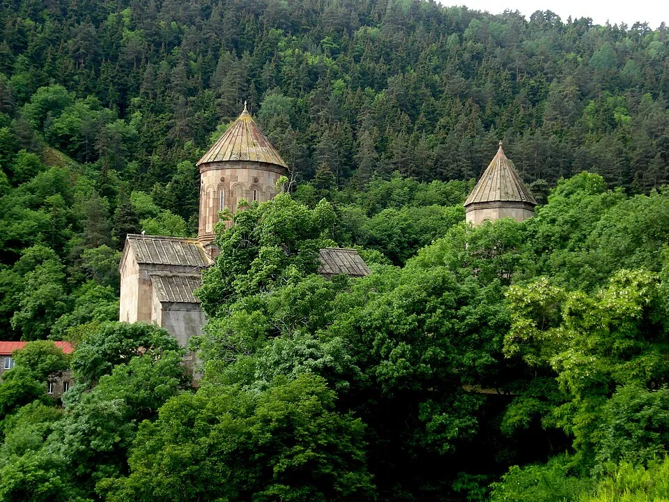
Situated atop a mountain in the Uraveli River Valley in the region of Samtskhe-Javakheti. Agara Monastery is surrounded on three sides by deciduous forest, with the fourth side guarded by a steep cliff overlooking the river.
The monastery was founded in the 10th century, springing up around a church from the 6th-7th centuries.
The main church of Agara Monastery is one of the largest and best-preserved single-naved churches in Georgia, dating back to the 10th-11th century.
Ancient paintings can still be seen in places on the walls, and a beautifully ornamented window remains over the main entrance door.
In addition, there are four churches from the 5th-14th centuries preserved in the monastery complex, with a bell-tower, a refectory, a cellar, and outbuildings.
Today, the complex is in ruins, but the dining area from the 11th-12th centuries is still preserved, as well as a bell tower from the 13th-14th centuries.
View on map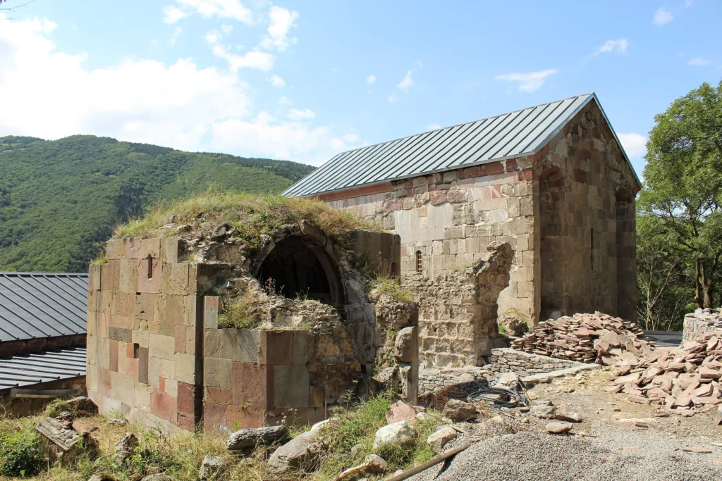
Church of the Virgin of Vale
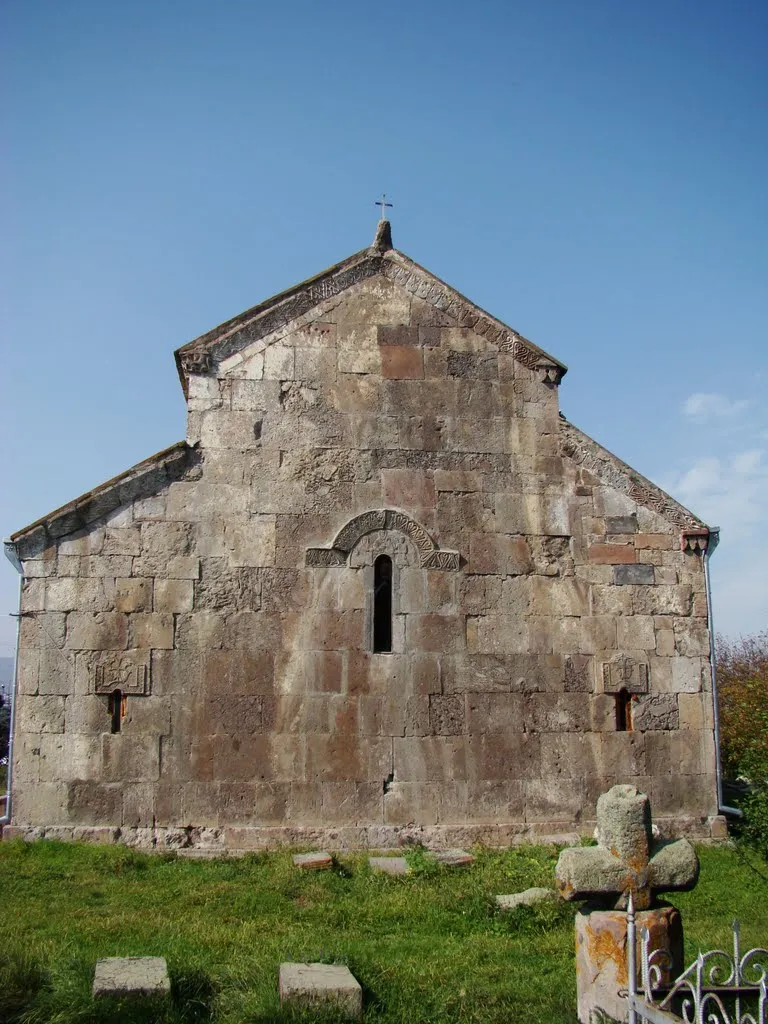
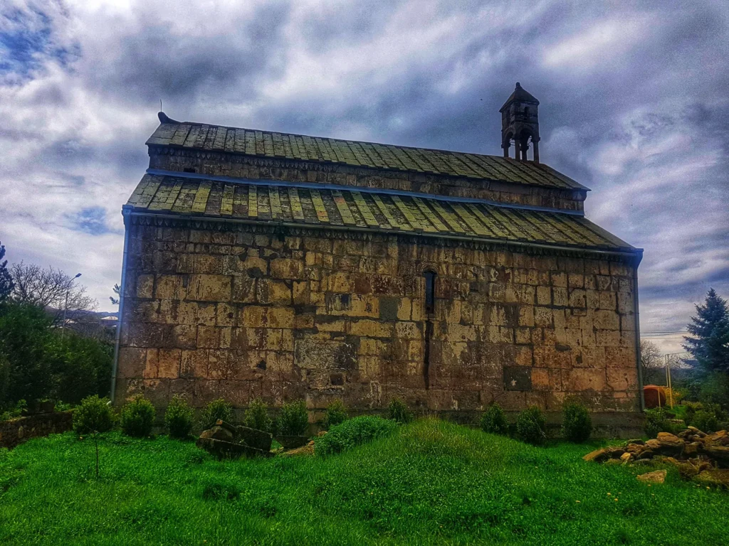
Is a church from the last quarter of the 10th century in the city of Vale (Akhaltsikhe Municipality), in the historical Samtskhe region. The Church of the Virgin of Vale was originally a domed church. Then, over time, its dome and vaults collapsed, and in 1561–1564 the building was rebuilt without a dome. Because of this, it became a three-nave basilica and has survived to this day.
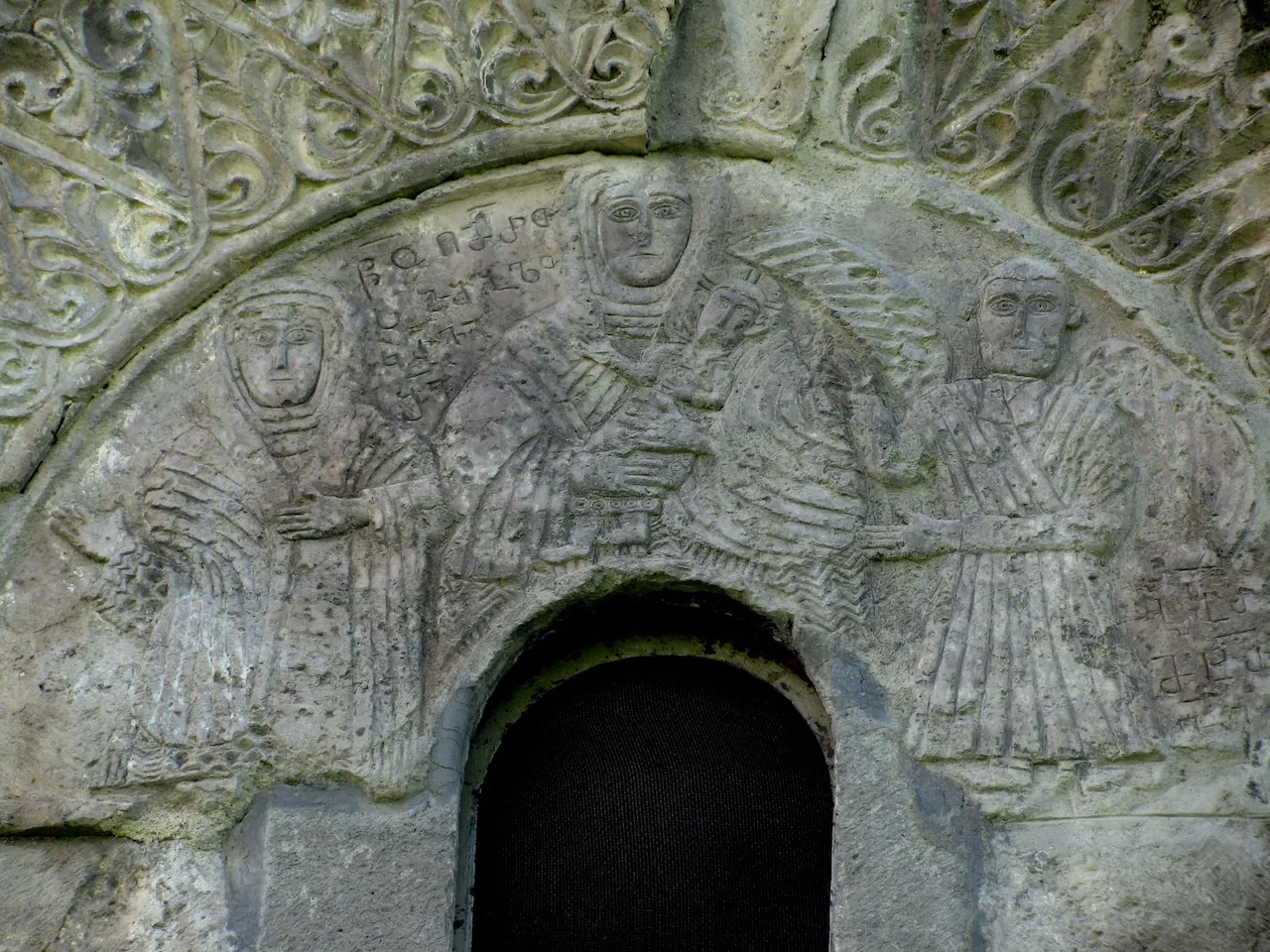
On the eastern facade of the Church of the Virgin of Vale, the upper part of the right wing has been repaired and the windows have been slightly widened. There are three windows on this facade, all three of which have interesting decorations. Above the side windows are relief crosses and carved arches, and above the main window is a relief group consisting of three figures, which is also surrounded by a carved arch. The middle figure is the Virgin Mary, on the left is a woman bowing to the Virgin Mary (the inscription in the capital reads: “Holy Mother of God, have mercy on Kravai.” Kravai is the woman’s name), on the right is the Archangel Gabriel. The church has two entrances – from the south and the west. The exquisite decoration of the temple attracts attention. The rich decoration of the western entrance is noteworthy, which is an important example of 10th century art: above the entrance is a huge rectangular stone, on which two horsemen facing each other are carved (presumably St. George and St. Demetrius). Above this stone are concentric arches of carvings. The common frame of the entrance is a carved arch resting on the wall columns.
It is noticeable that the pillars have been repaired, they are of unequal size and uneven. The arches resting on the pillars have also been changed. These changes are the result of the 16th century reconstruction.

Abastumani
Abastumani – a town in Adigeni Municipality, Samtskhe-Javakheti Region, Georgia. It is located on the southern slope of the Meskheti Range, in the Otskhe River Gorge. It is 25 kilometers from Adigeni and 28 kilometers from Akhaltsikhe. There are spa sanatoriums, the Abastumani Astrophysical Observatory, cultural, educational and healthcare facilities in Abastumani.
In the 9th-10th centuries, it was referred to as “Odzrkhe”. In the late Middle Ages, “Otskhe” was established, and from the 19th century – “Abastumani”. The current name may come from the family name of the Abazasdzes. Abastumani is a mountain-climatic resort (1340 m above sea level). In the 70s of the 19th century, the foundation for the construction of the resort was laid. The status of a town was granted in 1926.
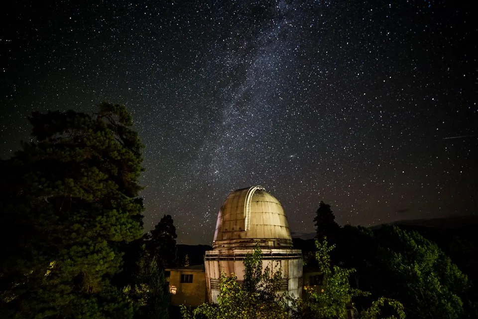
Observatory
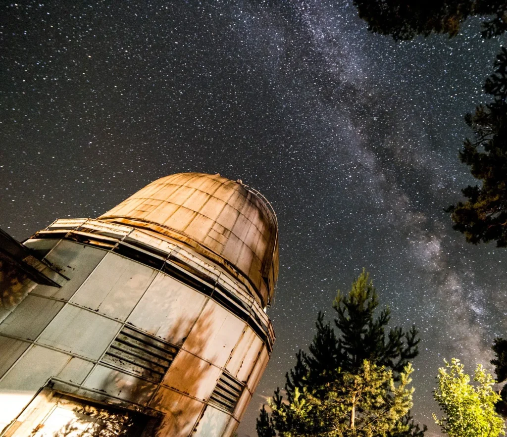
Evgeni Kharadze’s Georgian National Astrophysical Observatory is a scientific research institution in Georgia, in the Abastumani settlement of Adigeni municipality, on Mount Kanobili, 1700 m above sea level, 200 km from Tbilisi.
The main directions of scientific research of the observatory are the study of galaxies, stars, solar physics, solar system objects and the Earth’s upper atmosphere.
The observatory was founded on February 28, 1932, under the leadership of Professor Evgeni Kharadze and is the first mountain astrophysical observatory in the former Soviet Union. In 1934, a 40 cm telescope (refractor) of the Carl Zeiss company was installed in this observatory. In the same year, the Abastumani Observatory was elected a member of the Pacific Astrophysical Association. In 1942, the Georgian astronomer Giorgi Tevzadze discovered two previously unknown, new comets at the Abastumani Observatory, which were named “Comet 1942 Tevzadze 1” and “Comet 1942 Tevzadze 2”. This discovery was the first astronomical discovery made by a Georgian.
In 1954, a 70 cm meniscus telescope was installed at the observatory. Since 1957, the first artificial satellite observation station of the Earth has been operating, and two years later, a cable car stretching from Mount Kanobili to Abastumani was put into operation. In 1961, astronomer R. Kiladze was the first to measure the thickness of Saturn’s rings, and in 1974 he was the first to observe the atmosphere of the planet Mercury, while A. Churadze discovered the first supernova in the galaxy NGC 3389. The observatory has been integrated with Ilia State University since 2007 and is called the “Evgeni Kharadze Abastumani Astrophysical Observatory of Ilia State University”.
The observatory has a publishing base, where the “Astronomical Calendar” and the “Observatory Bulletin” have been published annually since 1961.
View on map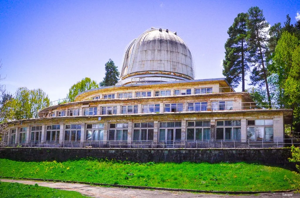
Abastumani cable car – Built to ferry astronomers and staff up to the observatory, the line connects the resort town with the summit of Mount Kanobili. Its bright yellow gondolas, manufactured by the Tbilisi Aviation Factory, are identical in design to the red cabins in Khulo and the blue ones at Tbilisi’s Turtle Lake – classic oval-shaped gondolas that became a Soviet standard. The modernist lower station, half-hidden in the forest of the Dendrological Park, is a striking piece of architecture in its own right. From here, the ropeway once whisked passengers silently through the pine trees before emerging at the observatory gates. Today, the cable car remains operational, but access is restricted to observatory staff. If you’re lucky, you might spot one of the yellow cabins suspended mid-line.
Glasenapp Tower, also known as “Giorgiseuli” — an immovable monument of the cultural heritage of Georgia; a mountain astronomical tower, built in the 1890s on the initiative of the Russian Tsar, George Alexander II, and astronomer Sergei Glazenap on the territory of Abastumani . A small telescope was located on the tower (the predecessor of the Abastumani Astrophysical Observatory). It is built on the rocky slope of Mount Kanobili. It is a stone tower of circular shape in plan, on which stands a wooden apical cylinder covered with a tin roof. The base of the building is built of hewn and processed squares. The tower rotates around its axis, which is achieved by means of iron rollers fixed between the stone base and the wooden cylinder.
Abastumani Alexander Nevsky Church, New Zarzma — an architectural monument in the town of Abastumani, Adigeni Municipality. Built in 1896-1898.The church complex (domed church, bell tower, fence) is a multifaceted interesting architectural ensemble, which is very noteworthy from an artistic-historical and urban point of view. It was built by order of Prince George, the son of Russian Emperor Alexander III, the younger brother of the last Russian Emperor Nicholas II. The prototype of the building is the main church of the Zarzma Monastery in Samtskhe (beginning of the 14th century) and the bell tower, which is why the Abastumani Church is also called “New Zarzma”. The author of the project is the European architect Otto Simonson, who worked in Tbilisi. The church’s paintings are by the Russian artist Mikhail Nesterov. The inscription on the marble plaque on the western wall of the church interior tells us that the foundation stone for the construction was laid on June 27, 1896, and the church was consecrated on September 13, 1898. On the same wall is M. Nesterov’s signature and the date of completion of the church’s paintings – 1904.
Abastumani Sulphur baths – an architectural monument in the town of Abastumani, Adigeni Municipality. The construction period of the bathhouse building is assumed to be the 1880s. The construction of the bathhouse required the creation of a network of underground canals. A large water reservoir was built near the Otskhe River away from the bathhouse, and a so-called refrigerator was built underground with stone canals, connected to the reservoir on one side and the bathhouse building on the other. The canals were dug, and a stone-paved brick bridge was built across the narrow riverbed, where the river formed a waterfall, which still bears the name of Remerti and overlooks the park of the same name. The refrigerator is a small stone structure half-buried in the ground, where a system of underground channels from a sulfuric water collection facility near the river converge, from which water is distributed to the main bathhouse building.
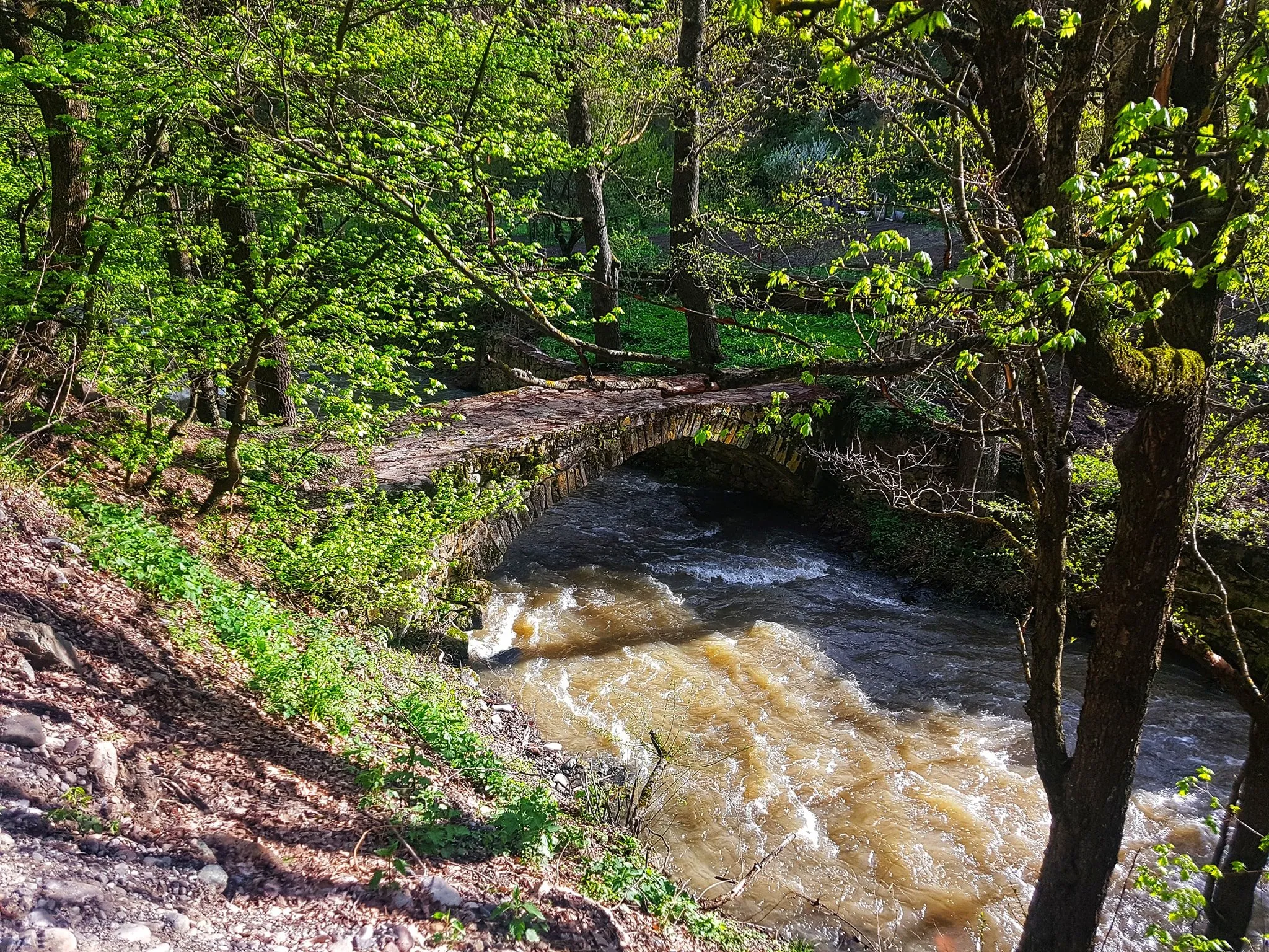
Odzrkhe Tamar’s Bridge — an immovable cultural monument of national significance. The bridge is located in the resort of Abastumani in the Adigeni municipality of the Samtskhe-Javakheti region, at the confluence of the rivers Otskhe and Kurtskhana, where a stone bridge crosses the Odzrkhe River.
The bridge is built of hewn stone from the rock, on a lime mortar, some of which are processed. Stone dams and a bridge support platform are dug out on both banks of the river. The width of the bridge is approximately 1.5-2 meters. The length is 6-7 meters. The bridge is located 2-3 meters below the road, in the river valley. Presumably, they used this bridge to cross to the monastery in the forest in Khertvisi, which is now in ruins.
View on mapRomanov Palace in Abastumani
Built in 1893 for Grand Duke George Alexandrovich Romanov, the Romanov complex in Abastumani originally comprised two residences: a summer palace, and a winter palace. Designed by Tbilisi-based architect Otto Jacob Simons, the single-storey summer house was constructed entirely from wood – thought to be beneficial for the lungs – and distinguished by its ornate fenestration and verandahs. The sturdier winter palace was made of stone.
After George’s untimely death, the complex was largely abandoned (though it’s said that the summer house became a favourite haunt of the Soviet elite). In the 1990s, the grounds were converted into a convent, and the Sisters of St. Panteleimon took up residence. A few years later, one of the buildings was badly damaged by fire.
surviving Romanov Palace – which has been completely restored – serves as accommodation for the sisters. The complex also contains a newly built chapel and an older church that houses icons brought here from Sapara Monastery near Akhaltsikhe. At present, the site is closed to visitors
View on map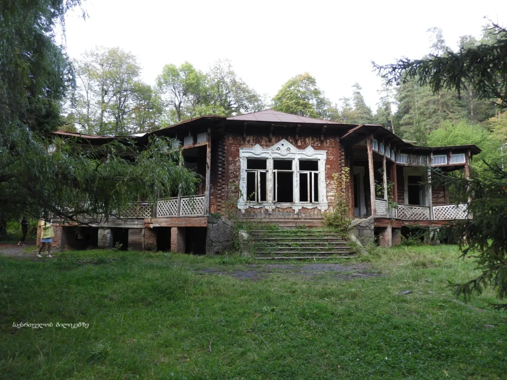
Zarzma Monastery
A monument of Georgian architecture in the village of Zarzma, Adigeni Municipality, Samtskhe-Javakheti Region. On November 7, 2006, according to the decree of the President of Georgia, it was awarded the category of an immovable cultural monument of national importance. The domed church, bell tower and several single-nave chapels (some are ruined) have survived. A little further away from them is a spring known from ancient times. Other monastic buildings (monks’ cells, refectory, etc.) have not been preserved. There are different opinions about the time of the monastery’s foundation (VIII century, IX century). It was originally founded by the early feudal cleric Serapion Zarzmeli. The church from Serapion’s time has not survived to this day.
The current church and bell tower of Zarzma were built in the first years of the 14th century during the reign of Beka I Mandaturtukhutses, the ruler of Samtskhe. The oldest historical relic is an inscription from the last decades of the 10th century, inserted into the arch of the entrance to one of the chapels, which was taken from an earlier building and tells the story of the campaigns of the Great Curate David III against Barda Skliaros. he church of Zarzma is a very important monument, in which some new signs characteristic of the Georgian architecture of that time are clearly visible. The wall paintings are also important, where, along with traditional stories, portraits of the owners of Samtskhe (Sargis, Beka Mandaturtukhutses, Sargis II, Kuarkuare), as well as portraits of historical figures of the 16th century (King Bagrat III of Imereti, Serapion Khurtsidze, etc.) have been preserved. The bell tower of the Zarzma Monastery is one of the largest in Georgia and is one of the best examples of this type of Georgian buildings. In the 18th–19th centuries, the abandoned temple, surrounded by a Muslim population, gradually deteriorated. All the property of Zarzma — icons, crosses, other church items, and above all the most important shrine — the Zarzma Transfiguration Icon — was taken to Guria and placed in a specially built new church in the village of Shemokmedi, which was also named Zarzma (currently, all the surviving treasures of Zarzma are kept in the Sh. Amiranashvili Art Museum in Tbilisi).
In the village of Zarzma, there is another Tamar-related place – “Tamar’s Springs”. The water flows from a small, hand-built wall. Why it is called “Tamars Springs” the villagers cannot say, although they know for sure that it is named after Tamar.“Tamar’s Spring” – 14th century – is just 50 meters from the Zarzma Monastery.
View on map
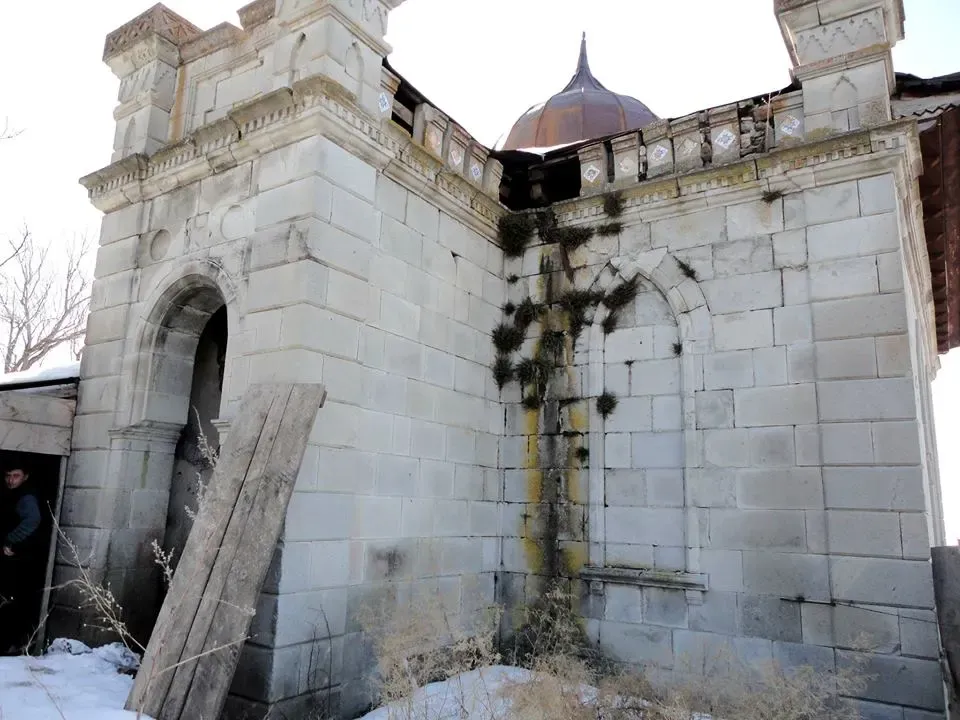
The Kharjami Mosque
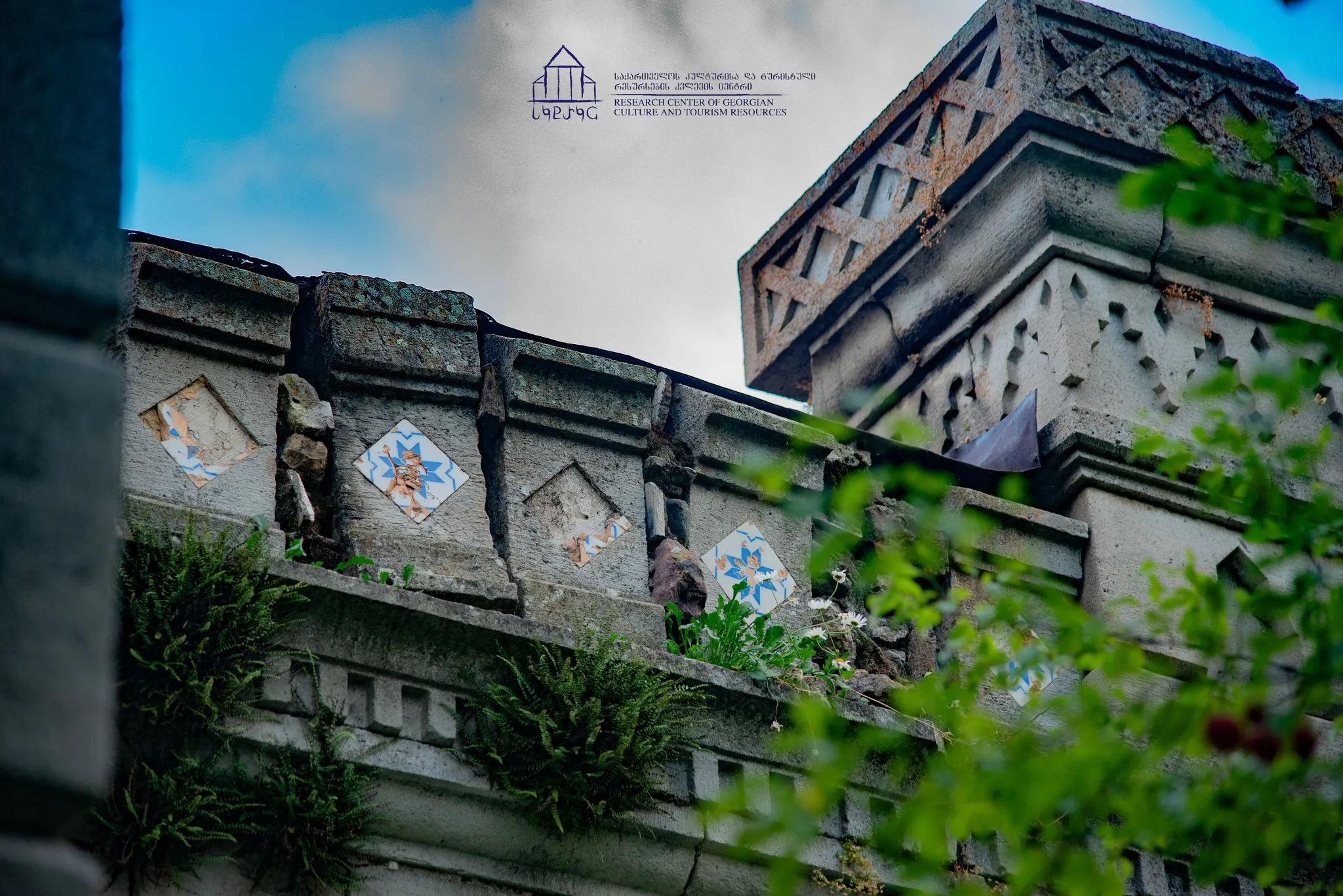
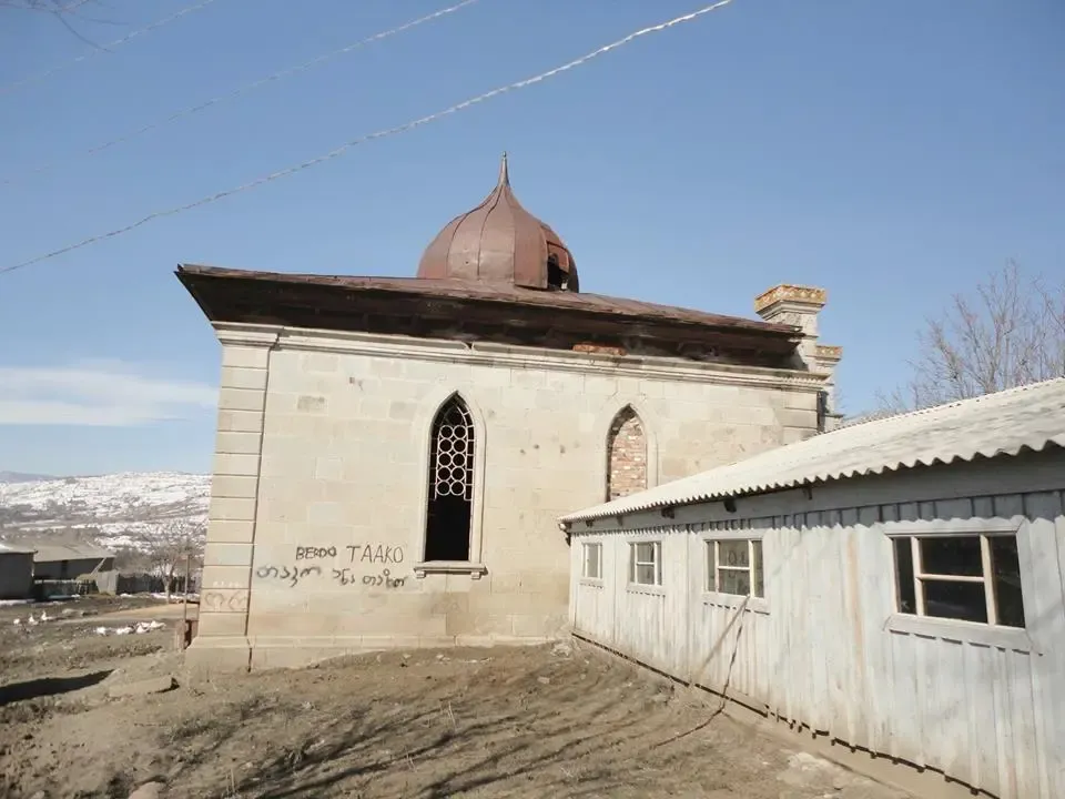
Is an architectural monument in the village of Kharjami, Adigeni Municipality. The mosque was built in the 19th century by local Muslim Meskheti, whose descendants were deported to Central Asia by Stalin in 1944.
The outer facade of the Kharjami Mosque is faced with hewn, white stone. It is decorated with simple and sophisticated carvings. It is decorated with pointed arches. The ceiling of the entrance is a classic Meskheti hall roof. The roof is covered with copper and is decorated with a small helmet-shaped dome, which is characteristic of mosques built in Samtskhe-Javakheti in the 19th and early 20th centuries. The decoration of the ceiling of the hall shows great similarity to the mosques of the same period in Samtskhe-Javakheti, as well as Adjara and the historical Lazet-Tao-Klarjeti. The interior of the mosque is damaged. Most of the plaster has fallen off.
The mosque was granted the status of a cultural heritage monument by the Ministry of Culture of Georgia in 2012.
View on map

Chule Monastery or Chulevi Monastery
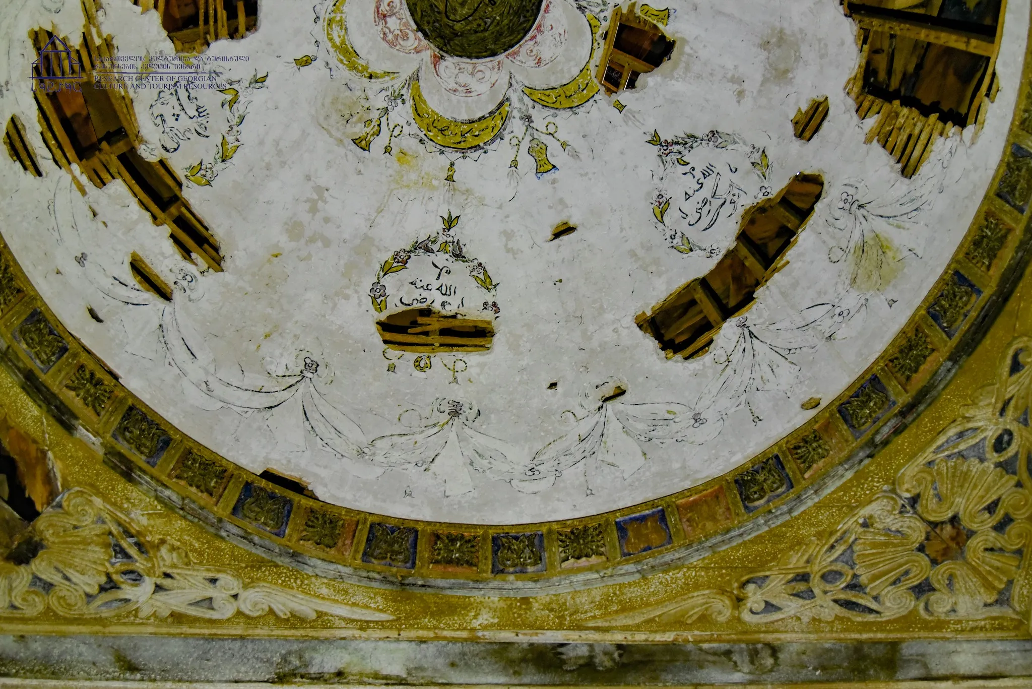
Is a 14th-century domed church of St. George. It is located in the historical Samtskhe, Patara Zanavi, Adigeni Municipality, on the left bank of the Kvabliani River.
The construction of the Chule Monastery dates back to 1381. Scientists believe that the word “Chule” in ancient Georgian meant “a fallen, hidden place.” From the Odin complex, only the domed church of St. George, built of well-polished stone of gray-pink tones, has survived to this day.
The current monastery dates back to the 14th century, but a shrine of St. George existed here before that. In the second half of the 11th century, Stephen Chuleveli was known among the scribes of the Black Mountain of Syria. This epithet indicates the birthplace of Stephen the First Martyr.
After the Ottomans took over Meskheti, monastic activity gradually died out in Chule and by 1595 it was completely deserted.
Today, monastic life has been revived in Chulevi.
View on map
Okros Tsikhe (Golden Fortress)
The fortress in Samtskhe-Javakheti region, Adigeni municipality, near the village Boladjuri, 170 m above sea level. The castle is located on a huge rocky massif and is difficult to reach (even inaccessible from some sides). It is one of the greatest Georgian fortresses.
The Golden Fortress was one of the main strongholds of the Jaqeli family, and it, along with other fortresses, formed the whole system of defensive fortifications in the midst of the Atabeg domain. The exact date of construction of the castle is unknown. It was probably built at the end of the XIII century, or in the beginning of the XIV century, and there is not any early written information about it. In the XV-XVI centuries, during the Turkish occupation, It played a major role in the defense of the Meskhetians.
View on map